


by David Moran, on Aug 16, 2018 11:55:44 AM
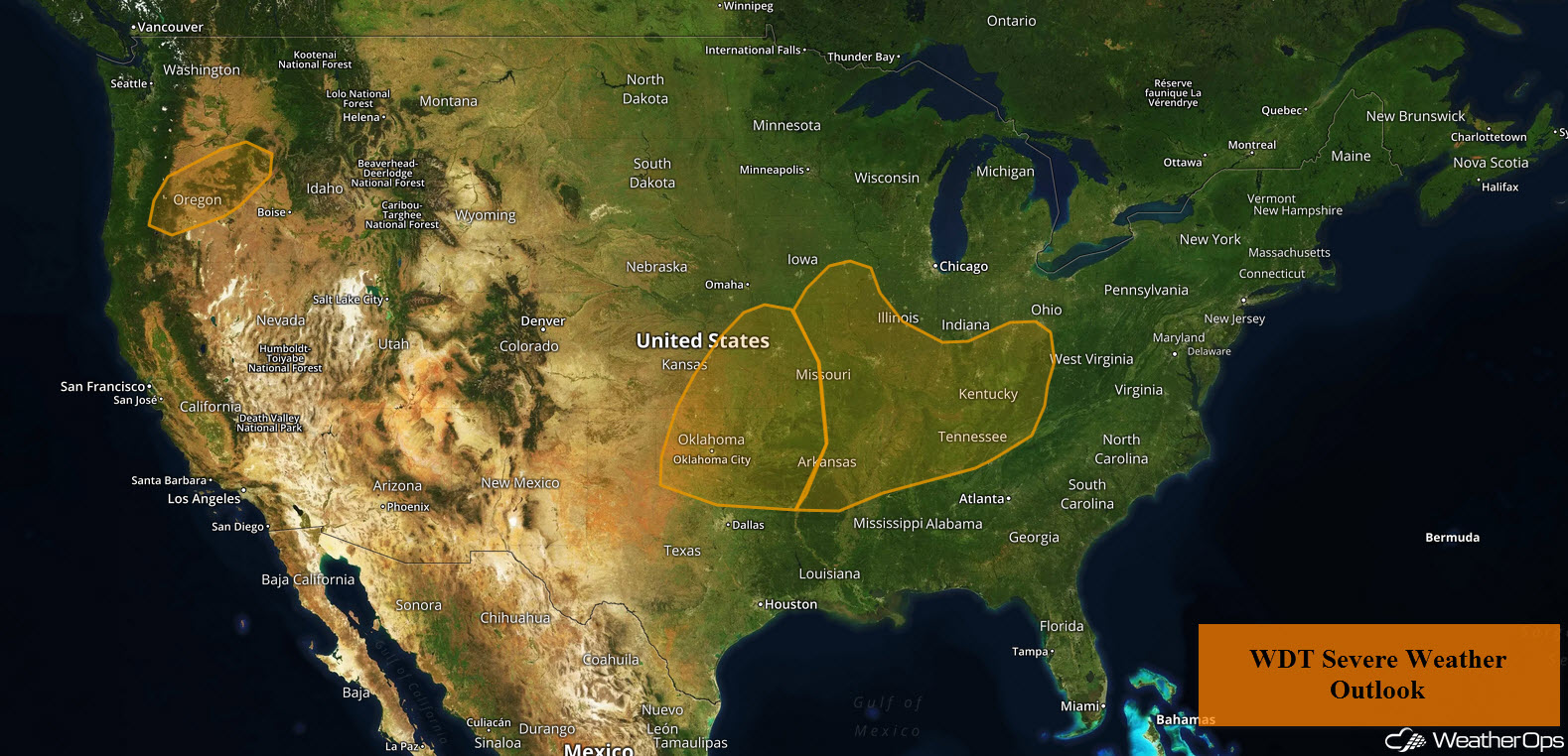
An upper level disturbance moving into the Pacific Northwest will allow for the development of thunderstorms across Oregon on Thursday. Thunderstorms are expected to develop across the Central Plains as instability increases this afternoon. Heavy rainfall is expected across the Central Plains and into the Ozarks along a slow moving front. Thunderstorms are forecast across Illinois, Iowa, and Northern Missouri as an area of low pressure moves across the region. A front will support thunderstorms across the Mississippi, Tennessee, and Ohio Valleys. There will also be potential for excessive rainfall across the Mid-Ohio Valley ahead of a slow moving cold front.
- Potential for Thunderstorms across Oregon on Thursday
- Thunderstorms Thursday across the Central Plains
- Excessive Rainfall from the Central Plains into the Ozarks on Thursday
- Risk for Thunderstorms Thursday across Illinois, Iowa, and Northern Missouri
- Thunderstorm Potential for the Mississippi, Tennessee, and Ohio Valleys Thursday
- Potential for Excessive Rainfall Thursday for the Mid-Ohio Valley
- Thunderstorms for Idaho and Southwest Montana on Friday
- Risk for Thunderstorms Friday from the Central Plains to the Tennessee Valley
- Potential for Excessive Rainfall Friday across the Ohio and Tennessee Valleys
- Thunderstorm Potential across the Northeast and Mid Atlantic on Friday
- Risk for Excessive Rainfall Friday for the Northeast
- Excessive Rainfall for the Southern High Plains Friday
- Thunderstorms from the Western High Plains to the Southern Plains on Saturday
- Excessive Rainfall Saturday from the Western High Plains into the Southern Plains
- Tropical Update
US Hazards
Potential for Thunderstorms across Oregon on Thursday
An upper level disturbance will move into the region during the afternoon. With increasing wind shear and instability, isolated strong thunderstorms are expected to develop. Activity will move northeastward through the early evening with damaging winds the primary hazard,
Major Cities in Region: Eugene, OR, Bend, OR
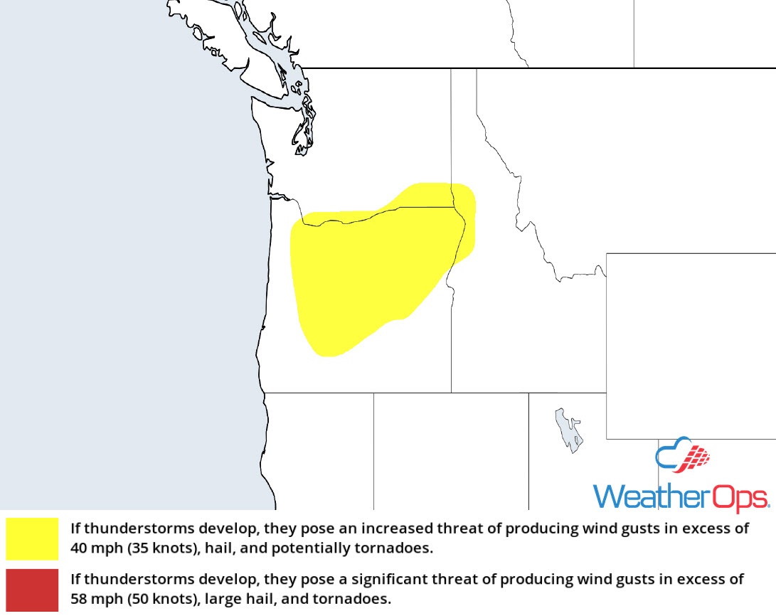
Thunderstorm Risk for Thursday
Thunderstorms Thursday across the Central Plains
A few strong thunderstorms are ongoing across southeast Nebraska this morning. This activity should weaken through the morning, but additional activity is expected during the afternoon. Daytime heating, plentiful moisture, and wind shear will support the development of thunderstorms; large hail and damaging winds will be the primary hazards with these storms. A few storms may continue after sunset.
Major Cities in Region: Dodge City, KS, Oklahoma City, OK, Wichita, KS, Tulsa, OK, Omaha, NE, Kansas City, MO
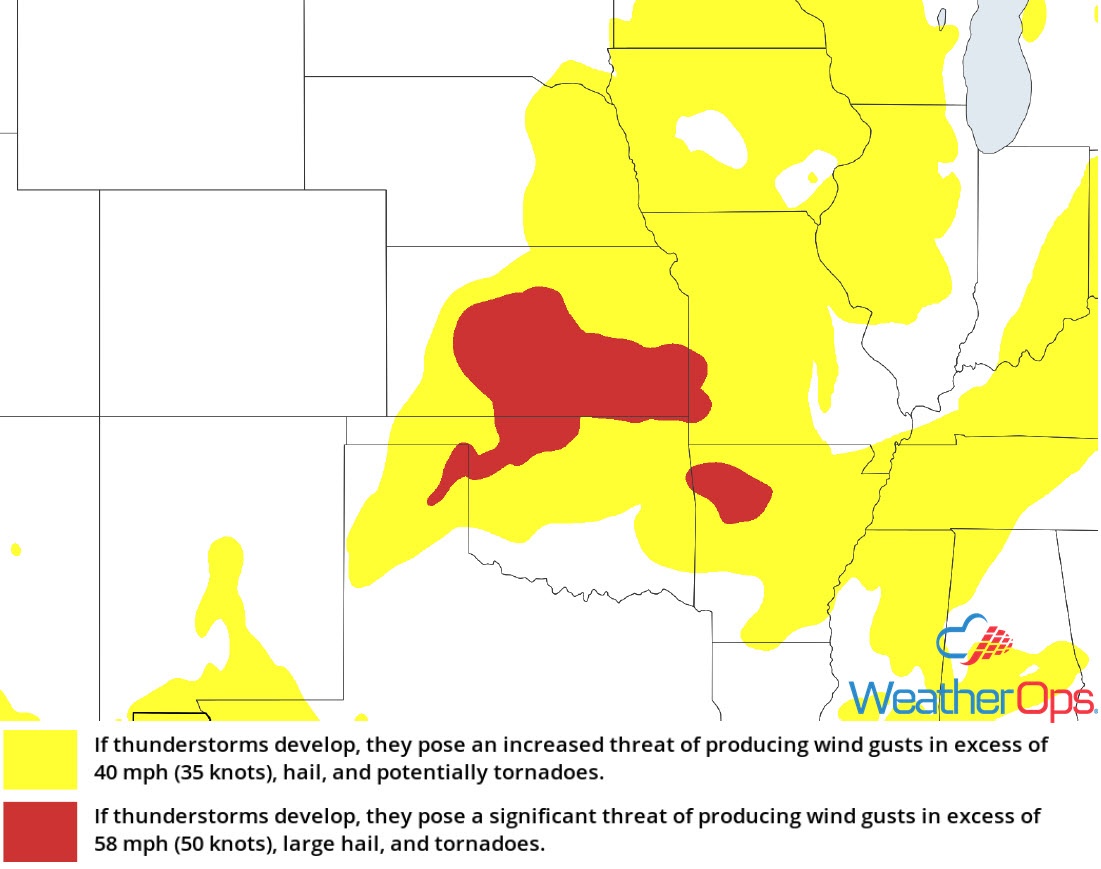
Thunderstorm Risk for Thursday
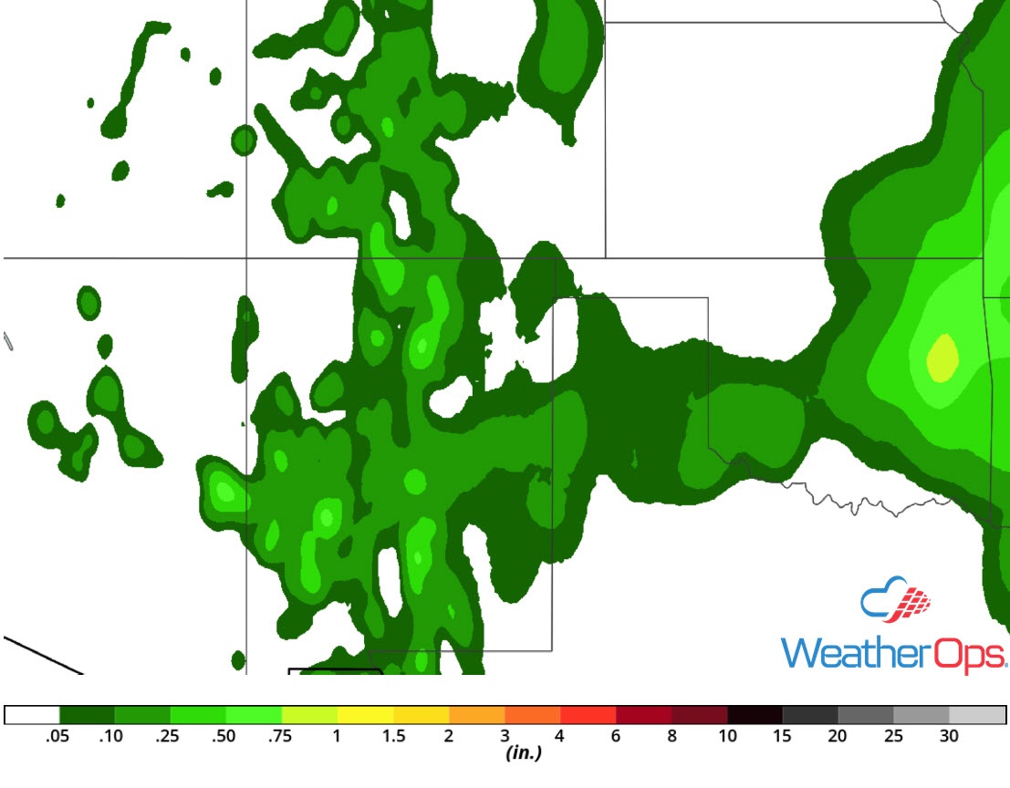
Excessive Rainfall from the Central Plains into the Ozarks on Thursday
In addition to the thunderstorm risk described above, some of this activity will have the potential to produce excessive rainfall. Rainfall totals of 1-2 inches are expected. Given recent rainfall, there will be a risk for flash flooding.
Major Cities in Region: Wichita, KS, Joplin, MO, Springfield, MO
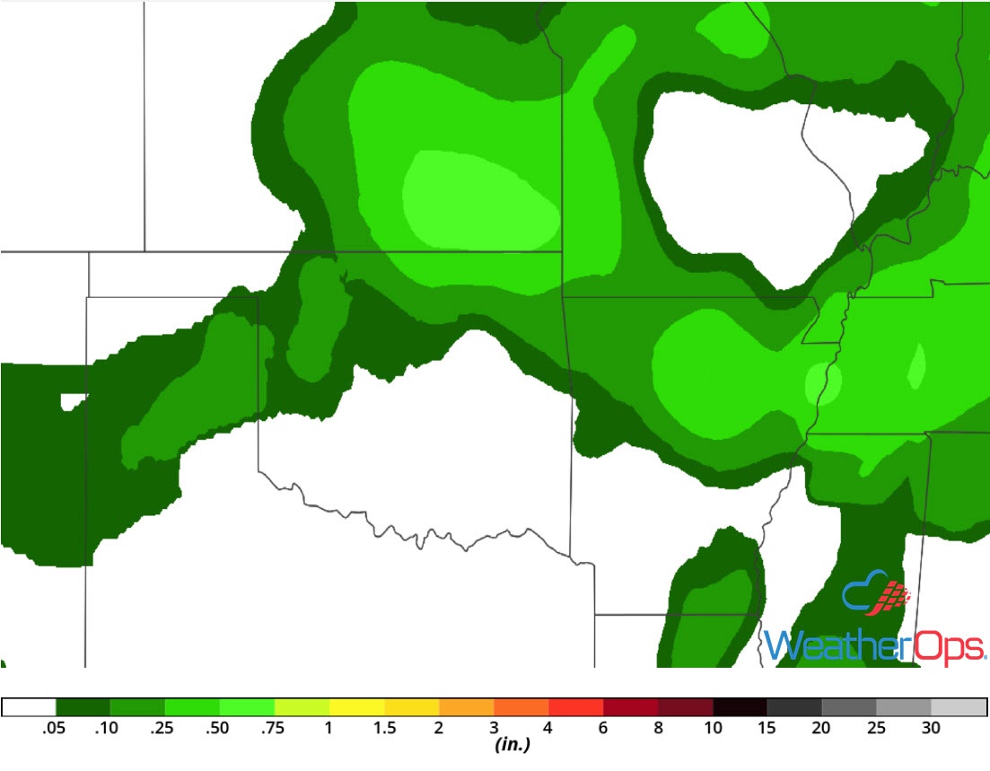
Rainfall Accumulation for Thursday
Risk for Thunderstorms Thursday across Illinois, Iowa, and Northern Missouri
Despite the primary front shifting to the south of the area, isolated strong to severe thunderstorms may develop this afternoon and evening. Instability will build as a result of warm surface temperatures, plentiful moisture, and cooling temperatures aloft. An upper level disturbance will support a threat for damaging winds.
Major Cities in Region: Kirksville, MO, Cedar Rapids, IA, Davenport, IA, Peoria, IL
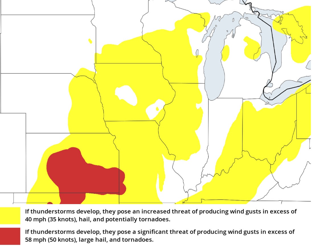
Thunderstorm Risk for Thursday
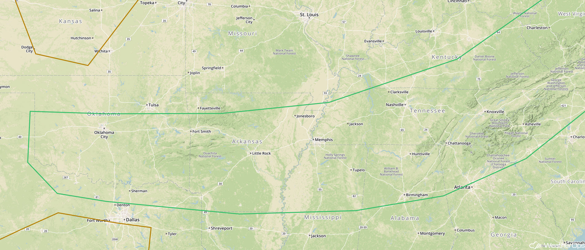
Thunderstorm Potential for the Mississippi, Tennessee, and Ohio Valleys Thursday
A slow moving cold front is producing scattered showers and thunderstorms from central Ohio southwestward into northeast Arkansas. These storms will have the potential to produce damaging winds. Additional activity is expected to develop across the Ohio and Tennessee Valleys by the mid to late afternoon. Strong instability and wind shear will support a risk for damaging winds and large hail.
Major Cities in Region: Memphis, TN, Nashville, TN, Louisville, KY, Cincinnati, OH
 Thunderstorm Risk for Thursday
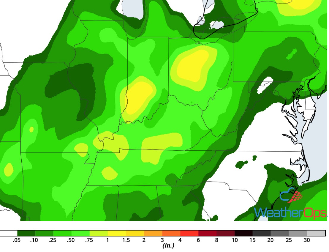
Potential for Excessive Rainfall Thursday for the Mid-Ohio Valley
The thunderstorms described above will have the potential to produce heavy rain. Widespread rainfall totals of 0.75 inch with locally higher amounts in excess of 2 inches are expected.
Major Cities in Region: Louisville, KY, Lexington, KY
Rainfall Accumulation for Thursday
Thunderstorms for Idaho and Southwest Montana on Friday
An upper level disturbance will move out of Washington and Oregon, and into Idaho by early Friday morning. Ahead of the trough, instability and increasing mid-level winds will support the development of isolated thunderstorms within the higher terrain. Damaging winds and large hail will be the primary hazards with these storms.
Major Cities in Region: Boise, ID, Missoula, MT
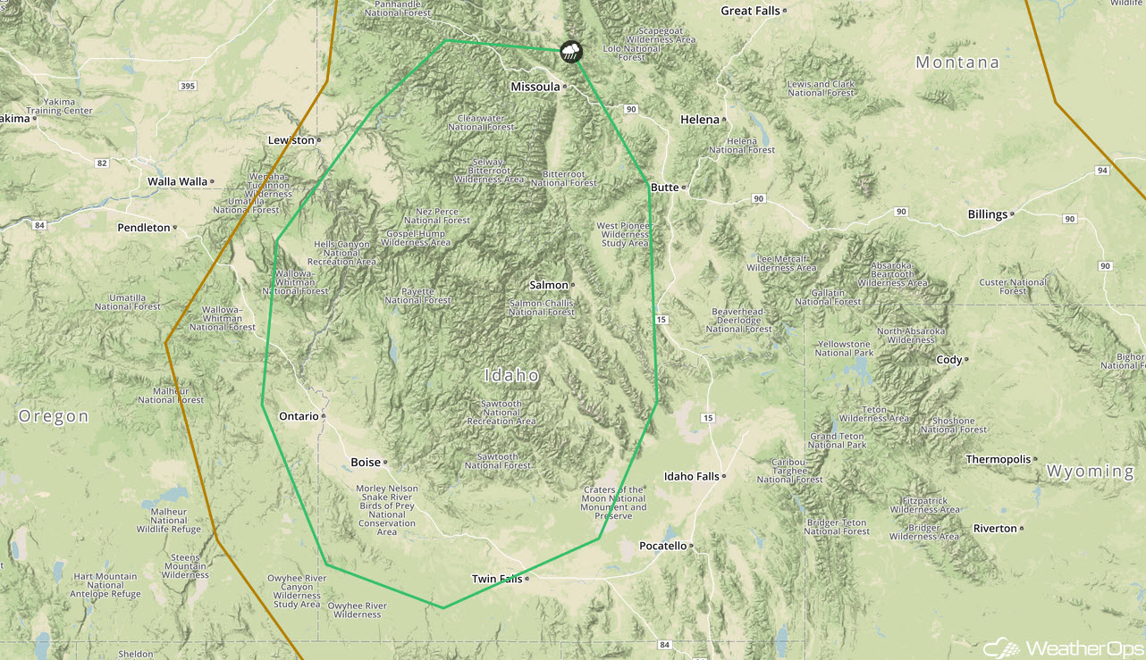
SPC Convective Outlook for Friday
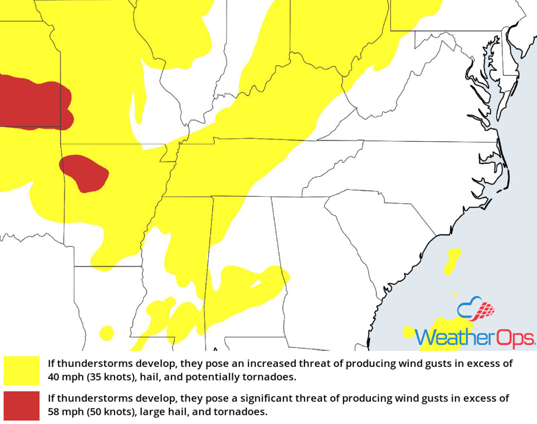
Risk for Thunderstorms Friday from the Central Plains to the Tennessee Valley
One or two weakening thunderstorm clusters may be ongoing along a front from the Ohio Valley into northern Oklahoma Friday morning. If enough clearing and daytime heating can occur along, and just south of the front, scattered thunderstorms may redevelop by the afternoon. Although upper level winds will not be particularly strong, large hail and damaging winds will be the primary hazards.
Major Cities in Region: Oklahoma City, OK, Fort Smith, AR, Little Rock, AR, Memphis, TN, Nashville, TN, Birmingham, AL, Chattanooga, TN, Knoxville, TN
SPC Convective Outlook for Friday
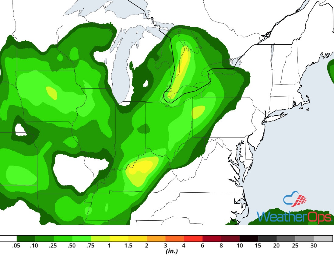
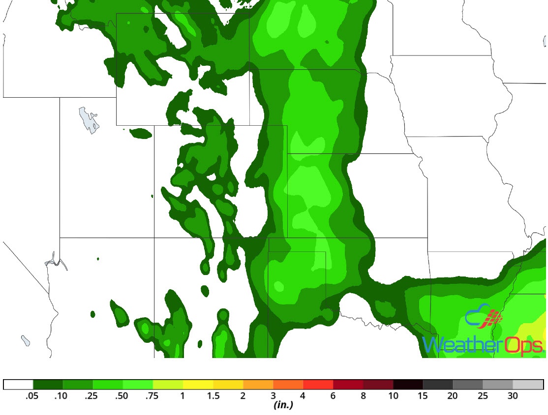
Potential for Excessive Rainfall Friday across the Ohio and Tennessee Valleys
Thunderstorm activity across the Tennessee Valley and northward into the Ohio Valley will have the potential to produce excessive rainfall. The first round of activity will be ongoing Friday morning ahead of a front. After a brief break, additional activity is expected to develop during the afternoon and evening. Widespread rainfall amounts near an inch with locally higher amounts in excess of 2 inches are expected. Flash flooding may occur in areas that receive multiple rounds of rain.
Major Cities in Region: Paducah, KY, Evansville, IN, Indianapolis, IN, Columbus, OH
Rainfall Accumulation for Friday
Thunderstorm Potential across the Northeast and Mid Atlantic on Friday
The potential for thunderstorms will be dependent upon whether morning cloud cover and showers clear out. If enough clearing occurs by the late morning and early afternoon, then instability and wind shear will be sufficient for the development of scattered showers and thunderstorms. Damaging winds will be the primary hazard with these storms.
Major Cities in Region: Washington, DC, Baltimore, MD, Philadelphia, PA, New York, NY, Albany, NY, Providence, RI, Boston, MA
SPC Convective Outlook for Friday
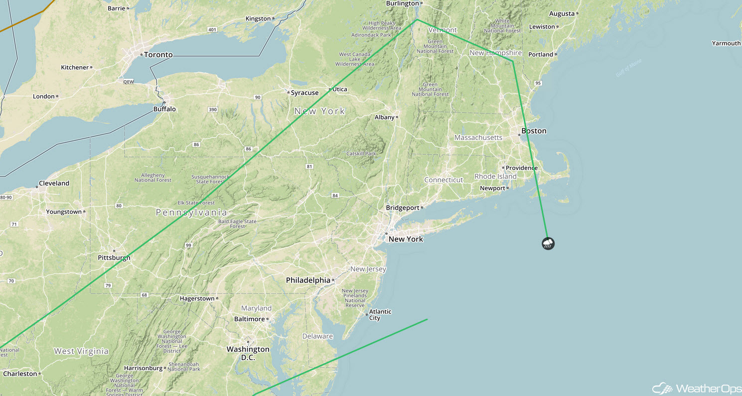
Risk for Excessive Rainfall Friday for the Northeast
Heavy rain will move into the Northeast on Friday as an area of low pressure slowly moves eastward. Widespread rainfall amounts of 1-2 inches with locally higher amounts in excess of 3 inches are forecast.
Major Cities in Region: Syracuse, NY, Burlington, VT, Augusta, ME
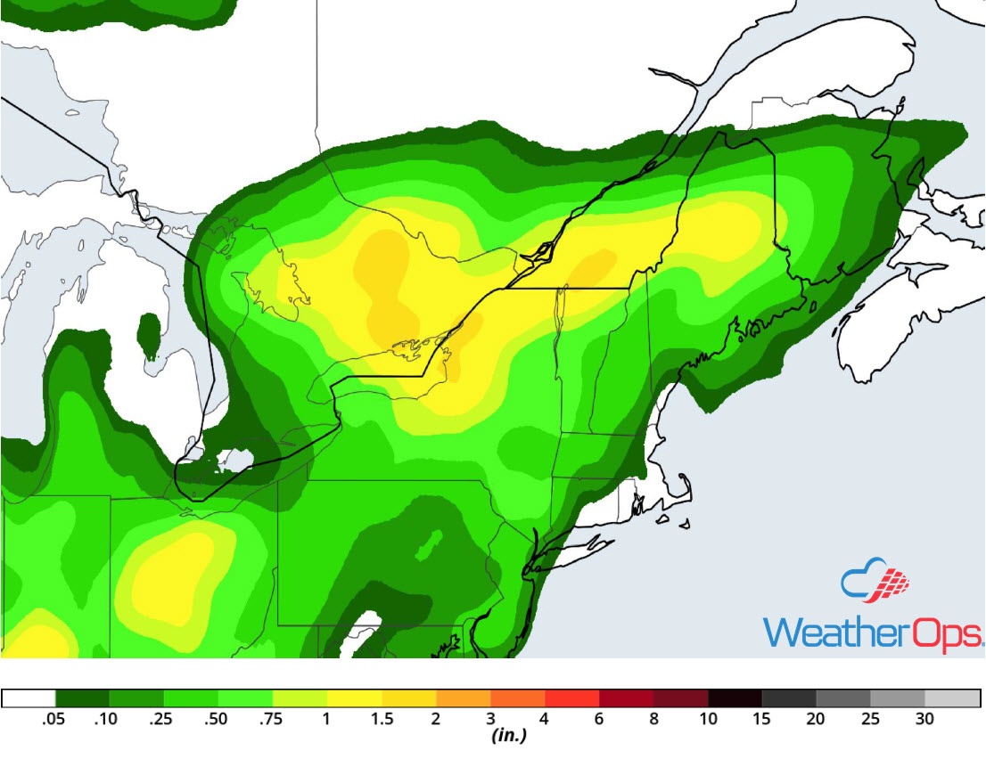
Rainfall Accumulation for Friday
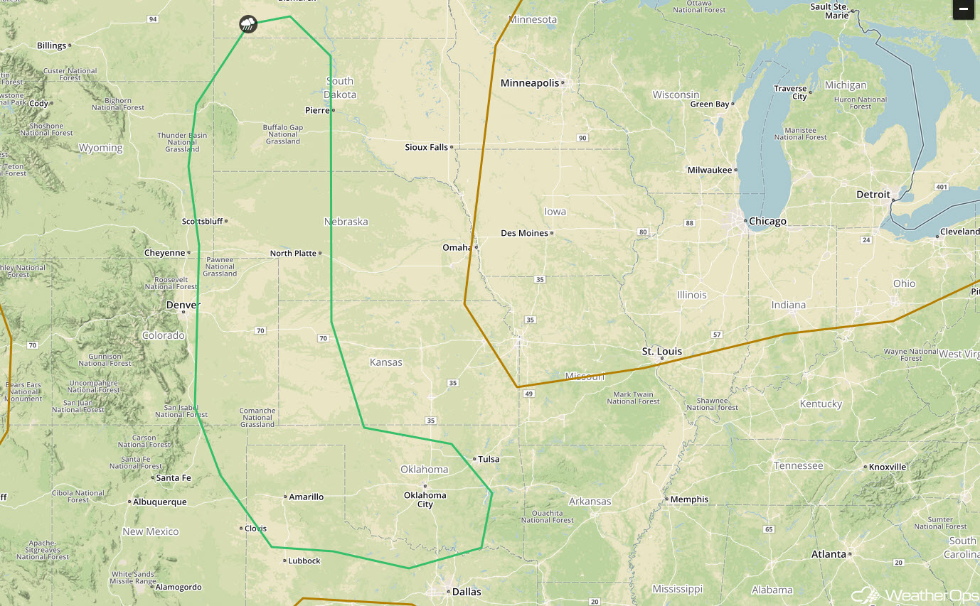
Excessive Rainfall for the Southern High Plains Friday
A series of mid-level disturbances will produce scattered thunderstorms across far eastern New Mexico and southeast Colorado while slowly shifting eastward across the High Plains late Friday afternoon through Friday night. Rainfall totals will range 1-2 inches with locally higher amounts in excess of 3 inches.
Major Cities in Region: Las Vegas, NM, Trinidad, CO, Clovis, NM
Rainfall Accumulation for Friday
Thunderstorms from the Western High Plains to the Southern Plains on Saturday
A trough in the lee of the Rockies will aid in the development of severe thunderstorms within the higher terrain on Saturday, Additional thunderstorms may develop as activity moves eastward, eventually evolving into a complex of thunderstorms. This complex may continue east-southeastward across southwest Kansas, the Texas Panhandle, and western Oklahoma during the overnight hours. Damaging winds and hail will be the primary hazards with these storms.
Major Cities in Region: Rapid City, SD, Goodland, KS, Amarillo, TX, Guymon, OK, North Platte, NE, Oklahoma City, OK
SPC Convective Outlook for Saturday
Excessive Rainfall Saturday from the Western High Plains into the Southern Plains
In addition to the thunderstorms described above, there will be a potential for excessive rainfall. Rainfall totals of 1-2 inches with locally higher amounts in excess of 3 inches are expected. Given recent heavy rainfall, there will be a slight risk for flash flooding.
Major Cities in Region: Goodland, KS, Amarillo, TX, Guymon, OK, Dodge City, KS
Rainfall Accumulation for Saturday
Tropical Update
Subtropical Storm Ernesto (green oval) is 585 miles east-southeast of Cape Race, Newfoundland and is moving northeastward at 16 mph. Winds are at 45 mph with higher gusts. Ernesto is expected to become a post-tropical cyclone tonight or early Friday.
A tropical wave (red oval) is located about 750 miles east-southeast of the Windward Islands and producing a large area of disorganized cloudiness and showers. Some gradual development may occur over the next couple of days as the system moves west-northwestward toward the Windward Islands. By late Saturday, conditions should become unfavorable for further development. Regardless of development, heavy rain is likely across the Lesser Antilles over the next few days.
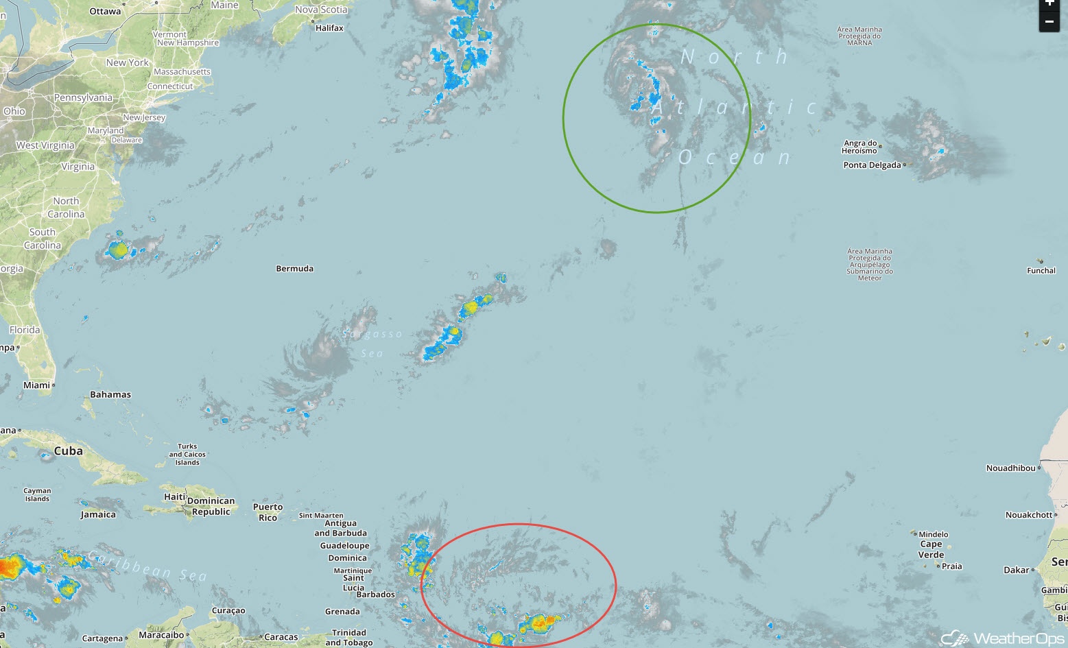
Enhanced Infrared Satellite
A Look Ahead
Showers and thunderstorms will continue to move across the Plains and Midwest on Sunday in association with an area of low pressure and cold front. On Monday, this activity will move into the Great Lakes and Ohio Valley. Rain will continue across the Great Lakes and Ohio Valley on Tuesday. By Wednesday, heavy rain will move into the Northeast.
