National Weather Summary for Thursday, April 7, 2016
by David Moran, on Apr 7, 2016 10:23:01 AM
Heavy rain will continue across New England on Thursday. Snow will be possible for portions of Indiana, Michigan, and Ohio Friday night into Saturday. Wildfire conditions will continue across portions of the Plains on Thursday.
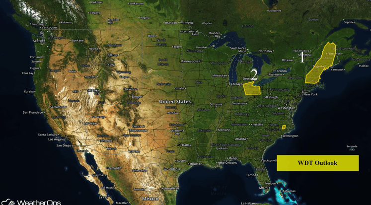
US Hazards
Region 1
An area of low pressure will move northeastward just west of New England today. As the cold front that extends southward from the low moves eastward through New England, heavy rain will be possible across Region 1. Rainfall amounts of 2-3 inches are expected, with locally higher amounts in excess of 4 inches possible. Rain should come to an end Friday morning.
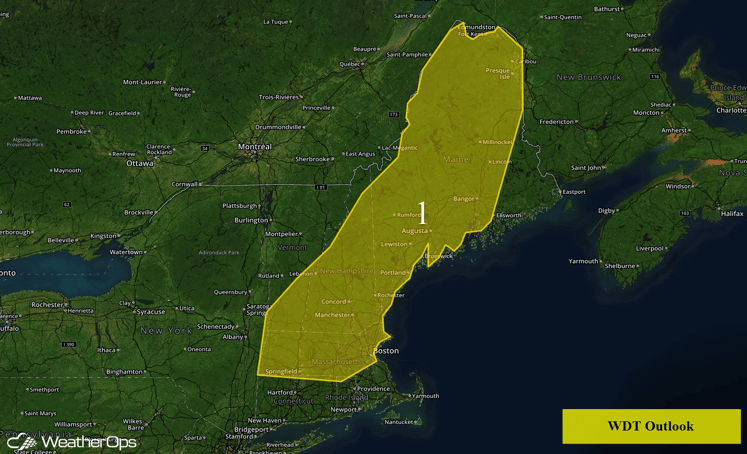
Region 1
Region 2
An area of low pressure will move south of Region 2 this weekend, bringing snow to the region as early as Friday evening and continuing into Saturday morning. Total accumulations of 3-5 inches with locally higher amounts in excess of 6 inches will be possible.
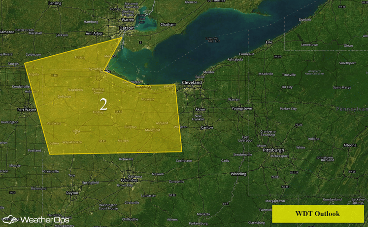
Region 2
Wildfire Conditions Continue Across the Plains
Wildfire conditions will continue across portions of the Plains on Thursday. Relative humidities between 15-25% and northwesterly winds of 25-35 mph with gusts in excess of 50 mph at times. These conditions, coupled with warm temperatures will allow any fires that get started to spread quickly.
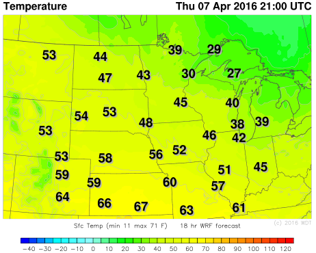
WDT WRF Temperatures 4pm CDT Thursday
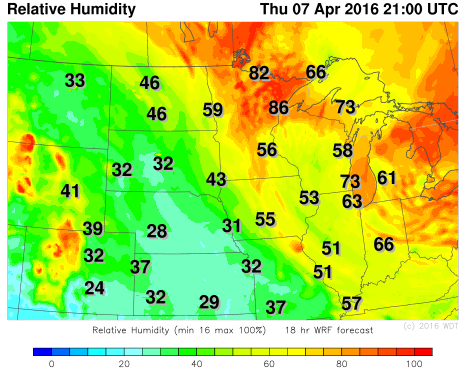
WDT WRF Relative Humidity 4pm CDT Thursday
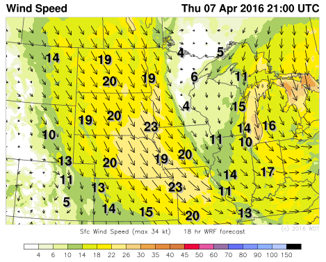
WDT WRF Winds 4pm CDT Thursday


