


by David Moran, on Apr 26, 2018 9:57:40 AM
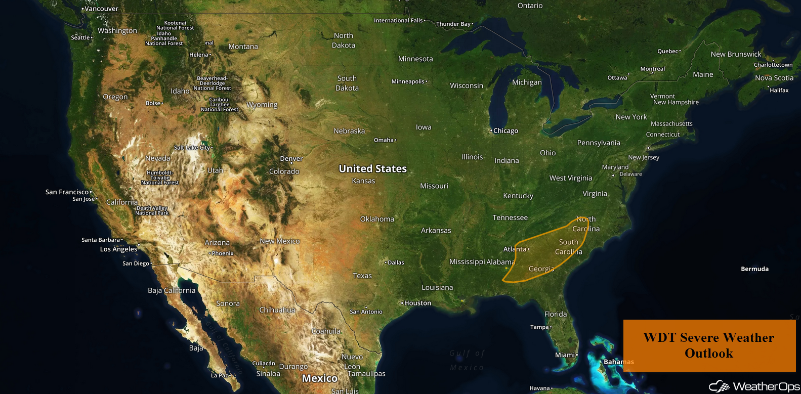
Thunderstorms will continue for portions of the Southeast on Thursday as an area of low pressure and cold front move through the region.
- Thunderstorms across the Southeast on Thursday
- Potential for Thunderstorms Friday across the Pacific Northwest
 US Hazards

Thunderstorms across the Southeast on Thursday
An area of low pressure in the Deep South and its associated cold front will slowly track eastward today. Ongoing showers and thunderstorms will spread along and ahead of the front and track. Ahead of this cold front, instability will build during the afternoon. With strong shear in place and forcing from the front, the intensity of this activity will increase; a few storms may become strong to severe. Hail and damaging winds will be the primary hazards with these storms.
Major Cities in Region: Columbus, GA, Atlanta, GA, Macon, GA, Columbia, SC, Charlotte, NC
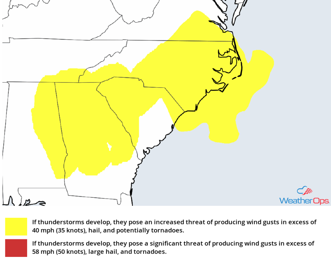 Thunderstorm Risk for Thursday
Potential for Thunderstorms Friday across the Pacific Northwest
A strong upper level disturbance will make its way into the Pacific Northwest on Friday. With this disturbance providing ample lift across the region and daytime heating producing at least marginal instability across this area, thunderstorms are expected to develop. A few storms may become severe with hail and damaging winds being the primary hazards.
Major Cities in Region: Boise, ID, Twin Falls, ID
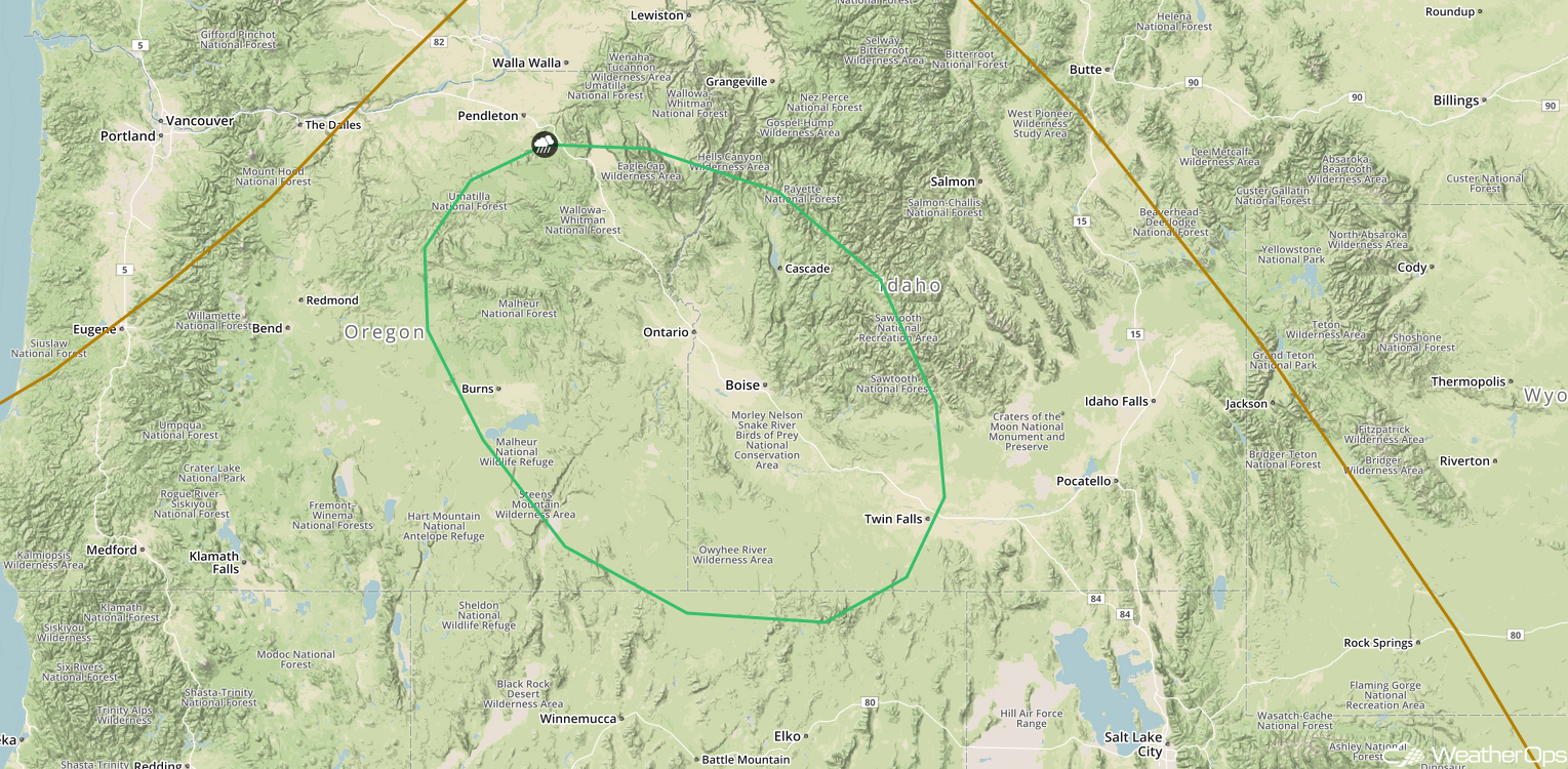 SPC Convective Outlook for Friday
A Look Ahead
The upper level system moving into the Pacific Northwest described above may bring some snow to the higher elevations late Saturday into Sunday. Early next week, an area of low pressure may bring rain to portions of the Northern Plains. Thunderstorms may develop across the Upper Midwest southward into the Central Plains ahead of a cold front Tuesday into Wednesday.
This is just a brief look at current weather hazards. We can provide you site-specific weather forecast information for the purpose of protecting your personnel and assets and to assess your weather risk. Try a 7-day demo right away and learn how timely precision weather information can enhance your bottom line.
