National Weather Summary for Monday, September 25, 2017
by David Moran, on Sep 25, 2017 10:14:04 AM
No hazards are currently in effect.
- Excessive Rainfall for the Southern Plains on Monday
- Risk for Excessive Rainfall Tuesday and Wednesday for Southwest Texas
- Tropical Update
 US Hazards
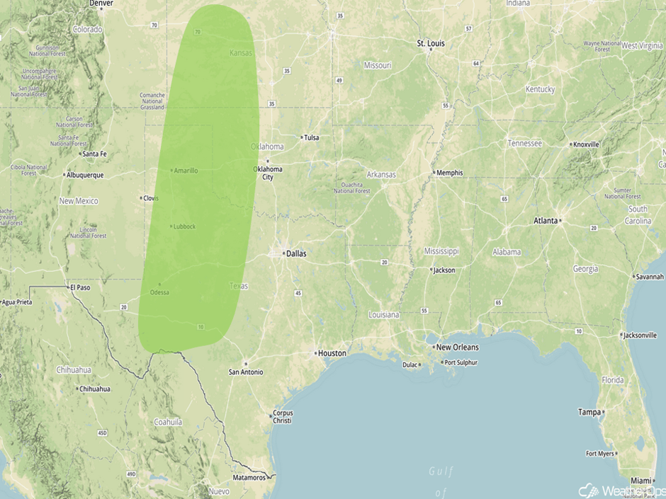
Excessive Rainfall for the Southern Plains on Monday
There will be a risk for excessive rainfall across the Southern Plains on Monday. Multiple days of widespread rainfall will likely prevent any significant strong to severe thunderstorms. A very slow moving cold front will continue to interact with ample moisture being brought northward from the Gulf of Mexico. Widespread showers and thunderstorms will occur for much of the day and evening over the region, with some strong thunderstorms during the afternoon. Localized flash flooding will be a potential hazard within training thunderstorms. Rainfall amounts in excess of 4 inches are forecast.
Major Cities in Region: Odessa, TX, Lubbock, TX, Amarillo, TX, Dodge City, KS
 Excessive Rainfall Risk Outline for Monday
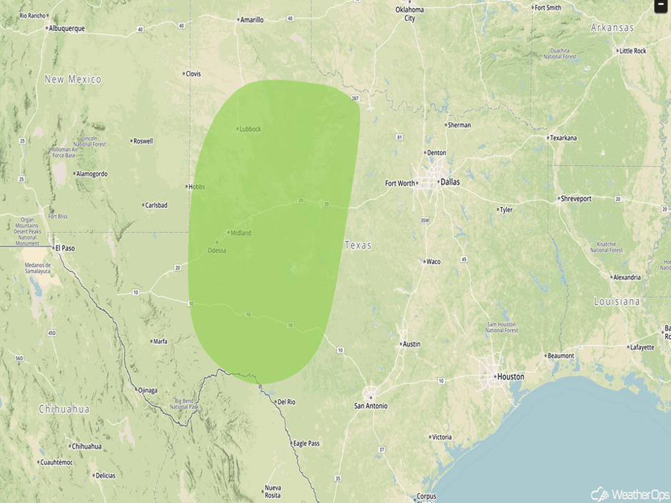
Risk for Excessive Rainfall Tuesday and Wednesday for Southwest Texas
The cold front pushing through the Midwest and Plains will stall over Texas on Tuesday, which will produce a threat for excessive rainfall through at least Wednesday. Areas of southwestern Texas can expect showers and thunderstorms to be widespread and persistent. Some isolated strong and gusty winds will be possible with this activity, but no severe activity is currently expected. Two day rainfall totals of 4-6 inches with locally higher amounts in excess of a foot are forecast. This will lead to the potential for flash flooding.
Major Cities in Region: Midland, TX, Lubbock, TX
 Excessive Rainfall Risk Outline for Tuesday
Tropical Update
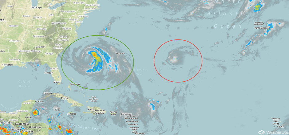
Hurricane Maria (green oval) is 335 miles south-southeast of Cape Hatteras, North Carolina and is moving northward at 7 mph. This general motion is expected to continue with a decrease in forward speed through Tuesday night. On the current forecast track, the center of Maria will move well east of the US during the next day or so. Maximum sustained winds are near 75 mph with higher gusts and Maria is expected to weaken to a tropical storm by Tuesday night.
Hurricane Lee (red oval) is nearly stationary about 910 miles east of Bermuda with sustained winds of 90 mph. Lee is forecast to move west-southwestward to westward. Little change in strength is forecast over the next 48 hours.
 Enhanced Infrared Tropical Satellite
A Look Ahead
Heavy rainfall will continue across the Southern Plains on Thursday along a stalled front. The flash flooding risk, however, will be greatly diminished. On Friday, a weak area of low pressure moving over the Great Lakes may produce some light showers.
This is just a brief look at current weather hazards. We can provide you site-specific weather forecast information for the purpose of protecting your personnel and assets and to assess your weather risk. Try a 7-day demo right away and learn how timely precision weather information can enhance your bottom line.


