National Weather Summary for Monday, September 11, 2017
by David Moran, on Sep 11, 2017 11:02:33 AM
Tropical storm to hurricane force conditions will continue Monday from Florida to the Carolinas as Tropical Storm Irma moves northward.
- Tropical Storm to Hurricane Force Conditions Monday from Florida to the Carolinas
- Elevated Conditions Continue for the Central Gulf of Mexico Monday
- Thunderstorm Potential Monday across Southern California
- Thunderstorms and Heavy Rainfall Continue for the Carolinas on Tuesday
- Tropical Update
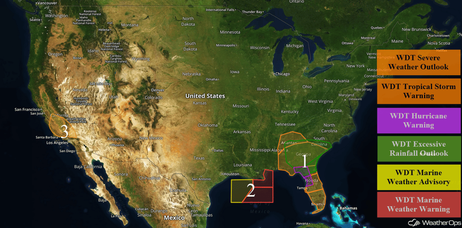 US Hazards
Tropical Storm to Hurricane Force Conditions Monday from Florida to the Carolinas
Irma is now a tropical storm and continues to weaken while moving north-northwestward. Tropical storm force conditions will likely persist across much of Florida through the evening hours. Winds of 40-50 mph with gusts in excess of 60 mph are forecast across southern Florida. A few lingering rainbands may allow for 0.50-1.50 inches of rainfall across this area. Along the coastal areas of Florida, winds of 50-65 mph with gusts to 80 mph, storm surge of 4-6 feet, and rainfall amounts of 3-6 inches with locally higher amounts are expected. Further inland from eastern Alabama eastward to South Carolina, rainfall amounts of 2-6 inches with locally higher amounts in excess of 7 inches are expected.
Update 2:34pm EDT: Tornado Watch in effect for portions of Georgia and South Carolina until 10pm EDT.
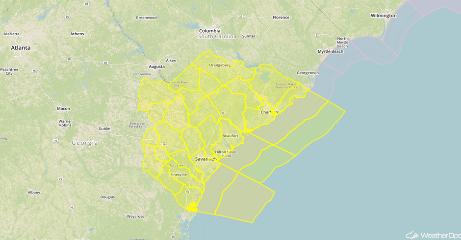 Tornado Watch
Update 2:54pm EDT: Tornado Warnings along South Carolina coast.
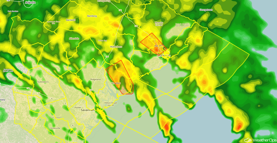 Radar 2:54pm EDT
Major Cities in Region: Birmingham, Al, Tallahassee, FL, Atlanta, GA, Tampa, FL, Orlando, FL, Miami, FL, Jacksonville, FL, Columbia, SC, Savannah, GA
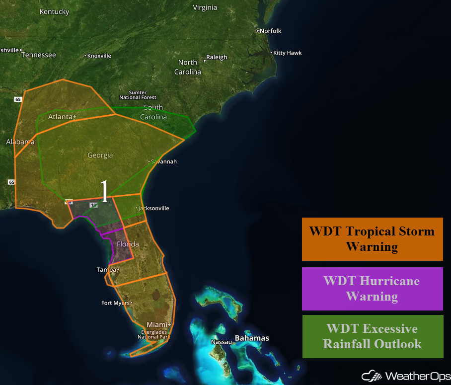 Region 1
Elevated Conditions Continue for the Central Gulf of Mexico Monday
Hurricane Irma will continue to track northward across Florida this morning and head into the Tennessee River Valley on Tuesday. As it does, it will continue to bring enhanced winds and seas to much of the Gulf of Mexico. With this system continuing to move further away, conditions will begin to improve Monday afternoon. Winds of 15-20 knots with gusts in excess of 25 knots and seas of 7-10 feet are expected. In far eastern portions of the region, seas of 10-15 feet are expected.
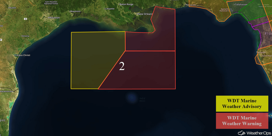 Region 2
Thunderstorm Potential Monday across Southern California
An upper level disturbance is nearly stationary along the southern California coast. This upper low will contribute to marginal instability and wind shear in the area. Cold temperatures aloft, warmer temperatures near the surface, and low level winds along areas of higher terrain should support the development of a few strong thunderstorms by this afternoon. Storm motions will be from southwest to northeast with wind gusts in excess of 40 mph the primary hazard.
Major Cities in Region: Fresno, CA, Bakersfield, CA
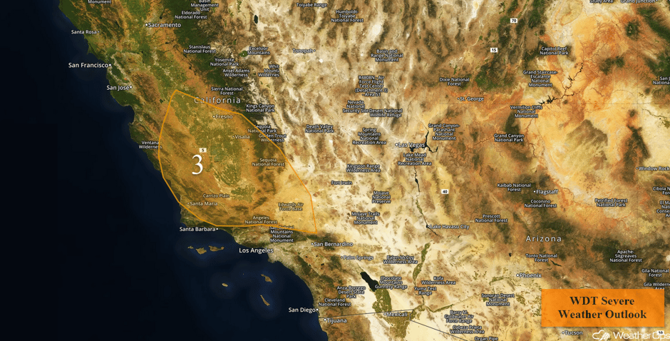 Region 3
Thunderstorms and Heavy Rainfall Continue for the Carolinas on Tuesday
Irma is expected to weaken to a low end tropical storm or tropical depression on Tuesday, however, continued moisture feeding into and along the eastern portion of Irma will provide an area of increased moisture and instability. Showers and some strong to severe thunderstorms are likely across the region. Primary hazards appear to be strong to severe wind gusts, moderate to very heavy rainfall, and possibly an isolated brief tornado or two.
Major Cities in Region: Raleigh, NC, Myrtle Beach, SC, Wilmington, NC
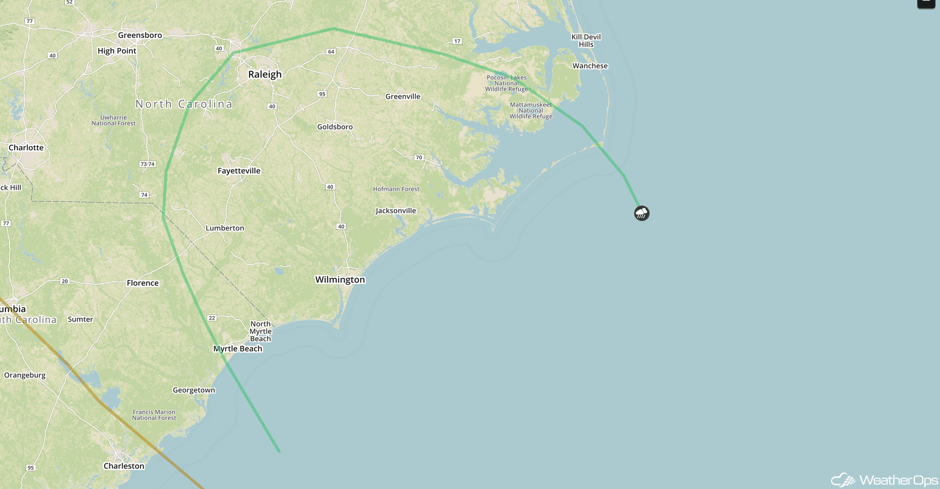 SPC Convective Outlook for Tuesday
Tropical Update
Irma (green oval) is now a tropical storm and centered 70 miles east of Tallahassee, FL. Maximum sustained winds are at 65 mph with higher gusts. Irma is currently moving toward the north-northwest at 17 mph, moving into southwestern Georgia later today and eastern Alabama Tuesday morning. Continued weakening is expected with Irma becoming a depression on Tuesday.
Hurricane Jose (blue oval) is currently located 305 miles north-northeast of the Grand Turk Island and is moving northward at 9 mph. Maximum sustained winds are at 105 mph. A turn toward the northeast is expected tonight with a slower motion toward the southeast Tuesday. Some weakening is expected during the next 48 hours.
A tropical wave (red oval) is located several hundred miles west-southwest of the Cabo Verde Islands and continues to produce disorganized showers and thunderstorms. Some development is possible during the next couple of days before upper level winds become unfavorable for development. This system is expected to move west-northwestward for the next two days and then turn northward over the central Atlantic.
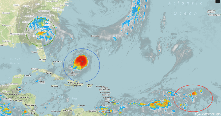 Enhanced Infrared Tropical Satellite
A Look Ahead
Irma will transition into a low on Wednesday. As it moves northeastward, showers and thunderstorms will develop from the Ohio River Valley to the East Coast. With recent heavy rain, there will be an increased risk for flooding and flash flooding. Showers and thunderstorms will continue across the Ohio Valley on Thursday. By Friday, a few showers and thunderstorms may linger across the Mid Atlantic as the remnants of Irma continue to push offshore. Into the weekend, a series of disturbances may allow for the development of showers and thunderstorms across the Plains and Midwest.
This is just a brief look at current weather hazards. We can provide you site-specific weather forecast information for the purpose of protecting your personnel and assets and to assess your weather risk. Try a 7-day demo right away and learn how timely precision weather information can enhance your bottom line.


