


by David Moran, on Oct 29, 2018 10:22:59 AM
Snow is expected across portions of Colorado and northern New Mexico Tuesday and Wednesday as an upper level system moves across the region.
- Snow for Colorado and Northern New Mexico Tuesday into Wednesday
- Thunderstorms Wednesday from Texas into the Lower Mississippi Valley
- Excessive Rainfall from the Lower Mississippi Valley into the Ohio Valley on Wednesday
- Tropical Update
US Hazards
Snow for Colorado and Northern New Mexico Tuesday into Wednesday
An upper level disturbance moving across the Rockies will likely bring accumulating snowfall to the Colorado Front Range and adjacent High Plains on Tuesday. Late Tuesday night and into Wednesday, snow will spread southward into New Mexico. Snow accumulations of 3-6 inches, with locally higher amounts in excess of 10 inches, are expected in the higher elevations. For the lower elevations, 2-4 inches with locally higher amounts in excess of 5 inches are forecast.
Major Cities in Region: Santa Fe, NM, Colorado Springs, CO
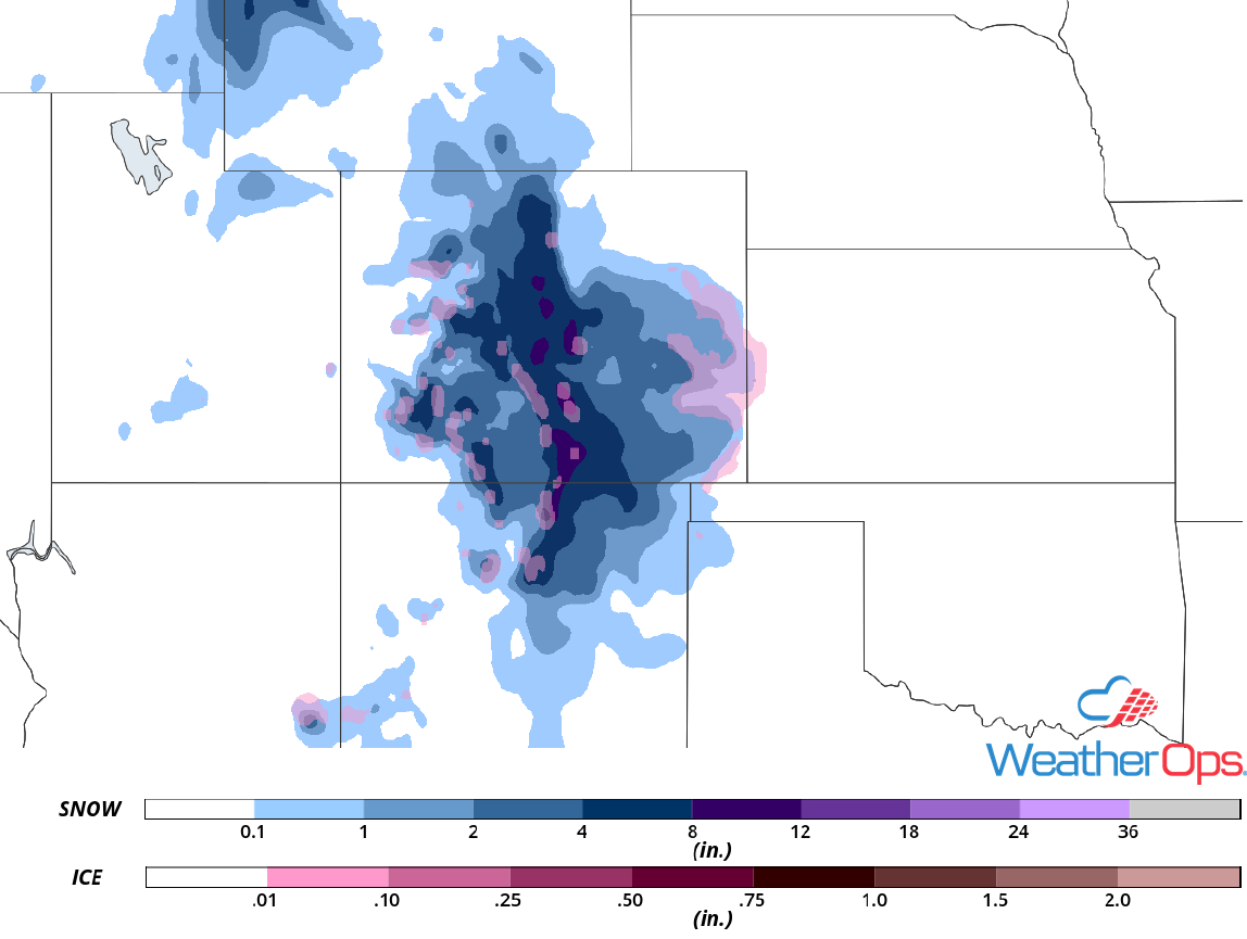
Snow Accumulation for Tuesday and Wednesday
Thunderstorms Wednesday from Texas into the Lower Mississippi Valley
A strong cold front is expected to track eastward on Wednesday. Increasing moisture will allow instability to build. With this instability and lift along the front, there will be a potential for severe thunderstorms during the afternoon and early evening. Damaging winds and hail will be the primary hazards with these storms.
Major Cities in Region: San Antonio, TX, Austin, TX, Waco, TX, Dallas, TX, Houston, TX, Baton Rouge, LA, Jackson, MS, New Orleans, LA
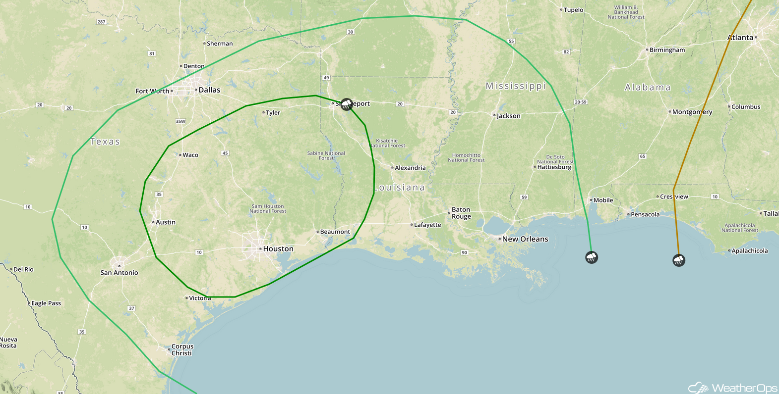
SPC Convective Outlook for Wednesday
Excessive Rainfall from the Lower Mississippi Valley into the Ohio Valley on Wednesday
The cold front described above will produce widespread showers and thunderstorms across the Lower Mississippi Valley into the Ohio Valley on Wednesday. With deep moisture spreading northward from the Gulf of Mexico, there will be a potential for excessive rainfall. Rainfall amounts will range 1-3 inches with locally higher amounts in excess of 5 inches, leading to an increased risk for flooding.
Major Cities in Region: Jonesboro, AR, Paducah, KY, Cincinnati, OH
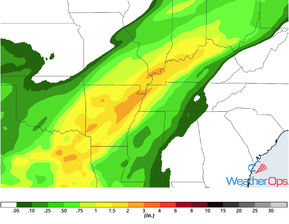
Rainfall Accumulation for Wednesday
Tropical Update
Hurricane Oscar is 620 miles southeast of Bermuda and is moving westward at 12 mph. A turn toward the northwest at a slower speed is expected later today, followed by a turn toward the north tonight. On Tuesday, it to begin moving toward the north-northeast with an increase in forward speed. Oscar is expected to accelerate quickly toward the northeast beginning on Wednesday. Maximum sustained winds are near 80 mph. Additional strengthening is forecast through Tuesday with gradual weakening expected afterward.
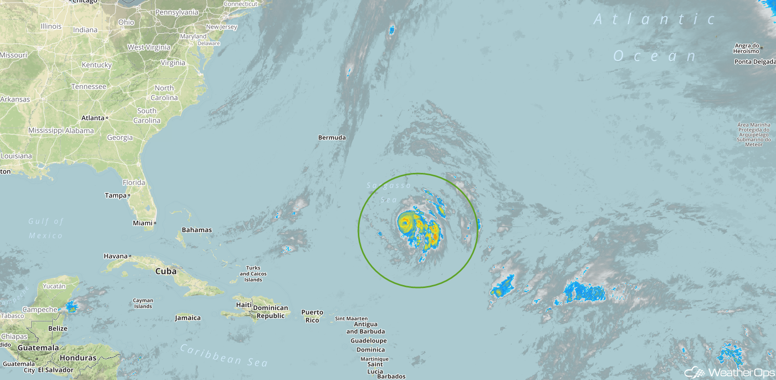
Enhanced Infrared Satellite
A Look Ahead
Showers and thunderstorms are expected for much of the eastern US on Thursday as an area of low pressure moves eastward. On Friday, light rain may develop from the Central Plains into the Mid Mississippi Valley. An area of low pressure moving across the Northern Plains and Upper Midwest may produce some light snow across the region on Saturday. Rain and snow may develop Sunday across portions of the Northern Rockies.
