National Weather Summary for Monday, November 6, 2017
by David Moran, on Nov 6, 2017 10:03:08 AM
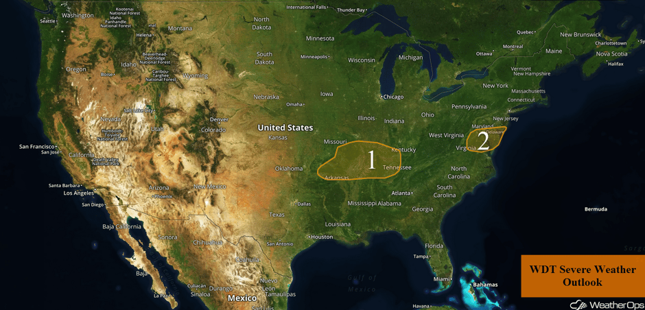
Thunderstorms are expected to develop across the Mid Mississippi Valley on Monday ahead of a cold front. Conditions will be favorable for the development of thunderstorms across the Mid Atlantic.
- Thunderstorms for the Mid Mississippi Valley on Monday
- Risk for Thunderstorms Monday for the Mid Atlantic
- Tropical Update
 US Hazards
Thunderstorms for the Mid Mississippi Valley on Monday
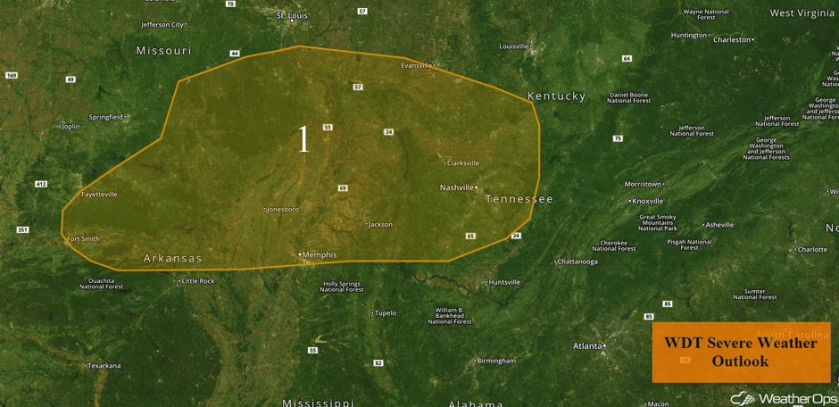
Thunderstorms are expected to develop across the Mid-Mississippi Valley this afternoon and evening as a cold front tracks through the region. While conditions ahead of the front are not supportive of widespread severe weather, the stronger storms will be capable of producing large hail and wind gusts in excess of 50 mph.
Major Cities in Region: Russellville, AR, Memphis, TN, Nashville, TN
 Region 1
Risk for Thunderstorms Monday for the Mid Atlantic
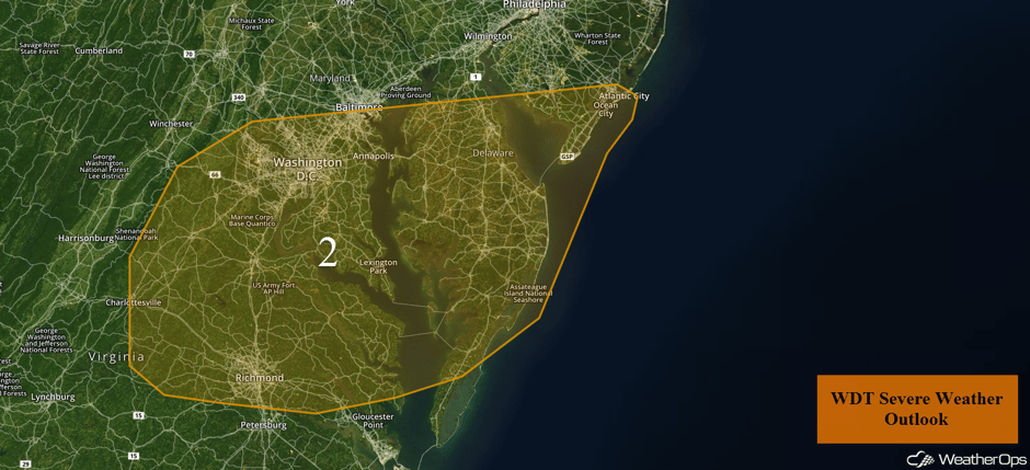
Thunderstorms are forecast for the Mid Atlantic this afternoon and evening ahead of a cold front. While widespread severe weather is not anticipated, the stronger storms may produce large hail and wind gusts in excess of 60 mph.
Major Cities in Region: Richmond, VA, Washington, DC, Atlantic City, NJ
 Region 2
Tropical Update
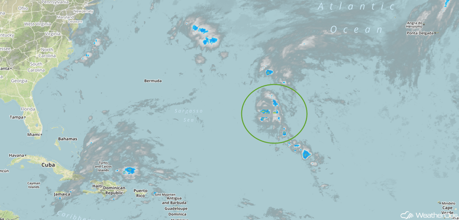
The center of Tropical Depression Nineteen is 990 miles east of Bermuda and is moving eastward at 6 mph. A turn toward the north-northeast or north is expected later today. This general motion is expected to continue through Tuesday. Maximum sustained winds are near 35 mph with higher gusts. This depression is expected to become a tropical storm later today.
 Enhanced Infrared Tropical Satellite
A Look Ahead
Rain is expected for the Pacific Northwest Wednesday into Thursday as an area of low pressure moves into the region. A fast moving system may bring a wintry mix of precipitation to portions of the the Midwest and Great Lakes on Thursday, but only light accumulations are expected. Otherwise, high pressure will dominate the weather for much of the country through next weekend,
Learn what to expect this winter by signing up for our Winter Weather Outlook webinar today.
This is just a brief look at current weather hazards. We can provide you site-specific weather forecast information for the purpose of protecting your personnel and assets and to assess your weather risk. Try a 7-day demo right away and learn how timely precision weather information can enhance your bottom line.


