


by David Moran, on Nov 26, 2018 10:56:53 AM
Snow will continue across the Midwest on Monday as an area of low pressure continues to move eastward. As this system progresses eastward, snow will persist across the Great Lakes through Tuesday. Thunderstorms will continue for portions of Florida along a cold front. Elevated winds and seas will continue for much of the Gulf of Mexico in the wake of this cold front.
- Continued Snow across the Midwest on Monday
- Snow through Tuesday across the Great Lakes
- Thunderstorms across Florida on Monday
- Elevated Winds and Seas Monday for the Gulf of Mexico
- Potential for Snow across the Northeast on Tuesday
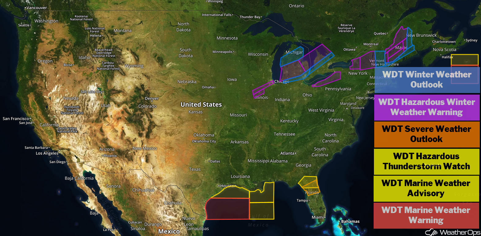
US Hazards
Continued Snow across the Midwest on Monday
The area of low pressure bringing snowfall to the Midwest will move out of the region later today. Light to moderate snowfall will continue through the morning with an additional 1-2 inches of snow expected in some areas.
Major Cities in Region: Indianapolis, IN, Fort Wayne, IN, Cincinnati, OH
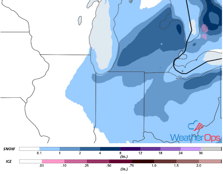
Snowfall Accumulation for Monday
Snow through Tuesday across the Great Lakes
The area of low pressure described above will linger across the region into Tuesday. As a result, moderate to heavy snow is expected, along with gusty winds. Visibility will be greatly reduced in some areas due to blowing snow. Accumulations will range 2-4 inches with locally higher amounts in excess of 6 inches.
Major Cities in Region: Grand Rapids, MI, Lansing, MI, Detroit, MI, Cleveland, OH, Buffalo, NY
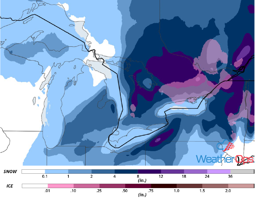
Snow Accumulation through Tuesday
Thunderstorms across Florida on Monday
Strong to severe thunderstorms will continue across portions of northern and central Florida through this evening as an upper level trough and cold front move eastward. Strong winds, hail, frequent lightning, and heavy rain will be the primary hazards with these storms.
Major Cities in Region: Tallahassee. FL, Tampa, FL, Orlando, FL, Jacksonville, FL
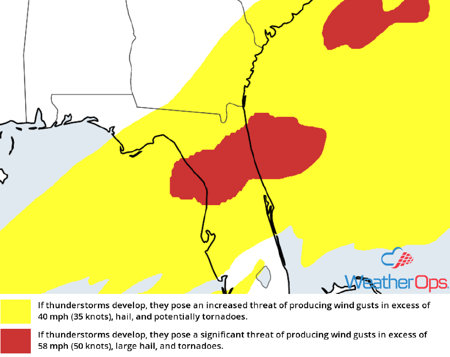
Thunderstorm Risk for Monday
Elevated Winds and Seas Monday for the Gulf of Mexico
Elevated winds and seas are expected across portions of the Gulf of Mexico on Monday in the wake of a cold front. Winds will range 25-35 knots with gusts in excess of 45 knots. Seas of 5-8 feet are forecast near the shore and 8-12 feet in the deeper waters.
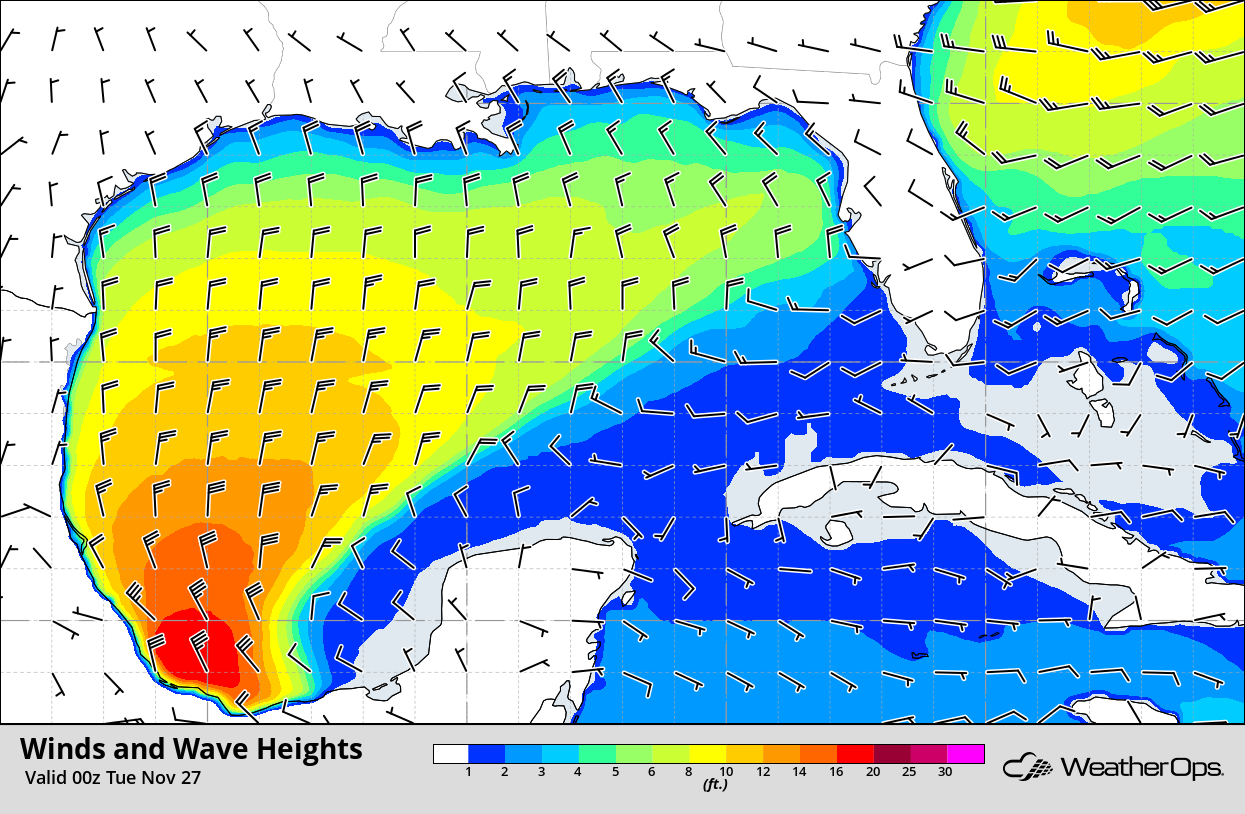
Winds and Wave Heights 6pm CST Monday
Potential for Snow across the Northeast on Tuesday
The area of low pressure expected to bring snow to the Midwest and Great Lakes will move into the Northeast on Tuesday. While the system will be weakening, moderate to heavy snow is forecast across much of the region. Snowfall totals will range 4-8 inches from Upper New York into Vermont. Further east across New Hampshire and Maine, accumulations in excess of 10 inches are expected, especially in the higher elevations across New Hampshire.
Major Cities in Region: Albany, NY, Burlington, VT, Manchester, NH, Bangor, ME
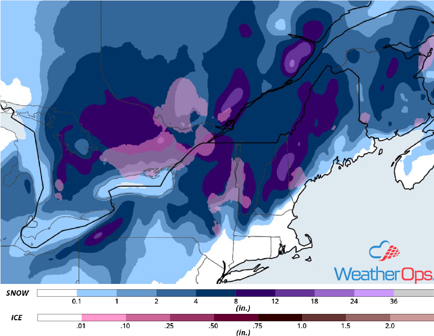
Snow Accumulation for Tuesday
A Look Ahead
Light snow is forecast across the Northeast Wednesday and Thursday as the area of low pressure described above continues to move out of the region. By Friday, snow, and perhaps some freezing rain, may develop across the Central Rockies. An area of low pressure is forecast to develop over the Southern Plains, bringing a potential for showers and thunderstorms from the Southern Plains into the Ohio Valley late Friday into Saturday. This activity will move into the Mid Atlantic and Northeast on Sunday.
