National Weather Summary for Monday, November 20, 2017
by David Moran, on Nov 20, 2017 10:33:47 AM
An area of low pressure will bring a risk for excessive rainfall and mountain snow to portions of northwestern California and southwestern Oregon on Monday. Snow will continue for portions of the Northeast throughout the day as a cold front associated with an area of low pressure in Canada moves through the region.
- Excessive Rainfall for Northwestern California and Southwestern Oregon on Monday
- Snow Continuing Monday Across the Northeast
 US Hazards
Excessive Rainfall for Northwestern California and Southwestern Oregon on Monday
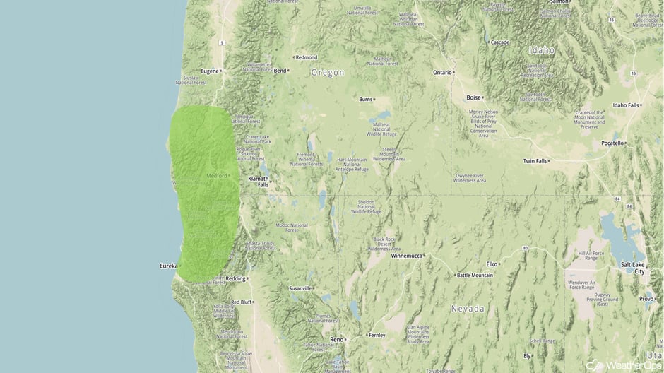
An area of low pressure will continue to move through the western US on Monday, bringing rain and mountain snow to much of the Northwest. This system, combined with plentiful moisture being streamed into the region, will allow for excessive rainfall primarily across northwestern California and southwestern Oregon. Rainfall amounts of 1-3 inches with locally higher amounts are expected. Further north, areas of heavy snow may develop, but it will likely be confined to higher elevations.
Major Cities in Region: Eureka, CA, Medford, OR
 Excessive Rainfall Risk Outline for Monday
Snow Continuing Monday Across the Northeast
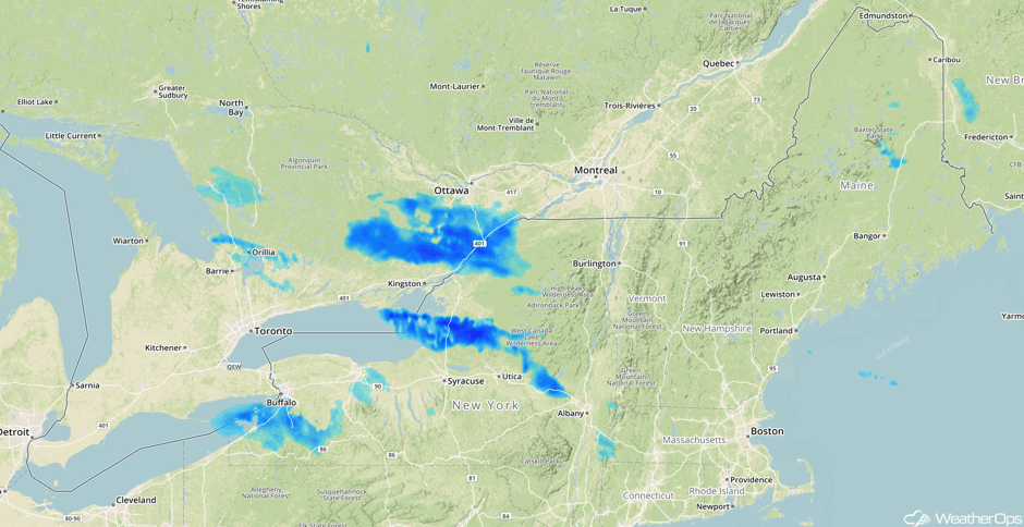
Lake effect snow will continue for portions of the Northeast through the day on Monday. Snowfall amounts of 2-5 inches with locally higher amounts in excess of 7 inches are forecast through tonight. In addition to the snow, winds in excess of 30 mph will allow for blowing and drifting snow, as well as low visibilities.
Major Cities in Region: Buffalo, NY, Syracuse, NY, Albany, NY
 Radar 10:32am EST
A Look Ahead
A front is forecast to stall over southern Florida on Tuesday, bringing the potential for light rain across the region. Light snow may develop across the Upper Midwest on the backside of an area of low pressure moving through southern Canada. Further west, an area of low pressure approaching the Pacific Northwest will bring a risk for heavy rain across portions of Washington and Oregon. Into Wednesday, an area of low pressure will bring showers and thunderstorms to portions of the Gulf Coast. Rain will continue for portions of the Northwest as the area of low pressure approaching the region moves inland through the end of the week.
Heading into Thanksgiving, showers and thunderstorms will continue for portions of the Southeast as an area of low pressure continues to move eastward. Light rain and snow may develop across the Great Lakes as a cold front moves through the region. Another area of low pressure may bring light rain and snow to the Great Lakes Saturday into Sunday.
This is just a brief look at current weather hazards. We can provide you site-specific weather forecast information for the purpose of protecting your personnel and assets and to assess your weather risk. Try a 7-day demo right away and learn how timely precision weather information can enhance your bottom line.


