National Weather Summary for Monday, May 9, 2016
by David Moran, on May 9, 2016 12:10:37 PM
Winds of 30-40 miles per hour with gusts in excess of 45 miles per hour are expected Monday morning through Tuesday afternoon for portions of the northwestern Gulf of Mexico. Severe thunderstorms are expected on Monday from the Ozark Plateau into the Red River Valley. Strong to severe thunderstorms are possible for portions of the Central Plains.
Into Tuesday, strong to severe thunderstorms are possible across portions of the Great Plains, Mississippi Valley, and Ohio Valley, as well as Central and Southern Texas. Excessive rainfall is possible across portions of eastern Montana on Tuesday. Another round of severe thunderstorms will be possible on Wednesday for portions of the Great Plains.
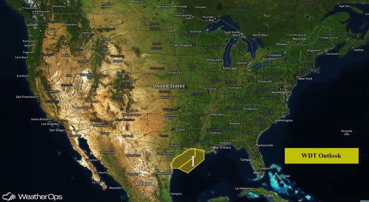
US Hazards
Region 1
Winds and seas are expected to increase through Monday morning as a surface low intensifies over the Great Plains. Southeasterly winds of 30-40 mph with gusts in excess of 45 mph will be possible Monday morning through Monday evening. In addition to the elevated winds, seas will build to 7-9 feet and persist into early Tuesday morning. Winds will return to moderate to fresh by daybreak Tuesday and seas will return to moderate.
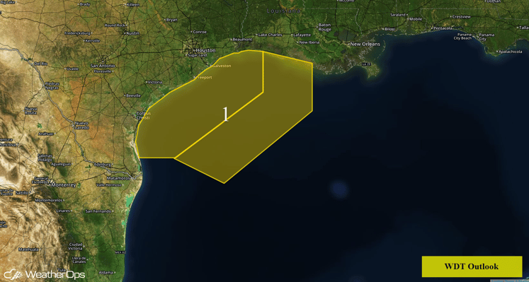
Region 1
Severe Thunderstorms Likely from the Ozark Plateau into the Red River Valley
Thunderstorms are expected to develop across portions of the Ozark Plateau into the Red River Valley Monday afternoon. Thunderstorms will likely begin as supercells with large hail, damaging winds, and tornadoes possible before merging into a squall line as they push through portions of Arkansas and Louisiana. As the storms line out, damaging winds will be the primary hazard.
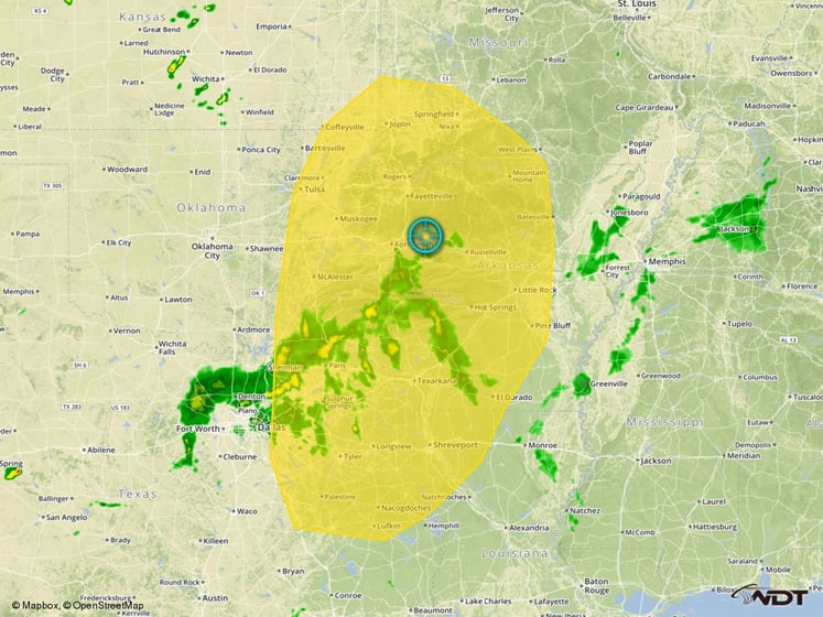
Severe Thunderstorm Risk Outline
Strong to Severe Thunderstorms Possible for Central Plains
From North Texas through Central Oklahoma and Eastern Kansas, the severe weather potential will be somewhat conditional depending on where the dryline sets up. If the dryline sets up further to the west, large hail and damaging winds will be the primary threats with a few tornadoes possible; if the dryline sets up further to the east, the thunderstorm risk would be reduced significantly. Meanwhile, to the north across the Mid-Mississippi Valley and portions of the Northern and Central Plains, thunderstorms capable of large hail and damaging winds will be possible. In addition, locally heavy rainfall will be possible; rainfall accumulations of 1-2 inches with locally higher amounts in excess of 3 inches will be possible in some locations.
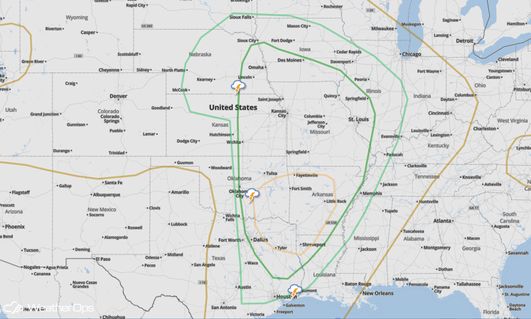
SPC Convective Outlook
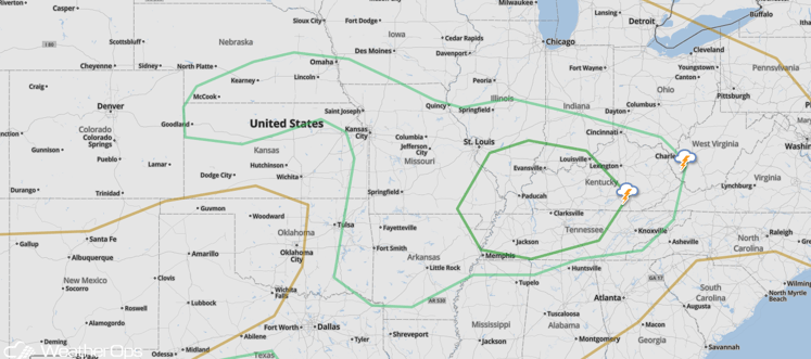
Severe Thunderstorms Possible for Great Plains and Mississippi/Ohio Valleys
The severe thunderstorm potential will shift eastward into Tuesday. As thunderstorms develop during the afternoon hours, damaging winds will be the primary hazard.
SPC Convective Outlook
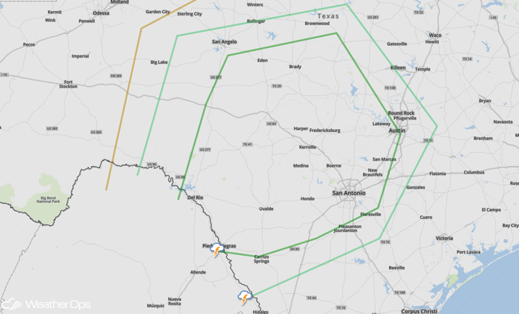
Strong to Severe Thunderstorms Possible for Portions of Southern and Central Texas
A few thunderstorms will be possible across portions of Southern and Central Texas Tuesday afternoon. Large hail and damaging winds will be the primary hazards with any thunderstorms that develop.
SPC Convective Outlook
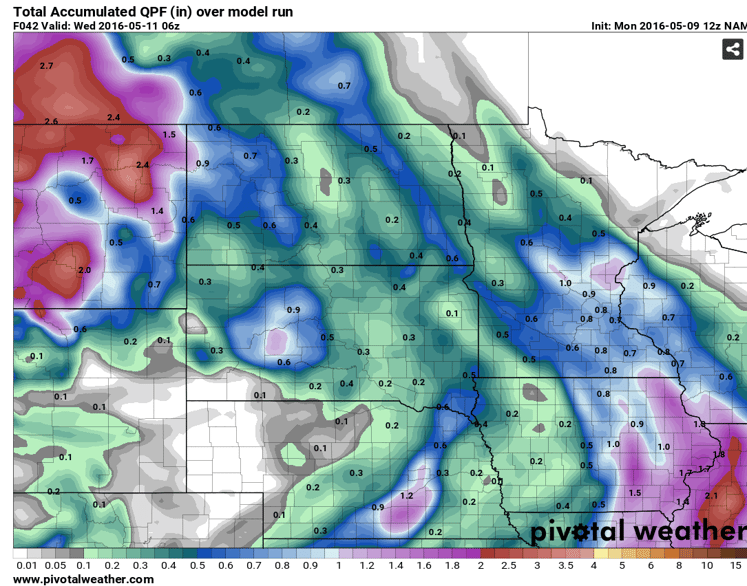
Excessive Rainfall Possible for porions of Eastern Montana
Excessive rainfall is possible across portions of eastern Montana as a surface low moves through the region. Rainfall accumulations of 1-3 inches with locally higher amounts in excess of 4 inches will be possible. Flash flooding will be possible in flood prone areas.
Accumulated Precipitation through 12am MDT Wednesday
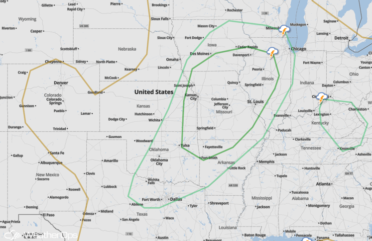
Severe Thunderstorms Possible for Portions of the Central Plains on Wednesday
Another round of severe weather is expected on Wednesday for portions of the Plains and Mid Mississippi Valley as a cold front approaching the region acts as a focal point for the development of thunderstorms. Thunderstorms are expected to quickly merge into a line, with damaging winds and hail being the primary hazards.
SPC Convective Outlook


