


by David Moran, on May 21, 2018 11:28:49 AM
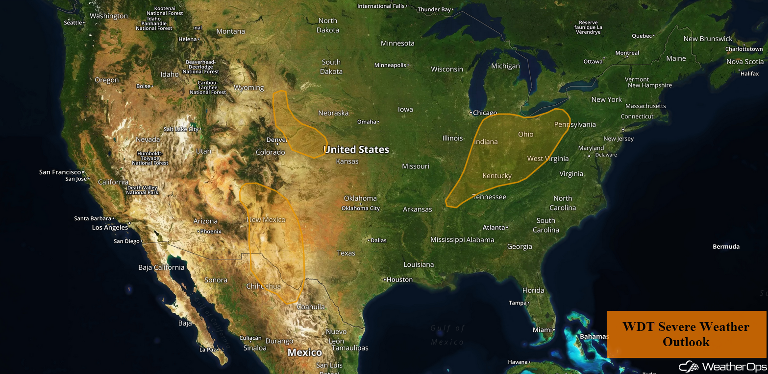
Thunderstorms may develop over portions of the Ohio Valley on Monday as an upper level system moves across the region. Increasing upslope flow will allow for the development of thunderstorms across the Southern Rockies. In addition to the thunderstorm potential over the Southern Rockies, there will be a risk for excessive rainfall.
- Thunderstorms for the Ohio Valley on Monday
- Potential for Thunderstorms Monday across the Southern Rockies
- Excessive Rainfall for the Southern Rockies on Monday
- Risk for Thunderstorms Tuesday across the Southern High Plains
- Thunderstorms for the Northern High Plains on Tuesday
- Thunderstorm Potential Tuesday for the Ohio Valley
- Thunderstorms for the Central US on Wednesday
- Potential for Thunderstorms Wednesday across the Mid Atlantic
- Tropical Update
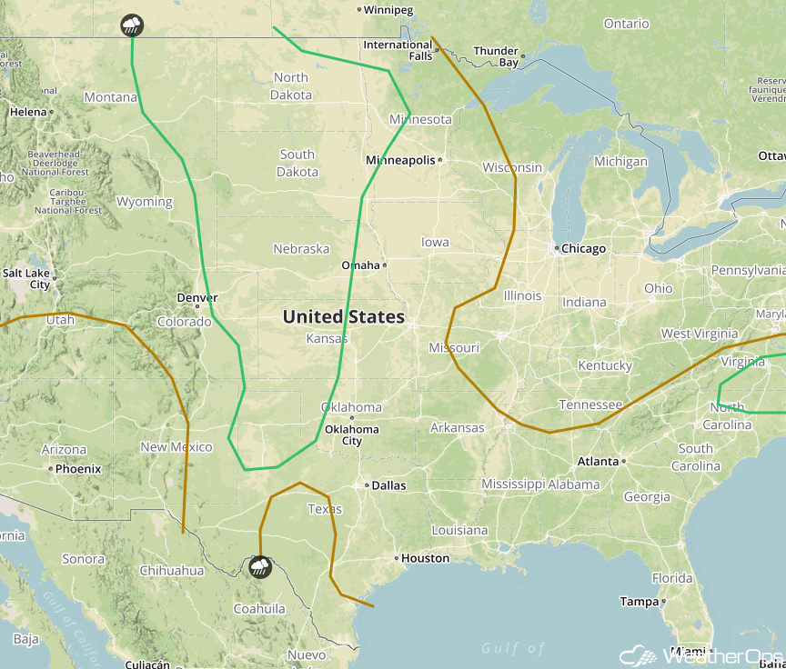
 US Hazards

Thunderstorms for the Ohio Valley on Monday
Showers are currently ongoing across portions of the Ohio Valley. While cloud cover may limit additional thunderstorm development, deep moisture and daytime heating should allow for the development of additional thunderstorms. Clusters of thunderstorms are expected to develop with damaging winds being the primary hazard. Across Indiana and Ohio, a few thunderstorms may become supercells with hail and an isolated tornado being potential hazards..
Major Cities in Region: Evansville, IN, Indianapolis, IN, Louisville, KY, Cincinnati, OH, Columbus, OH
 Thunderstorm Risk for Monday
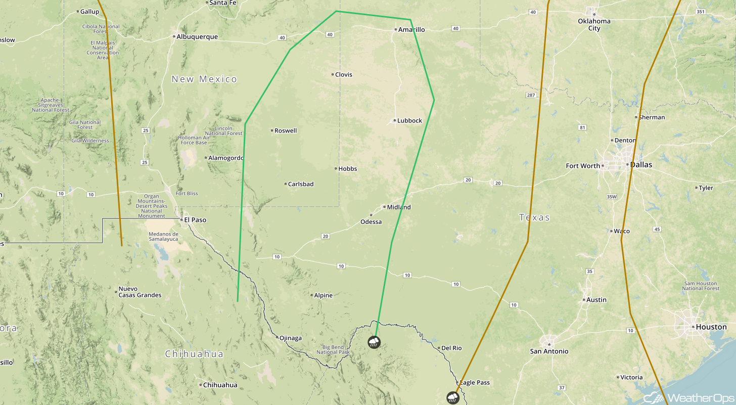
Potential for Thunderstorms Monday across the Southern Rockies
Thunderstorms may develop across portions of the Southern Rockies as a result of upslope flow. While conditions are not supportive of widespread thunderstorm development, a few strong to severe thunderstorms may develop. Large hail and damaging winds will be the primary hazards, but an isolated tornado cannot be ruled out.
Major Cities in Region: Albuquerque, NM, El Paso, TX, Roswell, NM
 Thunderstorm Risk for Monday
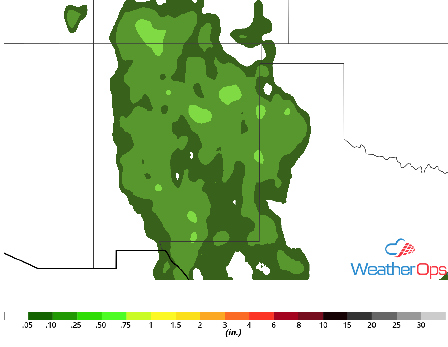
Excessive Rainfall for the Southern Rockies on Monday
In addition to the thunderstorms across the Southern Rockies, there will be a risk for excessive rainfall. Some of the stronger thunderstorms may produce locally heavy rain, allowing for localized flooding. Rainfall accumulations will range 1-2 inches with locally heavier amounts. Areas that received rain over the weekend will be at an increased risk for flooding.
Major Cities in Region: Albuquerque, NM, Roswell, NM, Carlsbad NM
 Rainfall Accumulation for Monday
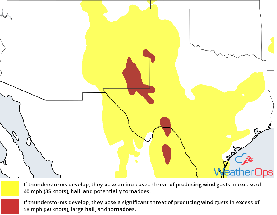
Risk for Thunderstorms Tuesday across the Southern High Plains
Scattered thunderstorms are expected across the Southern High Plains on Tuesday as a weak trough moves across the region and daytime heating occurs. This will promote a marginal risk of severe thunderstorms with large hail, damaging winds, and tornadoes all potential hazards. Storms may continue eastward into the Texas Panhandle during the evening and overnight hours.
Major Cities in Region: Roswell, NM, Carlsbad, NM, Midland, TX, Lubbock, TX, Odessa, TX
 SPC Convective Outlook for Tuesday
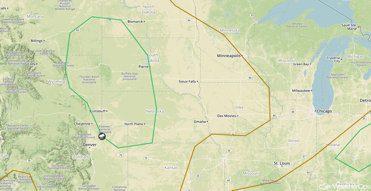
Thunderstorms for the Northern High Plains on Tuesday
Evening and nighttime thunderstorm activity is forecast across the Northern High Plains on Tuesday as a low level jet strengthens across the region. Storms should grow quickly into clusters, with hail and damaging winds the primary hazards.
Major Cities in Region: Gillette WY, Rapid City, SD, North Platte, NE, Pierre, SD
 SPC Convective Outlook for Tuesday
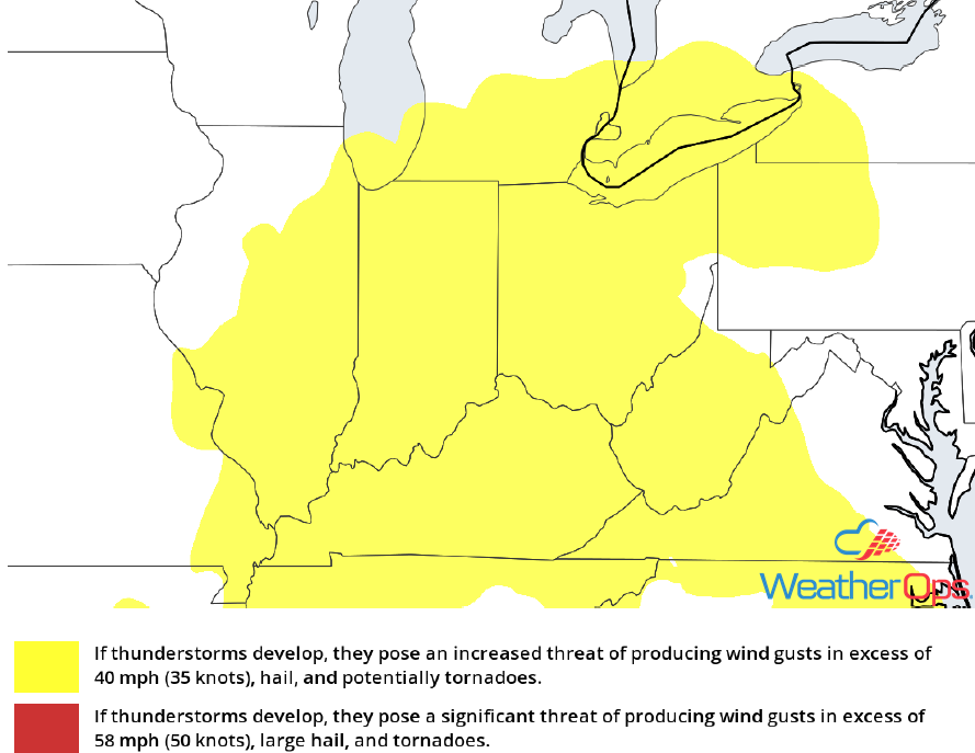
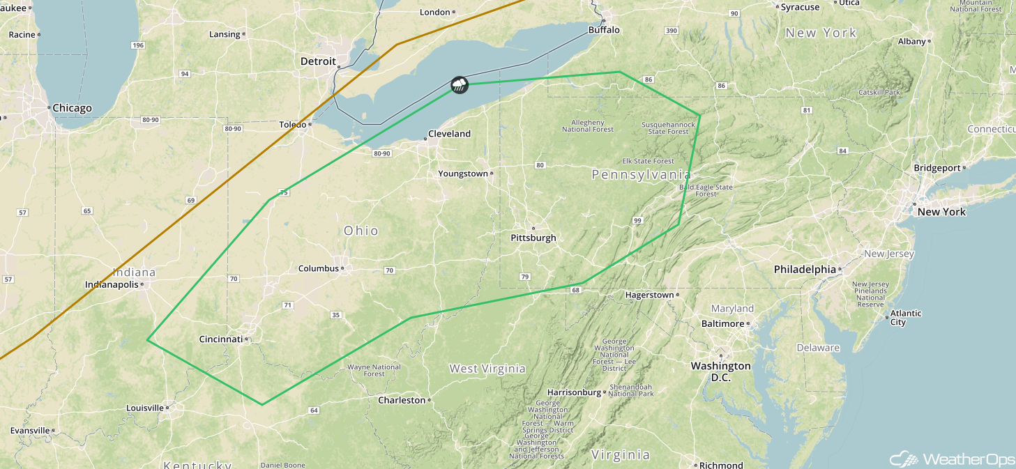
Thunderstorm Potential Tuesday for the Ohio Valley
Another round of strong to severe thunderstorms are forecast Tuesday as a frontal boundary moves across the region. Daytime heating should allow for new development along the front, with hail and damaging winds the primary hazards. Storms will move out of the region by the nighttime hours.
Major Cities in Region: Cincinnati, OH, Columbus, OH, Cleveland, OH, Pittsburgh, PA
 SPC Convective Outlook for Tuesday
Thunderstorms for the Central US on Wednesday
An area of low pressure will move across the Central US on Wednesday, allowing for widespread development of thunderstorms from the Northern High Plains southward through the panhandles of Oklahoma and Texas. Strong to severe thunderstorms should occur along this entire corridor, with hail and damaging winds the primary hazards. Across the Dakotas, a low level jet may allow for more widespread damaging winds and possibly an isolated tornado during the evening hours.
Major Cities in Region: Amarillo, TX, Goodland, KS, North Platte, NE, Rapid City, SD, Pierre, SD, Bismarck, ND, Minot, ND
 SPC Convective Outlook for Wednesday
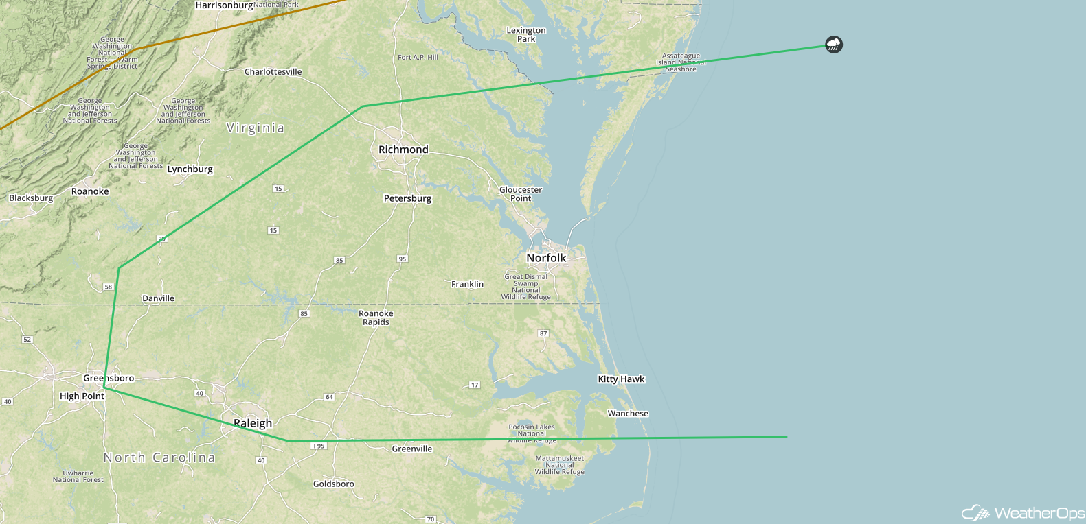
Potential for Thunderstorms Wednesday across the Mid Atlantic
As a cold front approaches the coast, strong to severe thunderstorms may develop across the Mid Atlantic on Wednesday. Hail and damaging winds will be the primary hazards with the stronger storms.
Major Cities in Region: Raleigh, NC, Richmond, VA, Norfolk, VA
 SPC Convective Outlook for Wednesday
Tropical Update
Widespread cloudiness and showers extending from the northwestern Caribbean across Cuba and the Florida Peninsula are associated with the interaction of a large upper level low with a weak surface trough. While environmental conditions are expected to be unfavorable for the development during the next couple of days, development may occur later in the week while the system moves into the central or eastern Gulf of Mexico. Regardless, heavy rainfall is forecast across western Cuba and Florida over the next several days.
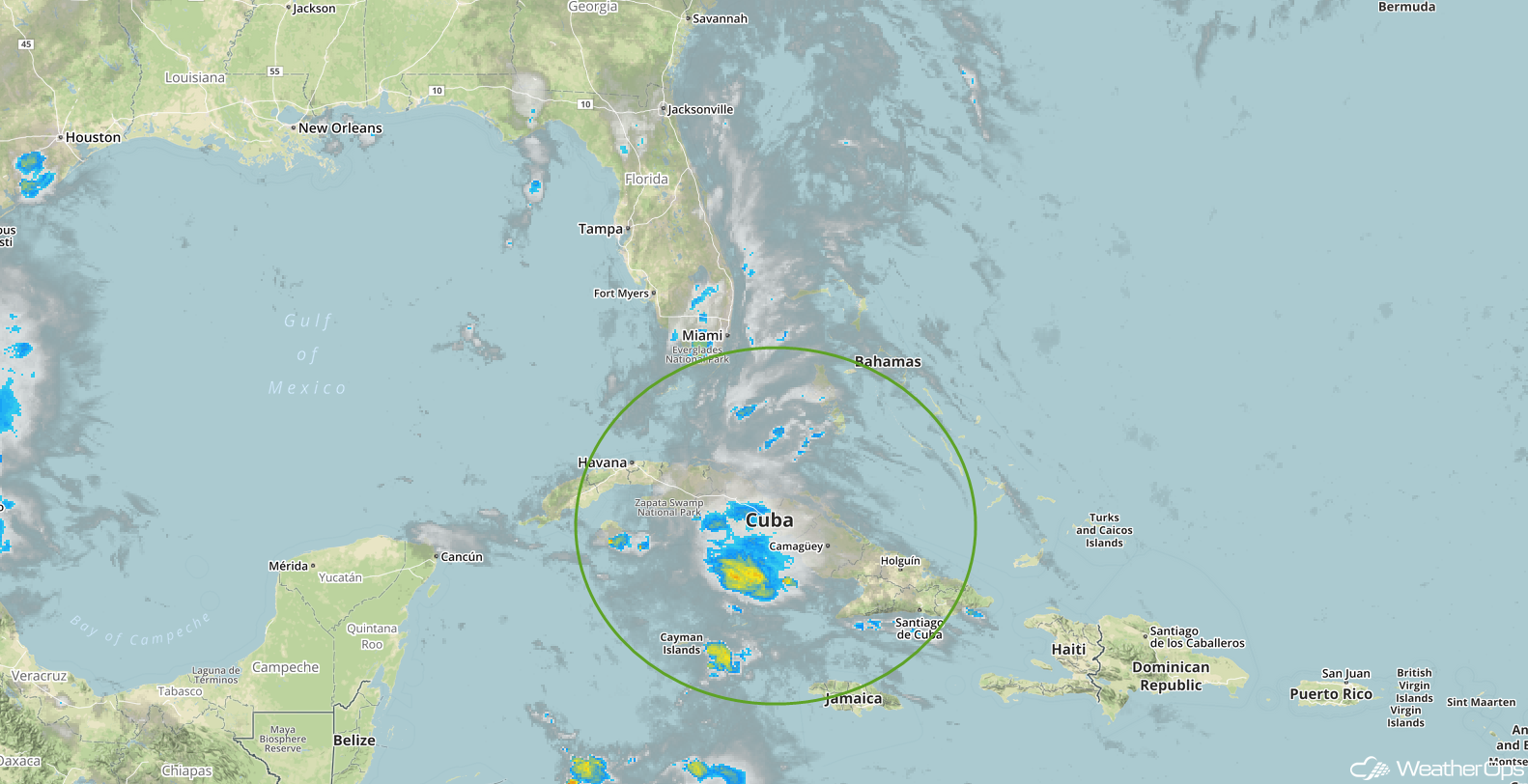 Enhanced Infrared Tropical Satellite
A Look Ahead
Going into Thursday, there may be some showers and thunderstorms across portions of the Central Plains ahead of a cold front. Across the Southeast, showers and thunderstorms are forecast in association with a cold front Thursday afternoon. Showers and thunderstorms will move into the Upper Midwest and Great Lakes on Friday.
Late in the week, the system over the Caribbean described above will slowly develop into an area of low pressure and track to the north or northwest toward the eastern Gulf of Mexico. While details are still uncertain, this system could become a tropical depression by the weekend, bringing the potential for heavy rain and flooding to much of Florida and the northern Gulf Coast.
This is just a brief look at current weather hazards. We can provide you site-specific weather forecast information for the purpose of protecting your personnel and assets and to assess your weather risk. Try a 7-day demo right away and learn how timely precision weather information can enhance your bottom line.
