National Weather Summary for Monday, May 16, 2016
by David Moran, on May 16, 2016 11:17:57 AM
Heavy rain will continue on Monday across portions of Oklahoma and Southern Kansas into South Central Missouri. Thunderstorms will continue through the early afternoon across portions of the northwestern Gulf of Mexico. Strong to severe thunderstorms are possible across portions of the Southern Plains with severe thunderstorms likely across the Northern Texas Panhandle and Northwest Oklahoma.
Going into Tuesday, severe thunderstorms will be possible for South Central Texas. Strong to severe thunderstorms will be possible from Southeastern Texas into Arkansas and Louisiana. Heavy rainfall is expected across portions of Eastern Texas.
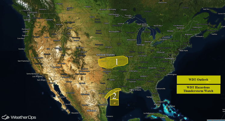
US Hazards
Region 1
An area of low pressure located in Colorado will slowly move eastward on Monday and the associated warm front will slowly lift northward into northern Oklahoma and southern Missouri. Heavy rainfall is expected along and north of the warm front from northern Oklahoma, southern Kansas, and into south-central Missouri as rain and thunderstorms are expected to train across Region 1 leading to heavy rainfall and the possibility of flooding. Rainfall amounts of 1-3 inches with locally higher amounts possible.
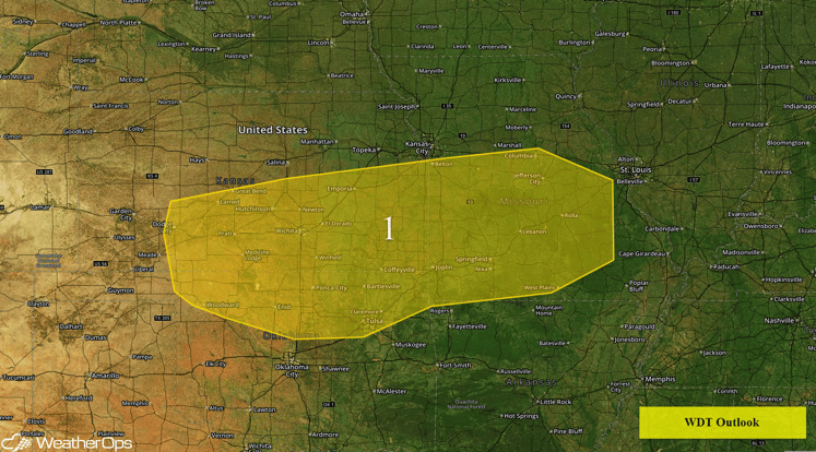 Region 1
Region 2
Heavy rain will continue to develop along the Texas coast through Louisiana during the day on Monday. With plentiful moisture in place and slow moving/training thunderstorms, rainfall amounts of 2-4 inches can be expected along the Texas coast with locally higher amounts possible. Thunderstorms will continue to move across the Northwestern Gulf of Mexico with waterspouts, strong winds, and large hail possible.
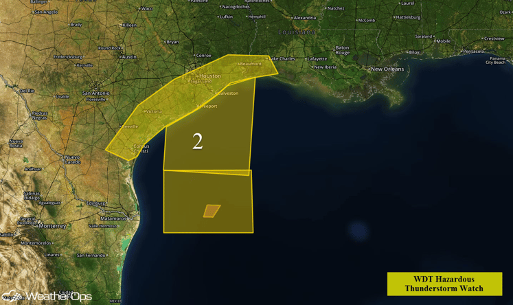
Region 2
Strong to Severe Thunderstorms Possible for Portions of Southern Plains
Strong to severe thunderstorms will be possible for portions of the Southern Plains on Monday as an area of low pressure in the Southwestern US slowly moves eastward into the Southern High Plains. As thunderstorms develop, large hail, damaging winds, and tornadoes will be possible. Severe thunderstorms will be most likely across portions of the Texas Panhandle and Northwestern Oklahoma. As thunderstorms continue into the evening, they will become linear through Central Oklahoma and Texas with large hail and damaging winds the primary threats.
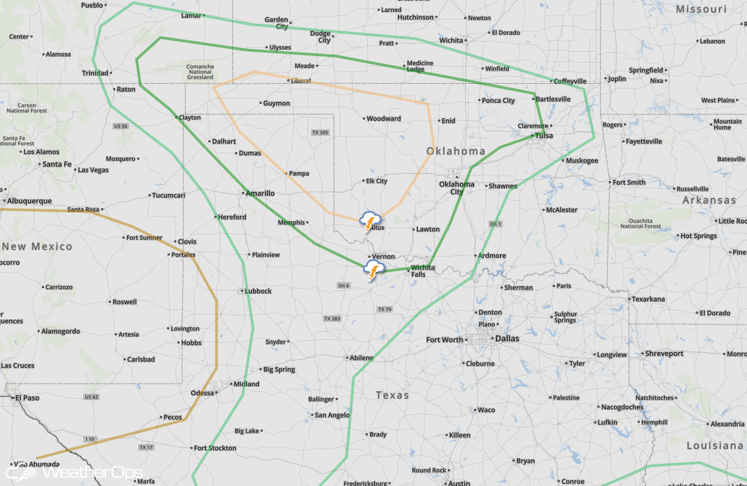
SPC Convective Outlook
Strong to Severe Thunderstorms Possible for Portions of Texas into Arkansas and Louisiana on Tuesday
As an area of low pressure and cold front continues to move eastward throughout the day on Tuesday, a line of strong to severe thunderstorms will continue to move southeastward. There will also be the potential for heavy rainfall as well across portions of central and eastern Texas as rainfall amounts of 1-2 inches with isolated higher amounts will be possible. Additional thunderstorms will be possible across portions of southern Louisiana and Texas with large hail and damaging winds, as well as a low risk for an isolated tornado. Any thunderstorms will become more linear during the evening hours with strong winds and large hail possible for portions of Louisiana and southeast Texas.
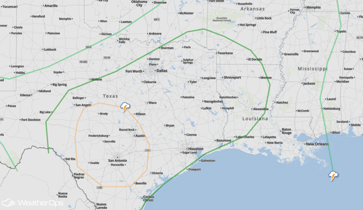
SPC Convective Outlook
Strong to Severe Thunderstorms Possible for the Northern Gulf Coast on Wednesday
As a cold front stalls near the Gulf Coast, strong to severe thunderstorms will be possible along and ahead of the front. Early morning thunderstorm activity, as well as cloud cover, may inhibit additional development of strong to severe thunderstorms later in the afternoon.
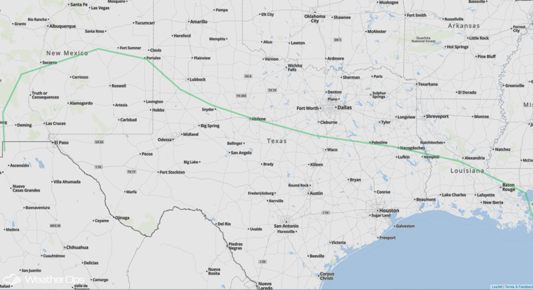
SPC Convective Outlook


