National Weather Summary for Monday, June 19, 2017
by David Moran, on Jun 19, 2017 10:59:52 AM
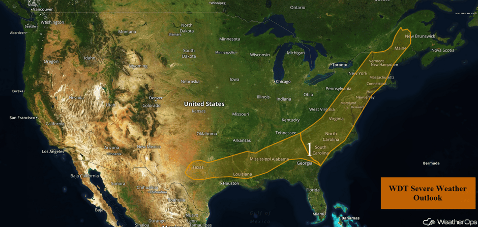
Severe thunderstorms are expected from the Northeast through Texas on Monday ahead of a cold front.
- Severe Thunderstorms Expected Monday from the Northeast through Texas
- Thunderstorm Potential for South-Central High Plains on Tuesday
- Risk for Thunderstorms Tuesday across Montana
- Strong to Severe Thunderstorms Possible Wednesday for the Central Plains and Upper Midwest
- Excessive Rainfall for the Gulf Coast on Wednesday
- Tropical Update
 US Hazards
Severe Thunderstorms Expected Monday from the Northeast through Texas
Thunderstorms are expected to develop in the late afternoon along a cold front. These storms will move in a northeasterly direction, as well as merge to form a line, as the day progresses. Daytime heating will allow these storms to intensify. The most intense storms are expected to weaken shortly after sunset. Damaging winds will be the primary hazard with these storms.
Update 12:24pm EDT: Severe Thunderstorm Watch in effect for portions of Connecticut, Massachusetts, New Jersey, New York, Pennsylvania, and Vermont until 8pm EDT.
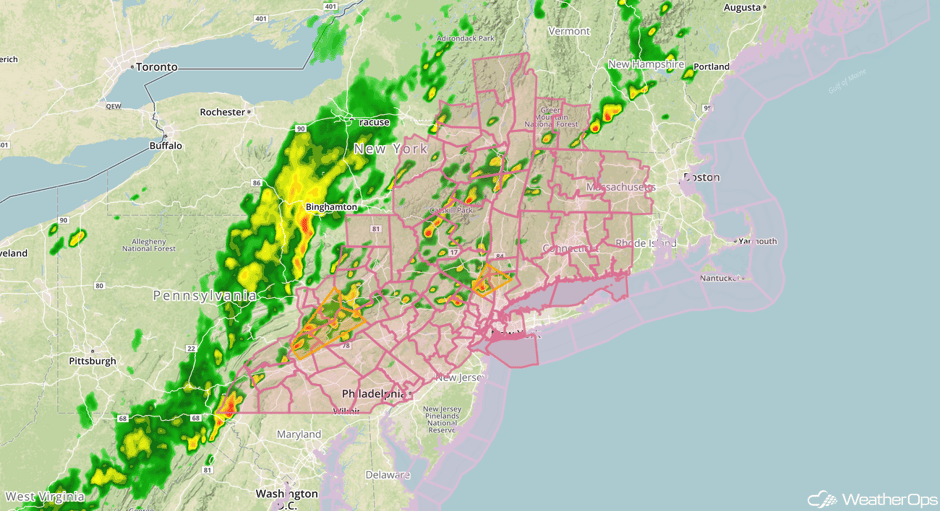 Severe Thunderstorm Watch
Update 12:31pm EDT: Severe thunderstorms capable of hail and damaging winds developing across the Northeast.
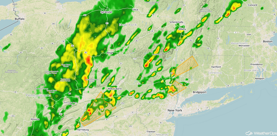 Radar 12:31pm EDT
Update 12:42pm EDT: Severe thunderstorm capable of hail and damaging winds north of Lynchburg, VA.
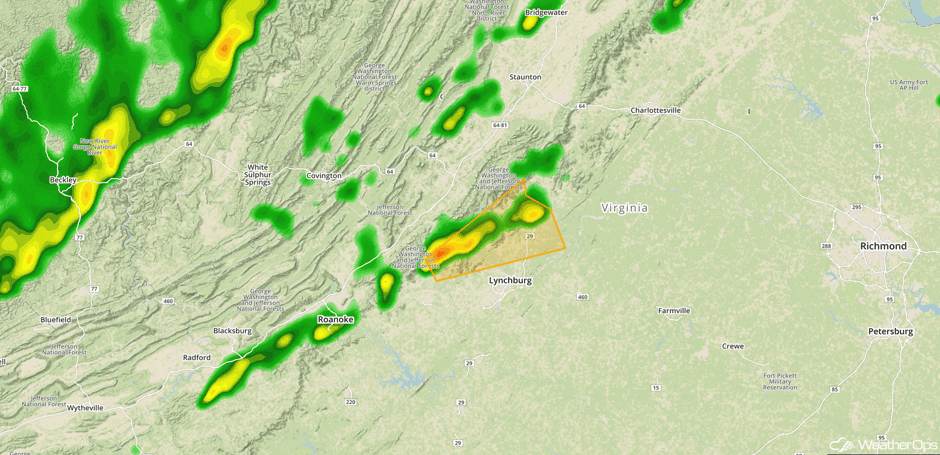 Radar 12:42pm EDT
Update 12: 54pm EDT: Severe Thunderstorm Watch for portions of Maryland, North Carolina, Virginia, and West Virginia until 8pm EDT.
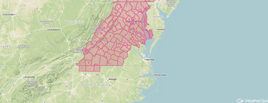 Severe Thunderstorm Watch
Update 1:02pm EDT: Severe thunderstorms capable of hail and damaging winds in northern Maryland and southern Pennsylvania.
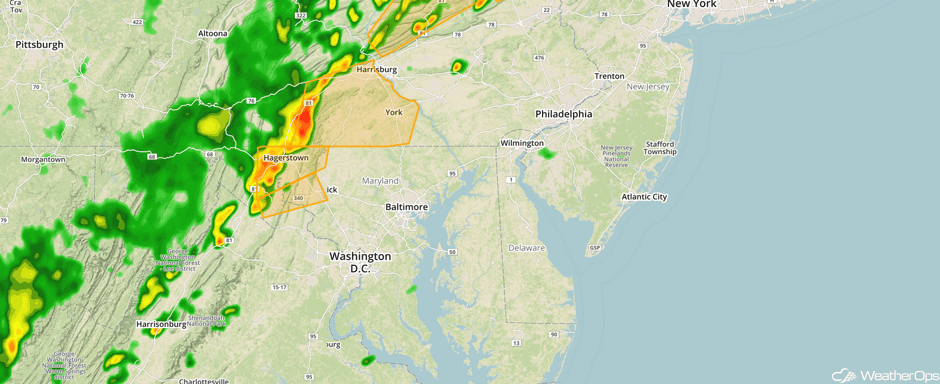 Radar 1:03pm EDT
Update 1:33pm EDT: Tornado Warning SE of Harrisburg, PA.
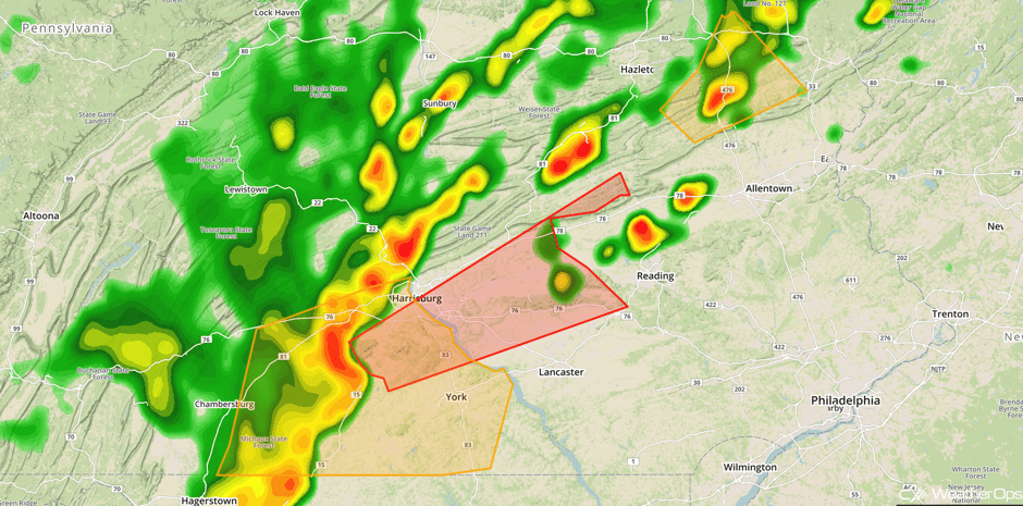 Radar 1:33pm EDT
Update 2:10pm EDT: Severe thunderstorms capable of hail and damaging winds in Central Maine.
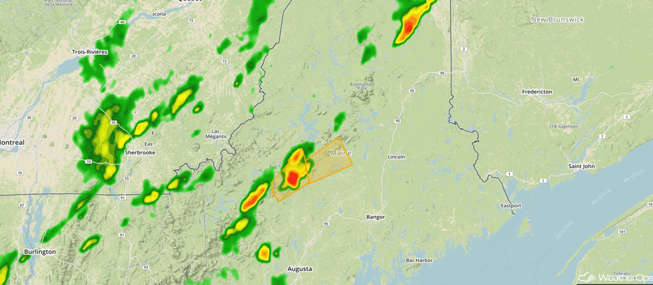 Radar 2:10pm EDT
Update 3:01pm EDT: Severe thunderstorms capable of hail and damaging winds approaching Washington, DC.
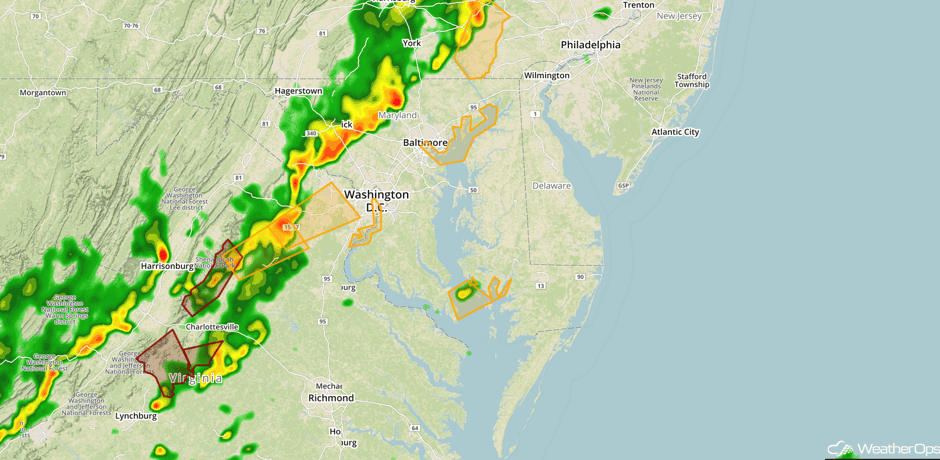 Radar 3:01pm EDT
Major Cities in Region: Dallas, TX, Shreveport, LA, Jackson, MS, Birmingham, AL, Atlanta, GA, Columbia, SC, Raleigh, NC, Norfolk, VA, Richmond, VA, Washington, DC, New York, NY, Boston, MA, Augusta, ME
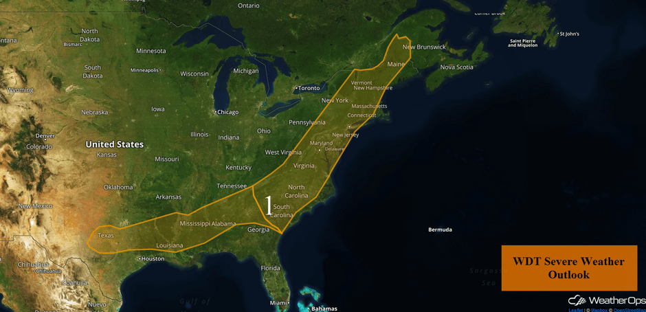 Region 1
Thunderstorm Potential for South-Central High Plains on Tuesday
Southerly to southwesterly winds on the west side of a high will allow a moist air mass to move into the area. Coupled with daytime heating, thunderstorm development is likely during the late afternoon and evening. Strong to severe winds gusts and large hail will be the primary hazards.
Major Cities in Region: Dodge City, KS
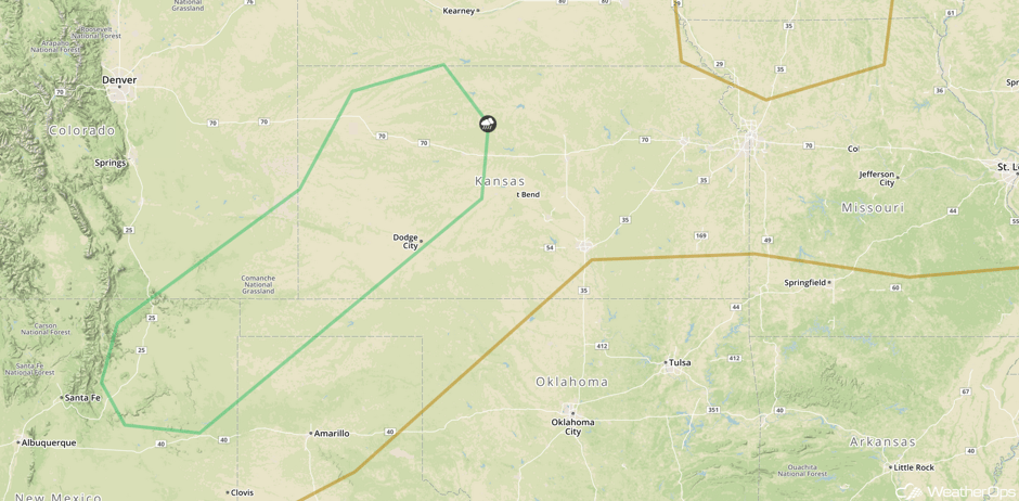 SPC Convective Outlook for Tuesday
Risk for Thunderstorms Tuesday across Montana
Isolated to widely scattered thunderstorms will likely develop over the higher terrain in southwest Montana and move eastward throughout the day. As thunderstorms develop, strong to severe winds and hail will be the primary hazards.
Major Cities in Region: Bozeman, MT, Billings, MT
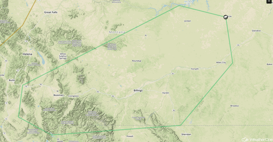 SPC Convective Outlook for Tuesday
Strong to Severe Thunderstorms Possible Wednesday for the Central Plains and Upper Midwest
A surface low and associated frontal boundaries will allow for the development of strong to severe thunderstorms. A very unstable airmass and marginal amounts of shear will be in place. Severe winds, large hail, and a few tornadoes will be the primary hazards with these storms.
Major Cities in Region: Dodge City, KS, Omaha, NE, Des Moines, IA, Minneapolis, MN
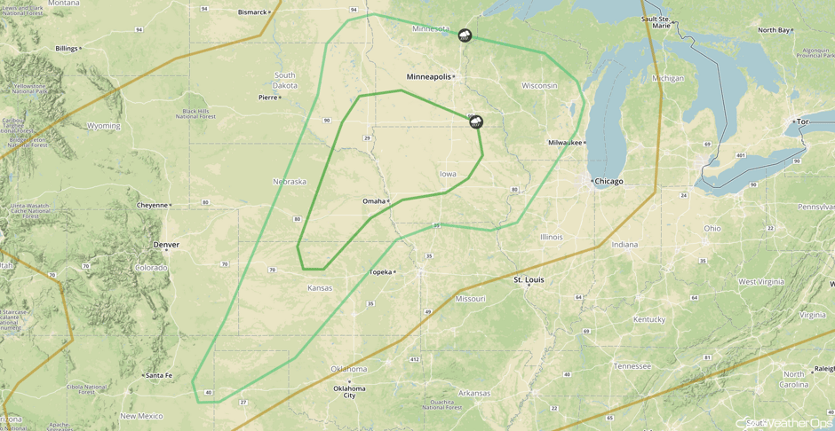 SPC Convective Outlook for Wednesday
Excessive Rainfall for the Gulf Coast on Wednesday
Outlying precipitation on the northwestern quadrant of the broad tropical feature 93L will bring moderate to heavy rainfall as it moves northwestward toward the western Gulf. Rainfall amounts of 1.5-3.5 inches with locally higher amounts exceeding 4.5 inches expected.
Major Cities in Region: New Orleans, LA
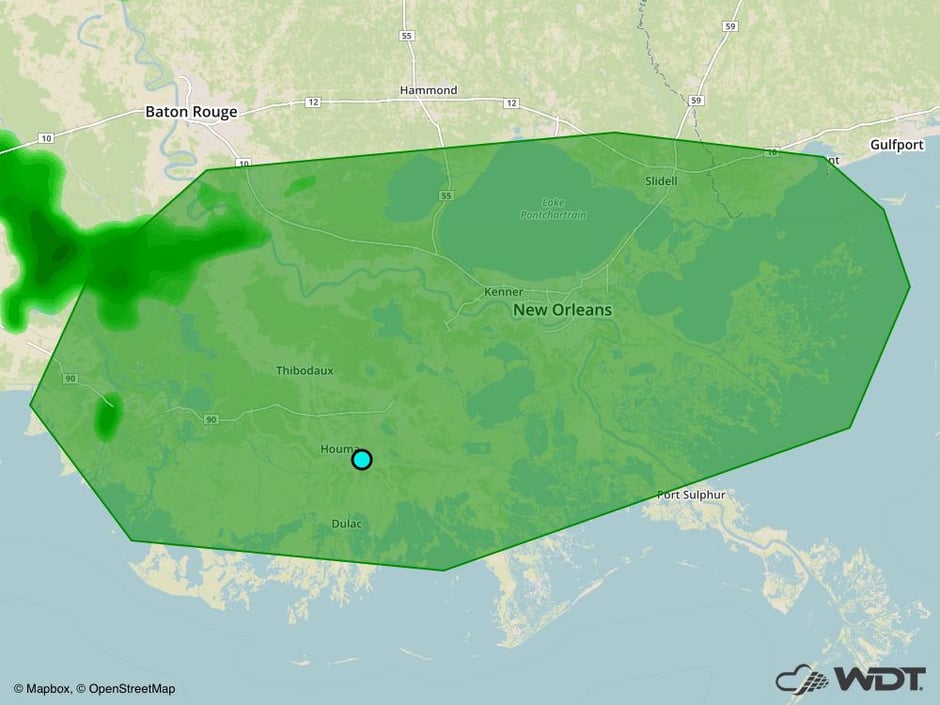 Excessive Rainfall Risk Outline for Wednesday
Tropical Update
A broad area of low pressure extending from the Yucatan Peninsula into the southeastern Gulf of Mexico continues to produce a large area of showers and thunderstorms. While the low still does not have a center of circulation, gradual development is expected through Tuesday while it moves across the southern and central Gulf of Mexico. A tropical or subtropical low is expected to develop, bringing heavy rain to portions of Central America, the Yucatan Peninsula, the Cayman Islands, and western Cuba in the next day or two.
Further east, a disturbance is located near the coast of Venezuela. Maximum sustained winds are at 40 mph with higher gusts expected. Further intensification is anticipated over the next 48 hours and this disturbance is forecast to be a tropical storm when it moves through the Windward Islands and Venezuela through Tuesday.
A Look Ahead
Thunderstorms may develop over the Northern Plains on Thursday as two areas of low pressure develop across the Plains and Manitoba. The risk for strong to severe thunderstorms appears to be low at this time.
This is just a brief look at current weather hazards. We can provide you site-specific weather forecast information for the purpose of protecting your personnel and assets and to assess your weather risk. Try a 7-day demo right away and learn how timely precision weather information can enhance your bottom line.


