


by Chris Kerr, on Jan 8, 2018 11:44:39 AM
A broad area of wintry precipitation is expected from the Tennessee Valley into the interior Northeast today. A frontal boundary pushing into the Gulf of Mexico will allow for thunderstorms, shifting winds, and rough seas.
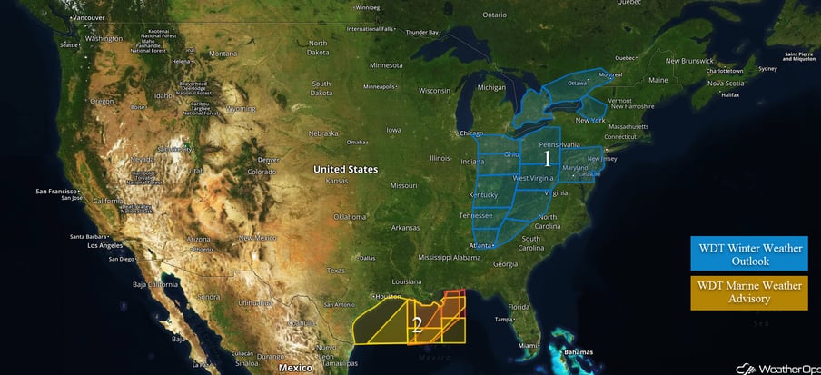
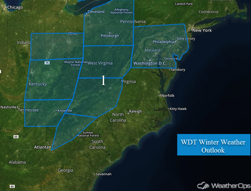
- Light amounts of freezing rain are possible from northern Georgia and into parts of Tennessee and North Carolina. Moderate snow will occur across parts of Kentucky, West Virginia, Ohio, and Pennsylvania.
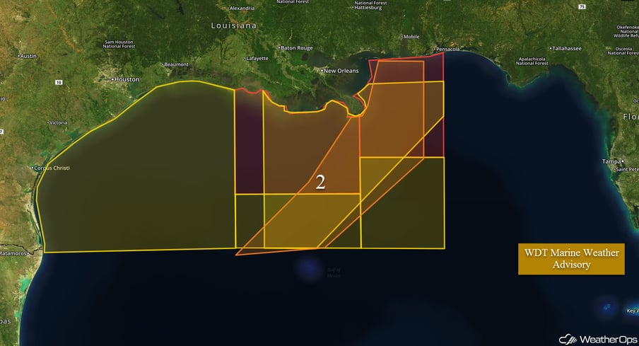
- Hazardous marine conditions possible across the Gulf of Mexico.
 US Hazards
Light amounts of freezing rain are possible from northern Georgia and into parts of Tennessee and North Carolina. Moderate snow will occur across parts of Kentucky, West Virginia, Ohio, and Pennsylvania.
A large area of wintry precipitation will be possible from the Atlanta area and northeastward on Monday. Snow can be expected from Pennsylvania into Upper New York, with accumulations of 1-2 inches, locally 4+ possible throughout the day. Further south, the primary hazard will be the potential for freezing rain. It appears ice accumulations will be mostly less than two-tenths of an inch, with accumulation potential decreasing with southward extent. The Monday morning commute may be hazardous for many people across the threat region.
Major Cities in Region: Atlanta, GA, Knoxville, TN, Cincinnati, OH, Pittsburgh, PA, Washington, DC
Marginally severe thunderstorms will be possible across the Alabama Gulf Coast and Florida Panhandle.
A cold front pushing into the Gulf will allow winds to shift from southerly to northerly today. This will allow seas to build and become rough at times. In addition, strong thunderstorms are possible along and ahead of the front.
A Look Ahead
Model guidance is in general agreement that a strong winter storm will impact the Great Plains region on Wednesday into Thursday. Low pressure will track through the Plains into the Midwest, with a large area of moderate to heavy snow to form north of a frontal boundary. Current thinking is snow will begin over the threat region during Wednesday evening and increase in intensity into Thursday. In addition to the potential for heavy snow, very strong winds are forecast to occur, with near-blizzard to possibly blizzard conditions to occur over portions of the Central Plains. Snow accumulations over a half foot can be expected across the region, with areas possibly seeing over a foot of snow wherever the heaviest bands develop. There will also be the potential for heavy ice accumulation along the transition zone over the Midwest, however, the uncertainty regarding this is high. The location of heaviest snow totals is uncertain at this time, however, the combination of snow and high winds will likely cause very hazardous travel conditions across the region.
This is just a brief look at current weather hazards. We can provide you site-specific weather forecast information for the purpose of protecting your personnel and assets and to assess your weather risk. Try a 7-day demo right away and learn how timely precision weather information can enhance your bottom line.
