National Weather Summary for Monday, January 16, 2017
by David Moran, on Jan 16, 2017 11:08:32 AM
Snow and freezing rain will continue across the Plains and Midwest on Monday as an upper level system continues to slowly move across the region. From east Texas to the Mid Mississippi Valley, thunderstorms are expected to develop ahead of a cold front on Monday.
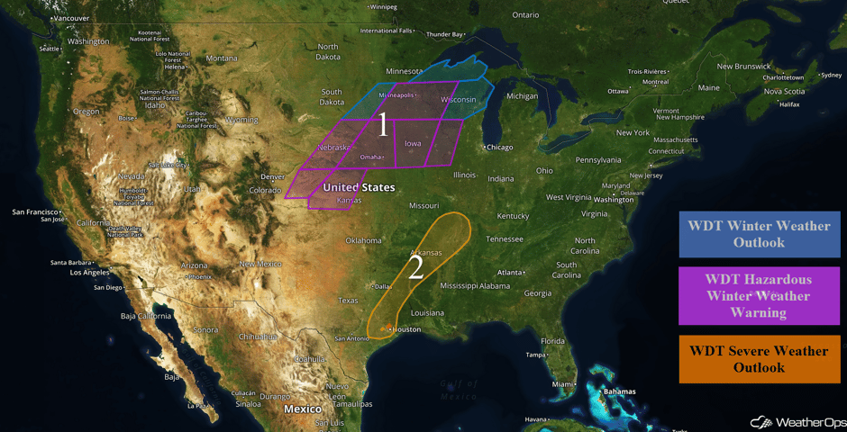 US Hazards
Region 1
A significant winter storm will continue to impact Region 1 through the day on Monday as an upper level system continues to move northeastward. Total snowfall accumulations of 4-6 inches are forecast across eastern Colorado and western Kansas. In addition, freezing rain accumulations between a tenth and a quarter of an inch and sleet accumulations around half an inch are expected. From southwestern Kansas to north central Kansas, 1-3 inches of snow and an additional quarter of an inch of freezing rain are possible. Across Nebraska and Iowa, snowfall accumulations of 3-6 inches are expected with ice accumulations between a tenth and a quarter of an inch. From eastern South Dakota into western Minnesota, snowfall accumulations of 1-2 inches are forecast with up to a tenth of an inch of ice. Across Minnesota and Wisconsin, 3-5 inches of snow in addition to up to two tenths of an inch of ice are expected.
Major Cities in Region: Goodland, KS, Grand Island, NE, Lincoln, NE, Omaha, NE, Sioux City, SD, Des Moines, IA, Minneapolis, MN, Davenport, IA, Green Bay, WI
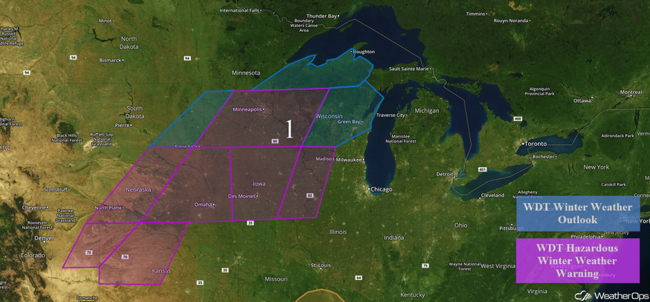 Region 1
Region 2
A slow moving cold front across the Arklatex region is forecast to become nearly stationary. Ongoing showers and thunderstorms will continue throughout the day along the front. A few embedded thunderstorms may produce severe wind, but an isolated tornado or two cannot be ruled out.
Major Cities in Region: Houston, TX, Shreveport, LA, Little Rock, AR, Memphis, TN
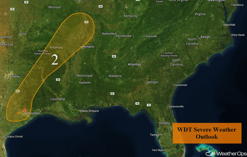 Region 2
Excessive Rainfall Possible for the Pacific Northwest Tuesday and Wednesday
A series of Pacific lows will begin to impact the west coast of the US Tuesday, with the first bringing heavy rain to portions of Washington and Oregon. Rainfall accumulations of 4-6 inches with isolated higher amounts in excess of 7 inches forecast on Tuesday, This heavy rain will continue into Wednesday and spread into Northern California. An additional 2-4 inches with locally higher amounts in excess of 5 inches are expected on Wednesday.
Major Cities in Region: Seattle, WA, Portland, OR, San Francisco, CA
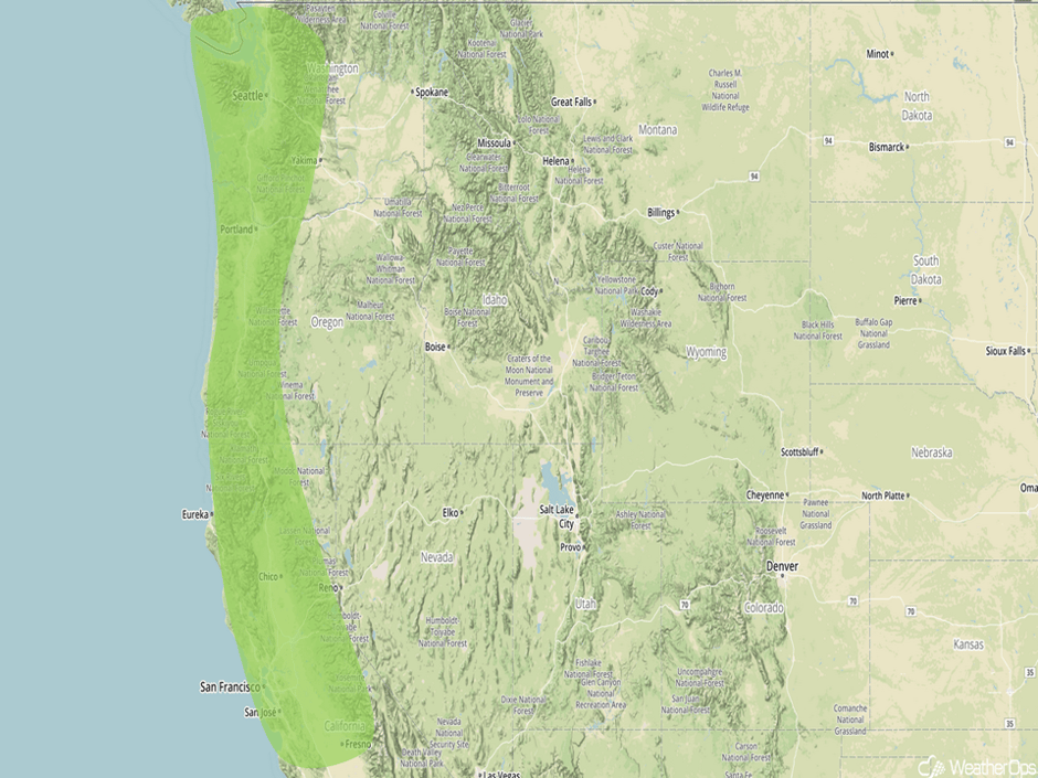 Excessive Rainfall Outline for Tuesday and Wednesday
Strong to Severe Thunderstorms Possible for East Central Texas on Tuesday
Isolated strong to severe thunderstorms may develop across east central Texas on Tuesday. These storms will develop ahead of a cold front associated with an area of low pressure moving across the Great Lakes. Large hail and damaging winds would be the primary hazards with these storms.
Major Cities in Region: Corpus Christi, TX
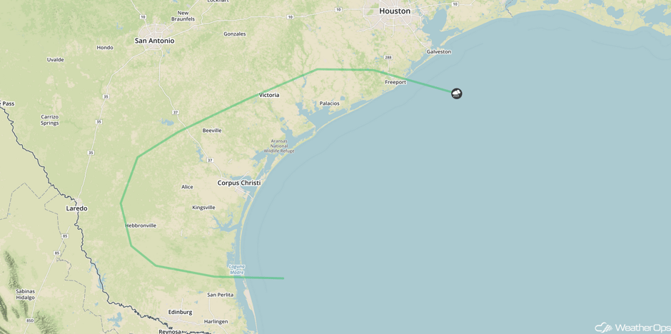 SPC Convective Outlook for Tuesday
Significant Snowfall Possible across New England on Wednesday
The low that is bringing wintry weather to the Plains currently will bring snow to portions of New England on Wednesday. While snowfall amounts will be dependent on the track of the system, snowfall amounts of 3-6 inches with isolated higher amounts in excess of 7 inches will be possible.
Major Cities in Region: Albany, NY, Portland, ME, Bangor, ME
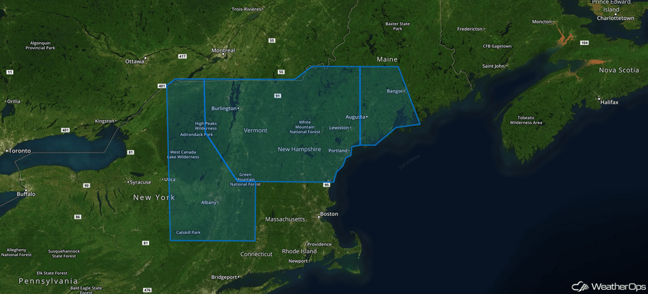 Significant Snowfall Risk Outline for Wednesday
Heavy snowfall will continue in the Sierra Nevadas on Thursday as an onshore push of moisture continues. Snowfall accumulations of 8-14 inches are possible in the Sierra Nevadas with this system.
This is just a brief look at current weather hazards. We can provide you site-specific forecast information for the purpose of protecting your personnel and assets. Try a 7-day demo right away and learn how timely precision weather information can enhance your bottom line.


