


by David Moran, on Feb 26, 2018 10:45:08 AM
Thunderstorms may develop across portions of Texas and Louisiana on Tuesday ahead of an upper level trough. Excessive rainfall is expected from Arkansas to Tennessee Tuesday into Wednesday.
- Thunderstorms for Northeast Texas and Louisiana on Tuesday
- Excessive Rainfall Tuesday and Wednesday from Arkansas into Tennessee
- Potential for Thunderstorms from the Arklatex Region into the Lower Mississippi Valley
 US Hazards

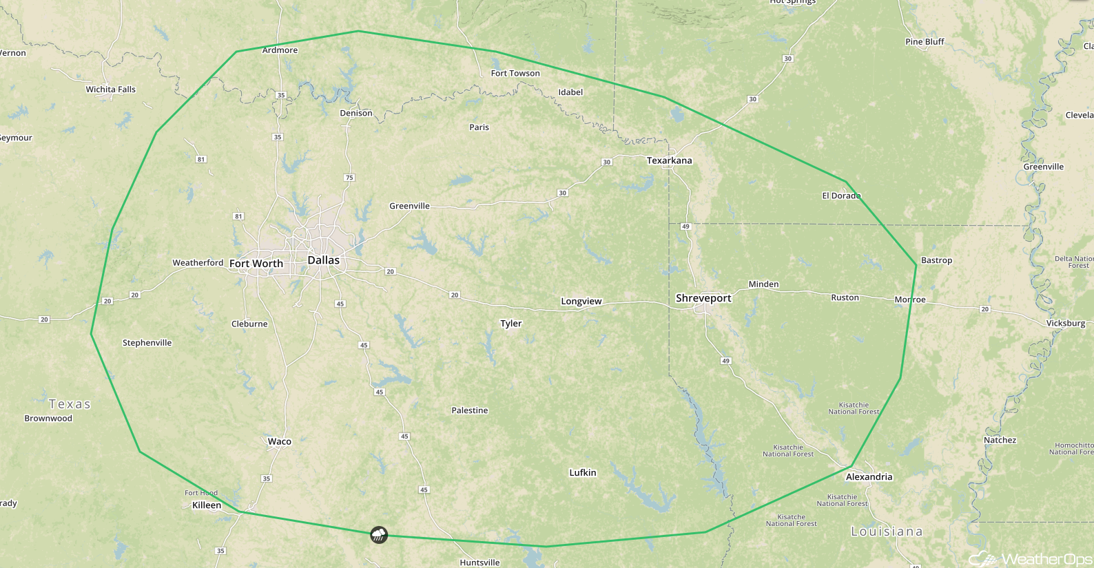
Thunderstorms for Northeast Texas and Louisiana on Tuesday
A trough lifting into Texas during the afternoon hours on Tuesday will allow for the development of thunderstorms. Large hail and damaging winds will be the primary hazards with these storms.
Major Cities in Region: Dallas, TX, Shreveport, LA, Monroe, LA
 SPC Convective Outlook for Tuesday
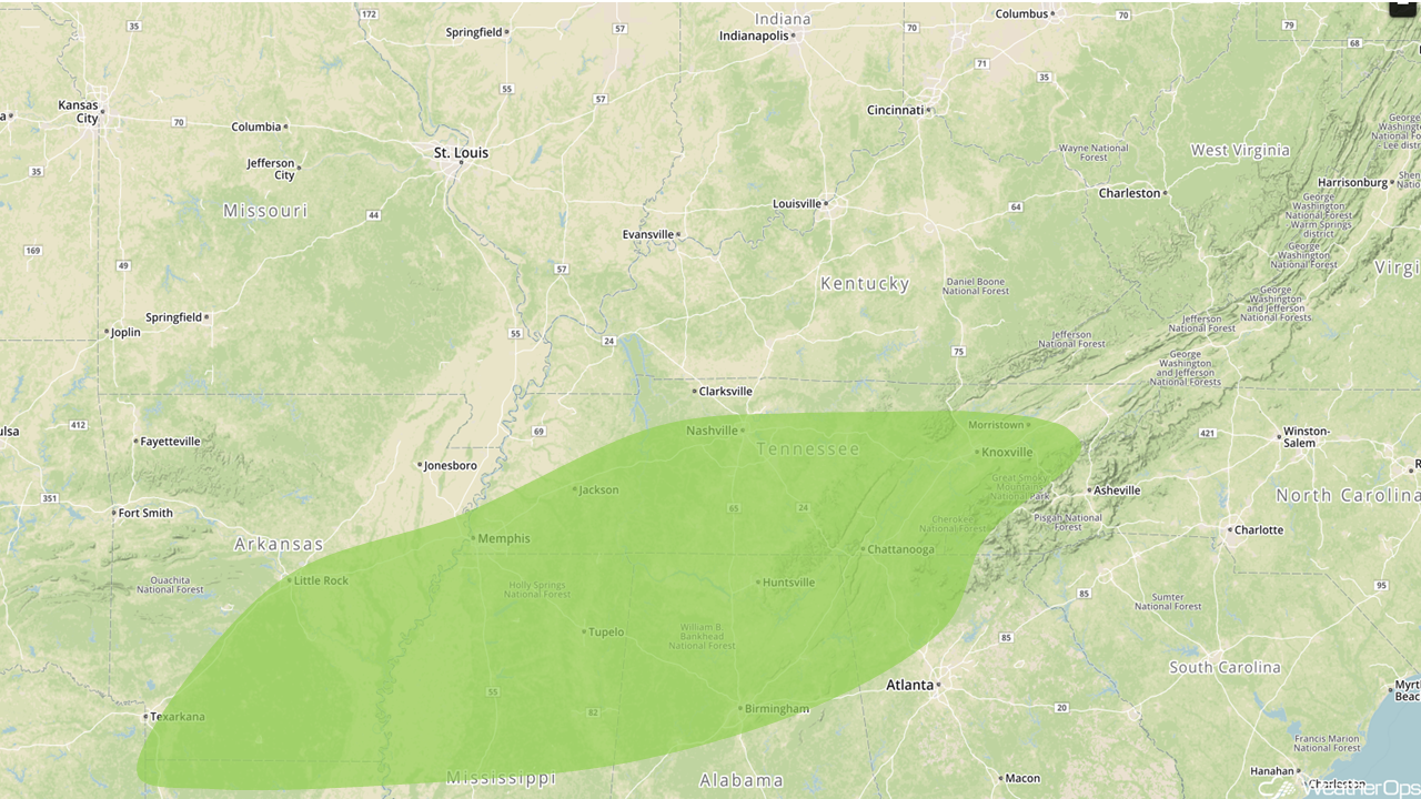
Excessive Rainfall Tuesday and Wednesday from Arkansas into Tennessee
The potential for excessive rainfall will extend from Arkansas to Tennessee Tuesday into Wednesday. Rainfall totals of 3-5 inches with locally higher amounts are expected, leading to a threat of flooding and excessive runoff.
Major Cities in Region: Shreveport, LA, Little Rock, AR, Memphis, TN, Nashville, TN, Birmingham, AL, Knoxville, TN
 Excessive Rainfall Risk Outline for Tuesday and Wednesday
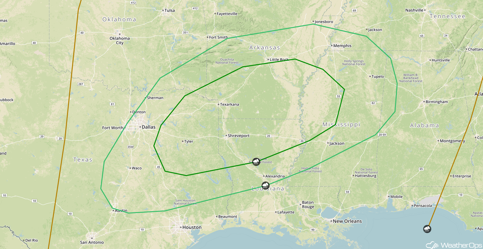
Potential for Thunderstorms from the Arklatex Region into the Lower Mississippi Valley
As an area of low pressure moves out of the Tennessee Valley on Wednesday, a second and stronger area of low pressure is forecast to develop over the Southern Plains. Thunderstorms are forecast to develop during the afternoon and evening, with large hail and damaging winds being the primary hazards.
Major Cities in Region: Dallas, TX, Shreveport, LA, Little Rock, AR, Memphis, TN, Jackson, MS
 SPC Convective Outlook for Wednesday
A Look Ahead
Scattered showers are forecast from the Lower Mississippi Valley into the Mid Atlantic on Thursday as an area of low pressure moves northward. Across the Northwest, an area of low pressure will bring rain to the lower elevations and snow to the higher elevations. As an upper level low tracks out of the Ohio Valley on Friday, showers are forecast for the Northeast. Snow may develop Friday across the Eastern Great Lakes and portions of New England. Rain and snow will continue across the Northwest on Friday with moderate to heavy snow spreading into the higher terrain of the Great Basin and Northern Rockies.
That is a brief look at current weather hazards. We can provide you site-specific weather forecast information to protect your staff and assets and to assess your weather risk. Try a 7-day demo right away and learn how timely precision weather information can enhance your bottom line.
