National Weather Summary for Monday, February 13, 2017
by David Moran, on Feb 13, 2017 11:19:21 AM
Strong to severe thunderstorms are expected to develop this afternoon across portions of Texas ahead of a cold front. To the northwest of the area of low pressure associated with the cold front, wintry precipitation is expected across the Texas Panhandle and eastern New Mexico. Heavy snow will continue across portions of Maine as an area of low pressure moves across the region.
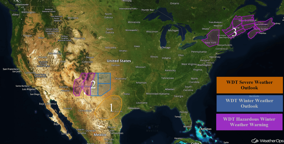 US Hazards
Region 1
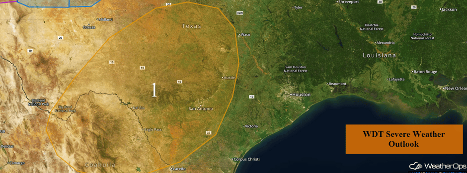
An upper level low will move into the region today and tonight. Thunderstorms are expected to increase in coverage from the west late this afternoon and tonight in association with this system. At this time, conditions do not appear overly supportive of a significant severe weather threat. Large hail and damaging winds will be the primary hazards with any storms that develop.
Major Cities in Region: San Angelo, TX, San Antonio, TX, Austin, TX
 Region 1
Region 2
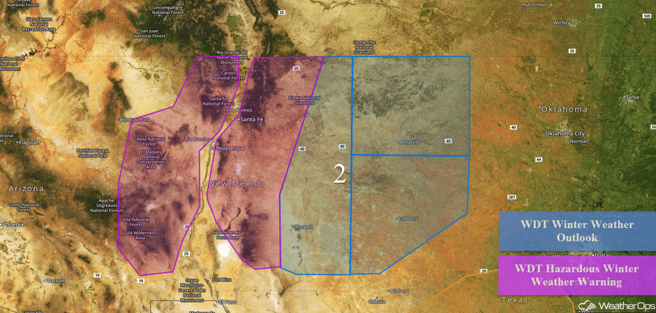
Snow will continue across the Southern Rockies and Southern High Plains as an area of low pressure moves across the region. Below 5,000 feet, snowfall accumulations of 4-8 inches with locally higher amounts in excess of 10 inches are forecast. Above 5,000 feet, snowfall amounts of 6-12 inches with locally higher amounts in excess of 14 inches are expected. In addition, winds of 25-35 mph with gusts in excess of 45 mph will reduce visibilities to less than a mile at times. Across eastern New Mexico and West Texas, up to 2 inches of snow are forecast with locally higher amounts in excess of 3 inches. In addition, light freezing rain accumulations up to a tenth of an inch will be possible.
Snow is falling on I-70 East headed toward White Sands Missile Range. Roads are slick #NM #Roads #Snow #Ice pic.twitter.com/zqY8iyudr2
— Samantha Lewis (@SamKFOX_CBS) February 13, 2017
Major Cities in Region: Albuquerque, NM, Santa Fe, NM, Roswell, NM, Amarillo, TX, Lubbock, TX
 Region 2
Region 3
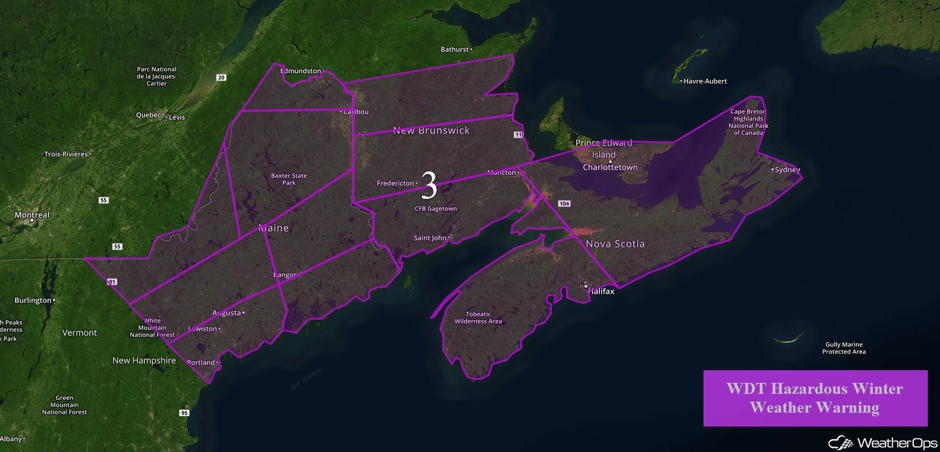
An area of low pressure will track from North-Central Canada into the Canadian Maritimes and Northeast Wednesday and Thursday. Moisture will be pulled into the region from the south and combine with cold air to produce areas of moderate to heavy snowfall. Snowfall amounts of 4-8 inches with locally higher amounts are expected. Winds gusting in excess of 25 mph will cause blowing and drifting snow.
Just another day at the office... #mewx #WeatherAuthority pic.twitter.com/lLPPlWbEVS
— Dan Lampariello (@DanWGME) February 13, 2017
Mercifully, the @WMTWTV engineering staff has cleaned off every car in the parking lot! #mewx 🎉❄️🚗 pic.twitter.com/2tY9q4y1pJ
— Paul Merrill (@PaulMerrillWMTW) February 13, 2017
They weren't kidding about this blizzard thing. My deck is completely buried and the bench is barely sticking out. 😳😬❄️ #MaineBlizzard #mewx pic.twitter.com/K1dyjpfte9
— Brittany Cote (@BrittanyCote94) February 13, 2017
Major Cities in Region: Burlington, VT, Portland, ME, Augusta, ME, Bangor, ME
 Region 3
Severe Thunderstorms Possible for Texas and Louisiana on Tuesday
Thunderstorms may develop from eastern Texas through the Florida Panhandle on Tuesday as an area of low pressure moves eastward. Ahead of this low, moisture will move northward, allowing instability to build. Storms are expected to grow into linear structures with damaging winds and tornadoes the primary hazards, but there will also be a risk for hail as well. Excessive rainfall amounts of 1-2 inches with locally higher amounts may lead to localized flooding.
Major Cities in Region: Houston, TX, Baton Rouge, LA, New Orleans, LA
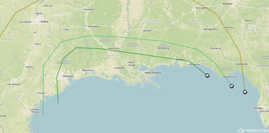 SPC Convective Outlook for Tuesday
Strong to Severe Thunderstorms Possible for Southeastern US on Wednesday
An area of low pressure, plentiful moisture, and a cold front will be moving across the Deep South on Wednesday. This will allow for another day of potential severe weather. Ongoing thunderstorms are expected to begin the day with activity moving toward the coastline. Large hail, damaging winds, and tornadoes will all be possible with these storms. During the evening, the thunderstorm risk will shift southward into Florida.
Major Cities in Region: Birmingham, AL, Atlanta, GA, Tampa, FL, Orlando, FL, Jacksonville, FL
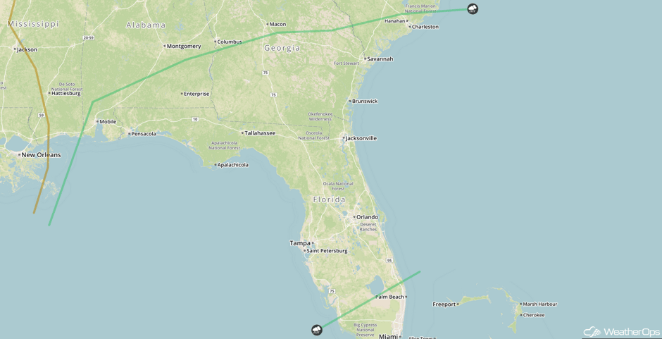 SPC Convective Outlook for Wednesday
Excessive Rainfall Possible for Pacific Northwest on Wednesday
Heavy precipitation will be possible along the coastal regions of the Pacific Northwest on Wednesday as a cold front begins to move into the region, allowing for heavy rainfall. Rainfall amounts of 1-2 inches with isolated higher amounts in excess of 3 inches will be possible, mostly along the bases of the high terrain of the region.
Major Cities in Region: Seattle, WA, Portland, OR, Eureka, CA, Chico, CA
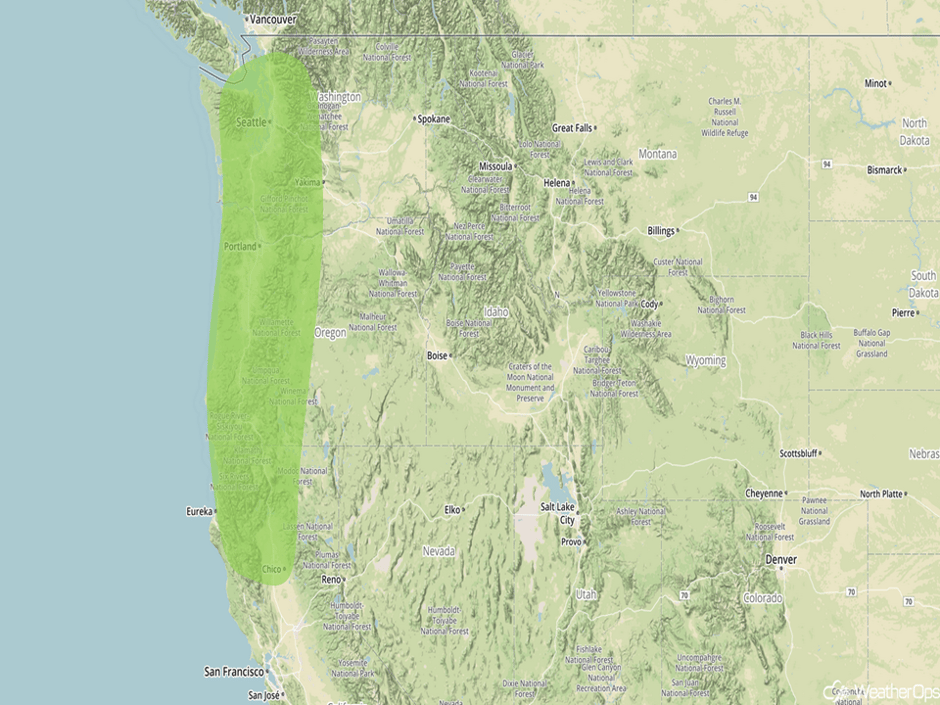 Excessive Rainfall Risk Outline for Wednesday
A Look Ahead
Heavy rainfall will continue across northern California on Thursday. Rainfall amounts of 1-2 inches are expected with locally higher amounts in excess of 3 inches. By Friday, heavy rainfall will move into southern California where 1-2 inches of rain and isolated higher amounts in excess of 3 inches are forecast.
This is just a brief look at current weather hazards. We can provide you site-specific forecast information for the purpose of protecting your personnel and assets. Try a 7-day demo right away and learn how timely precision weather information can enhance your bottom line.


