National Weather Summary for Monday, December 4, 2017
by David Moran, on Dec 4, 2017 10:22:14 AM
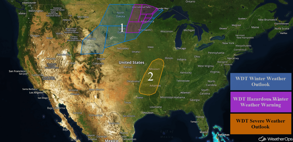
Heavy snowfall will continue for portions of the Upper Midwest on Monday as an area of low pressure moves across the region. Further to the south, thunderstorms may develop from the Ozarks into the Midwest ahead of the cold front associated with the area of low pressure across the Upper Midwest.
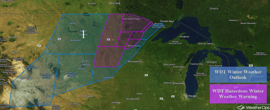
- Heavy Snowfall Continuing for Portions of the Rockies, Northern Plains, and Upper Midwest on Monday
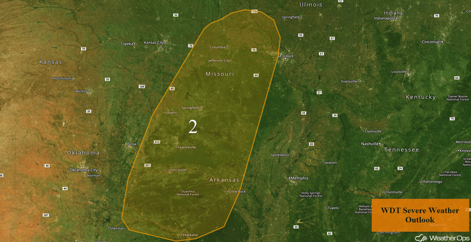
- Thunderstorms Monday from the Ozarks through the Midwest
 US Hazards
As a cold front surges through eastern Wyoming on Monday, moderate snow is forecast to continue behind the front. Snow accumulations of 2-4 inches with locally higher amounts in excess of 6 inches are forecast in the lower elevations. In the higher elevations, 8-12 inches are expected. Winds of 20-25 mph with gusts in excess of 40 mph will reduce visibilities to less than 2 miles at times. Further east across the Northern High Plains, 2-4 inches with locally higher amounts in excess of 6 inches are expected. Into the Upper Midwest, snow accumulations of 3-6 inches with locally higher amounts in excess of 7 inches are forecast. Snow accumulations may be as high as 8-12 inches across northern Minnesota. Combined with winds of 25-35 mph with gusts in excess of 50 mph, visibilities will be less than a mile and wind chills will range from 0 to 10 degrees.
Major Cities in Region: Cheyenne, WY, Minot, ND, Bismarck, ND, Pierre, SD, Grand Forks, ND, International Falls, MN
 Region 1
Thunderstorms Monday from the Ozarks through the Midwest
An area of low pressure currently over southwest Minnesota will intensify as it moves northeastward into Lake Superior by this evening. To the south of the low, a strong trailing cold front will surge southeastward into portions of the Midwest and South. Increasing moisture and strong winds aloft will set the stage for the development of scattered thunderstorms along the front this afternoon. Initially, storms may form in a semi broken line but by early this evening, storms will congeal into an eastward moving squall line. The primary threat with some of the better organized thunderstorms within the line will be damaging winds in excess of 50 mph. A brief tornado cannot be ruled out. The severe potential is low overall, but a few severe storms are anticipated. The severe weather threat will end as the front passes.
Major Cities in Region: Joplin, MO, Fort Smith, AR, Fayetteville, AR, Texarkana, AR. Springfield, MO, Little Rock, AR, Jefferson City, MO
 Region 2
A Look Ahead
The area of low pressure and cold front described above will continue to progress eastward on Tuesday, bringing the potential for rainfall from the Great Lakes southwestward into Texas. Rain will transition to snow across the Northeast Tuesday evening. On Wednesday, some light snow may develop across the Dakotas. This activity may expand across the Northern Plains on Thursday. Some moderate rainfall may develop along the East Coast on Friday in response to an area of low pressure off the East Coast.
This is just a brief look at current weather hazards. We can provide you site-specific weather forecast information for the purpose of protecting your personnel and assets and to assess your weather risk. Try a 7-day demo right away and learn how timely precision weather information can enhance your bottom line.


