National Weather Summary for Monday, December 18, 2017
by David Moran, on Dec 18, 2017 10:59:37 AM
A stalled front will be the focus for thunderstorm development from Southeast Texas into the Lower Mississippi Valley on Tuesday. This same front will also allow for a risk of excessive rainfall from Northeast Texas into portions of the Southeast.
- Thunderstorms Tuesday from Southeast Texas into the Lower Mississippi Valley
- Excessive Rainfall from Northeast Texas into the Southeast Tuesday and Wednesday
- Strong to Severe Thunderstorms Wednesday for Portions of the Southeast
 US Hazards
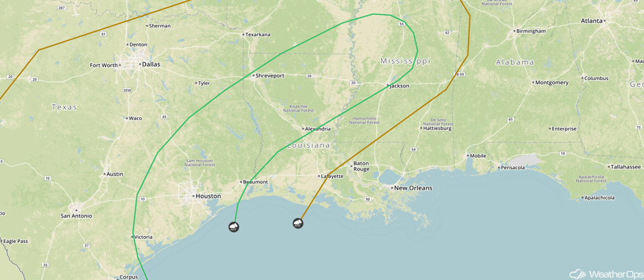
Thunderstorms Tuesday from Southeast Texas into the Lower Mississippi Valley
A stationary front near the Gulf Coast will serve as a focus for shower and thunderstorm activity on Tuesday as an upper level system moves across the region. Southerly winds will bring warm moist air northward, and instability should be sufficient for the development of thunderstorms by midday. Some of these storms are expected to become severe with damaging winds and an isolated tornado or two will be the the primary hazards. Activity is forecast to develop in east Texas initially and move into Louisiana and Mississippi throughout the day.
Major Cities in Region: Victoria, TX, Houston, TX, Shreveport, LA, Jackson, MS
 SPC Convective Outlook for Tuesday
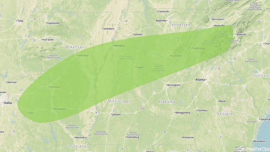
Excessive Rainfall from Northeast Texas into the Southeast Tuesday and Wednesday
There will be a threat for heavy rainfall from northeastern Texas into the Southeast Tuesday into Wednesday. An upper level system will aid in the development of an area of low pressure along the front later in the day. The front will become a warm front to the east of the low and moist air will be moving northward. Rainfall will begin along and north of the warm front, continuing into the overnight hours. Rain will spread into the Carolinas on Wednesday. Two day rainfall totals of 2-4 inches with locally higher amounts in excess of 5 inches are forecast. Flash flooding may become a concern as early as Tuesday evening.
Major Cities in Region: Texarkana, TX, Shreveport, LA, Little Rock, AR, Memphis, TN, Huntsville, AL. Chattanooga, TN
 Excessive Rainfall Risk Outline for Tuesday and Wednesday
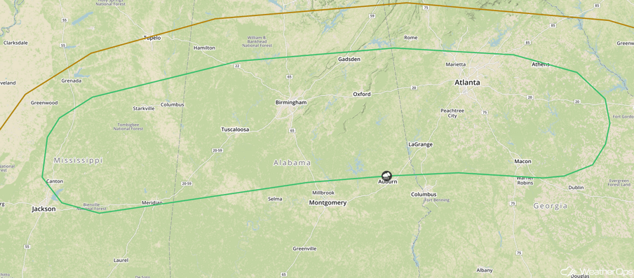
Strong to Severe Thunderstorms Wednesday for Portions of the Southeast
Some showers and thunderstorms may develop on Wednesday ahead of a cold front. Damaging winds and isolated tornadoes will be the primary hazards.
Major Cities in Region: Columbus, MS, Birmingham, AL, Atlanta, GA, Macon, GA
 SPC Convective Outlook for Wednesday
A Look Ahead
An area of low pressure forecast to develop in Colorado on Thursday will move northeastward into the Great Lakes throughout the day, allowing for the development of moderate to heavy snow across portions of Minnesota on Friday. Snowfall accumulations of 4-7 inches are forecast. Into the weekend, showers and thunderstorms are forecast on Saturday from the Texas Gulf Coast northeastward into the Ohio Valley. Some storms may produce heavy rain with rainfall totals of 1-2 inches and locally higher amounts.
This is just a brief look at current weather hazards. We can provide you site-specific weather forecast information for the purpose of protecting your personnel and assets and to assess your weather risk. Try a 7-day demo right away and learn how timely precision weather information can enhance your bottom line.


