by David Moran, on Dec 17, 2018 10:21:26 AM
Moderate to heavy snow will continue across the Northern Cascades and Rockies through Tuesday as an upper level trough moves across the region. Snow will persist across Maine through Tuesday. Continued snow is expected across the Sierra Nevadas on Monday.
- Continued Snow for the Northern Cascades and Rockies through Tuesday
- Snow Continuing through Tuesday across Maine
- Snow for the Sierra Nevadas on Monday
US Hazards
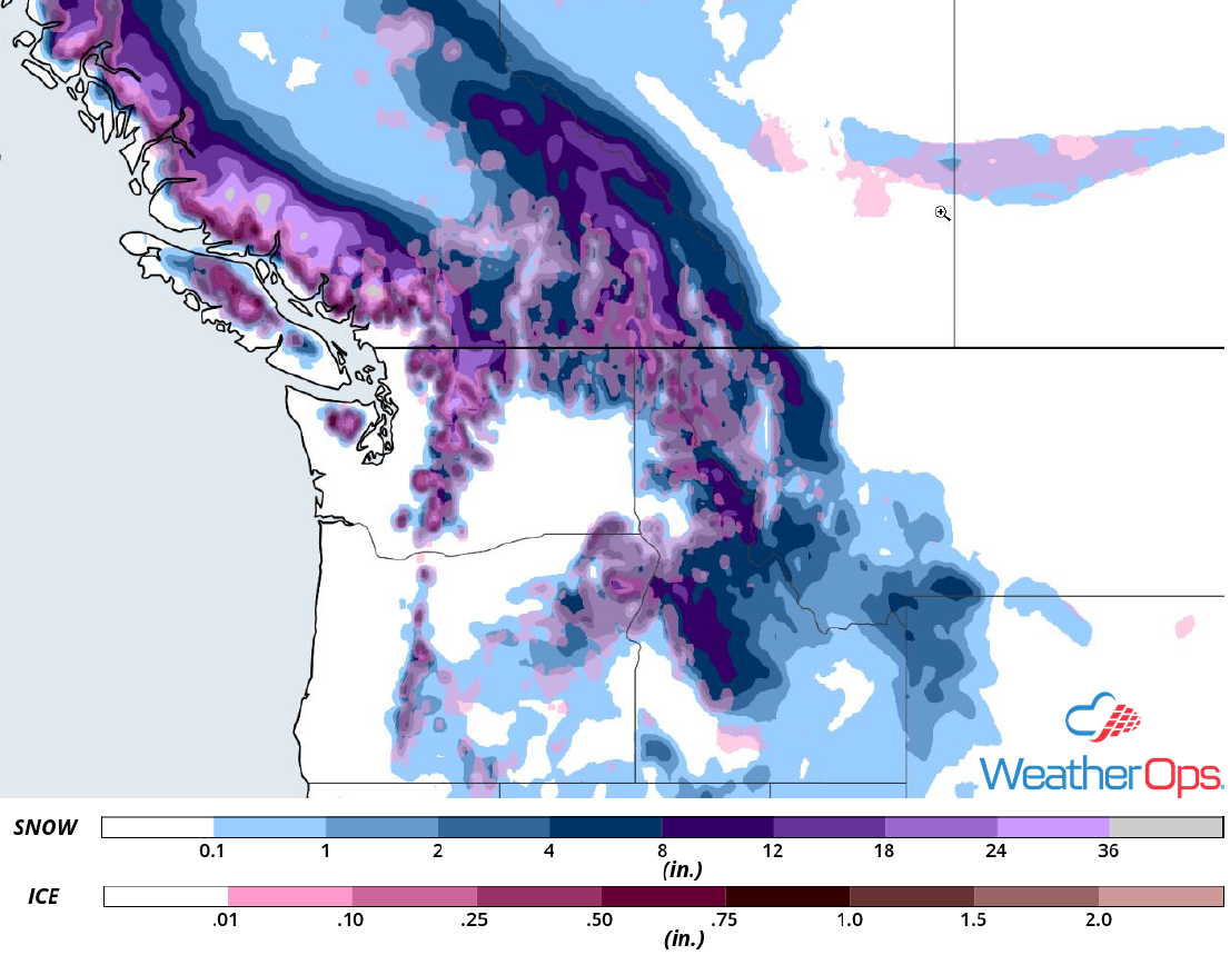
Continued Snow for the Northern Cascades and Rockies through Tuesday
Snow will continue across the Northern Cascades through Tuesday as an upper level trough continues to move eastward. Forecast snow totals of over two feet are likely in the highest ridges. Accumulations of 10-14 inches are expected from the Cascades into the Northern Rockies. In the lower elevations, snow accumulations will range 4-8 inches. A wintry mix is also forecast in the valleys. Precipitation will begin to taper off early Wednesday.
Major Cities in Region: Yakima, WA, Missoula, MT
Snow Accumulation for Monday
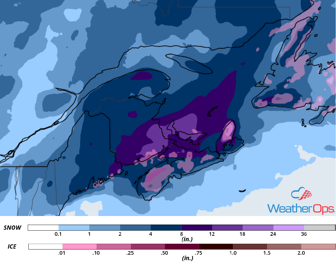
Snow Continuing through Tuesday across Maine
Snow will continue through Tuesday across Maine as an area of low pressure moves eastward. Accumulations will range 2-5 inches, increasing from west to east. Some light icing may also occur along the Maine coastline. Precipitation will wind down Tuesday afternoon as the area of low pressure moves off the coast.
Major Cities in Region: Portland, ME, Bangor, ME
Snow Accumulation through Tuesday
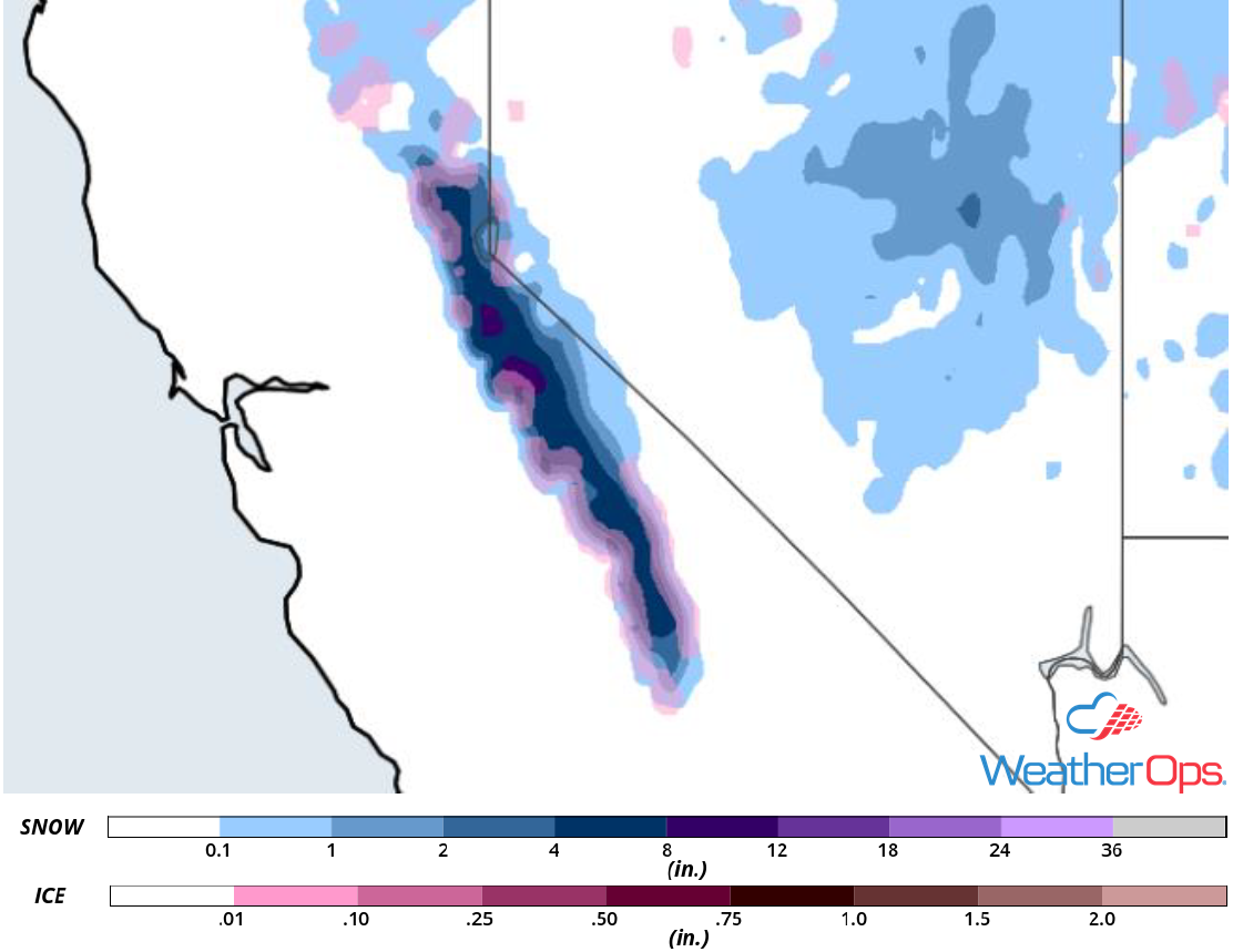
Snow for the Sierra Nevadas on Monday
Deep moisture associated with an upper level low off the West Coast will allow for moderate snowfall across the Sierra Nevadas today. Snowfall totals will range 5-8 inches in the mountains with higher totals in the mountain ridges. Below 7,000 feet, snow accumulations will range 2-5 inches. Freezing rain may develop in the valleys where temperatures are warmer. In the higher elevations, winds could gust in excess of 30 mph, creating the potential for blowing snow.
Major Cities in Region: South Lake Tahoe, CA
Snow Accumulation for Monday
A Look Ahead
Light snow is forecast to move into the Northern Rockies on Wednesday as an upper level trough moves eastward. Another round of snow may develop Thursday across the Cascades. More snow will move across the Northern Rockies on Friday. Going into the weekend, light snow and freezing rain is forecast Saturday across the Upper Midwest. Light snow may develop across the Northeast on Sunday.