National Weather Summary for Monday, August 8, 2016
by David Moran, on Aug 8, 2016 11:56:46 AM
Strong to severe thunderstorms are possible on Monday for portions of the Northern Rockies and Northern Plains as an upper level low moves eastward. Along the Gulf Coast, heavy rainfall will be possible as an area of low pressure moves along the coast. From portions of the Southeast into the Mid Atlantic, excessive rainfall will be possible in association with thunderstorms along a stationary front. On Tuesday, a cold front moving across the Plains will allow for the risk for strong to severe thunderstorms across the Northern Plains and Upper Midwest. Excessive rainfall will continue along the Gulf Coast as the area of low pressure along the coast continues to move westward. Shower and thunderstorm activity across the Arizona will increase, allowing for the potential for heavy rain. As the cold front across the Plains continues to move eastward on Wednesday, thunderstorms will continue across the Northern Plains and Upper Midwest. Heavy rainfall will continue along the Gulf Coast as the low along the coast continues to persist. Monsoonal showers and thunderstorms will continue across Arizona on Wednesday.
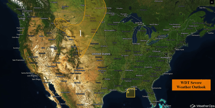
US Hazards
Region 1
A large upper level low over the Pacific Northwest region will likely result in the passage of one or two shortwave troughs through the Central and Northern Plains this afternoon and evening. While significant severe weather is not anticipated, isolated to scattered showers and thunderstorms, a few marginally severe, are expected by late afternoon or early evening with a low threat for damaging winds and large hail from the High Plains northeastward into Manitoba, Canada.
Major Cities in Region: Billings, MT, Rapid City, SD, Bismarck, ND, Cheyenne, WY, Denver, CO
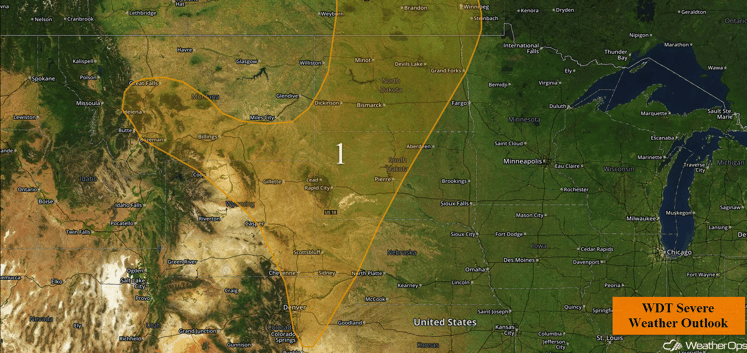
Region 1
Update 1:44pm CDT: Thunderstorms are developing across Western Colorado. Hail and damaging winds possible with some of these storms.
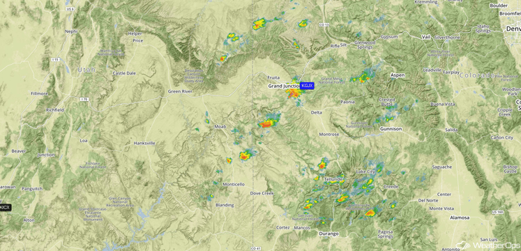
Western Colorado Radar 1:44pm CDT
Excessive Rainfall Possible Along the Gulf Coast Monday through Wednesday
Excessive rainfall will be possible along portions of the Gulf Coast as an area of low pressure continues to slowly move westward. Rainfall amounts of 1-3 inches with isolated heavier amounts in excess of 4 inches will be possible each day. Flooding will be possible as a result of these heavy rains.
Major Cities in Region: New Orleans, LA, Mobile, AL
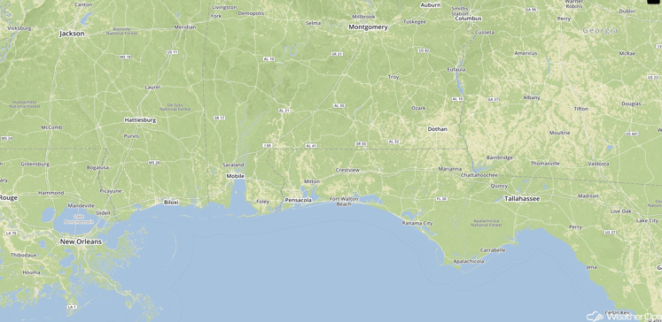
Excessive Rainfall Risk Area
Excessive Rainfall Possible for Portions of the Southeast and Mid Atlantic on Monday
A stationary front extending from the Southeast into the Mid Atlantic will serve as a focal point for the development of showers and thunderstorms across the region. With deep moisture spreading northward from the Gulf of Mexico, there will be a potential for excessive rainfall across the region. General rainfall amounts of 0.50-1.50 inches, with locally higher amounts in excess of 2 inches will be possible. With recent heavy rains, flooding will also be possible.
Major Cities in Region: Birmingham, AL, Atlanta, GA, Chattanooga, TN, Raleigh, NC, Richmond, VA
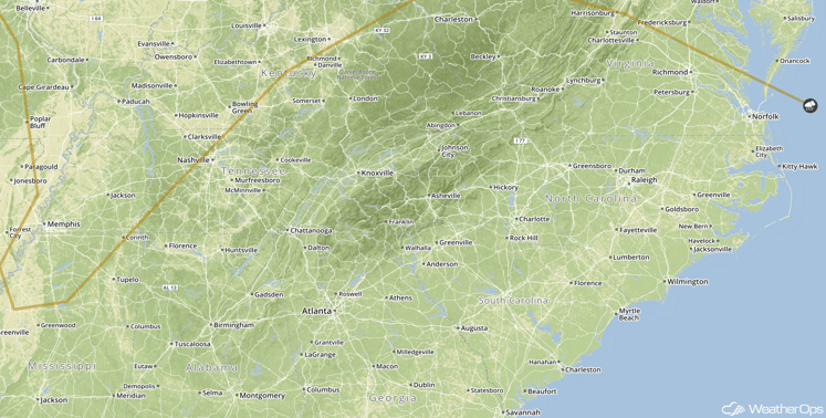
SPC Convective Outlook for Monday
Strong to Severe Thunderstorms Possible Tuesday Across the Northern Plains and Upper Midwest
A cold front moving southward out of Canada combined with a developing surface low progressing eastward out of the lee of the Rockies during the afternoon and evening, increasing in coverage after sunset. Conditions are expected to be favorable for the development of severe thunderstorms, with the highest risk across eastern Montana, southwest North Dakota, and northwest South Dakota. Large hail and damaging winds will be the primary hazards, but a few tornadoes cannot be ruled out during the afternoon and early evening.
Major Cities in Region: Bismarck, ND, Pierre, SD, Minneapolis, MN
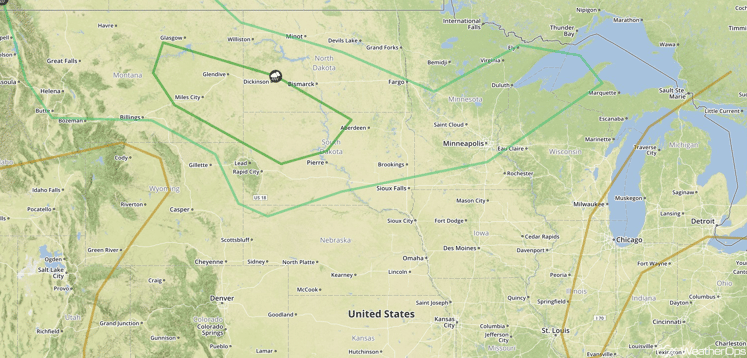
SPC Convective Outlook for Tuesday
Excessive Rainfall Possible Tuesday and Wednesday Across Portions of Arizona
Showers and thunderstorms are expected to increase again on Tuesday and Wednesday across portions of Arizona. Rainfall amounts of 1-3 inches with locally higher amounts of 4 inches will be possible. Some flooding and flash flooding will be possible on Wednesday.
Major Cities in Region: Phoenix, AZ, Tucson, AZ
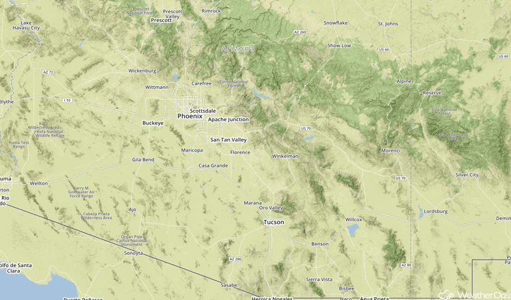
Excessive Rainfall Region for Tuesday and Wednesday
Strong to Severe Thunderstorms Possible Across the Northern Plains and Upper Midwest
A strong upper level disturbance is forecast to move east-northeast across the Northern Plains and into southern Canada on Wednesday. At the surface, a strengthening low pressure area and cold front will move eastward out of the High Plains region. Thunderstorms should become focused near the low and along and ahead of the cold front by the afternoon and evening hours across the Plains. Conditions should allow for the potential for severe thunderstorms capable of large hail, damaging winds, and isolated tornadoes. Storms may evolve into an organized complex by the late evening and overnight hours as they spread eastward into central and eastern Minnesota, with the threat transitioning to hail and damaging winds.
Major Cities in Region: Bismarck, ND, Pierre, SD, Minneapolis, MN
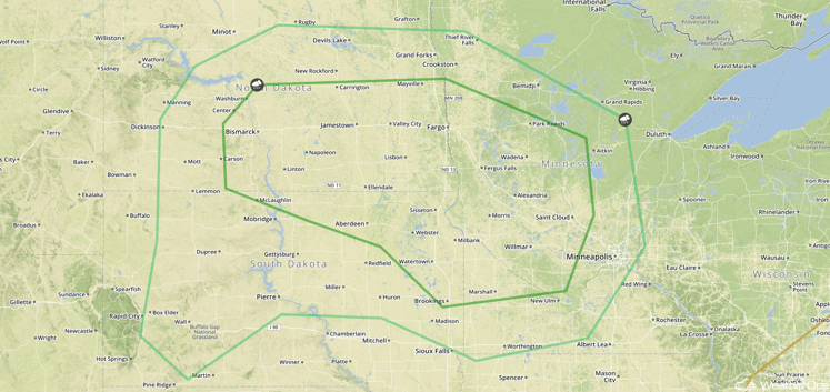
SPC Convective Outlook for Wednesday
This is just a brief look at current weather hazards. We can provide you site-specific forecast information for the purpose of protecting your personnel and assets. Try a 7-day demo right away and learn how timely precision weather information can enhance your bottom line.


