


by David Moran, on Aug 13, 2018 11:19:25 AM
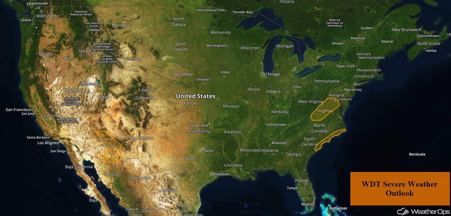
The threat for heavy to excessive rainfall will continue through Tuesday from North Texas into the Midwest as an upper level low stalls over the region. A cold front will be the focus for the development of thunderstorms across the Carolinas. Slow moving thunderstorms will continue across the Northeast, posing a risk for excessive rainfall. Thunderstorms are expected across southern Arizona as instability builds.
- Continued Excessive Rainfall through Tuesday from North Texas into the Midwest
- Thunderstorms for the Carolinas on Monday
- Excessive Rainfall Monday for the Northeast
- Risk for Thunderstorms across Southern Arizona on Monday
- Thunderstorm Potential Tuesday for the Northern High Plains
- Thunderstorms for the Central High Plains Wednesday
- Risk for Thunderstorms Wednesday for the Northeast
- Excessive Rainfall across the Midwest Wednesday
- Tropical Update
US Hazards
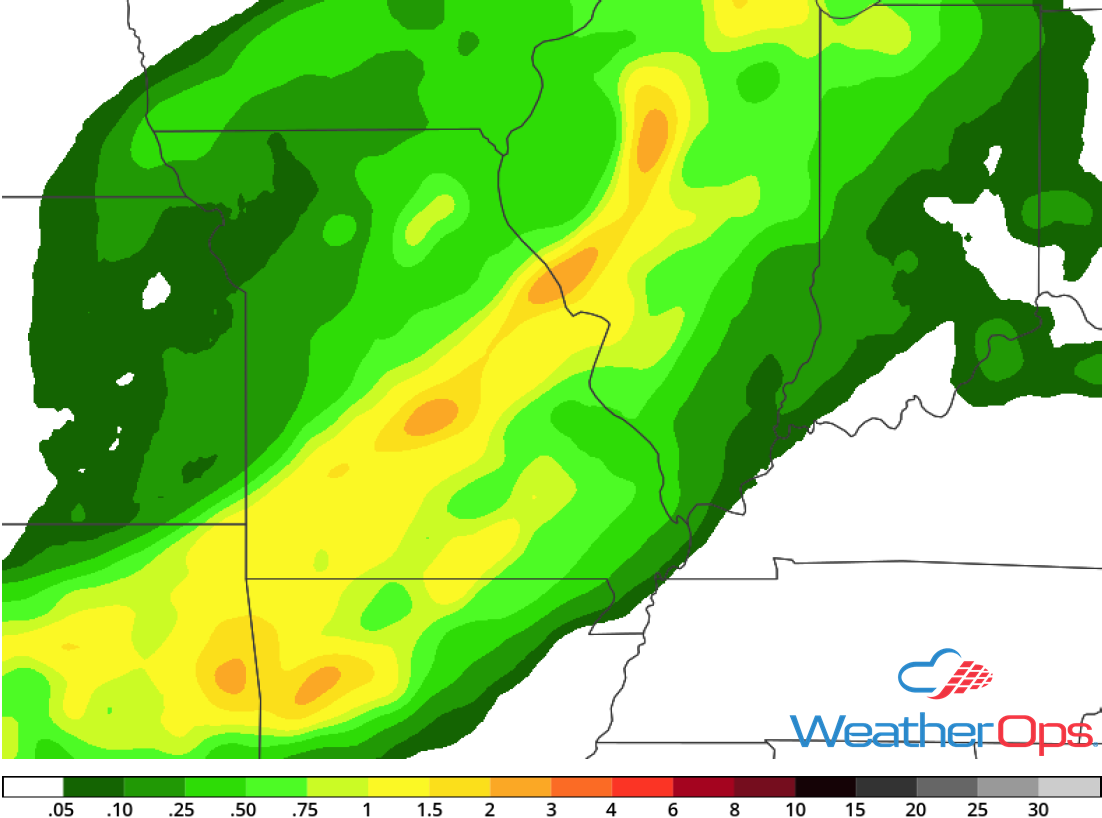
Continued Excessive Rainfall through Tuesday from North Texas into the Midwest
The threat for heavy rain leading to flash flooding will increase Monday and Tuesday from North Texas into the Midwest. An upper level low will shift northward on Monday with moisture streaming into the region. Scattered to widespread showers and thunderstorms will be common over the area for the next few days with the heaviest rain across North Texas and eastern Oklahoma on Monday. High rainfall rates within thunderstorms will produce a threat for isolated flash flooding. On Tuesday, the upper level low will stall with widespread showers and thunderstorms forecast across Oklahoma and into the Midwest. A large thunderstorm complex may develop Tuesday night over southern Kansas and northern Oklahoma that could produce a large area of heavy rainfall and flash flooding. Two day rainfall accumulations of 1-3 inches with locally higher amounts in excess of 4 inches are expected.
Major Cities in Region: Wichita Falls, TX, Oklahoma City, OK, Wichita, KS Tulsa, OK, Kansas City, MO, Joplin, MO
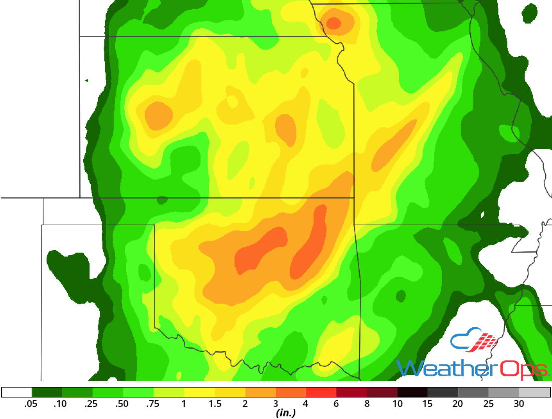
Rainfall Accumulation through Tuesday
Thunderstorms for the Carolinas on Monday
Strong to severe thunderstorms may develop across the eastern Carolinas as a cold front slowly moves across the region. Activity will develop during the late morning or early afternoon and track eastward over the coastal Plains throughout the day. Some storms will be capable of producing strong to damaging winds and large hail.
Major Cities in Region: Charleston, SC, Wilmington, NC
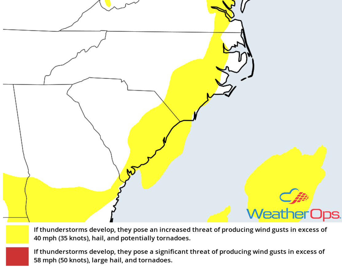
Thunderstorm Risk for Monday
Excessive Rainfall Monday for the Northeast
Areas of flash flooding are currently ongoing over portions of eastern Pennsylvania as slow moving, heavy thunderstorms increase in coverage this morning. Additional activity will develop throughout the day and evening as a slow moving area of low pressure and plentiful moisture produce widespread activity. Over eastern Pennsylvania, 2-3 inches with locally higher amounts in excess of 5 inches are forecast, leading to the risk of flash flooding. Elsewhere, accumulations of 1-2 inches with locally higher amounts in excess of 3 inches are expected.
Major Cities in Region: Binghamton, NY, Scranton, PA, New York, NY
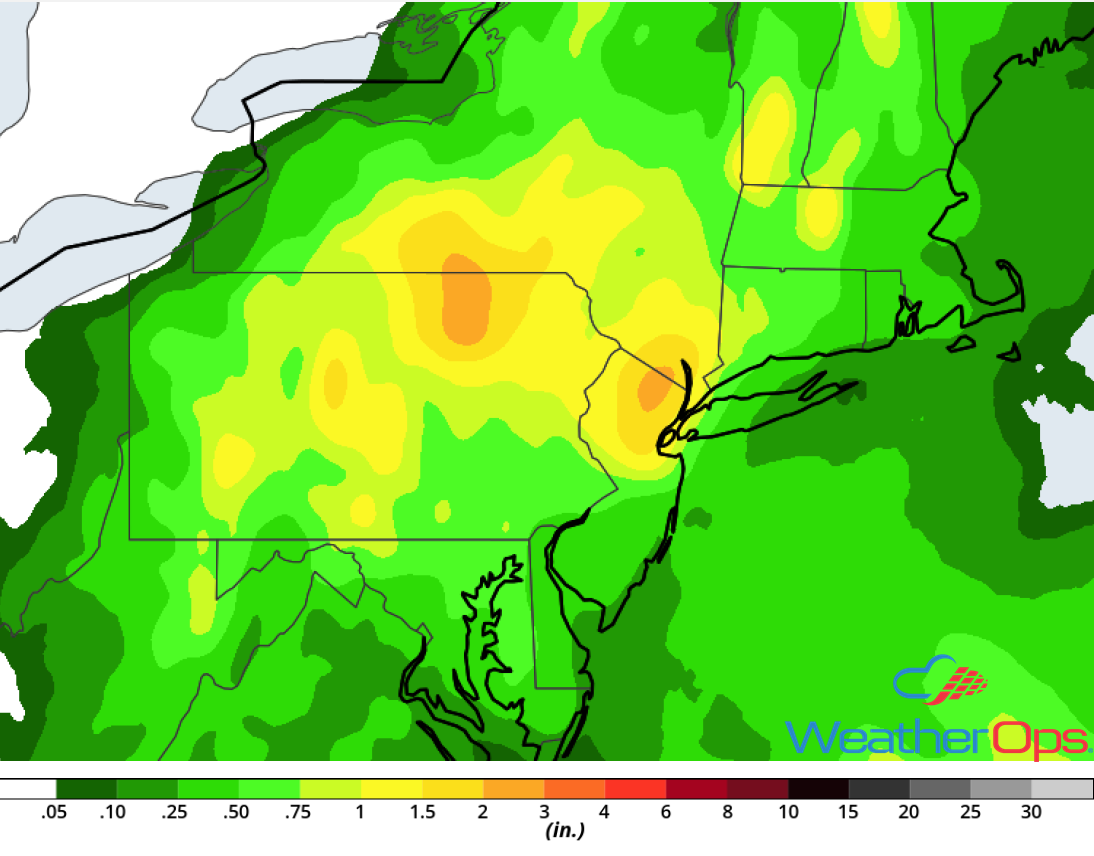
Rainfall Accumulation for Monday
Risk for Thunderstorms across Southern Arizona on Monday
Ample moisture will be in place over the southern portions of Arizona, allowing for another round of scattered thunderstorms during the afternoon. These storms will track southwestward with strong to damaging winds and hail the primary hazards. As these storms expand, dust storms will be likely.
Major Cities in Region: Phoenix, AZ, Tucson, AZ
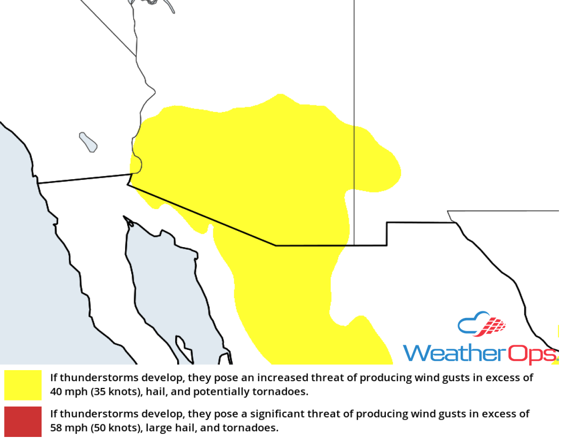
Thunderstorm Risk for Monday
Thunderstorm Potential Tuesday for the Northern High Plains
An upper level disturbance will aid in the development of thunderstorms across the High Plains Tuesday afternoon and evening. While instability will be marginal, storms that develop will have the potential produce large hail and damaging winds. Activity should diminish during the evening.
Major Cities in Region: Gillette, WY, Cheyenne, WY, Scottsbluff, NE
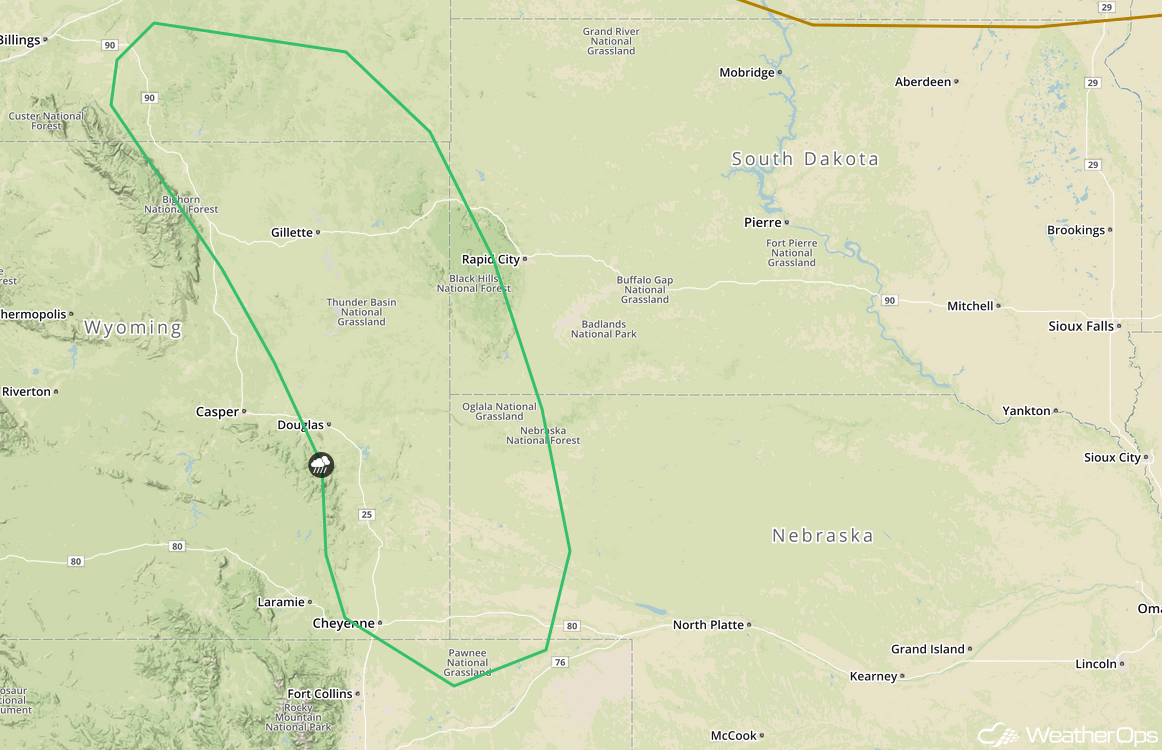
SPC Convective Outlook for Tuesday
Thunderstorms for the Central High Plains Wednesday
Strong to severe thunderstorms are expected to develop across the Central High Plains on Wednesday as upslope flow increases. Activity will develop during the afternoon with large hail and strong to damaging winds the primary hazards. The threat will diminish during the evening.
Major Cities in Region: Denver, CO, Colorado Springs, CO, Cheyenne, WY, Lamar, CO
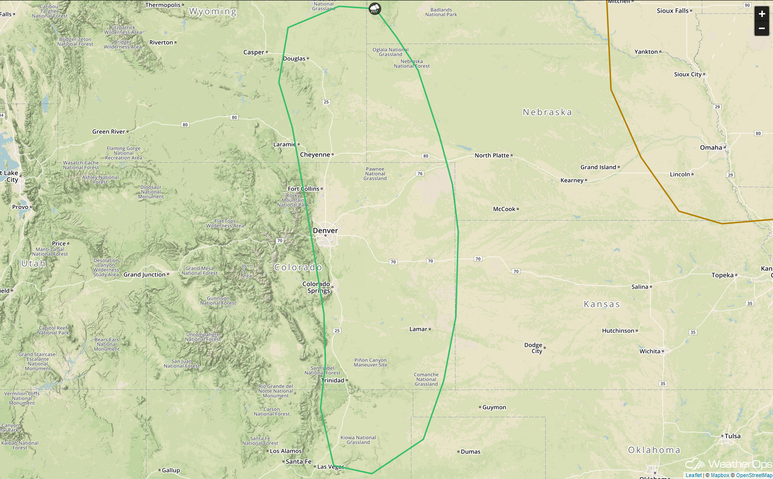
SPC Convective Outlook for Wednesday
Risk for Thunderstorms Wednesday for the Northeast
A cold front moving into the Northeast on Wednesday will allow for a threat for strong thunderstorms. Thunderstorms will develop along and ahead of the front during the late afternoon. Strong to damaging winds will be the primary hazard with these storms.
Major Cities in Region: Burlington, VT, Bangor, ME
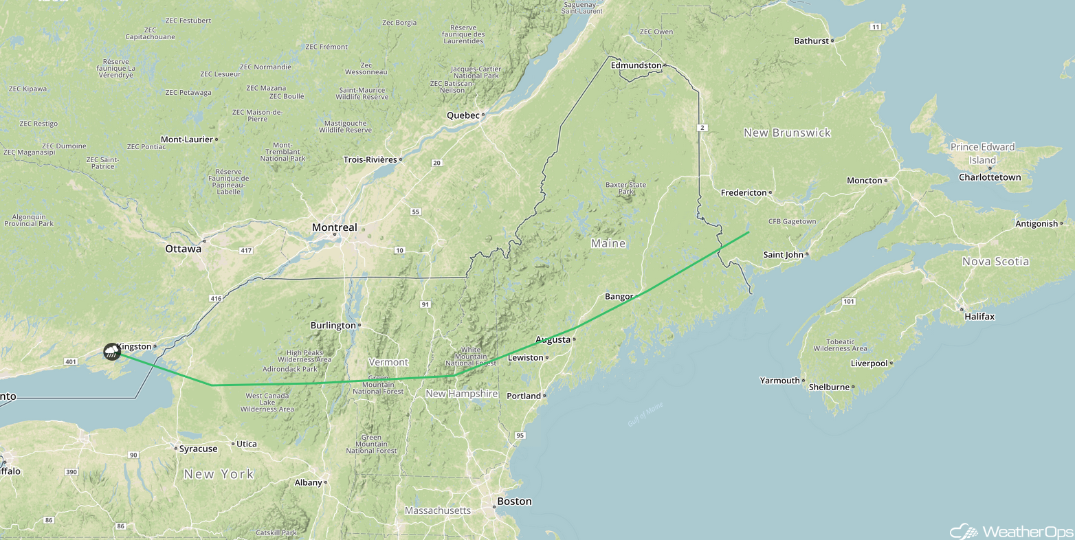
SPC Convective Outlook for Wednesday
Excessive Rainfall across the Midwest Wednesday
There will be a threat for excessive rainfall leading to areas of flooding over portions of the Midwest on Wednesday as a slow moving area of low pressure moves through the region. Scattered to widespread showers and thunderstorms will be likely for much of the day and into the evening. Activity will increase in intensity during the afternoon and produce isolated areas of heavy rain. Rainfall totals of 1-2 inches with locally higher amounts in excess of 2.5 inches are forecast.
Major Cities in Region:: Springfield, MO, St. Louis, MO, Springfield, IL
Rainfall Accumulation for Wednesday
Tropical Update
A non-tropical area of low pressure is about 600 miles south-southeast of Newfoundland. Conditions could become favorable for subtropical or tropical development during the next 2-3 days. If development occurs, the system should move northeastward over the north Atlantic.
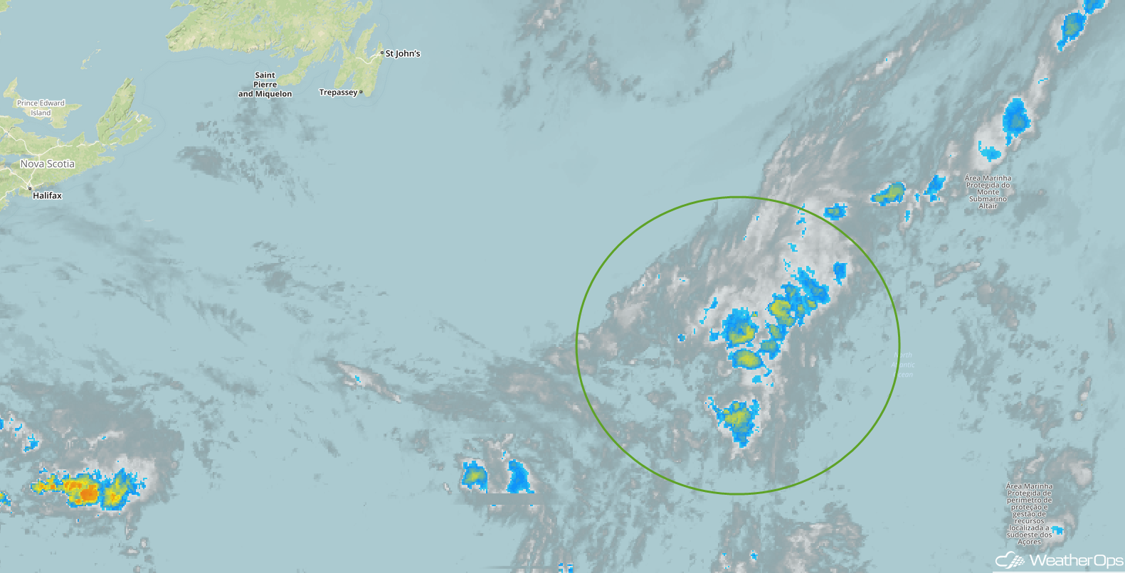
Enhanced Infrared Satellite
A Look Ahead
As the area of low pressure over the Plains continues to move northeastward, heavy rainfall will move into the Great Lakes on Thursday. By Friday, light to moderate rain will move into the Northeast. Going into the weekend, showers and thunderstorms will extend from the Ohio Valley into the Southeast ahead of a front on Saturday. Heavy rain may move over the Southern Plains on Sunday as an area of low pressure develops.
