National Weather Summary for Monday, August 1, 2016
by David Moran, on Aug 1, 2016 12:36:27 PM
Thunderstorms will be possible on Monday across the Northern Plains and the Upper Midwest ahead of a warm front. Across the Midwest, thunderstorms will lead to the potential for heavy rain. Monsoonal showers and thunderstorms will continue across the Desert Southwest. As an area of low pressure moves off the East Coast, moderate to heavy rainfall will be possible across the Northeast. Thunderstorms will continue across the Midwest on Tuesday as a cold front moves through the region. Across the Northern High Plains, thunderstorms are expected as an area of low pressure develops in the lee of the Rockies. Showers and thunderstorms are expected to continue across the Desert Southwest on Tuesday. A cold front moving through the Northern Plains on Wednesday will allow for the potential for thunderstorms across the region. Showers and thunderstorms are expected to continue across the Desert Southwest.
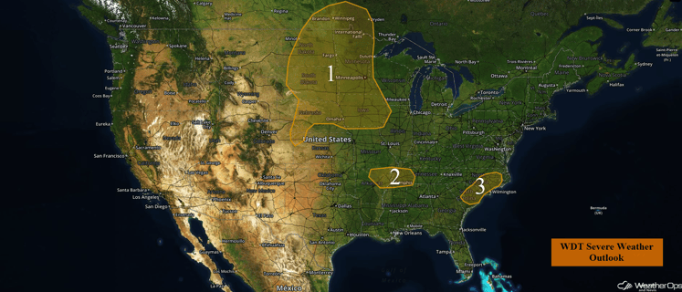
US Hazards
Region 1
Conditions are favorable for the development of thunderstorms across Region 1. At the surface, moist air will warm up as the day progresses and instability will increase as colder air aloft moves in. At the same time, an upper level trough will move across North Dakota and Minnesota, and a cold front and surface low will move through the Dakotas. Isolated strong to severe thunderstorms will develop across the region, with the main threat from the afternoon into the evening hours. The primary threats will be large hail and damaging winds, although an isolated tornado cannot be ruled out. These storms should consolidate into larger clusters and lines this evening and move to the east and southeast toward southern Minnesota and Iowa, with damaging winds being the primary hazard.
Across the Midwest, especially across Missouri, thunderstorms will continue to be possible throughout the day. With a high amount of moisture in the region, rainfall amounts of 2-3 inches with locally higher amounts in excess of 5 inches will be possible.
Major Cities in Region: Minot, ND, Fargo, ND, Minneapolis, MN, Des Moines, IA, Omaha, NE
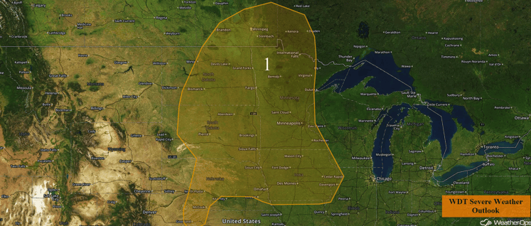
Region 1
Region 2
A cluster of strong to severe thunderstorms that moved through the region earlier this morning should produce an outflow boundary that will serve as the focal point for storm development across Region 2 this afternoon. Isolated severe thunderstorms will mainly produce a threat for damaging winds.
Major Cities in Region: Memphis, TN
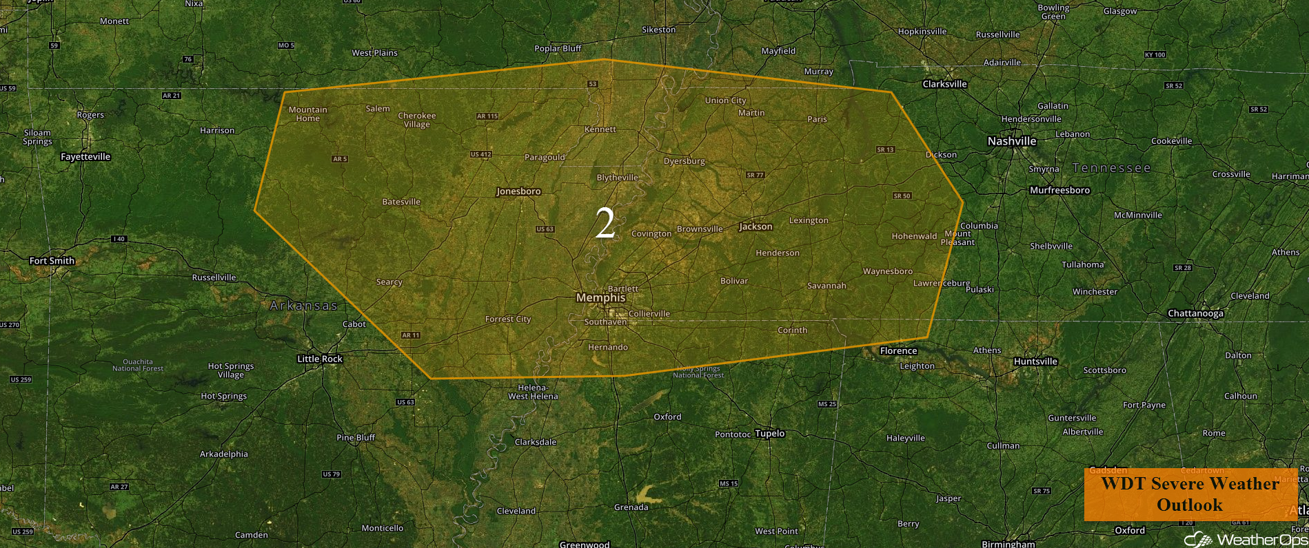
Region 2
Region 3
A few severe storms capable of damaging winds could form this afternoon across Region 3 along the sea breeze. In addition, weak vertical shear is providing a marginal environment to help promote storm development. These thunderstorms should develop during the afternoon hours as daytime heating reaches its maximum, with a primary threat of damaging winds.
Major Cities in Region: Raleigh, NC. Myrtle Beach, SC, Columbia, SC
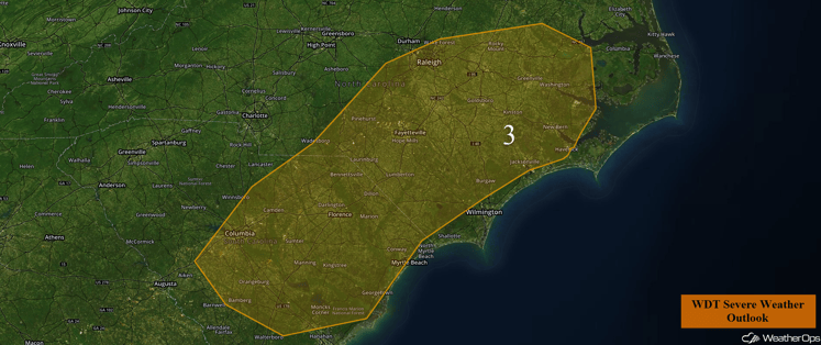
Region 3
Excessive Rainfall Possible Across the Desert Southwest on Monday
Monsoonal showers and thunderstorms are forecast to continue across the Desert Southwest. Overall slow storm motion will lead to potential to heavy to excessive rainfall for locations that receive rain. Rainfall accumulations of 2-3 inches will be possible.
Major Cities in Region: Flagstaff, AZ, Phoenix, AZ, Tucson, AZ, Albuquerque, NM
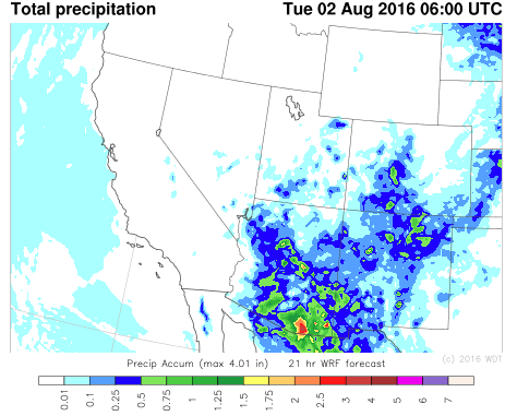
Total Precipitation through midnight MDT
Excessive Rainfall for Portions of the Northeast on Monday
As an area of low pressure moves offshore, northwesterly flow will bring moderate to heavy rain to the region on the northwest and west side of the low. Overall rainfall totals are forecast to range from 1-2 inches, with locally heavier amounts in excess of 3 inches, leading to the risk for flooding and flash flooding.
Major Cities in Region: Trenton, NJ, New York, NY, Boston, MA
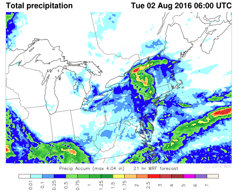
Total Precipitation through 2am EDT Tuesday
Strong to Severe Thunderstorms Possible Tuesday across the Midwest
Thunderstorms may develop over the Northern Plains and Tuesday morning and move eastward. While early morning thunderstorms will somewhat affect the thunderstorm potential later in the day, strong to severe thunderstorms will be possible during the afternoon and evening.
Major Cities in Region: Milwaukee, WI, Chicago, IL
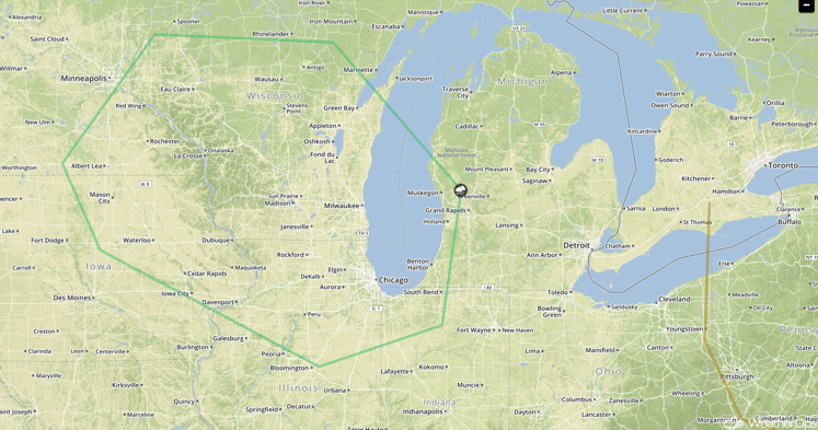
SPC Convective Outlook for Tuesday
Strong to Severe Thunderstorms Possible for the Northern High Plains on Tuesday
Strong lift is forecast to occur with a developing surface low in the lee of the Rockies. As the low intensifies, moisture and instability to the east of the low is forecast to lead to the development of strong to severe thunderstorms. Large hail and damaging winds are the primary hazards with these storms.
Major Cities in Region: Glasgow, MT
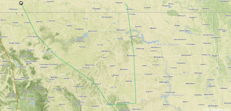
SPC Convective Outlook for Tuesday
Excessive Rainfall Possible Tuesday across the Desert Southwest
Similar monsoonal showers and thunderstorms are expected again into Tuesday. An additional 1-2 inches of rainfall will be possible over the region due to monsoonal storms, with locally heavier amounts in excess of 3 inches possible.
Major Cities in Region: Flagstaff, AZ, Phoenix, AZ, Tucson, AZ
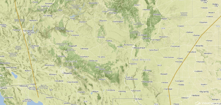
SPC Convective Outlook for Tuesday
Strong to Severe Thunderstorms Possible Wednesday Across the Northern Plains
A narrow area of instability is forecast to develop into the afternoon hours across the Dakotas ahead of a cold front. Within this area, strong to severe thunderstorms will be possible leading to strong winds and large hail. Storms are forecast to progress eastward as a cluster of thunderstorms or a line of thunderstorms capable of strong winds and hail into the evening.
Major Cities in Region: Bismarck, ND, Grand Forks, ND, Fargo, ND, Pierre, ND
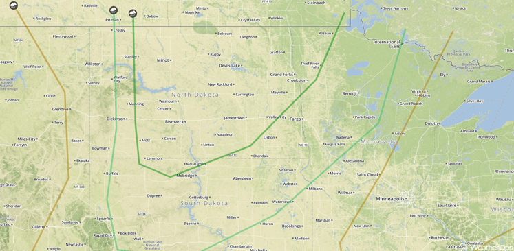
SPC Convective Outlook for Wednesday
Excessive Rainfall Possible for Portions of the Desert Southwest on Wednesday
Monsoon related showers and thunderstorms are expected to continue into Wednesday with an additional 1-2 inches of rainfall possible. With the heavy rainfall, flooding and flash flooding may occur due to precipitation runoff.
Major Cities in Region: Flagstaff, AZ, Phoenix, AZ, Tucson, AZ
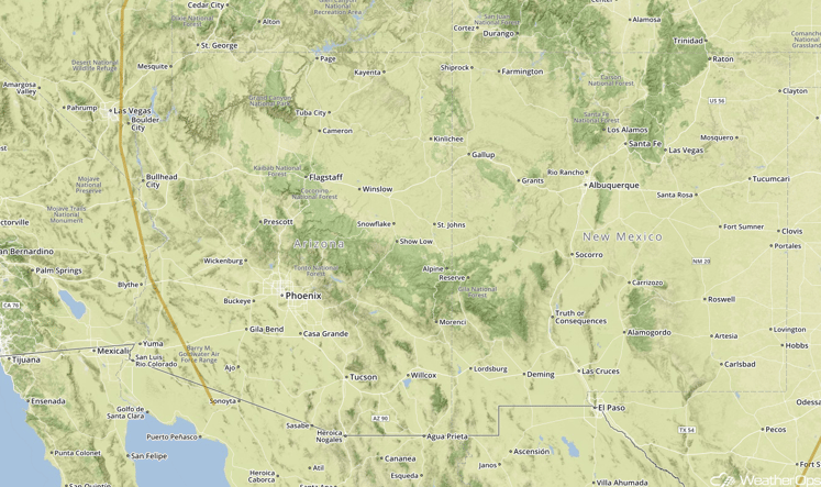
SPC Convective Outlook for Wednesday
This is just a brief look at current weather hazards. We can provide you site-specific forecast information for the purpose of protecting your personnel and assets. Try a 7-day demo right away and learn how timely precision weather information can enhance your bottom line.


