National Weather Summary for Monday, April 18, 2016
by David Moran, on Apr 18, 2016 11:06:42 AM
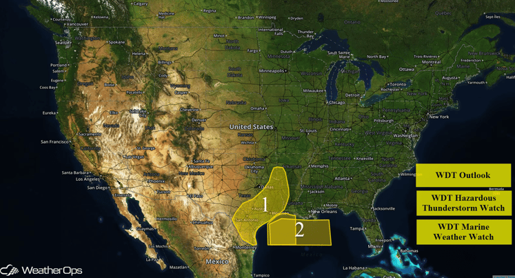
The threat for excessive rainfall will continue from Central and Eastern Texas into portions of Arkansas, Louisiana, and Oklahoma. Thunderstorms, as well as elevated winds and seas, will be possible for the Northern Gulf of Mexico through Monday evening.

US Hazards
Region 1
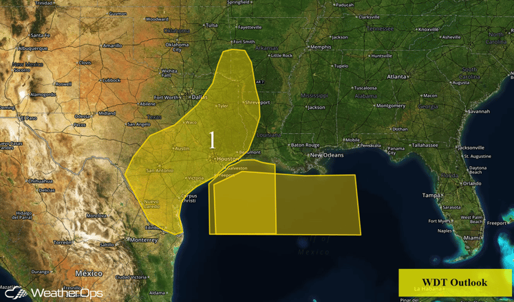
The threat for excessive rainfall will continue on Monday across Region 1. Ongoing showers and thunderstorms will slowly progress eastward during the day, with new development of thunderstorms within the sorthern portions of the region later in the afternoon. Flash flooding will exist northwest of the Houston area through the morning as heavy rainfall continues to inundate that area. Widespread 2-4 inches of rainfall will be possible with locally higher amounts in excess of 5 inches possible.

Region 1
Region 2
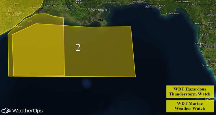
Hazardous thunderstorms will continue across portions of Region 2 into the afternoon across the western Gulf. The main hazards with any thunderstorms that form will be wind gusts in excess of 45 miles per hour. In addition, elevated winds and seas will continue across the northern Gulf of Mexico through early Monday evening. Winds of 20-30 miles per hour with gusts in excess of 35 miles per hour will be possible in addition to seas building to 7-9 feet.

Region 2


