by David Moran, on Sep 28, 2018 10:28:23 AM
No hazards are anticipated through Sunday as high pressure remains in place across much of the country. Light rain will continue across the Northeast as an area of low pressure moves offshore.
- Rain Continuing across the Northeast on Friday
- Tropical Update
US Hazards
Rain Continuing across the Northeast on Friday
Light rain will continue across much of the Northeast on Friday as an area of low pressure moves offshore. Additional rainfall amounts will range 0.25-075 inch with locally higher amounts in excess of an inch.
Major Cities in Region: Hartford, CT, Providence, RI, Boston, MA
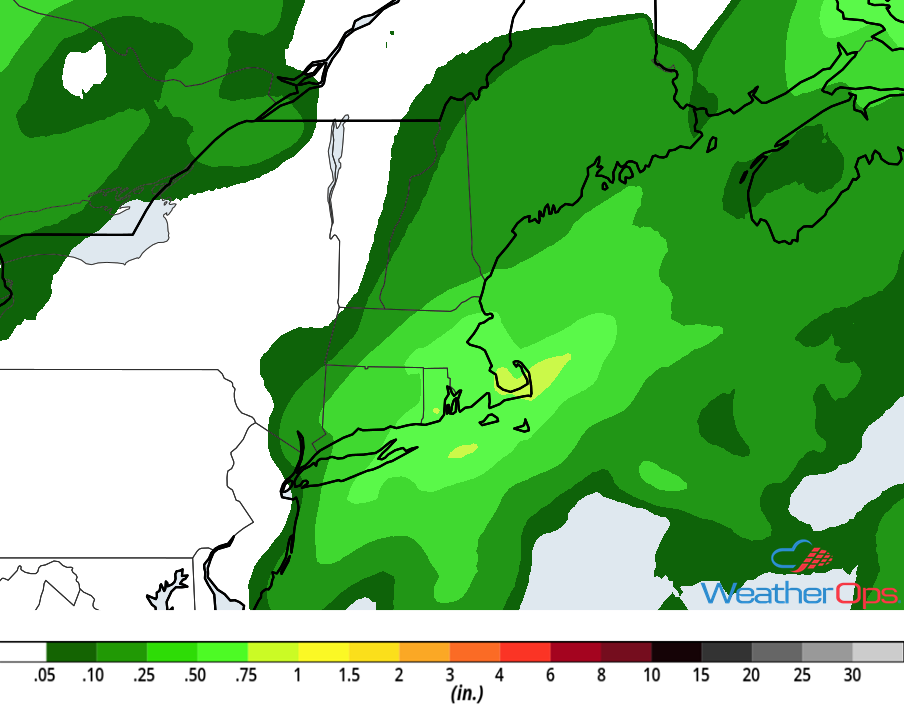
Rainfall Accumulation for Friday
Tropical Update
Tropical Storm Kirk (green oval) is 185 miles west-southwest of Martinique and is moving west-northwestward at 13 mph. This motion is expected to continue through Sunday. Kirk is expected to become a tropical depression and then degenerate into an area of low pressure on Saturday.
Post Tropical Cyclone Leslie (red oval) is located over the central Atlantic, several hundred miles west of the Azores. Shower activity has gradually increased near the center and Leslie is expected to become a subtropical cyclone today or tomorrow. Leslie will continue producing strong winds and high seas over the next few days regardless of when it transitions to a subtropical storm.
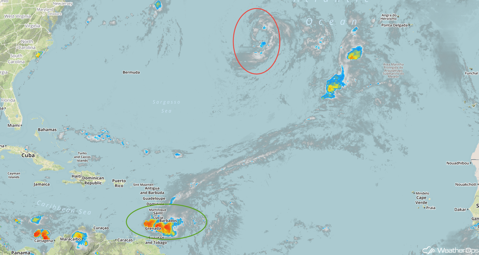
Enhanced Infrared Satellite
A Look Ahead
Generally benign conditions are expected to continue for a few days; it's relatively rare to have such calm conditions across the country for the start of fall. However, activity will increase next week as the remnants of Rosa begin to move into the Southwest late Monday, bringing a potential for heavy rain. Elsewhere, thunderstorms may develop from the Central Plains into the Great Lakes on Monday ahead of a cold front. Rain across the Southwest will increase in intensity on Tuesday; rainfall totals of 1-2 inches with locally higher amounts in excess of 3 inches are expected. An area of low pressure will intensify across the Plains on Wednesday, bringing a potential for showers and thunderstorms from the Northern Plains into the Great Lakes. Showers and thunderstorms may develop across the Great Lakes Thursday ahead of a cold front.