National Weather Summary for Friday, September 15, 2017
by David Moran, on Sep 15, 2017 10:27:40 AM
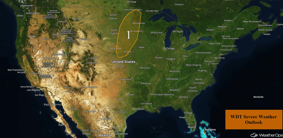
Thunderstorms may develop across portions of the Plains and Midwest on Friday along a stalled frontal boundary.
- Thunderstorms from the Plains through the Midwest on Friday
- Continued Thunderstorms Saturday from the Plains into the Midwest
- Tropical Update
 US Hazards
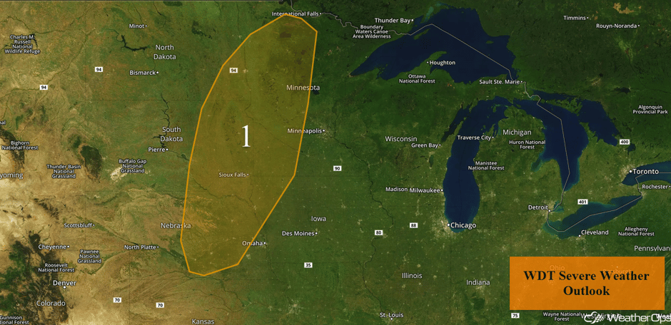
Thunderstorms from the Plains through the Midwest on Friday
A stationary front is forecast to stretch across the region on Friday, with an area of low pressure over southeastern South Dakota this morning. Into the late afternoon and early evening, a surface low is forecast to lift to the northeast with strong to severe thunderstorm development to the east and south of the center of the low. Overall upper level support is limited, although a severe thunderstorm cannot be ruled out. Large hail, damaging winds, and isolated tornadoes will all be potential hazards with any storm that becomes severe.
Major Cities in Region: Fargo, ND, Sioux Falls, SD, Sioux City, IA
 Region 1
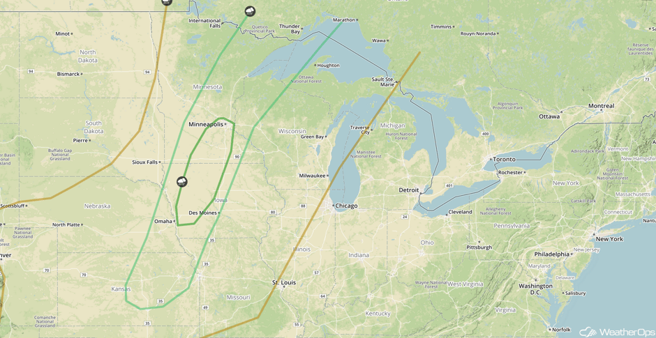
Continued Thunderstorms Saturday from the Plains into the Midwest
The risk for strong to severe thunderstorms will continue on Saturday along a cold front stretching from the Great Lakes into the Central Plains. Some morning thunderstorms may become severe with hail the primary hazard. Later into the afternoon, daytime heating should be sufficient for the development of new strong to severe thunderstorms with hail and damaging winds the main concerns.
Major Cities in Region: Omaha, NE, Des Moines, IA, Minneapolis, MN
 SPC Convective Outlook for Saturday
Tropical Update
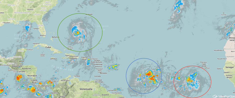
Tropical Storm Jose (green oval) is 500 miles south-southwest of Bermuda and is moving west-northwest at 8 mph. A gradual turn to the north is expected later today and on Saturday. Maximum sustained winds are at 70 mph with higher gusts. Some strengthening is expected over the next 48 hours with Jose forecast to become a hurricane later today.
Tropical Depression Fourteen (red oval) is located 435 miles south-southwest of the Cabo Verde Islands. Maximum sustained winds are 35 mph with higher gusts, This depression is forecast to become a tropical storm later today or tomorrow.
A tropical wave located about 1200 miles east of the Windward Islands (blue oval) is producing a large area of showers and thunderstorms. Environmental conditions are expected to be conducive for gradual development and a tropical depression is expected to develop in 2-3 days. Interests in the Lesser Antilles should closely monitor the progress of this system while it moves westward to west-northwestward at about 15 mph.
 Enhanced Infrared Tropical Satellite
A Look Ahead
A few showers and storms may develop across the Midwest on Sunday, but no significant hazards are anticipated. Hurricane Jose is expected to remain just offshore the east coast, however, a track toward the east coast cannot be ruled out. Elsewhere, high pressure will build, resulting in calm conditions for much of the country. Some high elevation snow may develop across portions of the Northern Rockies late next week.
This is just a brief look at current weather hazards. We can provide you site-specific weather forecast information for the purpose of protecting your personnel and assets and to assess your weather risk. Try a 7-day demo right away and learn how timely precision weather information can enhance your bottom line.


