


by David Moran, on Nov 16, 2018 10:05:09 AM
Snow will continue across the Northeast on Friday as an area of low pressure moves through the region. An upper level disturbance will bring a potential for snow to North Dakota and the Upper Midwest. Snow is expected across Wyoming as a weak disturbance moves southward across the Rockies.
- Snow Continuing for the Northeast on Friday
- Potential for Snow Friday across North Dakota and the Upper Midwest
- Snow for Wyoming Friday
- Additional Snow Saturday and Sunday for the Northeast
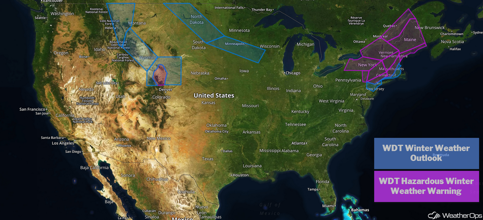
US Hazards
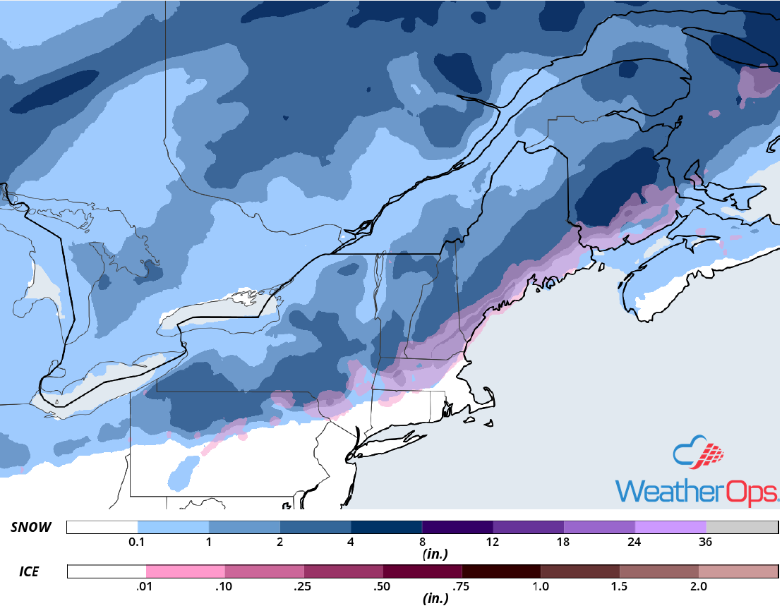
Snow Continuing for the Northeast on Friday
Snow will begin to taper off late Friday as the area of low pressure moving through the region finally exits. Additional snowfall accumulations of 1-3 inches with locally higher amounts in excess of 4 inches are expected from Upstate New York into New England. Across eastern Maine, 6-10 inches with locally higher amounts are forecast.
Major Cities in Region: Albany, NY, Burlington, VT, Portland, ME, Bangor, ME, Presque Isle, ME
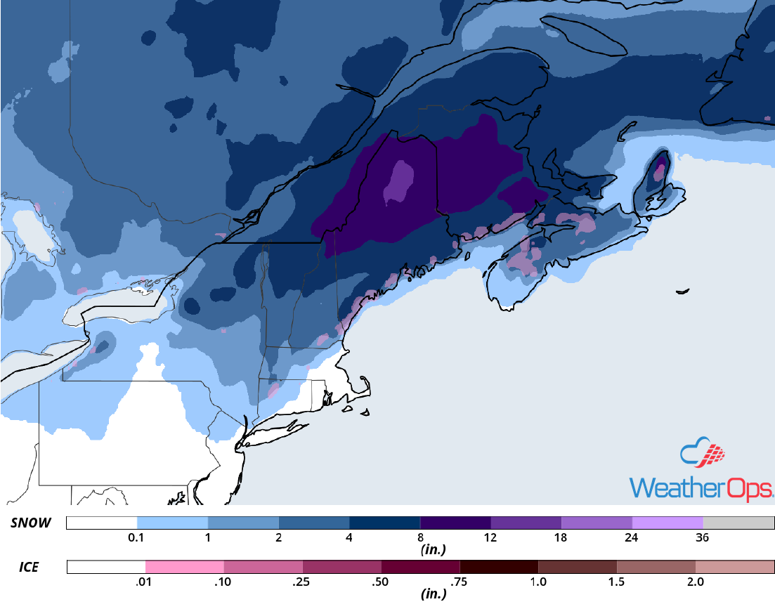
Snow Accumulation for Friday
Potential for Snow Friday across North Dakota and the Upper Midwest
Snow will continue on Friday as a clipper system moves through the region on Friday. The heaviest snow is forecast across western North Dakota from the late morning through midnight. Snowfall accumulations of 4-6 inches with locally higher amounts in excess of 8 inches are expected across western North Dakota. Elsewhere, snow accumulations will range 1-3 inches. Gusty winds will create low visibilities and hazardous travel conditions.
Major Cities in Region: Minot, ND, Bismarck, ND, Minneapolis, MN
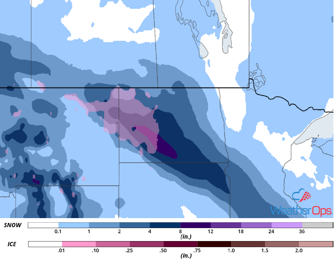
Snow Accumulation for Friday
Snow for Wyoming Friday
A weak disturbance is forecast to dig southward across western Montana and eventually into Wyoming Friday night. This will bring moderate to heavy snow to the higher elevations where 3-6 inches of snow are forecast. The highest peaks could receive close to a foot of snow.
Major Cities in Region: Cody, WY, Riverton, WY, Casper, WY
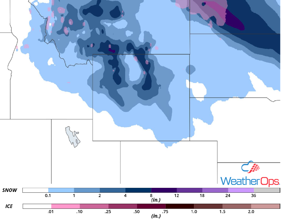
Snow Accumulation for Friday
Additional Snow Saturday and Sunday for the Northeast
Another area of low pressure will develop and move northeastward along a nearly stationary front over the eastern US Saturday into Sunday. Light to moderate snow is forecast as the low moves across the region. Snowfall accumulations of 1-3 inches with locally higher amounts in excess of 5 inches are expected.
Major Cities in Region: Albany, NY, Burlington, VT, Manchester, NH, Augusta, ME, Portland, ME
Snowfall Accumulation for Saturday and Sunday
A Look Ahead
Light to moderate snow may continue across portions of the Northeast on Monday as the area of low pressure described above moves out of the region. Lake effect snow may develop across western New York on Tuesday. An area of low pressure could produce some light snow and freezing rain Wednesday across the northern Great Lakes. Going into Thanksgiving, heavy rain is forecast across southern Louisiana.
