


by David Moran, on May 18, 2018 10:36:53 AM
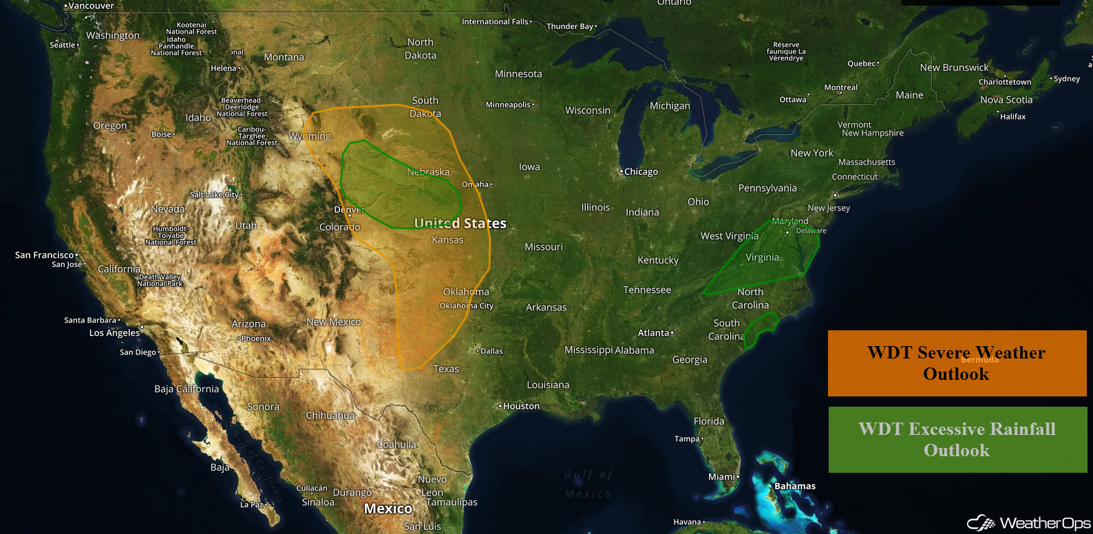
Thunderstorms are forecast to develop across the Great Plains and Front Range on Friday as an upper level trough moves into the area. Excessive rainfall will continue for portions of the Mid Atlantic and Central Appalachians. Across the Carolinas, heavy rainfall is forecast through Saturday in association with a stalled front. Showers and thunderstorms will continue across the Northern and Central Plains, leading to a risk of flooding.
- Thunderstorms across the Great Plains and Front Range on Friday
- Excessive Rainfall Friday for the Mid Atlantic and Central Appalachians
- Potential for Excessive Rainfall across the Carolinas through Saturday
- Risk for Excessive Rainfall Friday across the Northern and Central Plains
- Thunderstorms from the Central Plains to Mid Mississippi Valley on Saturday
- Thunderstorm Potential Saturday for the Ohio Valley
- Excessive Rainfall for the Northern Plains on Saturday
- Potential for Thunderstorms Sunday across the Midwest
 US Hazards

Thunderstorms across the Great Plains and Front Range on Friday
A strong upper level disturbance is forecast to move into the Plains on Friday. This will allow a cold front to move southward and an area of low pressure to intensify over the Central and Southern Plains. Thunderstorms are expected to develop during the afternoon with some storms becoming severe. Damaging winds and hail will be the primary hazards, but an isolated tornado cannot be ruled out. The development of a low level jet during the evening hours may increase the damaging wind threat.
Major Cities in Region: Goodland, KS, North Platte, NE, Dodge City, KS, Altus, OK
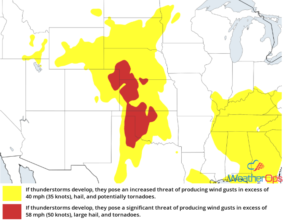 Thunderstorm Risk for Friday
Excessive Rainfall Friday for the Mid Atlantic and Central Appalachians
Scattered to widespread showers and thunderstorms will continue to overspread the Mid Atlantic region today. Due to recent heavy rains, there will be an increased risk of flooding and runoff. Additional rainfall amounts of 2-4 inches with locally higher amounts in excess of 5 inches are expected.
Major Cities in Region: Charleston, WV, Washington, DC, Baltimore, MD
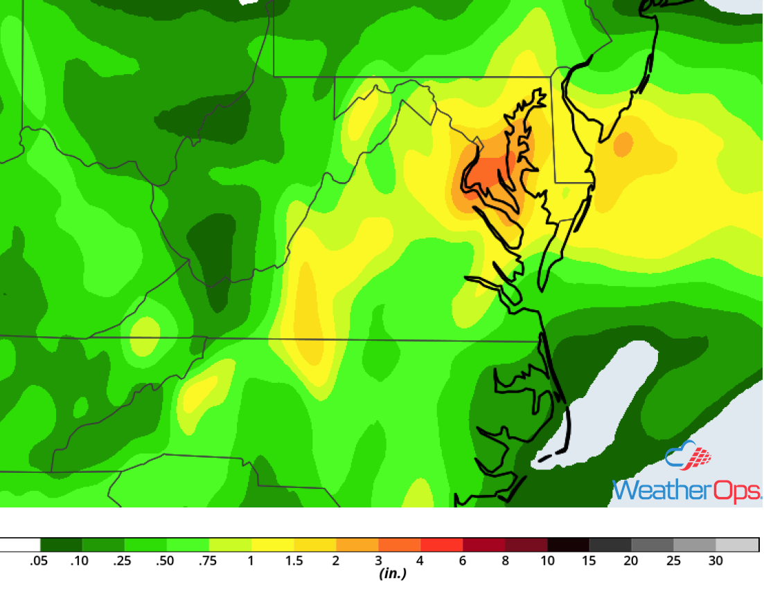 Rainfall Accumulation for Friday
Potential for Excessive Rainfall across the Carolinas through Saturday
Southerly flow over northeast South Carolina and southeast North Carolina will bring moisture into the region. With a stalled front to the north, scattered showers and thunderstorms will spread over the region through Saturday. Two day rainfall totals of 2-4 inches with locally higher amounts in excess of 5 inches are forecast, leading to the potential for flooding.
Major Cities in Region: Myrtle Beach, SC, Wilmington, NC, Greenville, NC
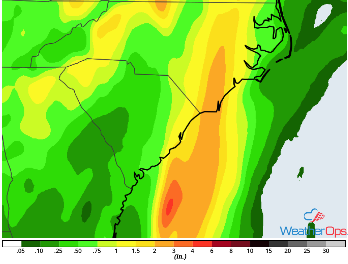 Rainfall Accumulation through Saturday
Risk for Excessive Rainfall Friday across the Northern and Central Plains
Showers and thunderstorms are forecast to develop once again across portions of the Northern and Central Plains. Activity is currently ongoing across the region, but additional thunderstorms are expected later this afternoon and evening. Excessive rainfall is expected for much of the region with rainfall accumulations of 1-3 inches and locally higher amounts in excess of 4 inches forecast. This may lead to an increased risk for flooding, especially in small streams and low-lying areas.
Major Cities in Region: North Platte, NE, Grand Island, NE
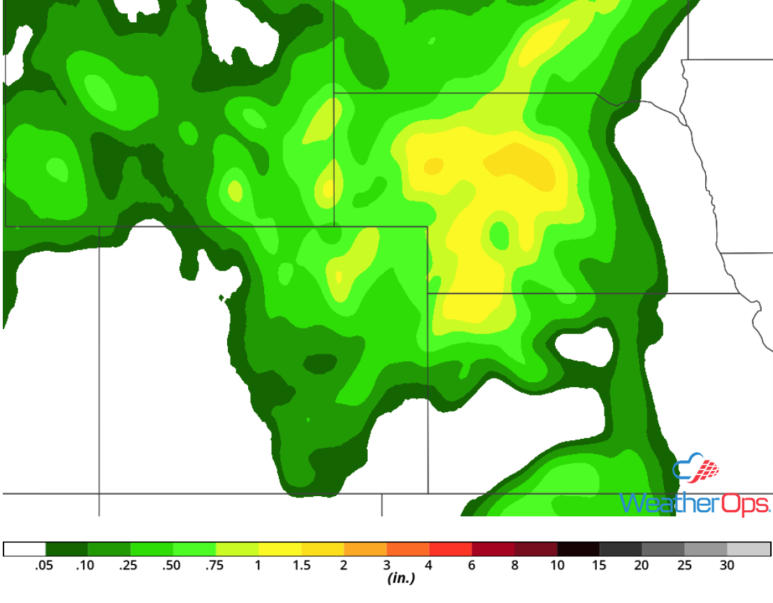 Rainfall Accumulation for Friday
Thunderstorms from the Central Plains to Mid Mississippi Valley on Saturday
A strong upper level disturbance will continue to progress across central portions of the country on Saturday, with an associated surface low moving northeastward. Thunderstorms are likely to develop and increase with daytime heating, with some thunderstorms becoming severe. Large hail, damaging winds, and tornadoes will all be potential hazards with these storms.
Major Cities in Region: Dodge City, KS, Wichita, KS, Topeka KS. Omaha, NE, Kansas City, MO, Des Moines, IA, Cedar Rapids, IA
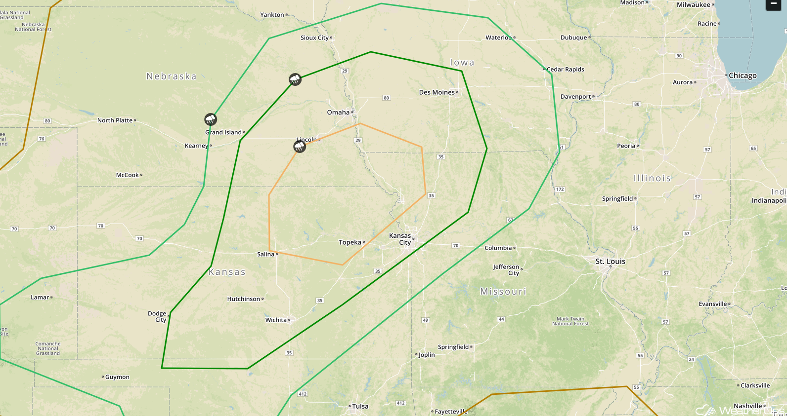 SPC Convective Outlook for Saturday
Thunderstorm Potential Saturday for the Ohio Valley
A weak upper level disturbance tracking through the Ohio Valley combined with a warm front lifting northward is likely to produce scattered thunderstorm activity during the afternoon and evening. Cloud cover should limit destabilization, but conditions may still allow for the development of strong to severe thunderstorms. Gusty winds and hail will be the primary hazards with the stronger storms.
Major Cities in Region: Charleston, WV, Cleveland, OH, Pittsburgh, PA
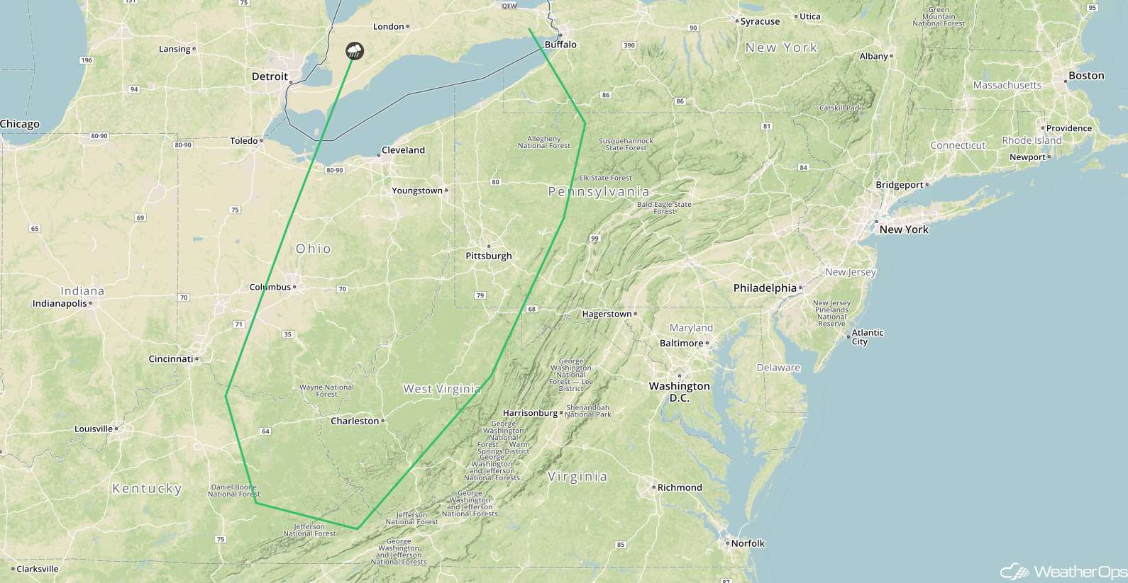 SPC Convective Outlook for Saturday
Excessive Rainfall for the Northern Plains on Saturday
As an area of low pressure lifts northeastward on Saturday, showers and thunderstorms are forecast to overspread much of eastern Nebraska and far western Iowa. Due to the prolonged nature of the event, there will be a risk for excessive rainfall. Rainfall amounts across the region are forecast to average 1-3 inches with locally higher amounts in excess of 4 inches.
Major Cities in Region: Lincoln, NE, Omaha, NE, Sioux City, IA
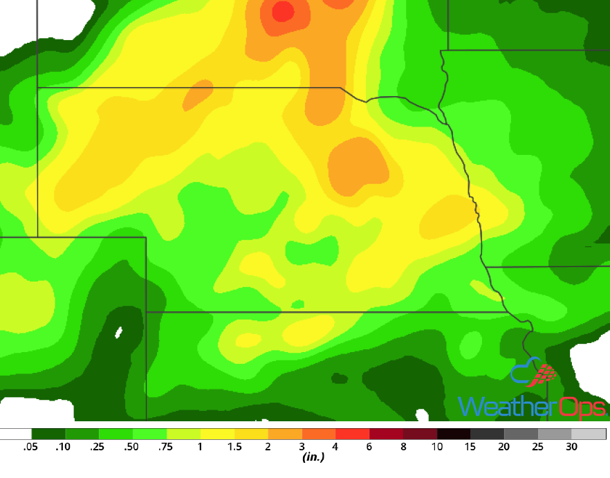 Rainfall Accumulation for Saturday
Potential for Thunderstorms Sunday across the Midwest
An upper level disturbance tracking from the mid-Mississippi Valley eastward into the Ohio Valley on Sunday is expected to produce scattered thunderstorms along and near a warm front lifting slowly northward. Thunderstorms should develop during the afternoon and evening. With the aid of outflow boundaries from earlier thunderstorms, there will be at least a marginal risk for strong to severe thunderstorms containing gusty winds and hail.
Major Cities in Region: Columbia, MO, St. Louis, MO, Indianapolis, IN, Cincinnati, OH, Columbus, OH
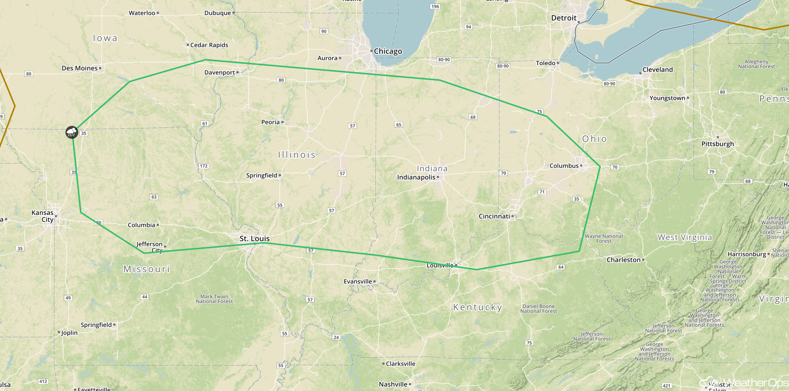 SPC Convective Outlook for Sunday
A Look Ahead
Showers and thunderstorms will continue from the Plains into the Ohio Valley Monday into Tuesday ahead of a cold front. Late Tuesday, thunderstorms may develop across portions of the Southern Plains as an area of low pressure begins to intensify. This activity will move into the Central Plains on Wednesday.
This is just a brief look at current weather hazards. We can provide you site-specific weather forecast information for the purpose of protecting your personnel and assets and to assess your weather risk. Try a 7-day demo right away and learn how timely precision weather information can enhance your bottom line.
