National Weather Summary for Friday, May 13, 2016
by David Moran, on May 13, 2016 11:36:52 AM
Strong to severe thunderstorms are possible on Friday for portions of the Carolinas southward to the Gulf Coast, as well as across portions of the Midwest through the Southern Plains. On Saturday, strong to severe thunderstorms will be possible for portions of the Mid Atlantic through the Northeast, as well as from portions of New Mexico through Louisiana. By Sunday, strong to severe thunderstorms will be possible for portions of New Mexico and Texas.
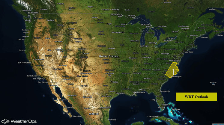
US Hazards
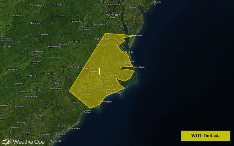
Region 1
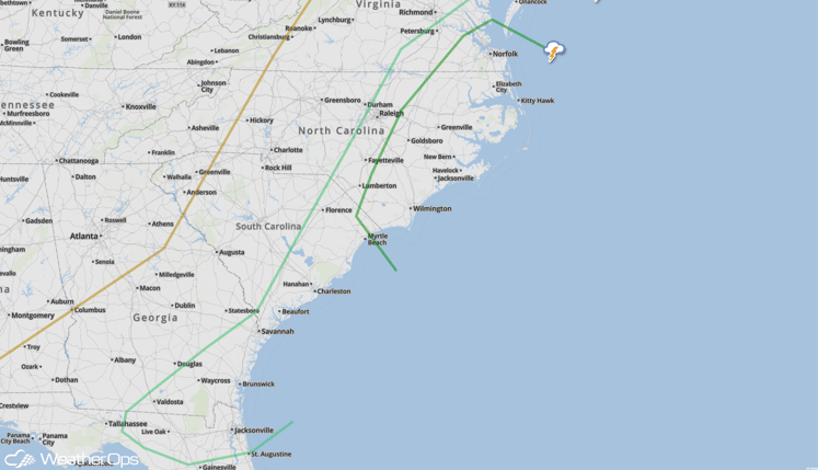
A cold front and an upper level trough will be moving into Region 1 on Friday and interact with warm, moist air, allowing for the potential for severe thunderstorms from the eastern Carolinas to southeastern Virginia. Some of these thunderstorms may have the potential to produce hail in excess of 1 inch in diameter and wind gusts in excess of 60 miles per hour. The tornado threat is low, however, an isolated tornado cannot be ruled out. Additional thunderstorms will be possible south and southwestward to the Gulf Coast later this morning and afternoon.
Region 1
SPC Convective Outlook
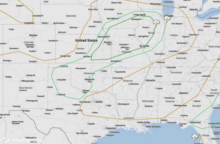
Severe Thunderstorms Possible Friday for portions of Midwest and Southern Plains
An area of low pressure and cold front will move across the Plains and into the Midwest on Friday, allowing for the development of thunderstorms, some of which could become severe. As thunderstorms develop, large hail and damaging winds will be the primary threats, however, an isolated tornado cannot be ruled out. In the Southern Plains, thunderstorms will develop late in the evening; large hail will be the primary threat with these storms.
SPC Convective Outlook
Strong to Severe Thunderstorms Possible from the Mid Atlantic through Northeast
A few strong to severe thunderstorms will be possible from portions of the Mid Atlantic through the Northeast on Saturday ahead of a cold front. Gusty and damaging winds will be possible across the region.
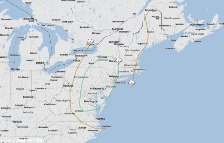
SPC Convective Outlook
Strong to Severe Thunderstorms Possible from New Mexico through Louisiana on Saturday
A cold front in the Southern Plains will slow down and stall out, allowing for the potential for thunderstorm development along and ahead of it. Large hail and strong winds will be the primary hazards with any thunderstorms that develop in this region.
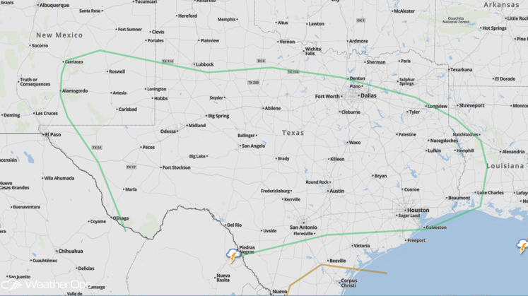
SPC Convective Outlook
Strong to Severe Thunderstorms Possible for Portions of New Mexico and Texas on Sunday
Thunderstorms will once again be possible on Sunday across portions of New Mexico and Texas along a stalled front. While early morning thunderstorms and cloud cover may inhibit widespread development of thunderstorms, the development of thunderstorms with the potential for large hail and damaging winds will be possible during the afternoon and evening.
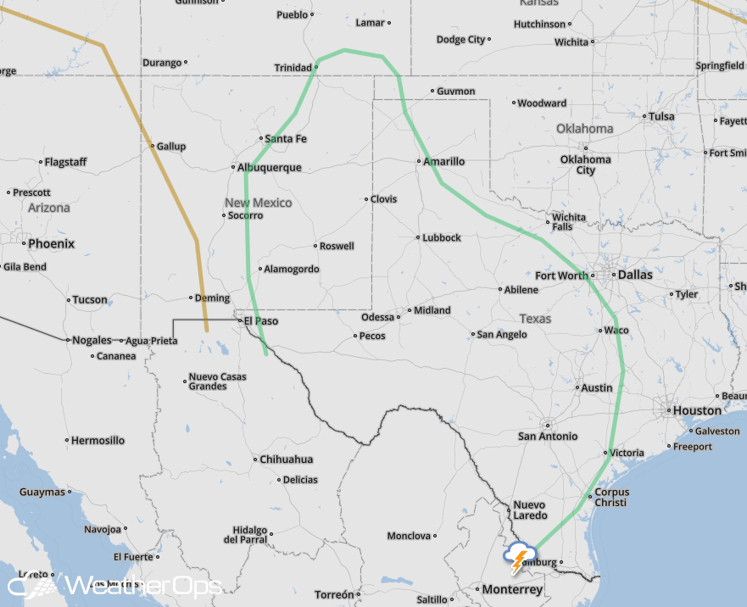
SPC Convective Outlook


