


by David Moran, on Mar 30, 2018 10:54:48 AM
Moderate to heavy snow is forecast for portions of the Northern Plains and Upper Midwest Friday into Saturday as an area of low pressure moves through the region. Elevated winds and seas, as well as thunderstorms, are expected for portions of the Gulf of Mexico through Friday afternoon.
- Snow for the Northern Plains and Upper Midwest Friday and Saturday
- Elevated Winds and Seas Friday for Portions of the Gulf of Mexico
- Potential for Snow across Portions of Wyoming and Nebraska Saturday into Sunday
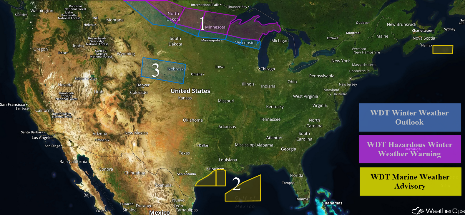 US Hazards

Snow for the Northern Plains and Upper Midwest Friday and Saturday
An area of low pressure is expected to develop over northern South Dakota on Friday and track eastward into southern Minnesota and Wisconsin Friday evening into Saturday morning. To the north of this system, there will be the potential for heavy snow. Snowfall accumulations of 6-8 inches with locally higher amounts in excess of 10 inches are expected.
Major Cities in Region: Minot, ND, Bismarck, ND, Fargo, ND, Duluth, MN, Green Bay, WI, Marquette, MI
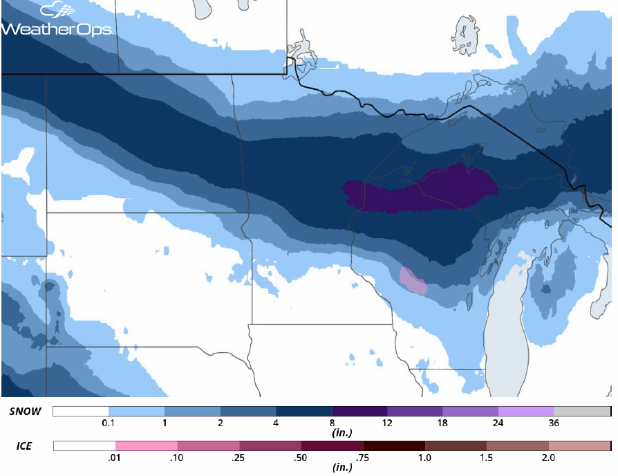 Snow Accumulation for Friday and Saturday
Elevated Winds and Seas Friday for Portions of the Gulf of Mexico
A second cold front moving off the Texas coast will reinforce the elevated winds and seas across the Gulf of Mexico through the afternoon. Winds will range 20-25 knots with gusts in excess of 35 knots. Seas will range 4-6 feet near the shore and 6-8 feet in the deeper waters. Further east across the central Gulf of Mexico, winds will be southerly to southwesterly at 10-15 knots. Behind the front, winds will become northerly at 20-30 knots with gusts in excess of 35 knots. Seas will range 6-8 feet. In addition, showers and thunderstorms are expected. Wind gusts in excess of 50 knots will be the primary hazard with these storms.
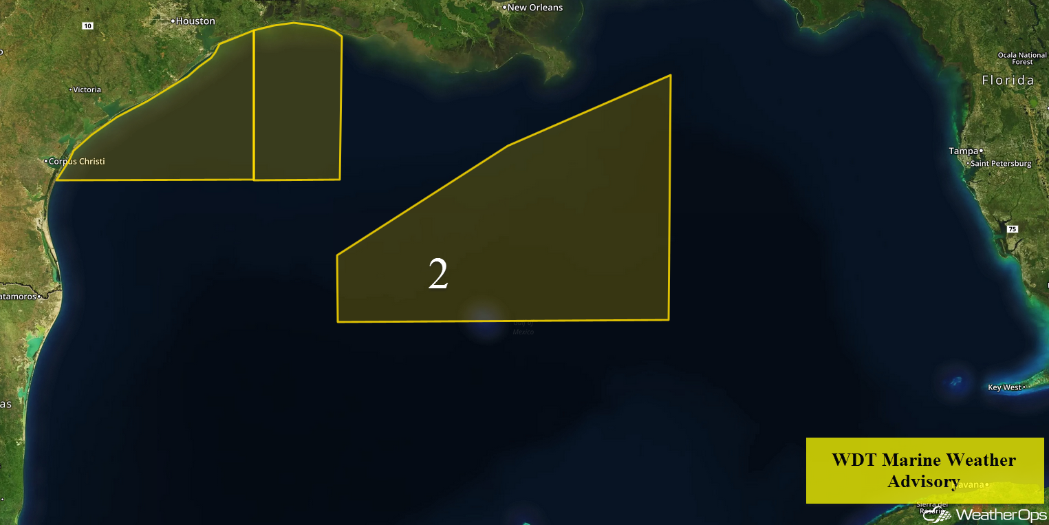 Region 2
Potential for Snow across Portions of Wyoming and Nebraska Saturday into Sunday
A weak area of low pressure is forecast to develop over the Central Plains Saturday and quickly move eastward. Because of the fast movement of the system, snow accumulations are expected to remain light. Snow accumulations of 2-4 inches with locally heavier amounts in excess of 5 inches are forecast through Sunday.
Major Cities in Region: Cheyenne, WY, North Platte, NE, Kearney, NE
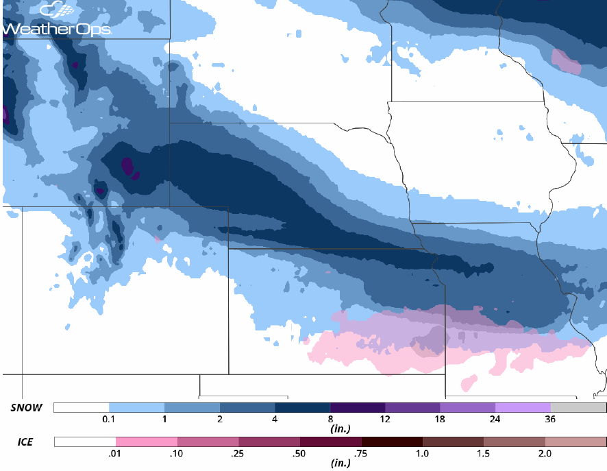 Snowfall Accumulations for Saturday and Sunday
A Look Ahead
Another area of low pressure may develop in the Northern Plains on Monday, bringing the potential for moderate to heavy snow Monday into Tuesday. This same system will bring the potential for snow to portions of the Northeast Tuesday into Wednesday.
This is just a brief look at current weather hazards. We can provide you site-specific weather forecast information for the purpose of protecting your personnel and assets and to assess your weather risk. Try a 7-day demo right away and learn how timely precision weather information can enhance your bottom line.
