


by Daphne Thompson, on Mar 23, 2018 10:43:33 AM
A winter storm is ongoing in the Northern Plains and is expected to move southeastward bringing several inches of snow and a glaze of ice to much of the Central Plains, Midwest, and Ohio Valley over the next several days. Strong to severe thunderstorms are possible across southern Nebraska and northern Kansas today in association with a low pushing across the region through this evening. In addition, an active weather pattern is setting up for early to midweek which will likely bring heavy rain and strong to severe storms across much of the Central and Southern Plains.
- Ongoing Winter Storm from Northern Plains to Ohio Valley
- Severe Weather Potential Across Northern Kansas and Southern Nebraska
 US Hazards
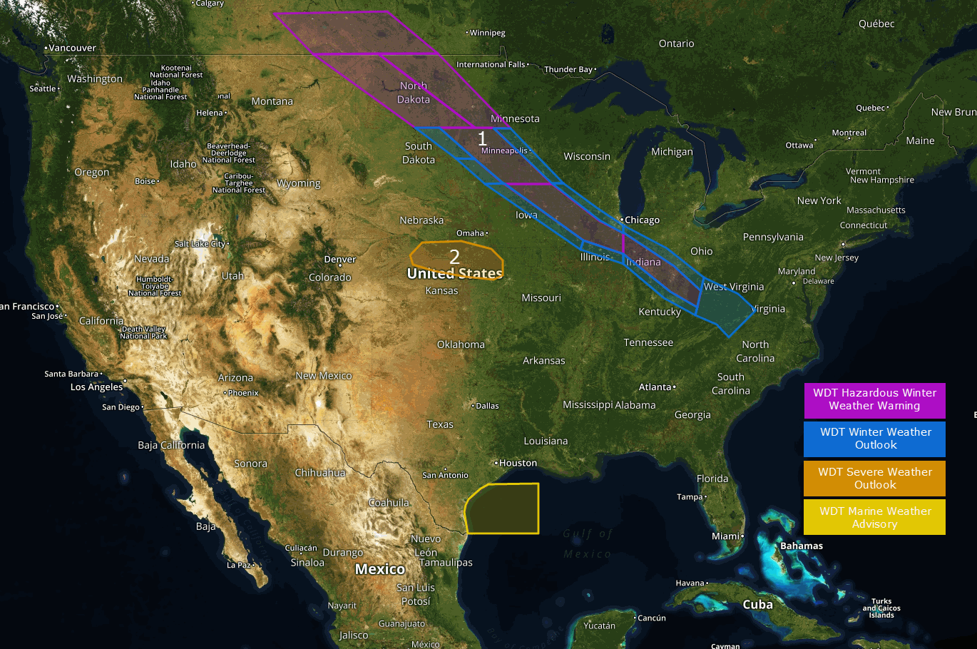
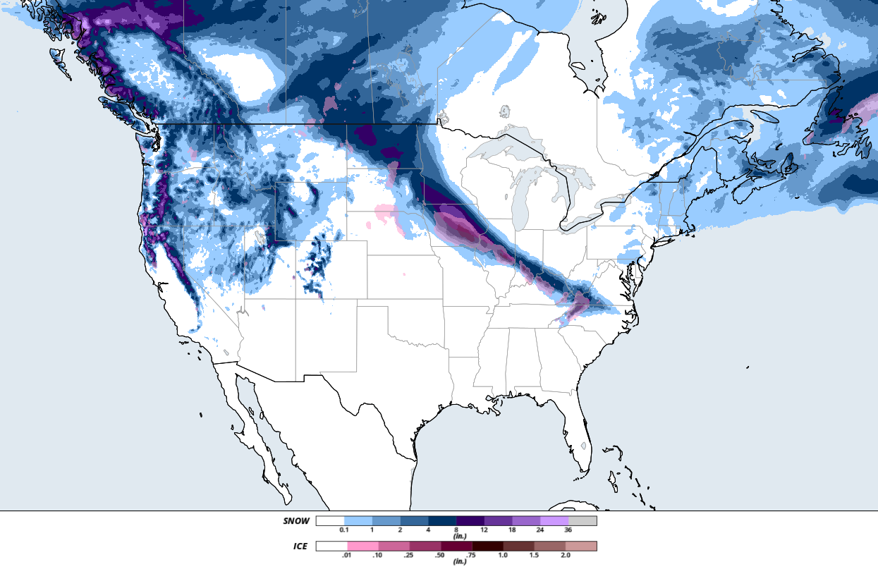
Ongoing Winter Storm from Northern Plains to Ohio Valley
Heavy snow is ongoing across the Northern Plains in association with a robust low currently located across the Central Plains. This low is forecast to push eastward, bringing heavy snow across the Northern Plains, portions of the Midwest, and the Ohio Valley over the next several days. Along with a light glaze of ice, many areas within the pink warning boxes north of the Ohio Valley could see 5-9 inches of snow, with locally higher amounts possible. Along the Ohio Valley region, slightly lesser amounts are expected, with up to 6 inches of snow possible. Along with significant snowfall, gusty winds and reduced visibility are possible, making travel in these areas dangerous.
Major Cities in Region: Bismark, ND, Minneapolis, MN, Indianapolis, IN, Cincinnati, OH
 Region 1
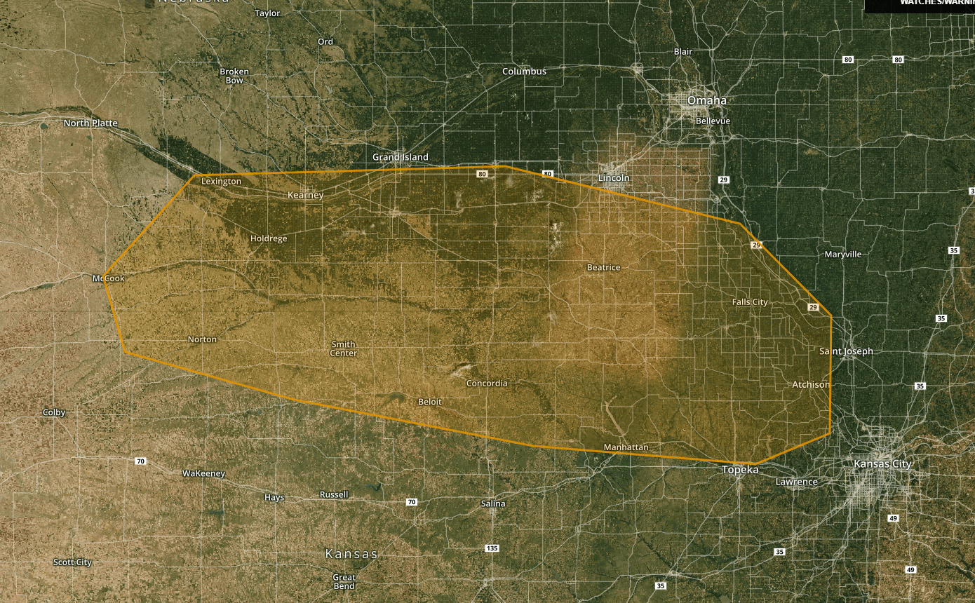
Severe Weather Potential Across Southern Nebraska and Northern Kansas
A low currently located in eastern Colorado is expected to push eastward today into the southern Nebraska and northern Kansas region by this afternoon. Daytime heating and sufficient moisture across the region will moderately destabilize the atmosphere by the afternoon hours, allowing thunderstorms to develop in association with the low. As the storms move eastward, moderate intensification is expected. The primary hazards associated with these thunderstorms are gusty winds and isolated instances of large hail. These storms are expected to continue on their eastward track into the overnight hours before weakening and moving out of the risk area.
Major Cities in Region: Kearney, NE, Beatrice, NE, Concordia, KS, Manhatten, KS
 Region 2
A Look Ahead
An active weather pattern is forecast to develop across the Central and Southern Plains bringing the potential for heavy rain and strong to severe thunderstorms by early next week and continuing through midweek.
This is just a brief look at current weather hazards. We can provide you site-specific weather forecast information for the purpose of protecting your personnel and assets and to assess your weather risk. Try a 7-day demo right away and learn how timely precision weather information can enhance your bottom line.
