National Weather Summary for Friday, March 10, 2017
by David Moran, on Mar 10, 2017 10:52:44 AM
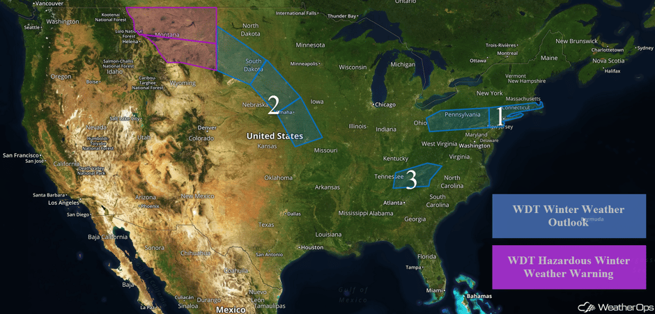
Snow will continue across portions of the Northeast through Friday as an area of low pressure moves to the south of the region. A stalled front will be the focus for snow across portions of the Plains through Saturday. An upper level trough will bring some light snow to the higher elevations of eastern Tennessee and western North Carolina late Saturday through early Sunday.
 US Hazards
Region 1
An area of low pressure moving to the south of Region 1 will continue to bring snow to the region through the day on Friday. Snow accumulations of 2-4 inches with isolated higher amounts in excess of 5 inches are expected.
Storm total of 2.25" of snow in Staten Island #NYwx. @EdValleeWx @nynjpaweather @NWSNewYorkNY @NEweatherHQ @NEWeatherWx pic.twitter.com/rXAeBm4ISk
— Kal Tellefsen⚡️ (@kal_tellefsen) March 10, 2017
Major Cities in Region: Pittsburgh, PA, New York, NY, Bridgeport, CT, Providence, RI
 Region 1
Region 2
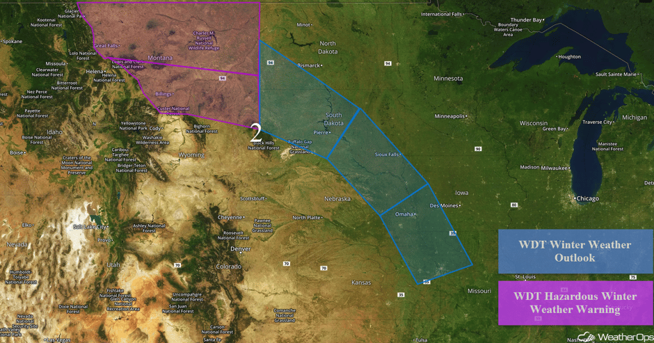
Snow will continue across portions of Montana through Friday afternoon. Accumulations of 4-6 inches with locally higher amounts in excess of 8 inches are expected. Further east across the Northern Plains and the Midwest, snow is expected along a stalled front through Saturday afternoon. Accumulations of 2-4 inches with locally higher amounts in excess of 5 inches are forecast from eastern South Dakota into northeastern Nebraska. Across eastern portions of Nebraska and Kansas, eastern Iowa, and northwestern Missouri, 3-5 inches of snow with locally higher amounts in excess of 6 inches are expected.
Major Cities in Region: Great Falls, MT, Billings, MT, Pierre, SD, Sioux Falls, SD, Omaha, NE, Kansas City, MO
 Region 2
Region 3
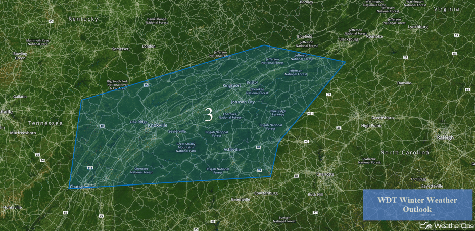
An upper level disturbance is forecast to move across the region in the wake of a cold front. Light to moderate snowfall is expected beginning late Saturday and continuing through early Sunday. The heaviest snowfall totals will likely be across the higher elevations of the Blue Ridge Mountains where locally higher amounts in excess of 4 inches are possible. Elsewhere, snowfall amounts of 1-3 inches are expected.
Major Cities in Region: Chattanooga, TN, Knoxville, TN, Johnson City, TN, Asheville, TN
 Region 3
A Look Ahead
Snow may develop across the Great Lakes, Ohio Valley, and Mid Atlantic on Monday as an upper level trough moves across the region. While there is still some uncertainty in snow amounts, several inches of snow appear likely. By Tuesday, snow will move into the Northeast and continue through early Wednesday.
This is just a brief look at current weather hazards. We can provide you site-specific weather forecast information for the purpose of protecting your personnel and assets and to assess your weather risk. Try a 7-day demo right away and learn how timely precision weather information can enhance your bottom line.


