


by David Moran, on Jun 29, 2018 11:51:16 AM
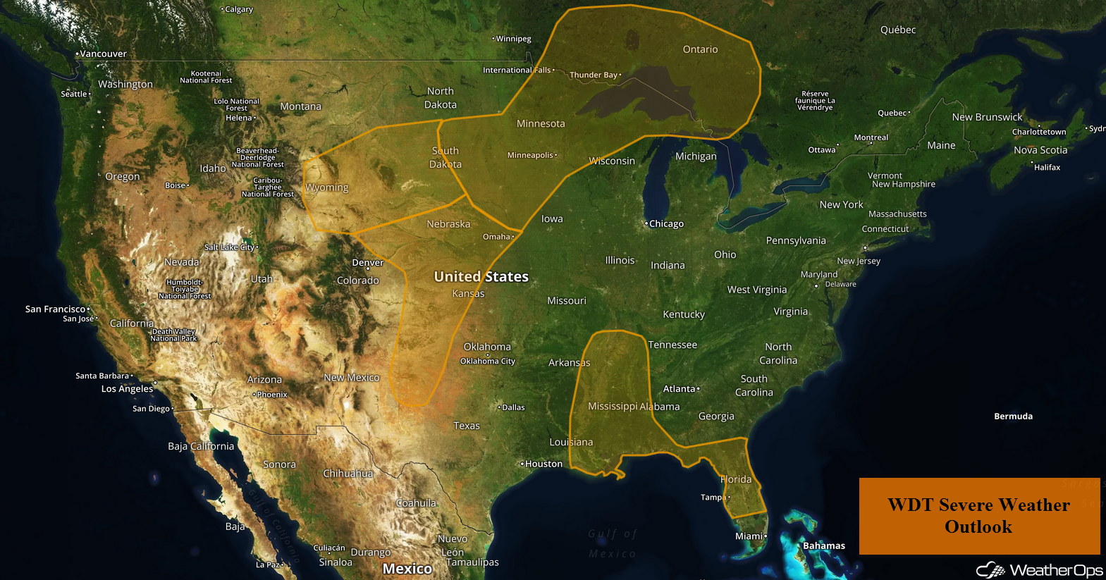
Thunderstorms are expected to develop across the Northern Plains and Upper Mississippi Valley on Friday ahead of a cold front. Further south, there will be a risk for severe thunderstorms across the Central High Plains as an area of low pressure develops in the lee of the Rockies. Warm, moist air across the Southeast will allow for a potential for thunderstorms during the afternoon hours.
- Thunderstorms Friday for the Northern Plains and the Upper Mississippi Valley
- Potential for Thunderstorms across the Central High Plains on Friday
- Risk for Thunderstorms Friday across the Southeast
- Thunderstorm Potential from the Plains into the Western Great Lakes on Saturday
- Excessive Rainfall Saturday for the Upper Mississippi Valley and Central Plains
- Thunderstorms for New England Saturday
- Risk for Thunderstorms Sunday for the Central Mississippi Valley and Great Lakes
 US Hazards

Thunderstorms Friday for the Northern Plains and the Upper Mississippi Valley
Thunderstorms are continuing to move across portions of northern Minnesota this morning. Additional storms are expected during the afternoon ahead of a cold front. As these storms develop, large hail and damaging winds will be the primary hazards, but a few tornadoes cannot be ruled out.
Major Cities in Region: Minot, ND, Bismarck, ND, Fargo, ND, Sioux Falls, SD, International Falls, MN, Duluth, MN
 Thunderstorm Risk for Friday
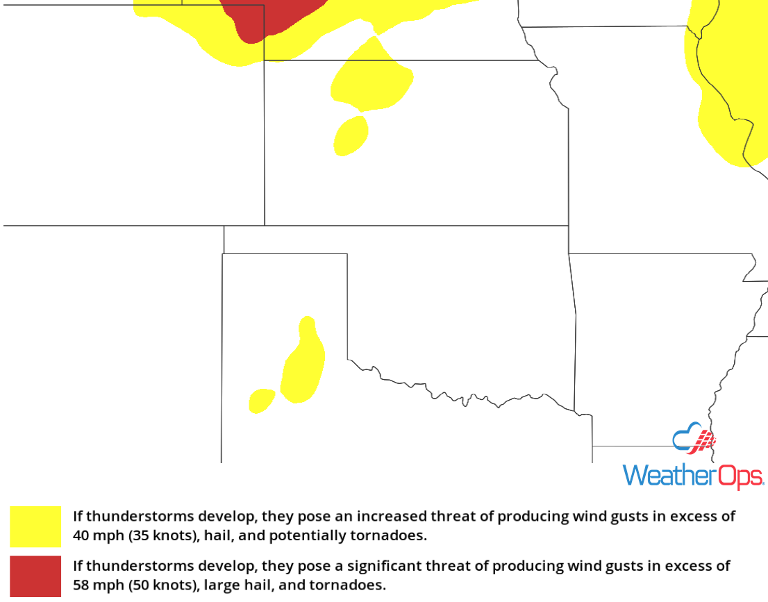
Potential for Thunderstorms across the Central High Plains on Friday
Southwesterly flow aloft should allow an area of low pressure to develop in the lee of the Rockies. As a result, isolated strong to severe thunderstorms are expected during the afternoon hours. Damaging winds and hail will be the primary hazards with these storms.
Major Cities in Region: Scottsbluff, NE, Amarillo, TX
 Thunderstorm Risk for Friday
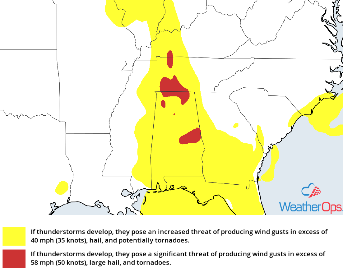
Risk for Thunderstorms Friday across the Southeast
Thunderstorms will likely develop this afternoon across the Southeast as instability builds due to daytime heating. Damaging winds will be the primary hazard, but there will also be a potential for some hail. Activity may continue into the overnight hours as activity begin to form clusters.
Major Cities in Region: Mobile, AL, Birmingham, AL, Huntsville, AL, Montgomery, AL
 Thunderstorm Risk for Friday
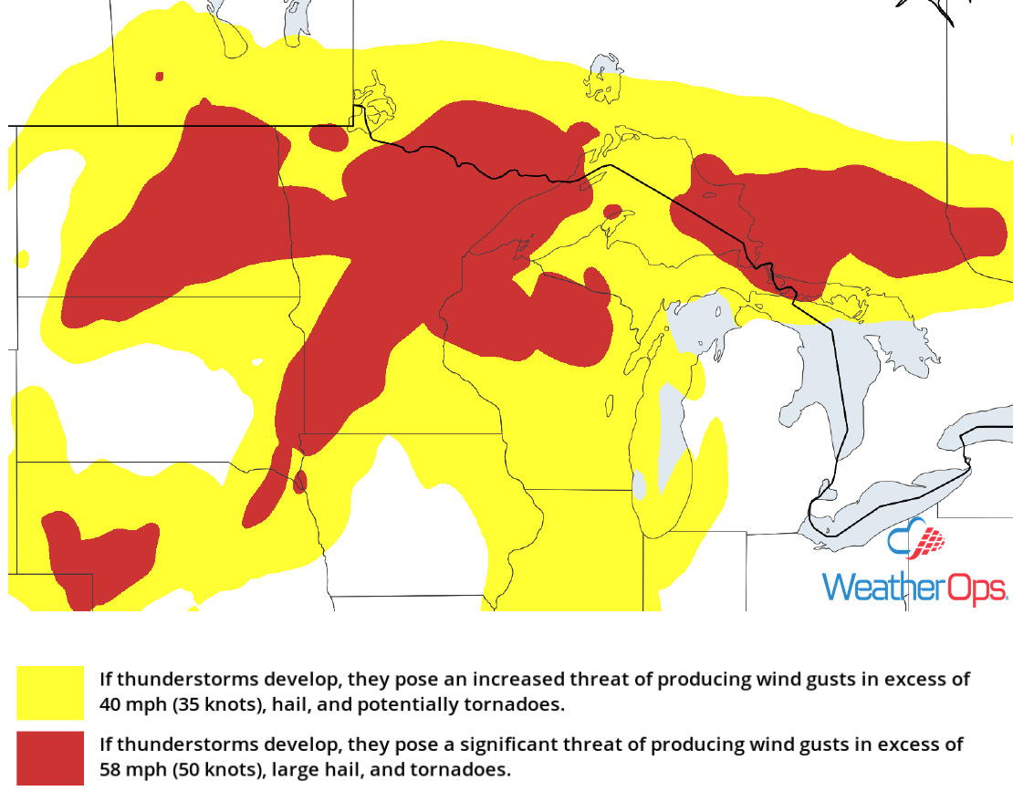
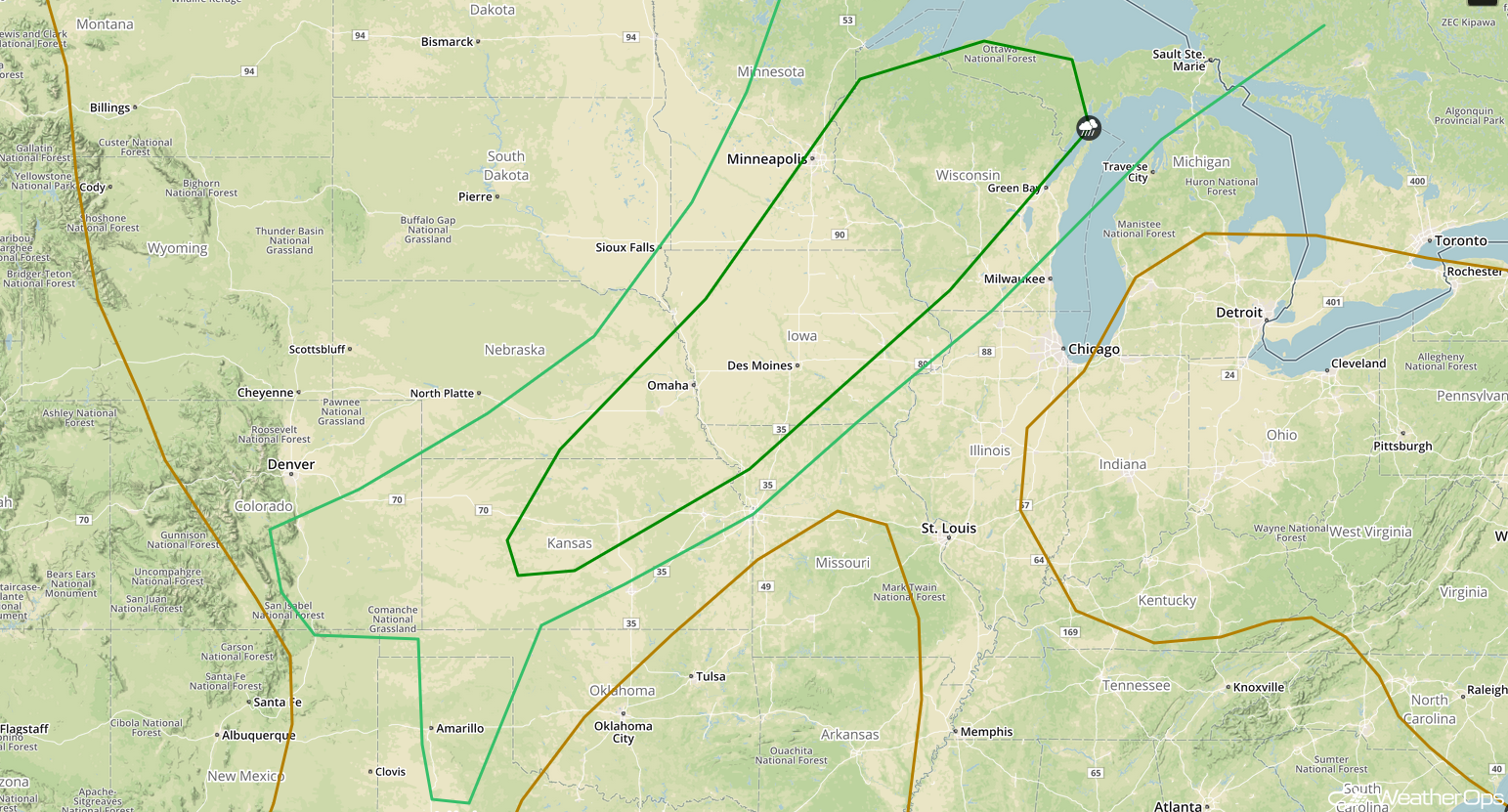
Thunderstorm Potential from the Plains into the Western Great Lakes on Saturday
A warm, moist air mass will be in place ahead of a cold front extending from Minnesota southwestward into Colorado. Lift provided by disturbances moving across the region should be sufficient to initiate the development of thunderstorms during the afternoon. Large hail, damaging winds, and tornadoes will all be potential hazards with these storms. Further to the southwest, isolated strong to severe thunderstorms are expected to develop along a dryline from southwestern Kansas into the Texas Panhandle. Damaging winds will be the primary hazard with these storms.
Major Cities in Region: Amarillo, TX, Dodge City, KS, Lincoln, NE, Omaha, NE, Des Moines, IA, Minneapolis, MN, Wausau, WI
 SPC Convective Outlook for Saturday
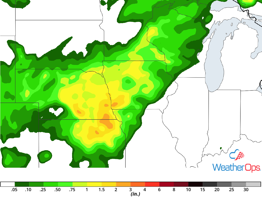
Excessive Rainfall Saturday for the Upper Mississippi Valley and Central Plains
In addition to the thunderstorm potential described above, there will be a potential for heavy to excessive rainfall. Rainfall accumulations of 1-2 inches with locally higher amounts in excess of 3 inches are expected.
Major Cities in Region: Topeka, KS, Lincoln, NE, Omaha, NE, Des Moines, IA, Minneapolis, MN, Wausau, WI
 Rainfall Accumulation for Saturday
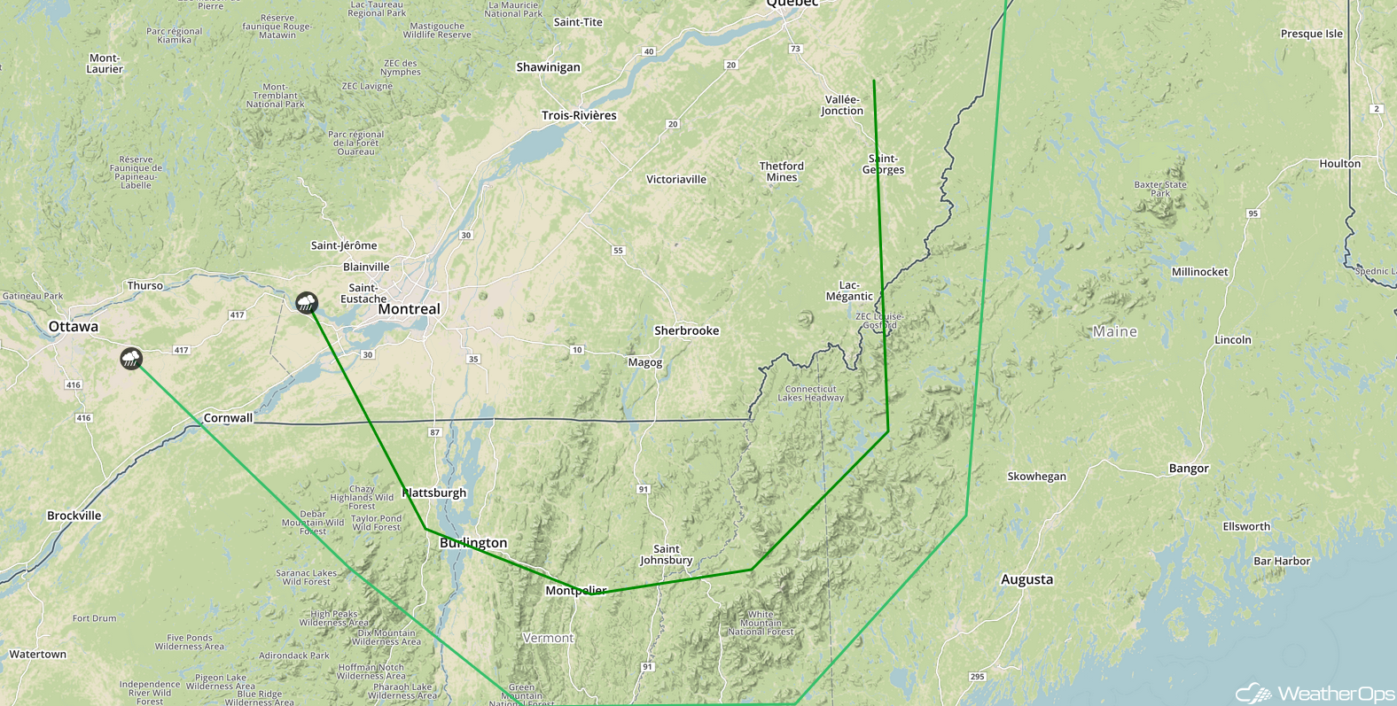
Thunderstorms for New England Saturday
Plentiful moisture and daytime heating will allow instability to build across portions of New England on Saturday as a disturbance moves into the region. This should create an environment favorable for the development of thunderstorms. Damaging winds and large hail will be the primary hazards with these storms.
Major Cities in Region: Burlington, VT
 SPC Convective Outlook for Saturday
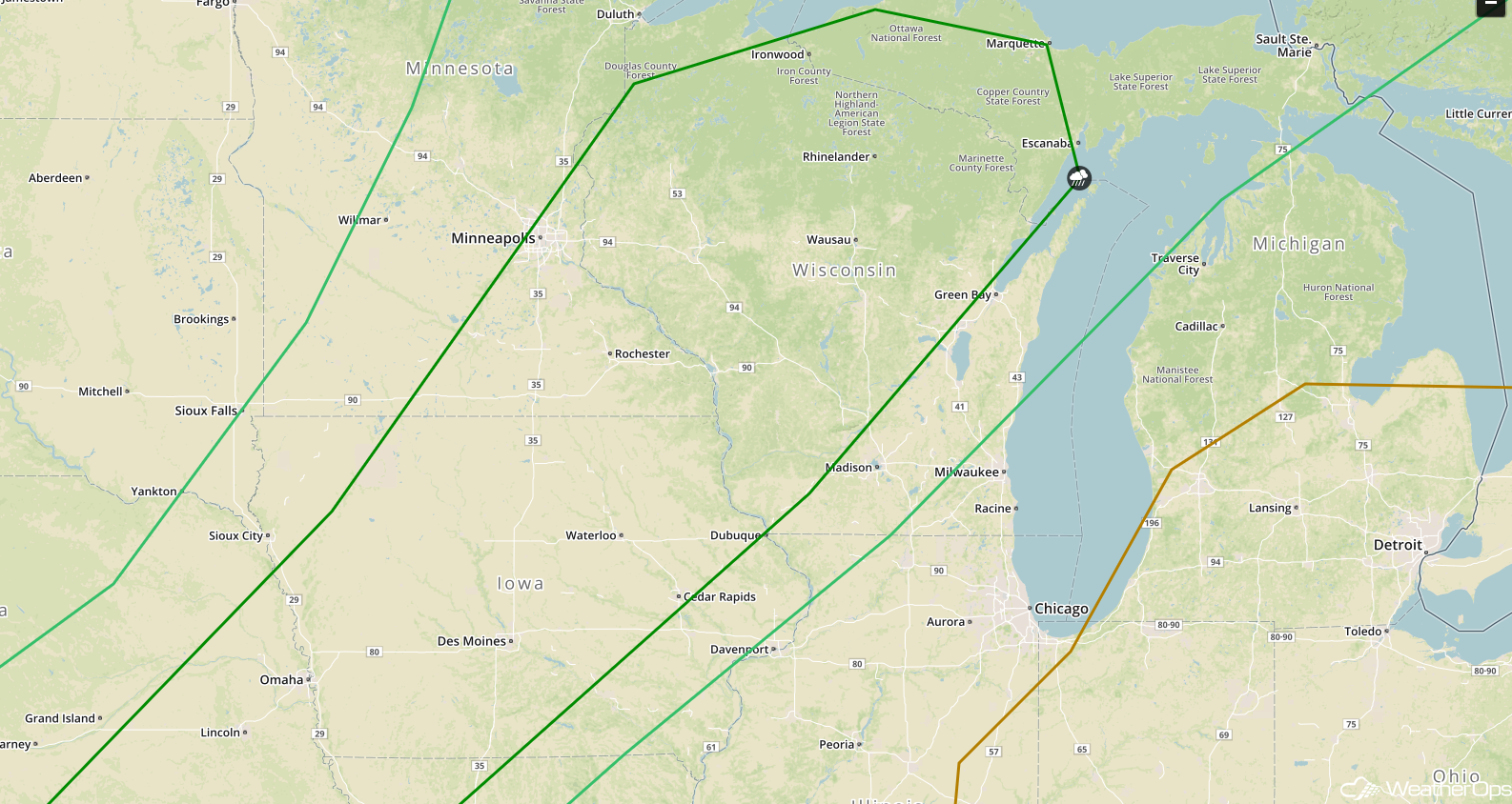
Risk for Thunderstorms Sunday for the Central Mississippi Valley and Great Lakes
An upper level system will be moving out of the Plains on Sunday. At the surface, a cold front will extend southwestward from the Great Lakes. Lift provided by the upper level system is expected to aid in the development of thunderstorms from the Great Lakes into the Central Mississippi Valley. Damaging winds and large hail will be the primary hazards with these storms.
Major Cities in Region: Cedar Rapids, IA, Wausau, WI, Green Bay, WI
 SPC Convective Outlook for Sunday
A Look Ahead
Thunderstorms will develop from the Great Lakes into the Southern Plains on Monday ahead of a cold front. On Tuesday, an area of low pressure will move across the Northern Plains, bringing a potential for showers and thunderstorms to the region. Another round of showers and thunderstorms may develop on Wednesday across the Northern Plains into the Upper Midwest. By Thursday, showers may develop across portions of the Great Lakes.
This is just a brief look at current weather hazards. We can provide you site-specific weather forecast information for the purpose of protecting your personnel and assets and to assess your weather risk. Try a 7-day demo right away and learn how timely precision weather information can enhance your bottom line.
