National Weather Summary for Friday, June 24, 2016
by David Moran, on Jun 24, 2016 11:24:47 AM
Isolated to scattered thunderstorms will be possible on Friday for portions of the Northern and Central Plains as an area of low pressure develops in Montana and moves into the Plains. A stalled front will be the focus for the development of thunderstorms from the Carolinas to the Ozarks. On Saturday, thunderstorms are possible across the Great Lakes as a cold front moves through the region. Further south, isolated thunderstorms are possible across the Central and Southern Plains ahead of a cold front. As the cold front continues to move eastward on Sunday, thunderstorms will be possible for the Great Lakes and Ohio Valley, as well as across the Midwest and Southern Plains.
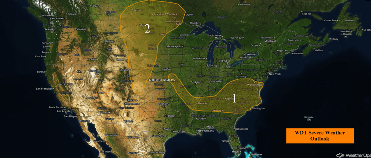
US Hazards
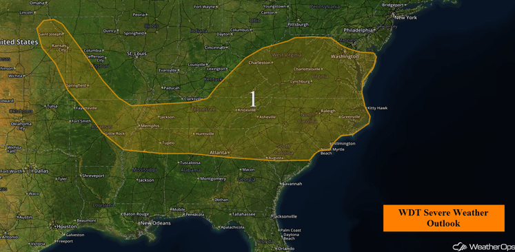
Region 1
A front draped across Region 1 will be the main focus for severe thunderstorms today. Given the plentiful moisture across the region as well as increasing instability as the afternoon progresses, thunderstorms are expected to increase in coverage and intensity becoming strong to possibly severe, especially just to the south of the front. The primary threat with any thunderstorms that develop will be strong wind gusts and large hail.
Region 1
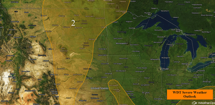
Region 2
An area of low pressure will move across the Plains today bringing the threat for showers and thunderstorms across Region 2. As the associated front moves across the region, a highly unstable atmosphere combined with ample moisture will result in the development of thunderstorms across the Central High Plains and High Plains regions. These thunderstorms will move eastward increasing in intensity and coverage as the thunderstorm progresses. The main threat with any thunderstorms that develop will be large hail and strong wind gusts, however, an isolated tornado or two cannot be ruled out.
Region 2
Strong to Severe Thunderstorms Possible for the Great Lakes on Saturday
Scattered thunderstorms are forecast through the Great Lakes region on Saturday. Southerly flow ahead of a cold front progressing eastward will increase moisture at the surface, allowing instability to build. An upper level low over central Canada, as well as an upper level trough will support the development of thunderstorms. As thunderstorms develop initially, large hail, damaging winds, and isolated tornadoes will be possible. By late afternoon and evening, thunderstorms will begin to cluster or become linear, leading to a higher threat for damaging winds.
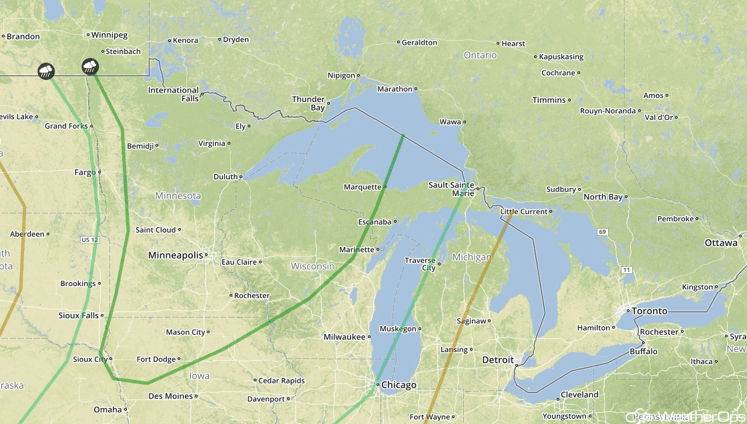
SPC Convective Outlook for Saturday
Strong to Severe Thunderstorms Possible on Saturday for Central and Southern Plains
As the cold front described in the previous section continues to move through the Plains, moderate instability is expected to build over the Central Plains with weaker instability across the Southern Plains. With an upper level trough moving across the region, isolated thunderstorm development will be possible. Strong wind gusts and hail will be the primary hazards with these storms.
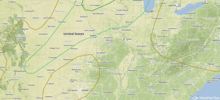
SPC Convective Outlook for Saturday
Strong to Severe Thunderstorms Possible Sunday for the Great Lakes and Ohio Valley
An upper level low across central Canada is forecast to continue to progress to the east on Sunday, as well as the cold front associated with the low. Ahead of the front, moderate instability is expected to form into the afternoon leading to scattered thunderstorm development. Thunderstorms are expected to become linear in nature, with damaging winds as the primary hazard.
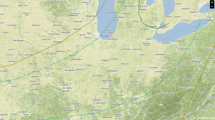
SPC Convective Outlook for Sunday
Strong to Severe Thunderstorms Possible for Midwest and Southern Plains on Sunday
The front mentioned above will linger across the Midwest and Southern Plains on Sunday. Moderate instability is forecast to build into the afternoon, however the support to the north of the upper level low will not be present. Additionally, warm air aloft will limit overall coverage of thunderstorms, with only isolated thunderstorms forecast. With the storms that do develop, hail and damaging winds will be the primary hazards.
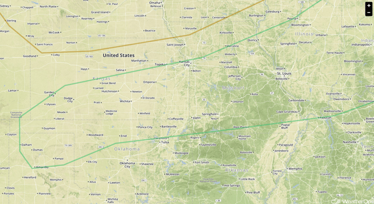
SPC Convective Outlook for Sunday


