National Weather Summary for Friday, June 23, 2017
by David Moran, on Jun 23, 2017 10:53:40 AM
Thunderstorms and excessive rainfall will continue Friday from the Ohio Valley into the Southern Plains ahead of a cold front. Daytime heating may allow for the development of thunderstorms across the Northeast on Friday.
- Thunderstorms from the Northeast into the Lower Mississippi Valley Friday
- Risk for Thunderstorms Friday across the Southern Plains
- Elevated Conditions continue for the Western Gulf of Mexico through early Friday Afternoon
- Thunderstorm Potential Saturday across the Southeast
- Strong to Severe Thunderstorms Possible for the High Plains on Sunday
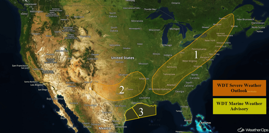 US Hazards
Thunderstorms from the Northeast into the Lower Mississippi Valley Friday
There will be a risk for isolated severe thunderstorms from the Northeast into the Lower Mississippi Valley on Friday. Gusty winds in excess of 30-40 mph will be the primary hazards with storms that develop across the Northeast. Showers and thunderstorms are ongoing ahead of a cold front extending from central Michigan southwestward into Missouri. Low level moisture associated with the remnants of Tropical Storm Cindy is moving northeastward ahead of the front. Heavy rain will be the primary threat from the Gulf Coast into southwest Pennsylvania. Any locations within this region that have breaks in the clouds will see a greater potential for severe thunderstorms this afternoon and evening.
Perhaps of greater concern will be the threat for widespread flooding across the Ohio Valley into the Southern states. The aforementioned cold front will interact with plentiful moisture accompanying the remnants of Tropical Storm Cindy. Widespread thunderstorms will produce extreme rainfall rates, possibly exceeding 1 to 2 inches per hour. It is within these storms where flash flooding will be of concern. Model guidance indicates there will be a large swath of 2 to 4 inches of rainfall west of the Appalachian Mountains, with locally higher amounts of 8 inches possible within areas that experience heavy and training thunderstorms.
Update 11:06am CDT: Tornado Warning northeast of Tupelo, MS.
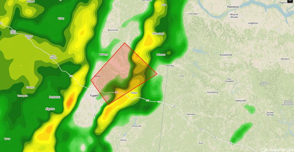 Radar 11:06am CDT
Update 12:01pm CDT: Severe thunderstorms capable of damaging winds SW of Florence, AL.
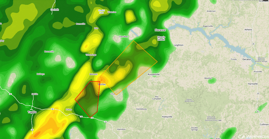 Radar 12:01pm CDT
Update 12:27pm CDT: Tornado Watch in effect until 8pm CDT for portions of Alabama, Georgia, Mississippi, and Tennessee.
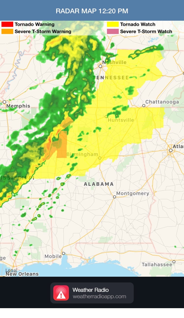 Tornado Watch
Update 2:01pm EDT: Severe thunderstorm capable of damaging winds north of Boston, MA.
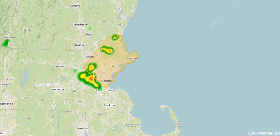 Radar 2:01pm EDT
Update 1:26pm CDT: Tornado Warning south of Florence, AL.
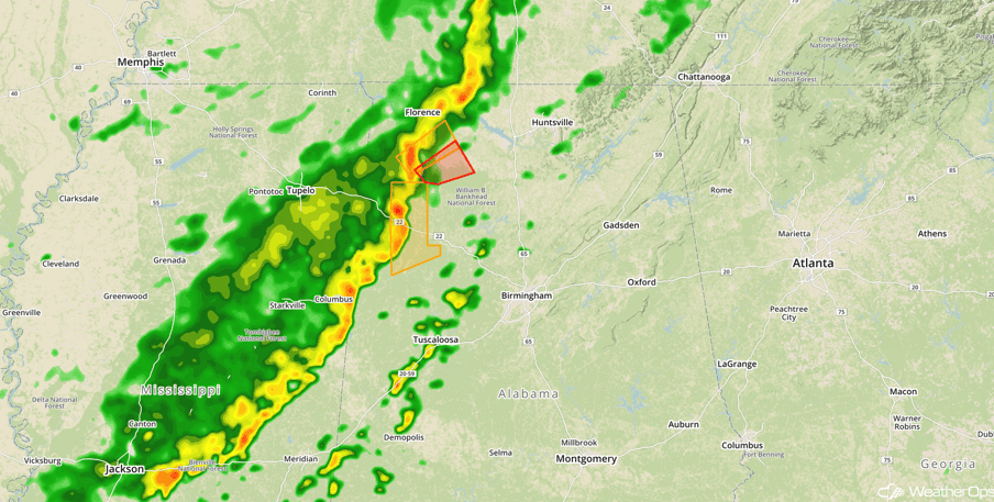 Radar 1:26pm CDT
Update 2:34pm EDT: Severe Thunderstorm Watch for portions of Kentucky, Maryland, Ohio, Pennsylvania, and West Virginia until 10pm EDT.
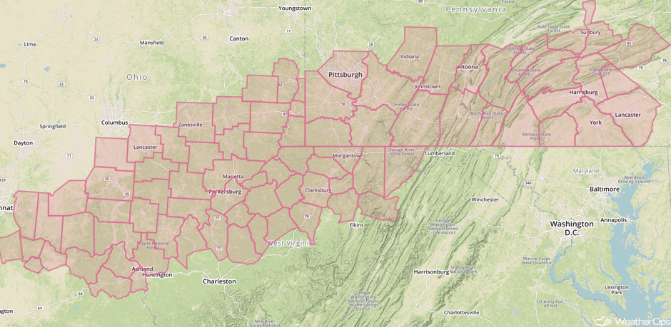 Severe Thunderstorm Watch
Update 2:53pm EDT: Tornado Warning south of Pittsburgh, PA.
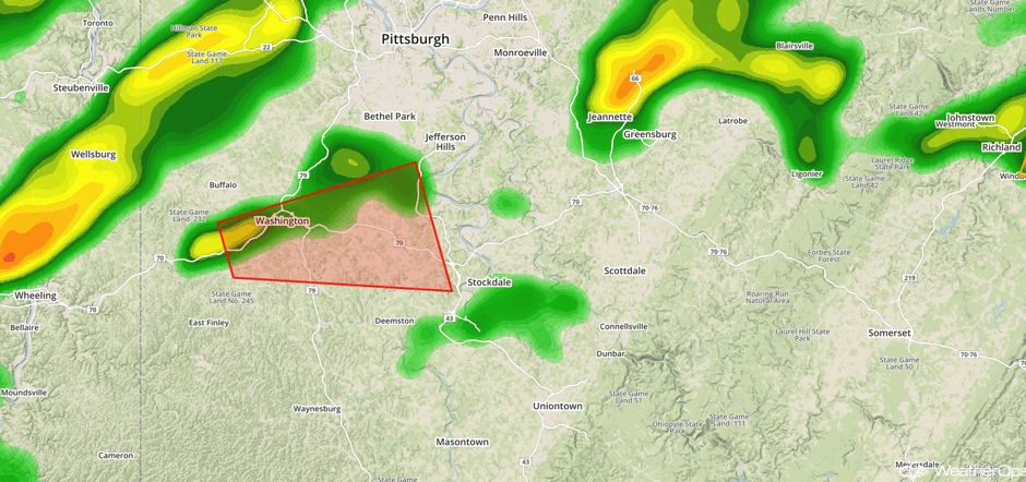 Radar 2:53pm EDT
Major Cities in Region: Jackson, MS, Memphis, TN, Nashville, TN, Birmingham, AL, Atlanta, GA, Pittsburgh, PA, Washington, DC, New York, NY
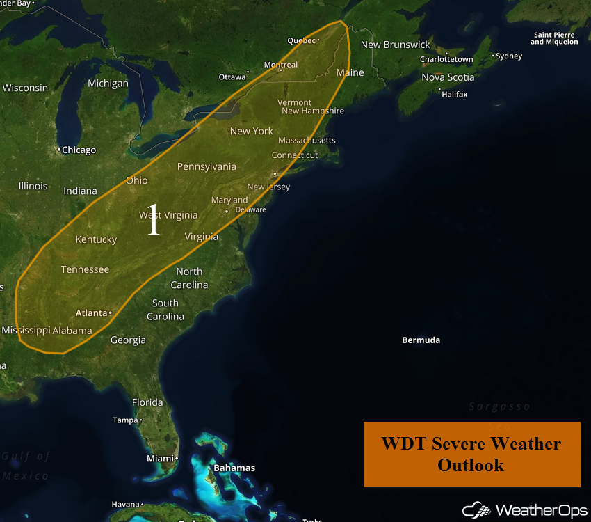 Region 1
Risk for Thunderstorms Friday across the Southern Plains
Moderate instability across central and northeast Texas ahead of a southward-moving cold front will allow for the development of thunderstorms this afternoon and evening. Damaging winds in excess of 50 mph will be the primary hazard, with a lesser threat of large hail. Storms are forecast to develop near the cold front across portions of Oklahoma, western Arkansas, and far northern Texas by mid to late afternoon. Storms are likely to be isolated before merging into a more organized line. Once storms become linear, the primary hazard will be damaging winds. Storms may continue into the overnight hours ahead of the front.
Update 11:02am CDT: Severe thunderstorm capable of damaging winds in north central Louisiana.
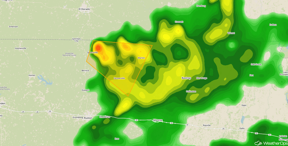 Radar 11:02am CDT
Major Cities in Region: Odessa,TX, Dallas, TX, Tulsa, OK, Shreveport, LA, Little Rock, AR
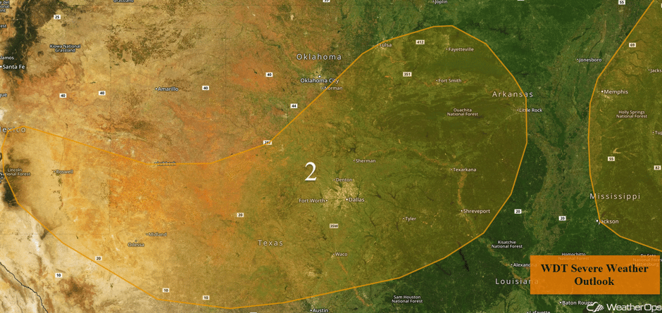 Region 2
Elevated Conditions continue for the Western Gulf of Mexico through early Friday Afternoon
Elevated winds and seas will continue across Region 3 through early Friday afternoon. Winds will become southerly at 20-25 knots with seas building to 6-8 feet.
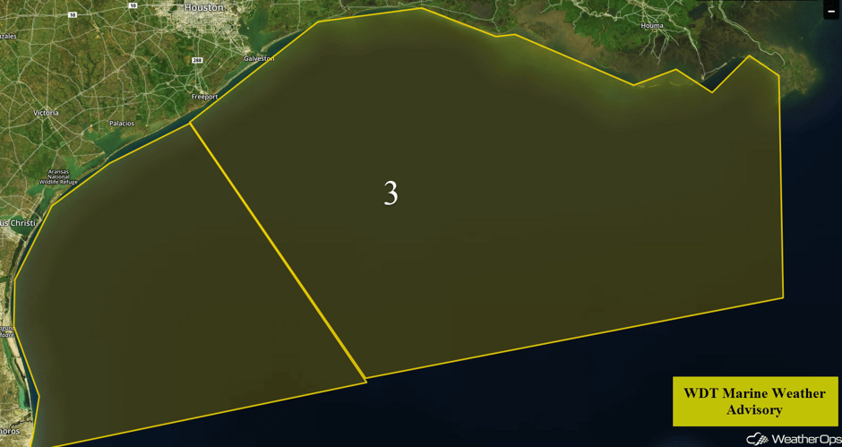 Region 3
Thunderstorm Potential Saturday across the Southeast
A cold front will continue to push into the Southeast on Saturday and will bring along with it the threat for strong thunderstorms to the region. Showers should be ongoing for much of the day due to ample moisture across the region. During the afternoon, instability will build, allowing for the development of thunderstorms. Some storms may be strong with damaging winds as the primary hazard into the early evening.
Major Cities in Region: Shreveport, LA, New Orleans, LA, Tallahassee, FL, Columbia, SC
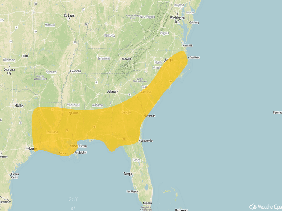 Thunderstorm Risk Outline for Saturday
Strong to Severe Thunderstorms Possible for the High Plains on Sunday
As high pressure builds into the eastern US, winds will be out of the east across the High Plains on Sunday. This will allow for the development of thunderstorms as upslope flow increases. Isolated to scattered thunderstorms may develop over the Colorado High Plains during the late afternoon and shift southeastward into the evening hours. Large hail and damaging winds will be the primary hazards with these storms.
Major Cities in Region: Albuquerque, NM, Santa FE, NM, Roswell, NM
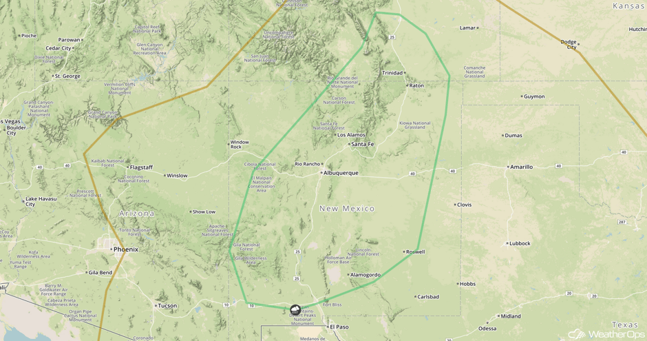 SPC Convective Outlook for Sunday
A Look Ahead
There will be a risk for thunderstorms across the Northern Plains on Tuesday as a warm front moves into the region. Thunderstorms may develop during the afternoon and move eastward during the evening.
This is just a brief look at current weather hazards. We can provide you site-specific weather forecast information for the purpose of protecting your personnel and assets and to assess your weather risk. Try a 7-day demo right away and learn how timely precision weather information can enhance your bottom line.


