


by David Moran, on Jun 10, 2016 11:05:16 AM
No WeatherOps hazards are currently in effect. Strong to severe thunderstorms will be possible on Friday across the Great Lakes and the Upper Midwest, as well as along the Montana/Canadian border. Going into Saturday, severe thunderstorms are expected for the Northern High Plains. There will be the potential for strong to severe thunderstorms across the Great Lakes. On Sunday, a risk for strong to severe thunderstorms will be present across portions of Minnesota, as well as the Colorado Front Range.
US Hazards
Strong to Severe Thunderstorms Possible for Portions of the Upper Midwest and Great Lakes on Friday
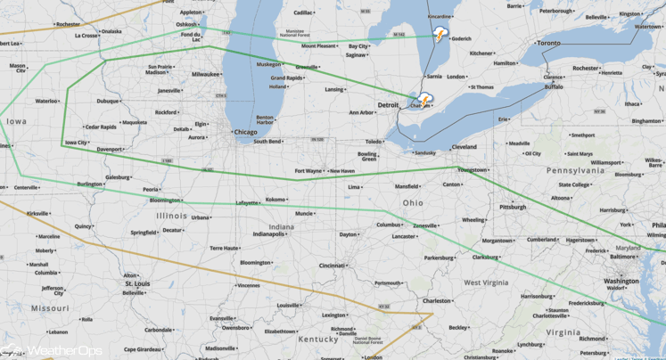
An area of low pressure moving across the Upper Midwest will promote the development of showers and thunderstorms across portions of Minnesota and Wisconsin this afternoon. As storms develop, damaging winds and large hail will be the main hazards, but there will also be a low tornado risk. Activity is expected to push southeastward through the evening with lingering severe impacts continuing after dark from the Minnesota/Iowa border into Central Wisconsin and Upper Michigan.
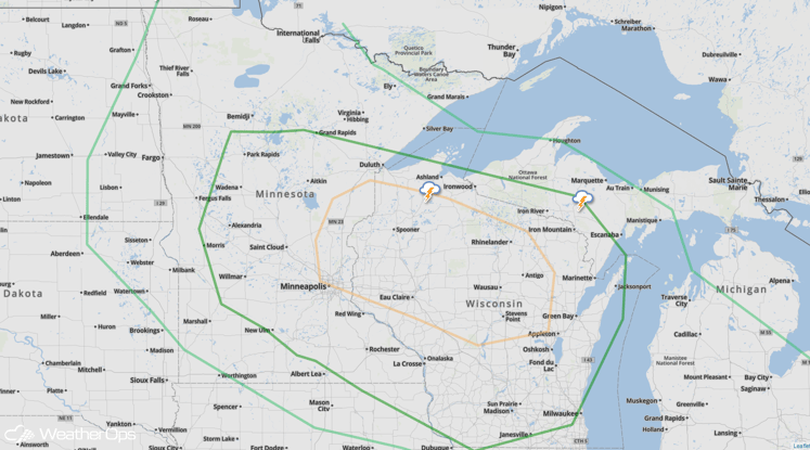
SPC Convective Outlook for Friday
Strong to Severe Thunderstorms Possible Near the Montana/Canada Border on Friday
A trough over the Pacific Northwest will begin to move eastward across the Northern Rockies this afternoon with isolated to scattered thunderstorms developing. Some thunderstorms may become severe and accelerate to the northeast with large hail, damaging winds, and isolated tornadoes possible. Storm activity is expected to linger after dark.
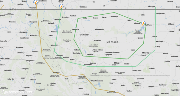
SPC Convective Outlook for Friday
Severe Thunderstorms Likely Across Northern High Plains on Saturday
High pressure across the Central US will change little on Saturday as a large trough lifts through the Northern Rockies. A very volatile atmosphere is expected to come together during the afternoon hours with severe thunderstorm development likely. Storms will pose a risk for large hail, damaging winds, and tornadoes.
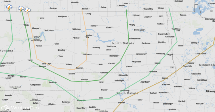
SPC Convective Outlook for Saturday
Strong to Severe Thunderstorms Possible for Portions of the Midwest on Saturday
A stationary front will stretch from west to east across the Midwest from Iowa into northern Indiana. Isolated to scattered thunderstorms will be possible along the front during the afternoon and evening hours. Storms will pose a primary risk for large hail and damaging winds, but an isolated tornado or two cannot be ruled out.
SPC Convective Outlook for Saturday
Strong to Severe Thunderstorms Possible for the Colorado Front Range on Sunday
A closed low pressure system over the Desert Southwest will remain trapped to the west as a significant ridge of high pressure over the Central CONUS. Conditions appear marginally favorable for scattered showers and thunderstorms, some severe, to develop across much of eastern Colorado with an attendant risk for hail and damaging winds.
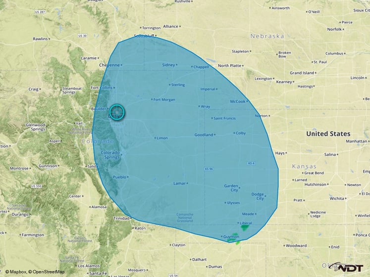
Thunderstorm Risk Outline for Sunday
Strong to Severe Thunderstorms Possible for Minnesota on Sunday
A front draped over the Midwest region will lift northward on Sunday into Central Minnesota. While the front remains in a region of very high surface moisture and surface instability, severe thunderstorms will continue to be possible with a risk for large hail and damaging winds, primarily during the afternoon and evening hours.
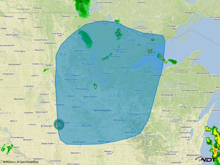
Thunderstorm Risk Outline for Sunday
