


by David Moran, on Jul 6, 2018 11:12:32 AM
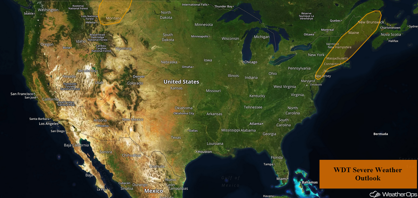
Thunderstorms will continue for portions of New England on Friday ahead of a cold front. A cold front across Montana will be the focus for thunderstorm development during the afternoon.
- Continued Thunderstorms for New England on Friday
- Thunderstorms Friday across Montana
- Potential for Thunderstorms for North Dakota and Minnesota on Saturday
- Risk for Thunderstorms Sunday from the Eastern Dakotas into the Upper Great Lakes
- Tropical Update
 US Hazards

Continued Thunderstorms for New England on Friday
Showers and thunderstorms will continue across New England through midday ahead of a cold front. Damaging winds and an isolated tornado will be the primary hazards with these storms. The threat will end as the cold front moves offshore this afternoon.
Major Cities in Region: Albany, NY, Boston, MA, Portland, ME, Bangor, ME
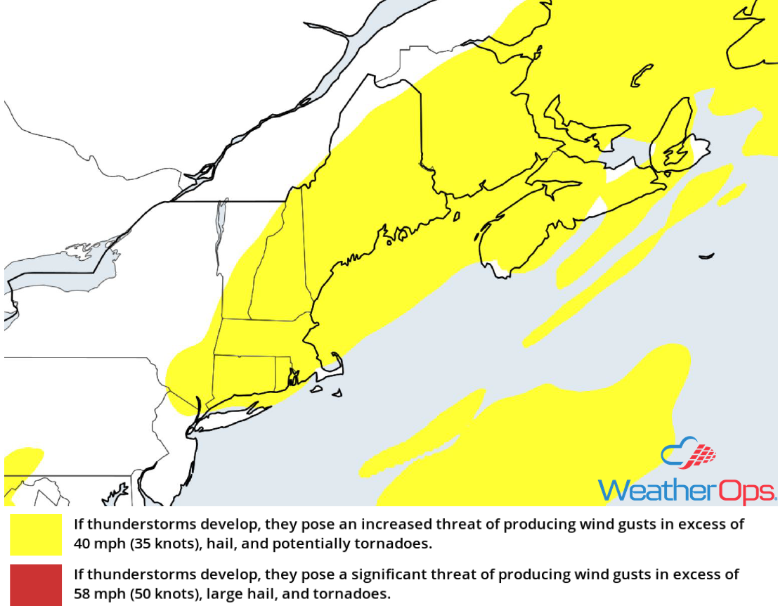 Thunderstorm Risk for Friday
Thunderstorms Friday across Montana
As moisture moves northward across the region, instability will build through the afternoon, allowing for the development of scattered thunderstorms as a cold front moves eastward. Damaging winds and large hail will be the primary hazards with these storms.
Major Cities in Region: Great Falls, MT, Glasgow, MT
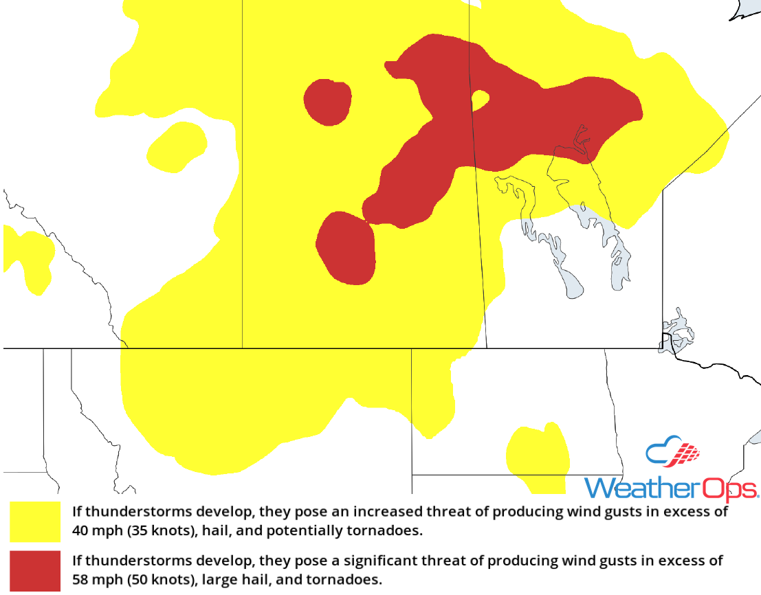 Thunderstorm Risk for Friday
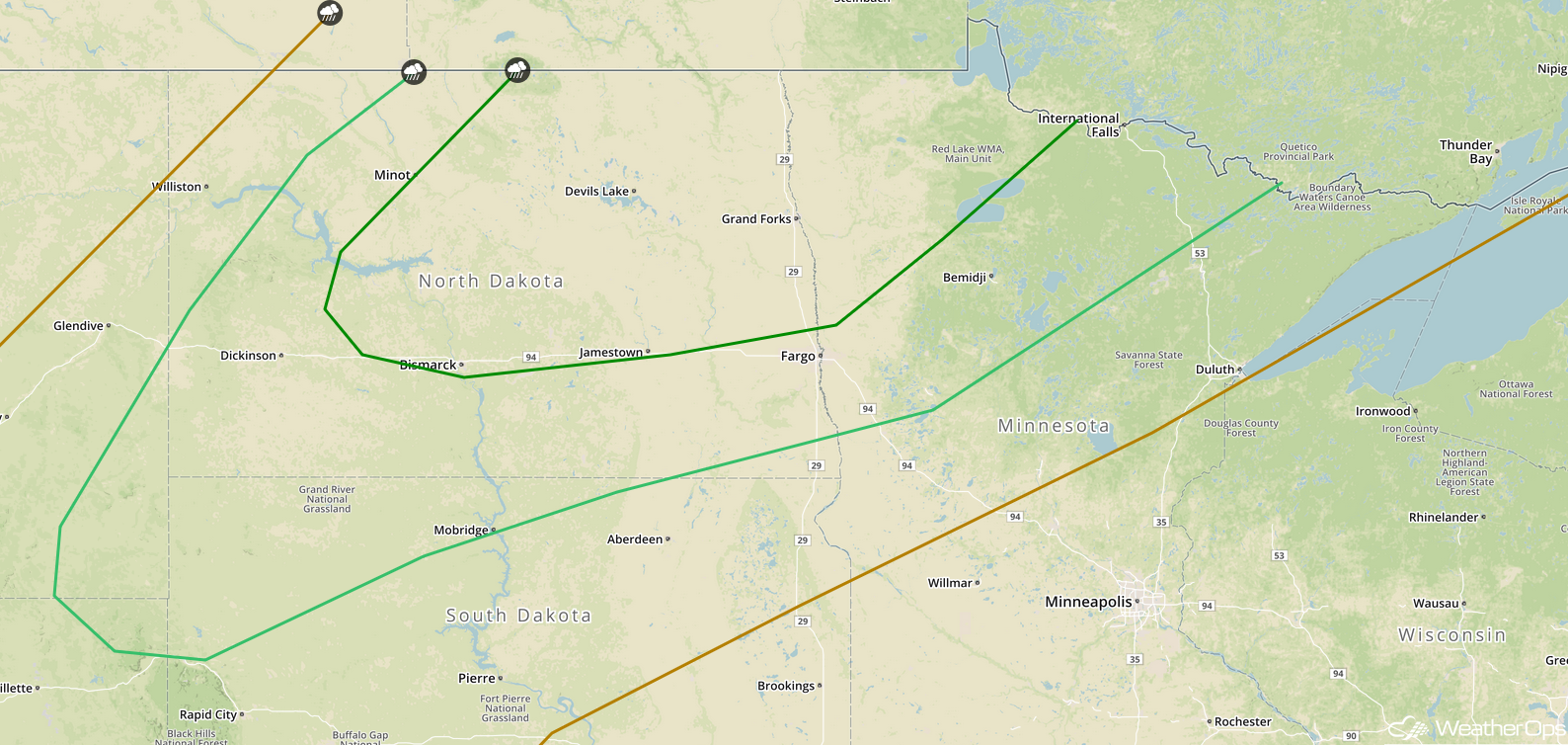
Potential for Thunderstorms for North Dakota and Minnesota on Saturday
Thunderstorms may develop across portions of North Dakota and Minnesota Saturday afternoon and evening as instability increases. With strong instability and wind shear in place, thunderstorms will likely develop. Damaging winds and hail will be the primary hazards with these storms, but isolated tornadoes cannot be ruled out.
Major Cities in Region: Minot, ND, Bismarck, ND, Grand Forks, ND, Fargo, ND
 SPC Convective Outlook for Saturday
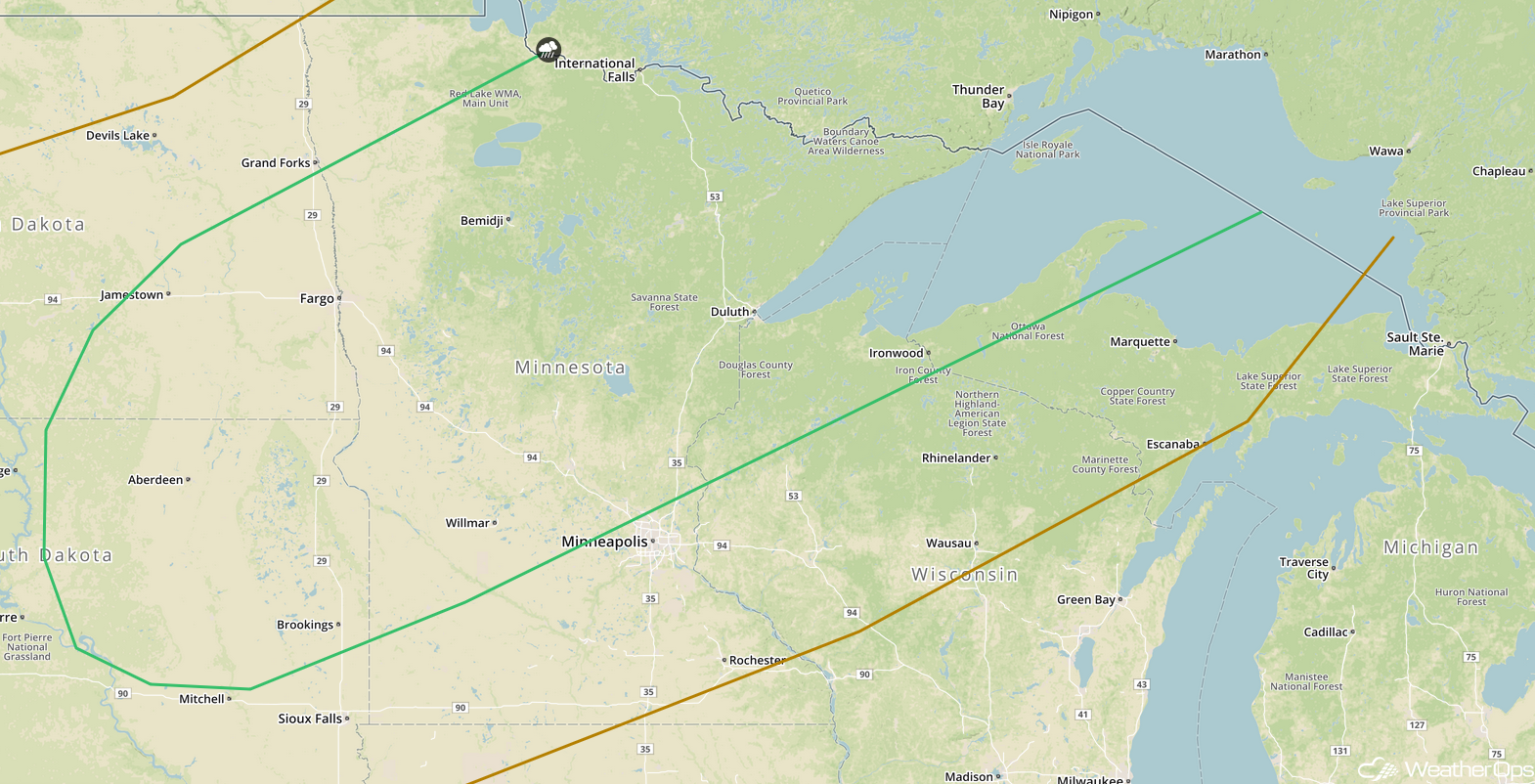
Risk for Thunderstorms Sunday from the Eastern Dakotas into the Upper Great Lakes
Thunderstorms may develop from the Eastern Dakotas into the Upper Great Lakes on Sunday. There is some uncertainty due to thunderstorms expected to move through the region Saturday night and Sunday morning. If this activity moves out of the area early enough, strong to severe thunderstorms may develop along a cold front Sunday afternoon and evening. Damaging winds and hail will be the primary hazards with any storms that do develop.
Major Cities in Region: Aberdeen, SD, Fargo, ND, International Falls, MN, Duluth, MN
 SPC Convective Outlook for Sunday
Tropical Update
Hurricane Beryl (green oval) is currently 1140 miles east-southeast of the Lesser Antilles and moving westward at 14 mph. Sustained winds are at 75 mph. Some strengthening is expected over the next 24-36 hours. Beryl is expected to increase in forwarding speed through the weekend and weaken to a tropical storm early Sunday.
Showers and thunderstorms are increasing in association with an area of low pressure a few hundred miles southeast of the North Carolina coast (red oval). Environmental conditions are expected to be conducive for additional development, and a tropical depression is likely to develop over the next couple of days while the system moves northwestward. It will likely stall near the coast of North Carolina over the weekend.
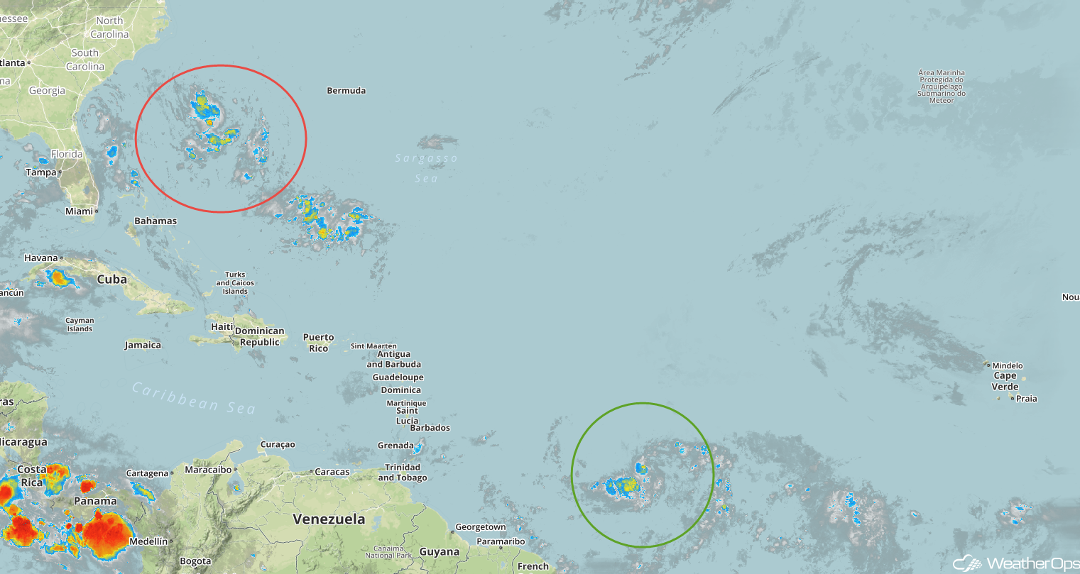 Enhanced Infrared Satellite
A Look Ahead
The area of low pressure off the coast of North Carolina will move closer to the coast on Monday and move northward along the East Coast through the week. Current model guidance indicates that the heaviest rain may remain offshore. Light showers may develop across the Ohio Valley and Southeast on Monday and Tuesday as a result of daytime heating. On Wednesday, thunderstorms will extend from the Northeast into the Appalachians ahead of a cold front. Thunderstorms may develop across the Northern Plains and Upper Midwest as a cold front moves through the region on Thursday.
This is just a brief look at current weather hazards. We can provide you site-specific weather forecast information for the purpose of protecting your personnel and assets and to assess your weather risk. Try a 7-day demo right away and learn how timely precision weather information can enhance your bottom line.
