National Weather Summary for Friday, July 29, 2016
by David Moran, on Jul 29, 2016 12:28:45 PM
An area of low pressure lifting along the East Coast will help produce showers and thunderstorms from the Mid Atlantic to the Northeast on Friday. A stationary front will be the focus for the development of thunderstorms and heavy rain from the Great Plains to the Ohio Valley. Thunderstorms will be possible across southern Arizona as instability builds throughout the day. Heavy rain will be possible across the Great Lakes ahead of an upper level disturbance. Thunderstorms will be possible across the Mid Atlantic again on Saturday ahead of an area of low pressure. Across the Central Plains, thunderstorms will be possible as a warm front lifts northward. Heavy rainfall will be possible from the Mid Atlantic to the Northeast, Central Plains to the Mid Mississippi Valley, and across southern Arizona. Heading into Sunday, thunderstorms will be possible across the Northern Plains as a cold front moves out of the Rockies. Heavy rain will continue across portions of the Northeast and Southern Arizona.
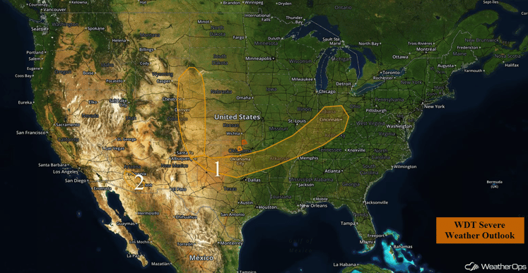
US Hazards
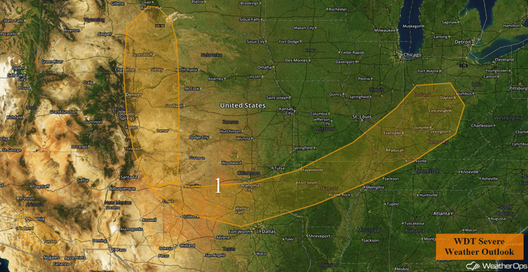
Region 1
Weak upslope flow will lead to the development of scattered thunderstorms across northeastern New Mexico, eastern Colorado, and southeastern Wyoming. Given the moderate wind shear and instability in place across Region 1, some thunderstorms may become severe. Large hail is expected to be the primary hazard. A few storms could also produce locally strong wind gusts. The severe weather threat should diminish during the evening hours. In addition, heavy rain will be possible from eastern Colorado into the Mid-Mississippi Valley. General rainfall amounts of 0.50-1.50 inches with locally higher amounts in excess of 2 inches, in addition to some flooding, will be possible.
Major Cities in Region: Cheyenne, WY, Denver, CO, Oklahoma City, OK, Cincinnati, OH
Region 1
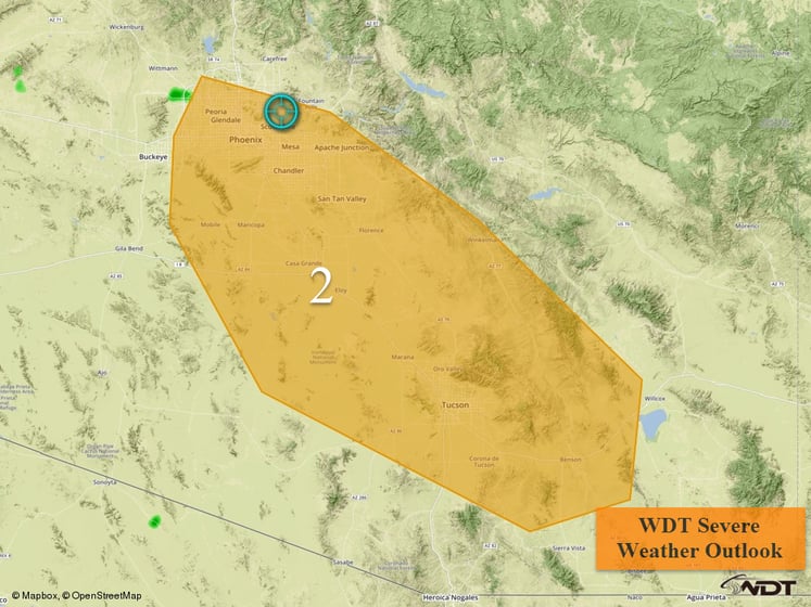
Region 2
Thunderstorms are expected to develop this afternoon across Region 2. A few of these thunderstorms could produce strong wind gusts in excess of 50 mph. The most likely time for severe weather will be during the afternoon and evening hours.
Major Cities in Region: Phoenix, AZ, Tucson, AZ
Region 2
Strong to Severe Thunderstorms Possible From Mid Atlantic to Northeast
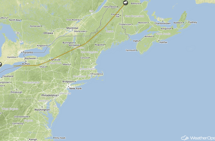
An area of low pressure lifting northeastward along the Mid Atlantic coast and across Cape Cod will produce scattered to widespread showers and thunderstorms across the region. Rain will be possible through the evening as the low moves out. Marginal instability and increasing wind shear will allow for some strong to possibly severe thunderstorms, especially from the late morning through the afternoon, with gusty winds the main threat.
Major Cities in Region: Washington, DC, New York, NY, Boston, MA
SPC Convective Outlook for Friday
Excessive Rainfall Possible Friday Across the Great Lakes
Showers and thunderstorm activity associated with an upper level disturbance is forecast to spread southward across the southern Great Lakes region today. General rainfall amounts in this region may range from 0.50-1.50 inches with locally higher amounts in excess of 2 inches possible.
Major Cities in Region: Chicago, IL, Cleveland, OH, Milwaukee, WI
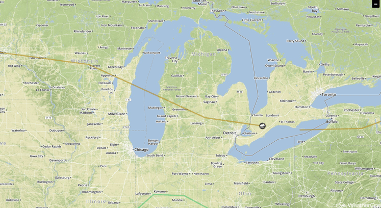
SPC Convective Outlook for Friday
Strong to Severe Thunderstorms Possible Saturday Across the Mid Atlantic
Afternoon and early evening thunderstorms are expected to develop across interior portions of the Mid Atlantic ahead of an area of low pressure. Decent moisture, favorable wind shear, and modest instability in place may allow for the development of a few strong or marginally severe storms, with gusty winds the main threat. In addition, heavy rainfall will be possible for portions of the Mid Atlantic into the Northeast. Rainfall amounts of 1-2 inches with locally higher amounts in excess of 3 inches will be possible for many locations.
Major Cities in Region: Richmond, VA
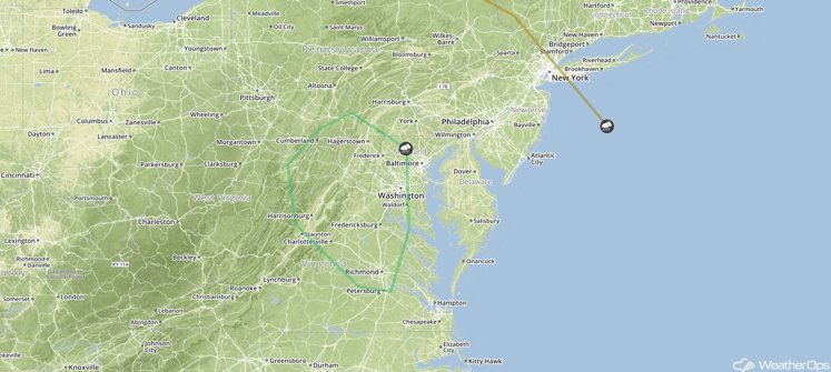
SPC Convective Outlook for Saturday
Strong to Severe Thunderstorms Possible Saturday for Portions of the Central Plains
Northwesterly flow aloft may produce isolated thunderstorms across portions of the Central Plains on Saturday. Thunderstorm activity should be focused along an eastward advancing warm front, initially developing in the afternoon hours before spreading into the lower elevations by the evening hours. Favorable wind shear and instability will allow for a marginal risk of severe thunderstorms, with gusty winds and hail the primary hazards. Further eastward across portions of the Central Plains and into the Mid-Mississippi Valley, heavy rain will be possible. General rainfall amounts of 1-2 inches with locally higher amounts in excess of 3 inches will be possible.
Major Cities in Region: Rapid City, SD, Goodland, KS, Joplin, MO, Memphis, TN
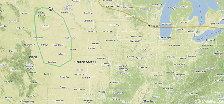
SPC Convective Outlook for Saturday
Excessive Rainfall Possible for Southern Arizona on Saturday
Shower and thunderstorm activity is forecast to develop during the afternoon and early evening across portions of southern Arizona on Saturday. General rainfall amounts of 0.50 to 1.50 inches, with locally heavier amounts in excess of 2 inches, will be possible. Due to the expected rain on Friday, there may be an increased threat of localized flooding across the region.
Major Cities in Region: Phoenix, AZ, Tucson, AZ
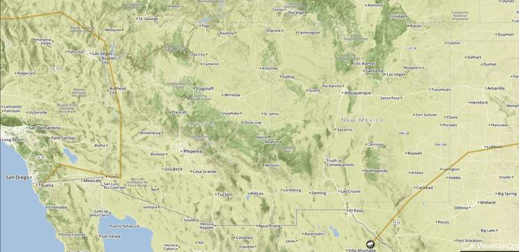
SPC Convective Outlook for Saturday
Strong to Severe Thunderstorms Possible Sunday Across the Northern Plains
A developing cold front moving out of the Northern Rockies and into the Northern Plains should be a focus for the development of thunderstorms across western portions of the Dakotas by Sunday afternoon, progressing eastward and possibly evolving into a thunderstorm complex during the evening and overnight hours. Initially, a few supercell thunderstorms will be possible with gusty winds, hail, and an isolated tornado possible. Gusty winds will then be the primary hazard by the late evening and overnight hours.
Major Cities in Region: Minot, ND, Bismarck, ND. Pierre, SD, Rapid City, SD
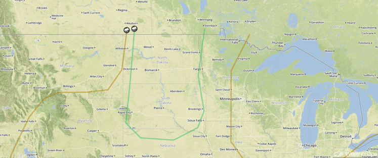
SPC Convective Outlook for Sunday
Excessive Rainfall Possible Across the Northeast on Sunday
Shower and thunderstorm activity will continue to spread across the Northeast on Sunday as an area of low pressure moves northeastward off the coast. Rainfall amounts of 1-2 inches with locally higher amounts in excess of 3 inches will be possible. Locations that received heavy rain on Saturday may be under an increased risk of flash flooding on Sunday.
Major Cities in Region: Albany, NY, Burlington, VT, Concord, NH
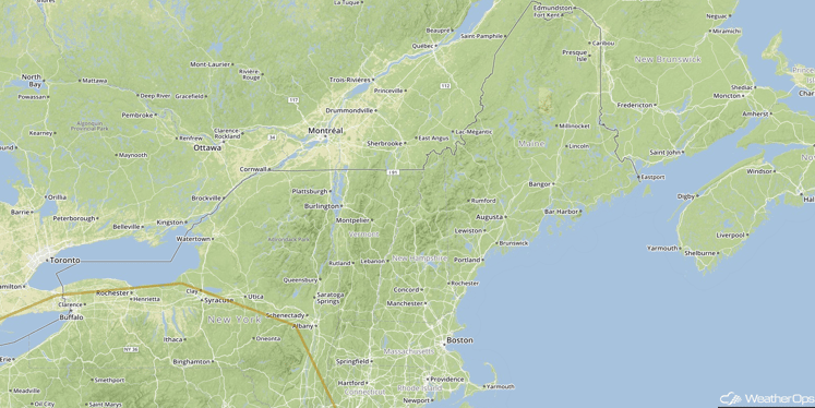
SPC Convective Outlook for Sunday
Excessive Rainfall Possible Across Southern Arizona on Sunday
Periods of showers and thunderstorms are likely to continue across portions of southern Arizona on Sunday, and the rain activity may be a bit more widespread and prolonged than the past few days. Rainfall amounts of 0.50-1.50 inches, with locally higher amounts in excess of 2 inches will be possible. A continued threat of flooding may persist for areas that have received repeated heavy rainfall.
Major Cities in Region: Phoenix, AZ, Tucson, AZ
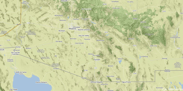
Excessive Rainfall Threat Region
This is just a brief look at current weather hazards. We can provide you site-specific forecast information for the purpose of protecting your personnel and assets. Try a 7-day demo right away and learn how timely precision weather information can enhance your bottom line.


