National Weather Summary for Friday, January 5, 2018
by David Moran, on Jan 5, 2018 10:45:53 AM
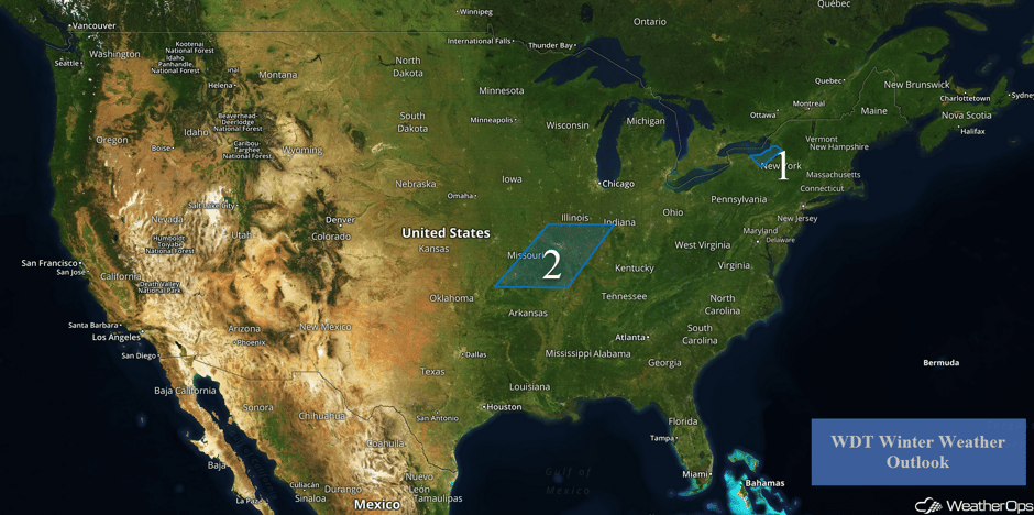
Lake effect snow will continue for portions of western New York through Saturday afternoon as an area of low pressure moves along the East Coast.
- Lake Effect Snow Continuing for Western New York through Saturday Afternoon
- Wintry Precipitation Sunday across Missouri and Illinois
 US Hazards
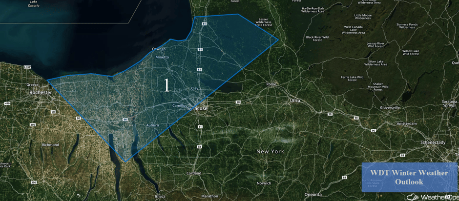
Lake Effect Snow Continuing for Western New York through Saturday Afternoon
Northwesterly winds building on the southwest side of a very strong area of low pressure moving along the East Coast will promote moderate to heavy lake effect snow through Saturday afternoon. Total snow accumulations of 4-8 inches with locally higher amounts in excess of 9 inches are forecast, especially near the lake. In addition, blowing snow will reduce visibilities and make travel very difficult.
Major Cities in Region: Rochester, NY, Syracuse, NY
 Region 1
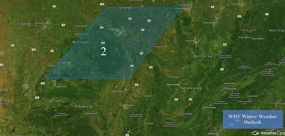
Wintry Precipitation Sunday across Missouri and Illinois
A strong upper level disturbance is forecast to move across the central US on Sunday and will bring the potential for wintry weather to the region. An area of low pressure developing across the Southern Plains will draw moisture northward from the Gulf of Mexico, allowing precipitation to develop across the region by late Sunday morning or afternoon. With an arctic air mass still likely to be in place over the region, temperatures should be below freezing when precipitation begins. There is some uncertainty in precipitation type, however freezing rain and sleet appear most likely with some snow mixing in. Snow and sleet accumulations will be fairly low, generally 2 inches or less. However, freezing rain could be a more significant concern with ice accumulations ranging 0.10-0.25 inch, with locally higher amounts. This could lead to widespread hazardous travel conditions, downed tree branches, and power outages. Precipitation should come to an end Sunday night as a warm front moves northward. This will allow temperatures to begin climbing above the freezing mark, though treacherous travel conditions could persist through the Monday morning commute.
Major Cities in Region: Springfield, MO, Jefferson City, MO, St. Louis, MO, Springfield, IL
 Region 2
A Look Ahead
An area of low pressure moving across the southern US will bring showers, thunderstorms, and wintry precipitation from the Gulf of Mexico into the Great Lakes on Monday. Some light icing may also occur across portions of Kentucky and Tennessee. An area of low pressure moving into the Pacific Northwest will produce rain and high elevation snow. On Tuesday, rain and high elevation snow is forecast across portions of California.
This is just a brief look at current weather hazards. We can provide you site-specific weather forecast information for the purpose of protecting your personnel and assets and to assess your weather risk. Try a 7-day demo right away and learn how timely precision weather information can enhance your bottom line.


