


by Chris Kerr, on Jan 12, 2018 11:26:45 AM
A significant winter storm will continue to affect a notable portion of the Great Lakes, Ohio Valley, and interior Northeast today into tonight, resulting in hazardous travel conditions. Heavy rainfall will be possible across parts of coastal New England, within the warm sector of the winter storm. Marginally severe thunderstorms are possible across portions of the Carolinas as a strong cold front pushes through the region. Rough conditions will continue across a majority of the Gulf in the wake of the strong cold front that pushed through the region late yesterday and early this morning. Finally, lingering snowfall across the Northern Rockies will come to an end later today.
- The significant winter storm across the Midwest, Ohio Valley, and interior Northeast will bring heavy snow, freezing rain, dangerous wind chills, and hazardous travel conditions to the region today and tonight.
- Heavy rainfall expected across coastal New England.
- Marginally severe thunderstorms expected across mainly coastal areas of the Carolinas.
- Lingering snowfall across portions of Montana.
- Rough conditions will persist across a majority of the Gulf today.
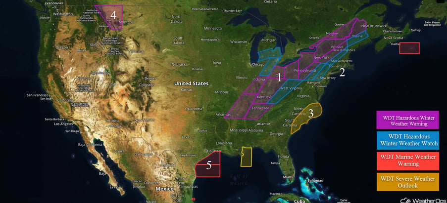
US Hazards
The significant winter storm across the Midwest, Ohio Valley, and interior Northeast will bring heavy snow, freezing rain, dangerous wind chills, and hazardous travel conditions to the region today and tonight.
The winter storm will progress northeastward today with a widespread area of wintry precipitation expected across a large area. Several inches of snow along with some ice accumulations will be possible for many locations, leading to extremely hazardous travel conditions.
Major Cities in Region: Memphis, TN, Nashville, TN, Louisville, KY, Indianapolis, IN, Columbus, OH, Charleston, WV, Cleveland, OH, Pittsburgh, PA, Detroit, MI, Buffalo, NY
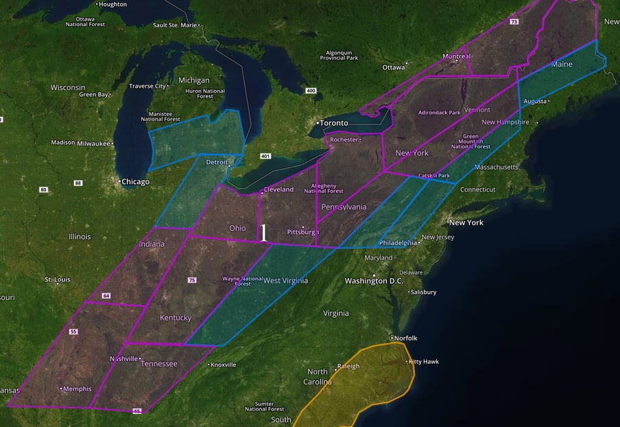 Region 1
Heavy rainfall expected across coastal New England.
Deep moisture overspreading the eastern US in advance of the above-mentioned winter storm is expected to allow for widespread rain and showers across coastal portions of the New England beginning this afternoon and continuing through the night. Rainfall amounts of 1-2 inches, locally 3+, may lead to an excessive rainfall threat across the region.
Major Cities in Region: New York, NY, Hartford, CT, Providence, RI, Boston, MA
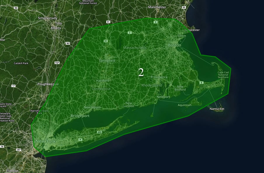 Region 2
Marginally severe thunderstorms are expected across mainly coastal areas of the Carolinas.
A strong cold front tracking eastward into the region will allow for the development of marginally severe thunderstorms this afternoon and early evening, mainly across coastal areas of the Carolinas. While conditions in the region are not overly favorable for widespread severe thunderstorms, a few thunderstorms containing damaging winds in excess of 55 mph and small hail will be possible.
Major Cities in Region: Wilmington, NC, Myrtle Beach, SC, Charleston, SC
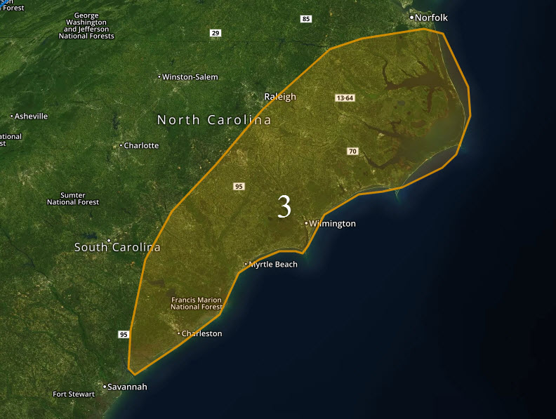 Region 3
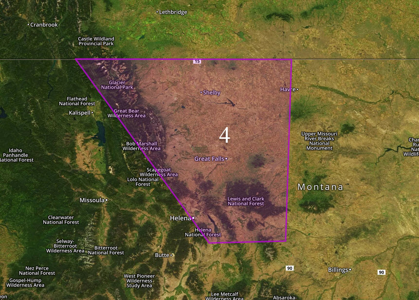
Lingering snowfall across portions of Montana.
Lingering snowfall will occur across the western part of the state today. An additional 2-6” can be expected. Travel to be very difficult and hazardous during the threat time before the snow tapers off Friday afternoon.
Major Cities in Region: Helena, MT, Great Falls, MT
 Region 4
Rough conditions will persist across a majority of the Gulf today.
Post-frontal northwesterly winds in excess of gale force at times will persist across the Gulf today, allowing for very rough seas. As the front continues to clear to the east and south of the Gulf later, today winds will begin to relax, and seas will decrease.
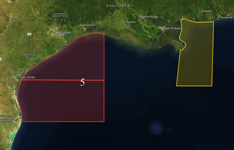 Region 5
A Look Ahead
Heavy snow and some ice/sleet will overspread the Northeast/New England during the day on Saturday. Another storm system will track through the northern Plains by late Saturday and into Sunday. Significant snowfall is unlikely. Some model guidance does suggest however that this system may strengthen early next week and bring another round of heavy snowfall to the Great Lakes/interior Northeast.
This is just a brief look at current weather hazards. We can provide you site-specific weather forecast information to protect your staff and assets and to assess your weather risk. Try a 7-day demo right away and learn how timely precision weather information can enhance your bottom line.
