National Weather Summary for Friday, February 26, 2016
by David Moran, on Feb 26, 2016 10:44:46 AM
No US Hazards are in effect for Friday.

US Hazards
Wildfire danger across the Plains on Saturday
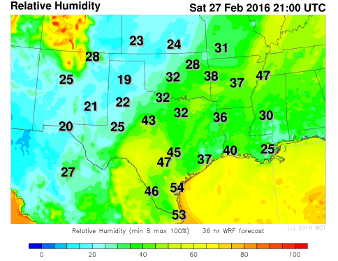
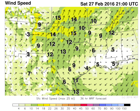
Dry and windy conditions will create a very high fire danger across portions of the Plains on Saturday. Southerly to southwesterly winds will increase through the day on Saturday as a trough develops in the lee of the Rockies. With relative humidities between 20-40% and southwesterly winds 15-25 miles per hour with gusts in excess of 35 miles per hour, fire conditions will be near critical levels. The fire danger will continue into Sunday, but will decrease somewhat. The highest fire potential will be across western portions of Oklahoma and Texas.
 WDT WRF Relative Humidity 3pm CST Saturday

WDT WRF Surface Winds 3pm CST Sunday
Elsewhere, mostly dry conditions are expected across the country as high pressure dominates much of the country. A weak system will continue to move inland across the Pacific Northwest and into the Northern Rockies allowing for isolated showers and high elevation snowfall. Light to moderate snow is expected from the Northern Plains to Great Lakes ahead of a clipper system. Another system moving into the Pacific Northwest on Sunday will bring gusty winds, showers, and mountain snow to the region.


