


by David Moran, on Feb 2, 2018 10:25:11 AM
Snow is expected across portions of the Northern Rockies Saturday through Monday as a series of upper level disturbances move through the region. Elevated winds and seas are forecast for portions of the Gulf of Mexico through Saturday afternoon in the wake of a cold front.
- Snow for the Northern Rockies Saturday through Monday
- Elevated Winds and Seas for Portions of the Gulf of Mexico through Saturday Afternoon
 US Hazards

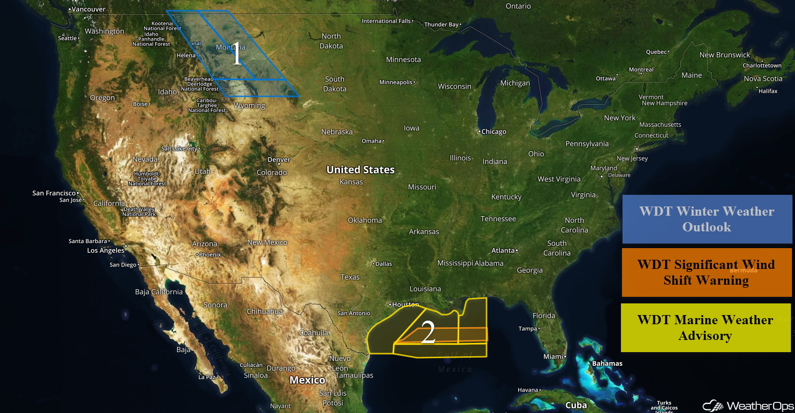
Snow for the Northern Rockies Saturday through Monday
Snow will begin across the Northern Rockies on Saturday as a series of upper level troughs move across the region. Accumulations of 6-8 inches with locally higher amounts in excess of 10 inches are forecast for the lower elevations of western Montana. In the higher elevations, 12-18 inches with locally higher amounts in excess of 24 inches are expected. Further east across central Montana, accumulations will range 4-6 inches with locally higher amounts in excess of 8 inches. For southern Montana and northern Wyoming, accumulations of 2-4 inches with locally higher amounts in excess of 5 inches are forecast.
Major Cities in Region: Helena, MT, Great Falls, MT, Billings, MT, Sheridan, WY
 Region 1
Elevated Winds and Seas for Portions of the Gulf of Mexico through Saturday Afternoon
A cold front moving across the Gulf of Mexico will allow for elevated winds and seas through Saturday afternoon. For western areas, winds will be north-northeasterly at 20-27 knots with gusts in excess of 30 knots. Seas will be 5-8 feet near the shore and 6-9 feet in the deeper waters. Further east, winds ahead of the front will be from the south at 5-10 knots. Behind the front, winds will be northeasterly at 22-28 knots with gusts in excess of 30 knots. Seas near the shore will be 4-8 feet and 7-9 feet in the deeper waters.
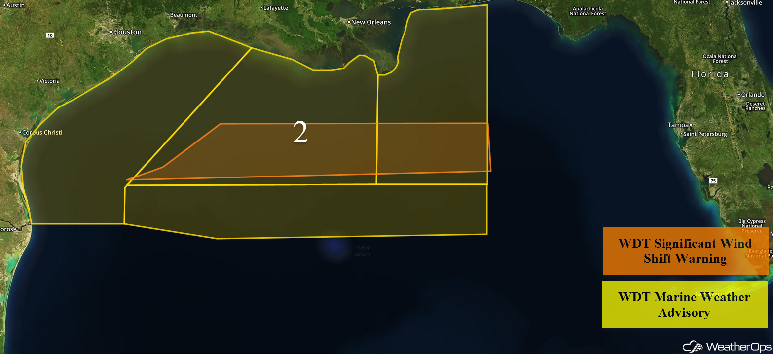 Region 2
A Look Ahead
An area of low pressure strengthening over the Central US will move toward the Great Lakes and Midwest on Tuesday, bringing snowfall to a large portion of the US. Snow will spread into the Northeast on Wednesday. For the Great Lakes into the Northeast, moderate to heavy snowfall will be possible. Two day accumulations of 8-16 inches with locally higher amounts in excess of 20 inches are forecast.
This is just a brief look at current weather hazards. We can provide you site-specific weather forecast information to protect your staff and assets and to assess your weather risk. Try a 7-day demo right away and learn how timely precision weather information can enhance your bottom line.
