by David Moran, on Dec 21, 2018 9:56:47 AM
Snow and freezing rain are forecast across New England through Saturday as an area of low pressure moves through the region. This same system will bring a potential for excessive rainfall to portions of New England on Friday. An area of low pressure will bring snow to the Appalachians through Saturday. Elevated winds and seas will continue across the Gulf of Mexico through early Saturday afternoon in the wake of a cold front.
- Snow and Freezing Rain across New England through Saturday
- Excessive Rainfall Friday for New England
- Snow for the Appalachians through Saturday
- Elevated Winds and Seas through Early Saturday Afternoon across the Gulf of Mexico
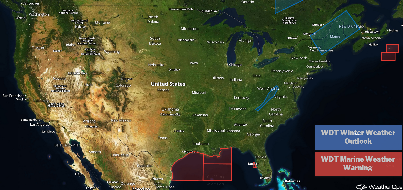
US Hazards
Snow and Freezing Rain across New England through Saturday
A strong area of low pressure is moving into the Northeast today. This will bring snow to portions of New England; accumulations will generally range 1-2 inches with locally higher amounts in excess of 4 inches. Some freezing rain may develop to the north of the associated warm front. Ice accumulations are expected to be less than 0.10 inch, but there could still be some slick roads.
Major Cities in Region: Burlington, VT
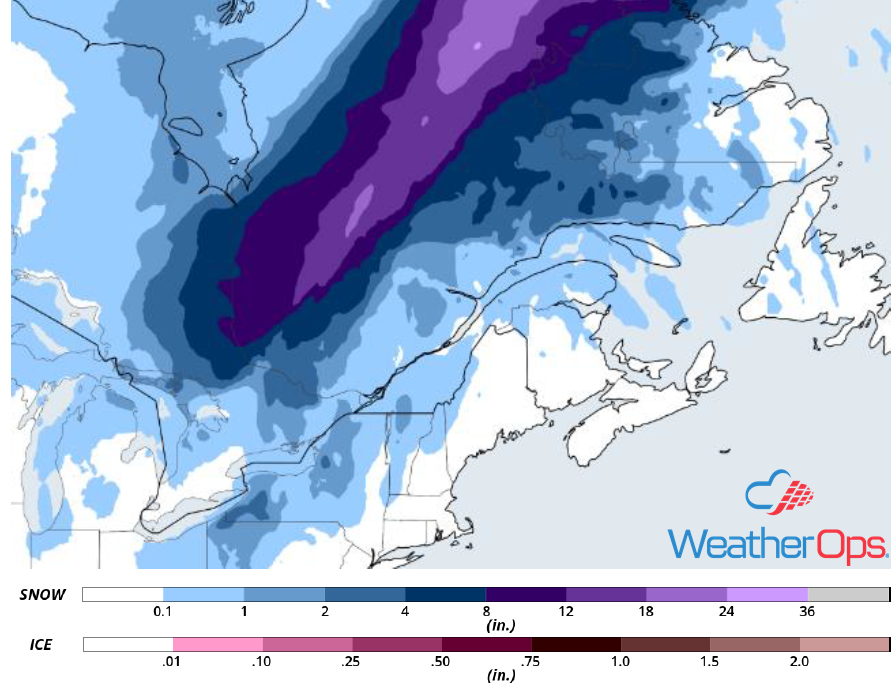
Snow Accumulation for Friday and Saturday
Excessive Rainfall Friday for New England
The same area of low pressure described above will bring a potential for excessive rainfall. Rainfall totals will range 1-3 inches with locally higher amounts in excess of 4 inches.
Major Cities in Region: Manchester, NH, Portland, ME, Bangor, ME
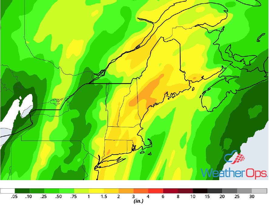
Rainfall Accumulation for Friday
Snow for the Appalachians through Saturday
As a strong area of low pressure moves into Canada, northwesterly winds will develop along the western slopes of the Appalachians. These upslope winds will allow for the development of snow, primarily in the higher elevations. Snow accumulations of 1-5 inches with locally higher amounts in excess of 6 inches are expected.
Major Cities in Region: Knoxville, TN, Roanoke, VA
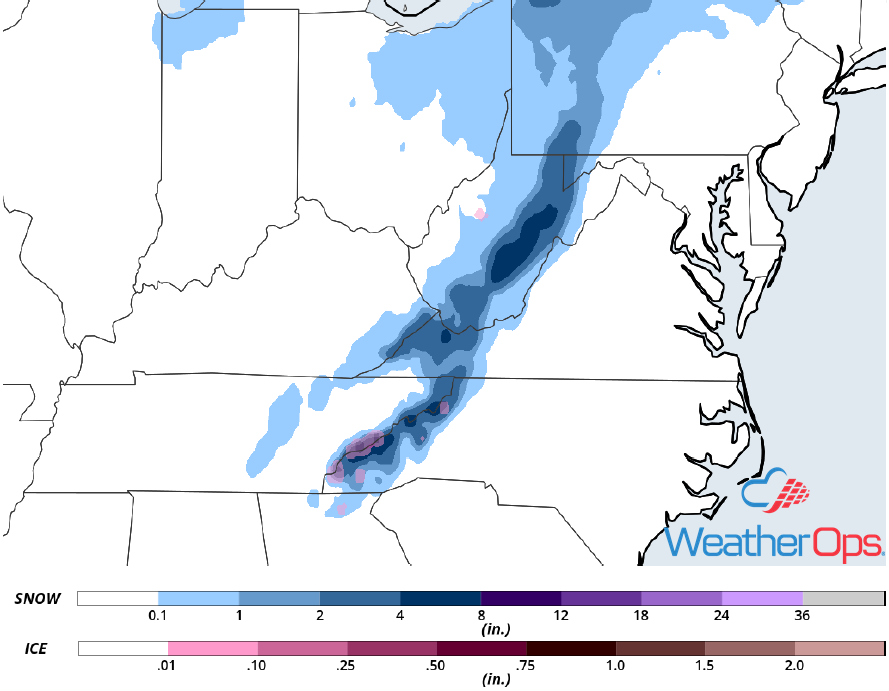
Snow Accumulation for Friday and Saturday
Elevated Winds and Seas through Early Saturday Afternoon across the Gulf of Mexico
Elevated winds and seas will continue across the Gulf of Mexico through early Saturday afternoon as high pressure builds in behind a cold front. Winds will be northwesterly to north-northwesterly at 30-40 knots with gusts in excess of 50 knots. Seas will range 7-14 feet near the shore and 15-23 feet in the deeper waters.
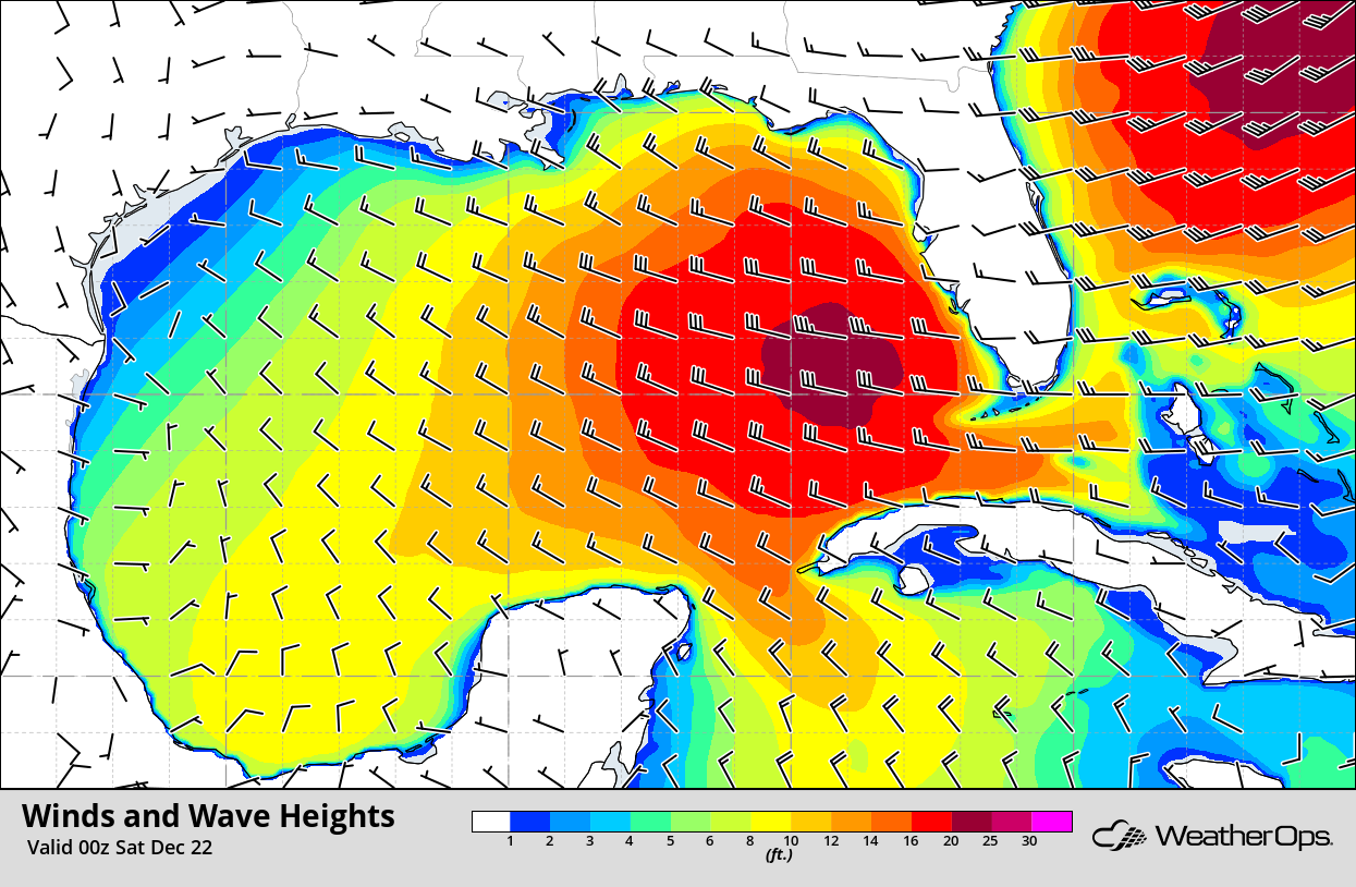
Winds and Wave Heights 6pm CST Friday
A Look Ahead
Snow will move into the Northern and Central Rockies on Christmas Eve as an upper level system moves across the region. This snow will continue into Christmas Day. Heavy snow may develop over the Southern Rockies on Wednesday. Further east, an area of low pressure is forecast to move across the Plains, bringing showers and thunderstorms to the Central and Southern Plains and snow from the High Plains into the Midwest. Thunderstorms will move into the Southeast and Ohio Valley on Thursday with snow extending from the Plains into the Great Lakes.