National Weather Summary for Friday, December 16, 2016
by David Moran, on Dec 16, 2016 11:20:11 AM
Heavy snow will continue for portions of the Northern Rockies, Plains and Great Lakes on Friday. As an upper level system moves across the Western US, thunderstorms are expected across portions of Utah. Snow is likely during the day on Saturday across portions of the Plains as an area of low pressure continues to progress eastward. To the south of this system, thunderstorms will likely develop across portions of the Southern US ahead of the associated cold front.
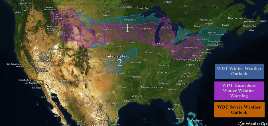 US Hazards
Region 1
Snow will continue across Region 1 through the weekend as an area of low pressure moves eastward. Across the Rockies, snow accumulations of 5-10 inches, with locally higher amounts in excess of 12 inches, are expected in the valleys. For the higher elevations, 10-20 inches, with isolated higher amounts in excess of 2 feet, are expected. In addition to the snow, wind chills as low as -15 are likely late Friday into early Saturday morning. Further to the east across the High Plains, snowfall amounts of 4-8 inches, with locally higher amounts in excess of 10 inches, will be possible. In addition, winds will be 15-25 mph with gusts in excess of 30 mph, allowing for wind chills from -25 to -35 F. Across the Northern Plains, snowfall amounts of 3-5 inches, with locally higher amounts in excess of 6 inches, are expected. Sustained winds in excess of 25 mph may limit visibilities to less than 2 miles at times. Into the Great Lakes, 4-8 inches of snow, with locally higher amounts in excess of 10 inches, are expected. There will also be a potential for some light icing across the lower peninsula of Michigan. For the eastern Great Lakes and Northeast, snowfall accumulations of 4-8 inches, with locally higher amounts in excess of 10 inches, will be possible on Saturday. In addition, ice accumulations up to a tenth of an inch and winds of 15-20 mph with gusts in excess of 30 mph are expected.
Major Cities in Region: Helena, MT, Cheyenne, WY, Pierre, SD, Sioux Falls, SD, Minneapolis, MN, Milwaukee, WI, Chicago, IL, Detroit, MI, Cleveland, OH, Pittsburgh, PA, Rochester, NY, Albany, NY, Montpelier, VT, Manchester, NH, Portland, ME, Augusta, ME
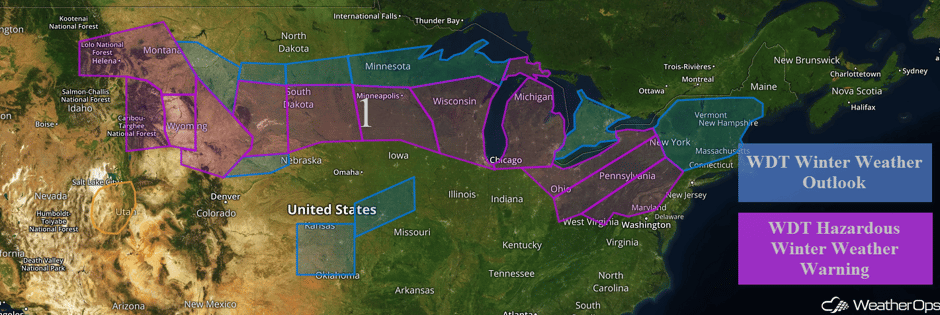 Region 1
Region 2
A strong Arctic cold front is forecast to move across the Central and Southern Plains on Saturday. As a strong upper level system moves eastward, periods of snow are expected to develop and spread from west to east across the region. Snowfall accumulations of 2-4 inches, with isolated amounts in excess of 5 inches, are expected. Gusty winds of 15-25 mph with higher gusts will allow for areas of blowing snow and reduced visibilities. Wind chills will fall below 0 F by Saturday evening. Across portions of northeastern Kansas and northwestern Missouri.
Major Cities in Region: Wichita, KS, Topeka, KS, Kansas City, MO
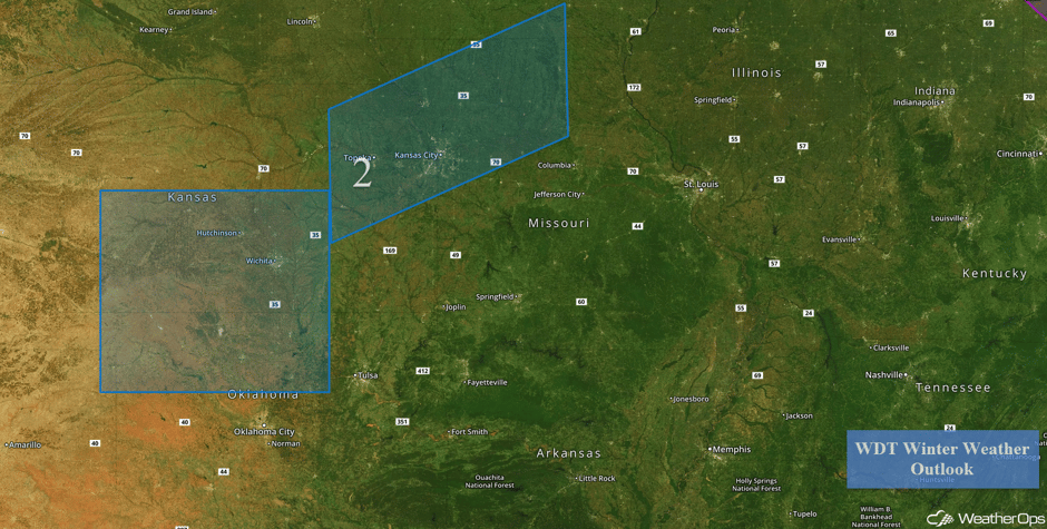 Region 2
Region 3
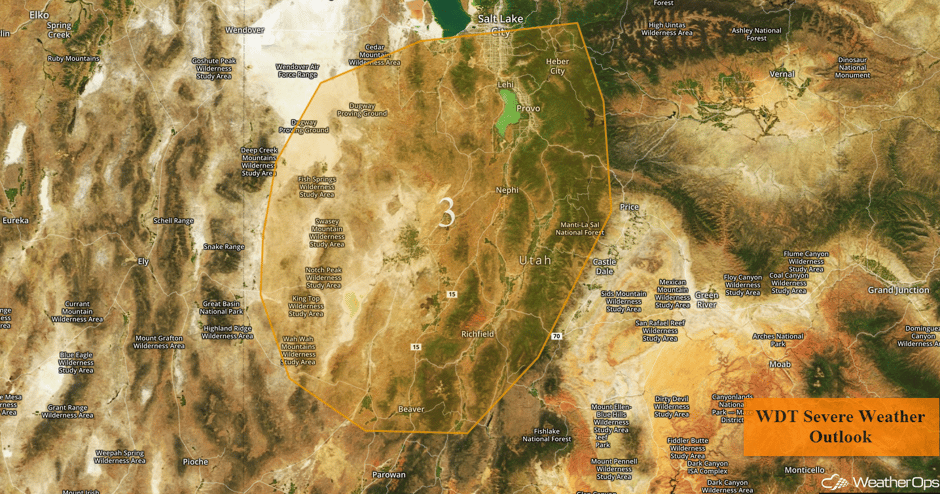
Thunderstorms may develop across portions of Utah as an area of low pressure and cold front, as well as a strong upper level trough, moves through the Western US. Thunderstorms will be most likely during the late morning through mid-afternoon. Gusty winds will be the primary hazard with any storms that develop.
Major Cities in Region: Salt Lake City, UT
Update 11:26am MST: Severe thunderstorms capable of damaging winds approaching Salt Lake City.
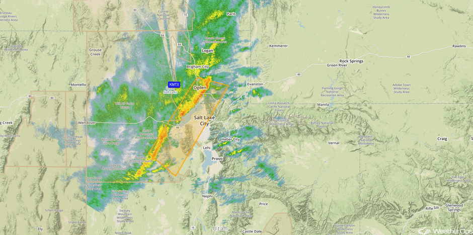 Radar 11:26am MST
 Region 3
Excessive Rainfall Possible for Southern California on Saturday
A cold front moving southeastward into Southern California will continue to produce showers across the region before activity diminishes later this evening. Rainfall amounts of 1-2 inches, with isolated higher amounts in excess of 3 inches, may cause some runoff issues.
Major Cities in Region: Los Angeles, CA, San Diego, CA
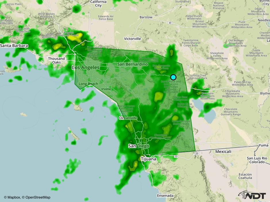 Excessive Rainfall Risk Outline for Friday
Strong to Severe Thunderstorms Possible Saturday for Portions of the Southeast
A strong cold front is expected to move into southern portions of the Southeast on Saturday, with thunderstorms developing along and ahead of it. Thunderstorms will likely begin to develop by the afternoon and early evening as low-level moisture and wind shear increases ahead of the front. Any storms that develop will have a risk for damaging winds, but large hail and isolated tornadoes cannot be ruled out. Activity should begin to decrease by the overnight hours.
Major Cities in Region: Houston, TX, Shreveport, LA, New Orleans, LA, Jackson, MS, Memphis, TN, Birmingham, AL
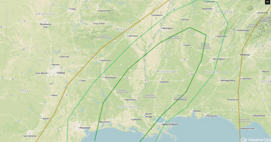 SPC Convective Outlook for Saturday
A Look Ahead
A frontal system moving into the Pacific Northwest on Monday will bring the potential for heavy snowfall across the Cascades. Snowfall accumulations may exceed a foot in the higher elevations with lighter accumulations in lower elevations. Along the coastal areas of western Washington, excessive rainfall will be possible with rainfall amounts of 1-3 inches and locally higher amounts in excess of 4 inches.
This is just a brief look at current weather hazards. We can provide you site-specific forecast information for the purpose of protecting your personnel and assets. Try a 7-day demo right away and learn how timely precision weather information can enhance your bottom line.


