by David Moran, on Dec 14, 2018 10:18:48 AM
Thunderstorms will continue to develop across North Central Florida on Friday along and ahead of a cold front. Excessive rainfall is expected from Northern Florida into the Carolinas. Snow will continue across the Northern Cascades through Sunday as a series of upper level lows move through the region. Elevated winds and seas are expected to continue through Saturday evening as a cold front moves eastward.
- Thunderstorms for North Central Florida on Friday
- Excessive Rainfall Friday from North Florida into the Carolinas
- Snow for the Northern Cascades through Sunday
- Elevated Winds and Seas through Saturday Evening across the Gulf of Mexico
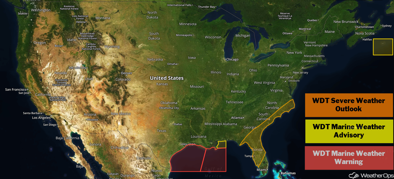
US Hazards
Thunderstorms for North Central Florida on Friday
A cold front is moving into northern Florida this morning. Thunderstorms, some severe, will continue to develop along and ahead of the front with severe winds and an isolated tornado or two the primary hazards with these storms. These hazards are most likely during the afternoon when daytime heating peaks. Activity will diminish tonight with the loss of daytime heating.
Major Cities in Region: Tallahassee, FL, Jacksonville, FL
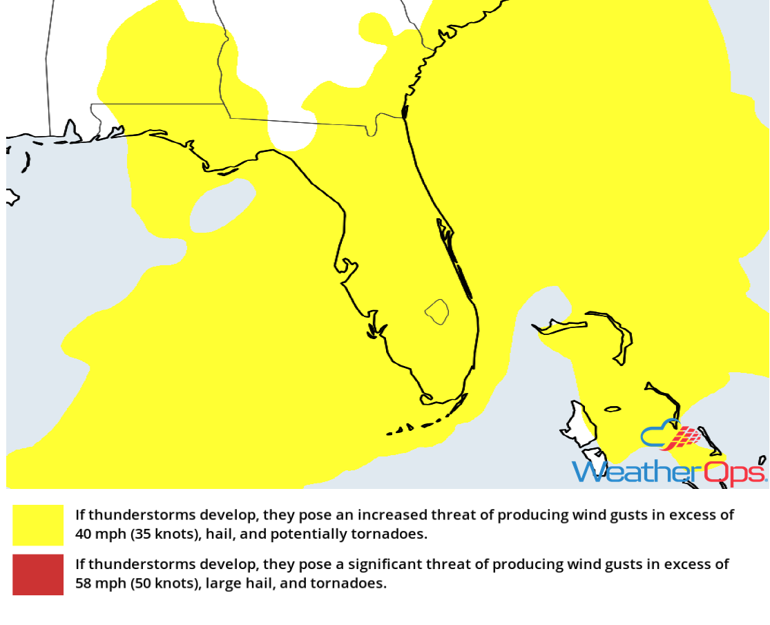
Thunderstorm Risk for Friday
Excessive Rainfall Friday from North Florida into the Carolinas
As the cold front described above continues to move eastward, there will be a potential for excessive rainfall from Northern Florida into the Carolinas. Rainfall amounts of 1-2 inches with locally higher amounts in excess of 3 inches are forecast, resulting in a potential for flooding and local runoff.
Major Cities in Region: Tallahassee, FL, Jacksonville, FL, Savannah, GA, Charleston, SC, Myrtle Beach, SC, Wilmington, NC
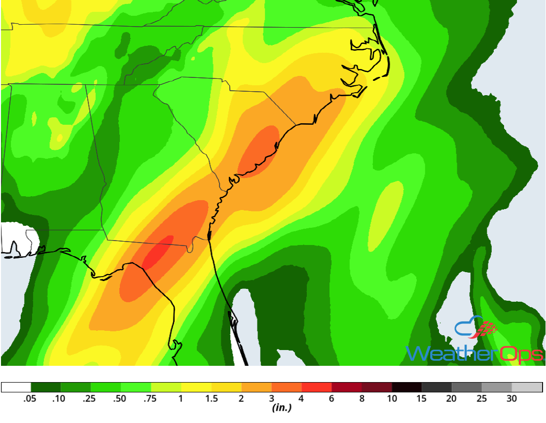
Rainfall Accumulation for Friday
Snow for the Northern Cascades through Sunday
Moderate to heavy snow will increase in coverage late Friday and continue through Sunday across the Northern Cascades as an upper level low moves through the Pacific Northwest. Three day snowfall totals will approach or exceed 3 feet in the higher elevations. Snow accumulations of 8-12 inches are expected in the lower elevations.
Major Cities in Region: Yakima, WA
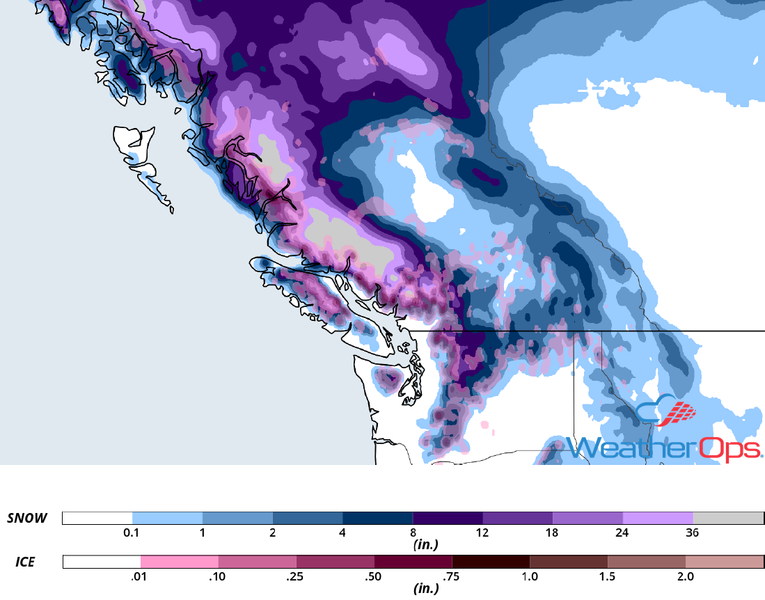
Snowfall Accumulation through Sunday
Elevated Winds and Seas through Saturday Evening across the Gulf of Mexico
Elevated winds and seas will continue across the Gulf of Mexico through Saturday evening in the wake of a cold front. Winds will initially be westerly before becoming west-northwesterly and finally northwesterly at 35-40 knots with gusts in excess of 50 knots. Seas will range 8-12 feet near the shore and 14-18 feet in the deeper waters.
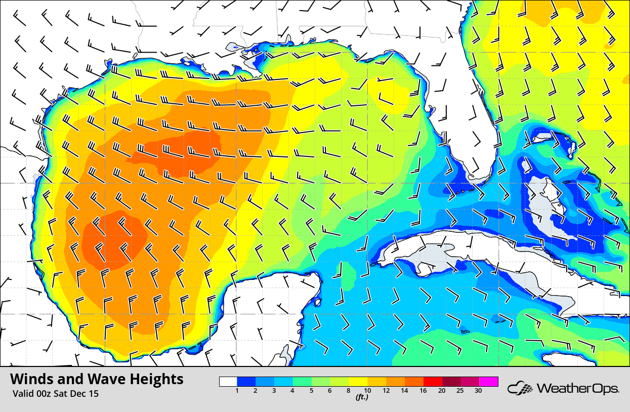
Winds and Wave Heights 6pm CST Friday
A Look Ahead
Snow is forecast across the Sierra Nevadas on Monday as an upper level low moves across the region. Across the Northeast, snow is expected late Monday into Tuesday. Snow will move across the Northern Rockies on Tuesday. Light freezing rain may develop across the Upper Midwest on Wednesday as an area of low pressure moves eastward. Snow is forecast across the Great Lakes on Thursday.