


by David Moran, on Apr 27, 2018 10:21:39 AM
Thunderstorms are forecast across the Pacific Northwest on Friday as an upper level system moves onshore.
- Thunderstorms for the Pacific Northwest on Friday
- Potential for Thunderstorms Sunday across the High Plains
- Thunderstorms for the Central Plains on Wednesday
 US Hazards

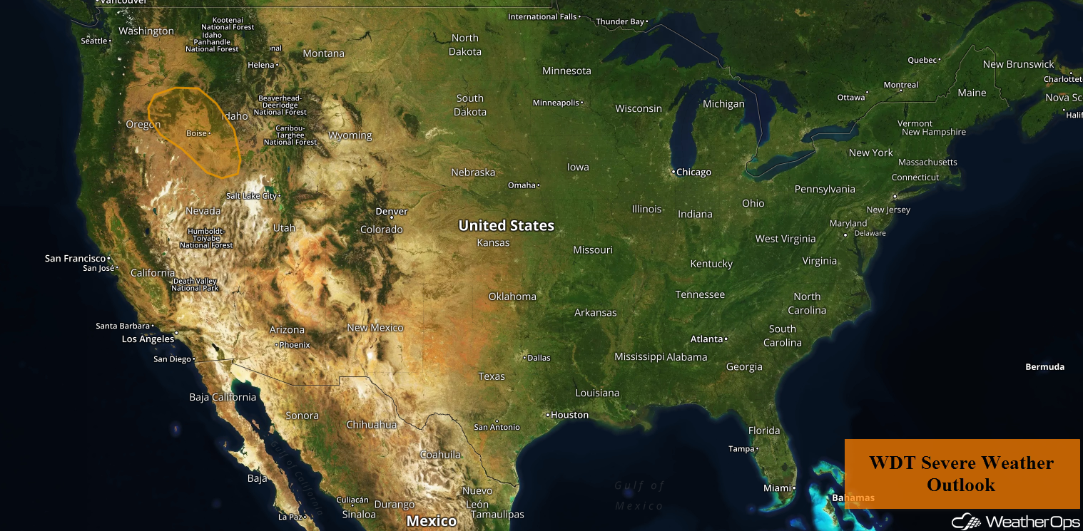
Thunderstorms for the Pacific Northwest on Friday
A strong upper level trough will move into the Pacific Northwest today. Daytime heating will produce marginal instability across the region. With strong wind shear and ample lift, scattered showers and thunderstorms are forecast to increase in coverage this afternoon and evening. As storms develop, hail and damaging winds will be the primary hazards.
Major Cities in Region: Boise, ID, Twin Falls, ID
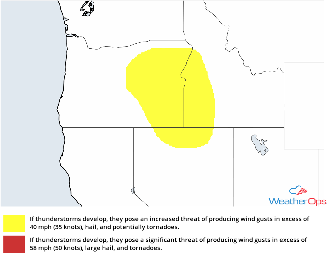 Thunderstorm Risk for Friday
Potential for Thunderstorms Sunday across the High Plains
A strong area of low pressure will slowly make its way across the Northern Rockies and into the High Plains on Sunday. The associated warm front will track northeastward across the High Plains and into the Midwest. To the south of the front, warm moist air will be lifted northward. This will result in increasing instability across the region. With strong forcing from the low, scattered showers and thunderstorms are forecast during the afternoon. Some storms will become strong to severe with large hail and damaging winds the primary hazards. The threat will quickly diminish during the overnight hours,
Major Cities in Region: Amarillo, TX, North Platte, NE, Scottsbluff, NE, Rapid City, SD
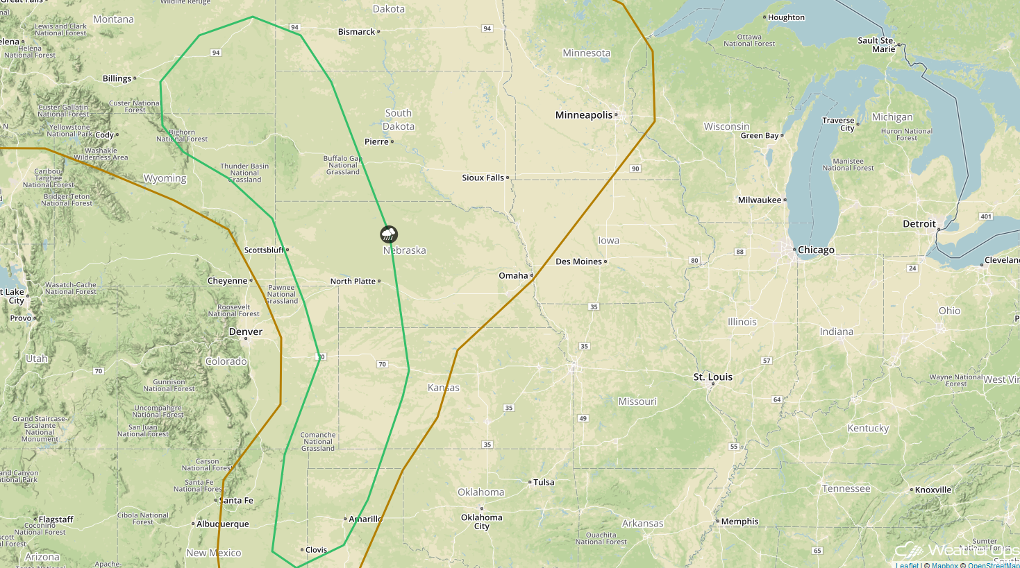 SPC Convective Outlook for Sunday
Thunderstorms for the Central Plains on Wednesday
By Wednesday, an area of low pressure developing in the lee of the Rockies will move into the Plains, allowing for a risk for thunderstorms across portions of the Central and Southern Plains. While some uncertainty still exists, there appears to be the potential for the development of strong to severe thunderstorms capable of large hail, damaging winds, and tornadoes.
Major Cities in Region: Lawton, OK, Oklahoma City, OK, Tulsa, OK, Kansas City, MO, Omaha, NE
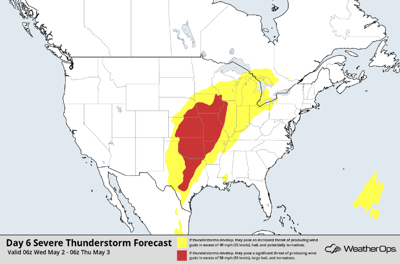 Thunderstorm Forecast for Wednesday
A Look Ahead
Snow may develop across the higher elevations of Oregon late Saturday into Sunday as the upper level system described above continues to move into the region. Snow is forecast on Monday across the Northern Rockies as this system continues to move eastward.
This is just a brief look at current weather hazards. We can provide you site-specific weather forecast information for the purpose of protecting your personnel and assets and to assess your weather risk. Try a 7-day demo right away and learn how timely precision weather information can enhance your bottom line.
