National Weather Summary for Friday, April 14, 2017
by David Moran, on Apr 14, 2017 10:00:57 AM
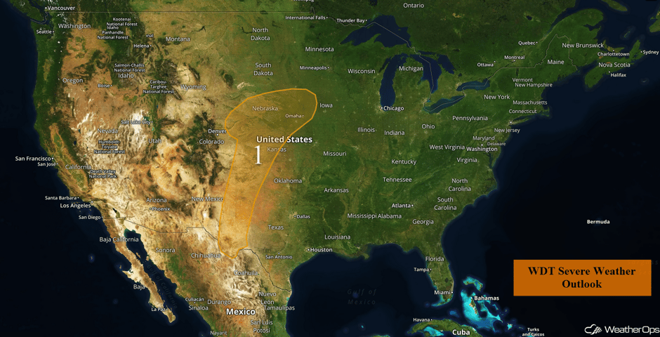
A cold front and dryline will be the focus for thunderstorm development across the Plains into West Texas on Friday.
- Strong to Severe Thunderstorms Possible Friday from the Plains into West Texas
- Thunderstorm Potential for Portions of the Plains and Midwest on Saturday
 US Hazards
Strong to Severe Thunderstorms Possible Friday from the Plains into West Texas
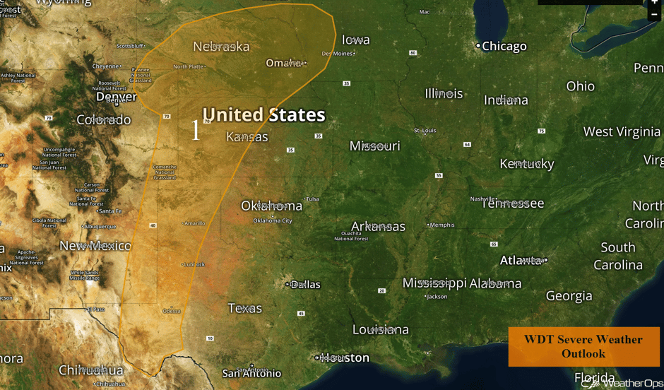
There will be a potential for isolated to widely scattered thunderstorms across western Texas into the Central Plains on Friday. A large dryline will extend from eastern Colorado into the Big Bend by the afternoon, with thunderstorms developing during the mid to late afternoon to the east. Activity should be mostly isolated with large hail and damaging winds the primary hazards, but an isolated tornado cannot be ruled out. Activity should diminish by early evening.
Major Cities in Region: Odessa, TX, Lubbock, TX, Amarillo, TX, Dodge City, KS, Goodland, KS, North Platte, NE, Omaha, NE
 Region 1
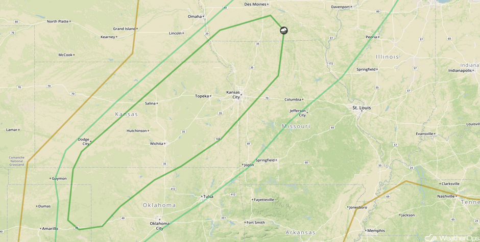
Thunderstorm Potential for Portions of the Plains and Midwest on Saturday
The system that is expected to cause severe weather on Friday will continue to progress eastward on Saturday. The cold front will have progressed into the Central Plains, and will extend from the center of the low near the Great Lakes southwestward into southeastern Colorado. A dryline will extend from a low along the front in northern Kansas southwestward into the Texas Panhandle. Daytime heating of the moist air mass ahead of the front should increase instability. Showers and thunderstorms are expected to develop along and ahead of the cold front. Isolated strong to severe thunderstorms are expected from the eastern Texas Panhandle northeastward into the Midwest. Storms should develop in the afternoon and will likely continue through the night as a cold front continues to move to the south. Gusty winds will be the primary hazard with these storms. In addition to the thunderstorms, moderate to heavy rain will be possible. Rainfall amounts of 1-2 inches will be possible with the heaviest amounts associated with any training thunderstorms.
Major Cities in Region: Woodward, OK, Wichita, KS, Topeka, KS, Kansas City, MO
 SPC Convective Outlook for Saturday
A Look Ahead
Showers and thunderstorms will continue from Oklahoma across the Ozarks and into the Mid Atlantic states along a cold front that will become stationary. Since the air mass to the south and east of the front remains moist and unstable, precipitation should be fairly common across the region, and some locations could receive another 1-2 inches of rain on Monday. Persons in this area should be aware of the possibility of heavy rains from Sunday night into Monday.
This is just a brief look at current weather hazards. We can provide you site-specific weather forecast information for the purpose of protecting your personnel and assets and to assess your weather risk. Try a 7-day demo right away and learn how timely precision weather information can enhance your bottom line.


