National Weather Summary for Friday, April 1, 2016
by David Moran, on Apr 1, 2016 10:32:02 AM
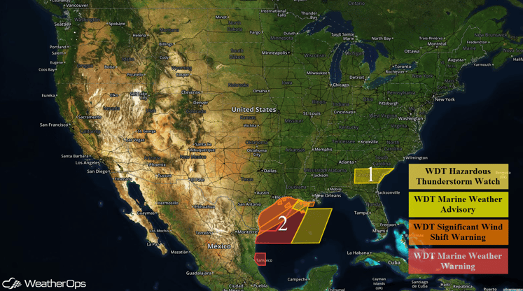
A line of thunderstorms will continue to move eastward across portions of the Southeast Friday morning and afternoon. A cold front moving into the Gulf of Mexico on Friday will allow for elevated winds with gale force gusts in addition to rough to very rough seas.

US Hazards
Region 1
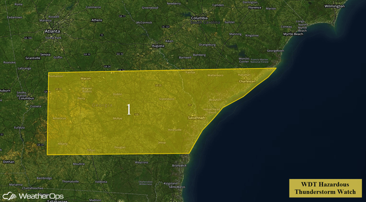
A line of thunderstorms is will continue to progress eastward across Region 1 through the morning hours. Instability should be sufficient for thunderstorms that have already developed to maintain their intensity, but occasional intensification of individual cells is presently forecast with damaging winds and a few isolated tornadoes possible.

Region 1
Region 2
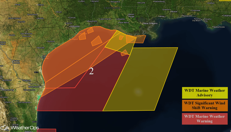
A cold front will begin to move into the northwestern Gulf of Mexico Friday morning. Winds will shift abruptly from southwest to northwest and finally to north-northeast. Winds will also increase from 10-20 miles per hour to 30-40 miles per hour with higher gusts possible. Seas will build to 8-10 feet. Ahead of the cold front, a few thunderstorms will be possible. Conditions will improve on Saturday across the northwestern Gulf of Mexico and early Sunday across the central Gulf of Mexico.

Region 2


