National Weather Summary for Thursday, August 27, 2015
by WeatherOps, on Aug 27, 2015 4:49:24 AM
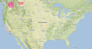
Isolated strong to severe thunderstorms, excessive rainfall, and flash flooding are possible on Thursday for portions of the North Central High Plains.
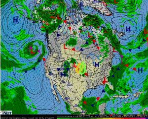
A surface low is expected to develop and strengthen in the north central Plains today and track northeast through the region. Strong to severe thunderstorms are possible along the associated warm and cold fronts where there will be moderate to strong instability and moderate wind shear. There is some uncertainty whether storms will form due to widespread rainfall. However, if they do develop, they will increase in coverage and intensity during the afternoon and evening hours. Some storms will have the potential to become severe with large hail and damaging winds being the main hazards, but a tornado or two is possible after sundown in northeast Nebraska.
Excessive rainfall is also possible across the north central Plains ahead of the aforementioned surface low. 1-2 inches of rain will be possible with some isolated areas picking up in excess of 3 inches. Flash flooding with heavier thunderstorms is possible.


