National Weather Summary for Monday, August 18, 2015
by WeatherOps, on Aug 17, 2015 4:38:18 AM
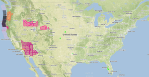
Scattered severe thunderstorms are possible on Monday across the Colorado Front Range. Locally heavy rainfall is possible across the Northern Great Plains.
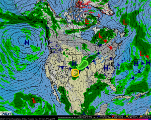
A developing low over Southern Wyoming will strengthen and turn out of the southeast by Monday afternoon. This will provide strong upslope flow along the Front Range, allowing for thunderstorms to develop. Ample moisture, warm temperatures, and strong winds aloft will allow for thunderstorms to become severe. Hail in excess of one inch in diameter and damaging winds in excess of 60 miles per hour will be the primary hazards. A few tornadoes will be possible, especially over northeast Colorado. Thunderstorms will likely begin to develop along the Front Range around 3pm and move into the high plains by evening.
Showers and thunderstorms ongoing across the Northern Great Plains will continue throughout the day along a slow moving cold front. Given the slow movement of the rain, locally heavy rainfall will be possible. Widespread accumulations of 1-2 inches are expected with locally higher amounts in excess of 2.5 inches possible.


